The best cycling routes in Triadelphia Reservoir Recreation Area
3.5
(3)
33
riders
16
rides
Touring cycling in Triadelphia Reservoir Recreation Area is characterized by routes that navigate the rolling hills of Montgomery and Howard Counties, Maryland. The landscape features wooded areas and expansive views of the reservoir, which was formed by damming the Patuxent River. While dedicated long-distance cycling trails within the WSSC-managed reservoir property are limited, many touring cycling routes utilize public roads bordering the area, offering mostly well-paved surfaces. These routes provide opportunities to experience the region's natural beauty, including lush greenery…
Last updated: July 2, 2026
5
riders
43.8km
02:40
380m
380m
Moderate bike ride. Good fitness required. Mostly paved surfaces. Suitable for all skill levels.
4
riders
36.3km
02:18
310m
310m
Moderate bike ride. Good fitness required. Mostly paved surfaces. Suitable for all skill levels.

Sign up for free
4
riders
44.3km
02:42
410m
410m
Moderate bike ride. Good fitness required. Mostly paved surfaces. Suitable for all skill levels.
3.0
(2)
7
riders
Moderate bike ride. Good fitness required. Mostly paved surfaces. Suitable for all skill levels.
4.0
(1)
5
riders
36.5km
02:14
330m
330m
Moderate bike ride. Good fitness required. Mostly paved surfaces. Suitable for all skill levels.
Get access to more routes and recommendations from other explorers.
Sign up for free
Already have an account?
Our route recommendations are based on thousands of hikes, rides, and runs completed by other people on komoot.
Start today with a free account
Your next adventure awaits.
Login or Signup
Popular around Triadelphia Reservoir Recreation Area

Tips from the Community

This spot along Hardy Road has a scenic view of a rustic countryside.
0
0

Elder Pine Brewing is a great place for a stop during a ride. There is outdoor seating, food trucks, and is located in a tranquil setting.
0
0
Nice pedestrian bridge over the Little Patuxent River. It is popular with cyclists and walkers, so make sure you look out for other trail users.
0
0

This 650-acre park is dedicated to environmental preservation and honors environmental activist Rachel Carson with the conservation of the park. There are plenty of well-maintained dirt trails throughout the area as well.
1
0
The Hawlings River is a 13-mile long tributray of the Patuxent River. This section of the river runs through the peaceful surroundings of the Rachel Carson Conservation Park.
0
0

Nestled at the source of the Patuxent River, this expansive 6,700-acre park features a nature center, scenic hiking trails, fishing opportunities, and kayak rentals. There are plenty of trails to ride your bike on.
0
0
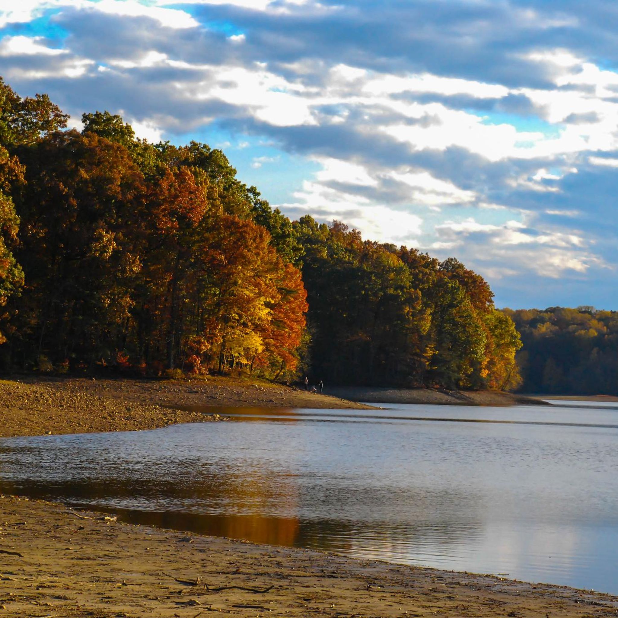
The 800-acre reservoir is situated directly behind the Brighton Dam on the Patuxent River. You can enjoy a nice view of the reservoir from the sidewalk along the dam.
0
0
The Patuxent Branch Trail is a multi-use, paved 10.4-mile trail that follows the Little Patuxent River.
0
0
Frequently Asked Questions
What is the general terrain like for touring cycling in the Triadelphia Reservoir Recreation Area?
Touring cycling in the Triadelphia Reservoir Recreation Area primarily involves routes on public roads surrounding the reservoir. These routes often feature rolling hills and mostly well-paved surfaces. While the WSSC-managed property has some trails, many are not suitable for touring bikes due to unpaved sections, exposed soil, rocks, and roots. Cyclists can expect wooded areas and expansive views of the reservoir.
How many touring cycling routes are available in the Triadelphia Reservoir Recreation Area?
There are over 10 touring cycling routes available in the Triadelphia Reservoir Recreation Area. These routes cater to various skill levels, with 1 easy, 9 moderate, and 3 difficult options to explore.
Are there any family-friendly touring cycling routes in the area?
While the guide focuses on touring cycling, which often involves public roads with traffic, the area does offer routes suitable for those comfortable with such conditions. For a moderate option, consider the Little Patuxent River – Patuxent Branch Trail loop from Clarksville, which follows the river and provides a mix of natural scenery.
What natural features or landmarks can I expect to see while cycling around Triadelphia Reservoir?
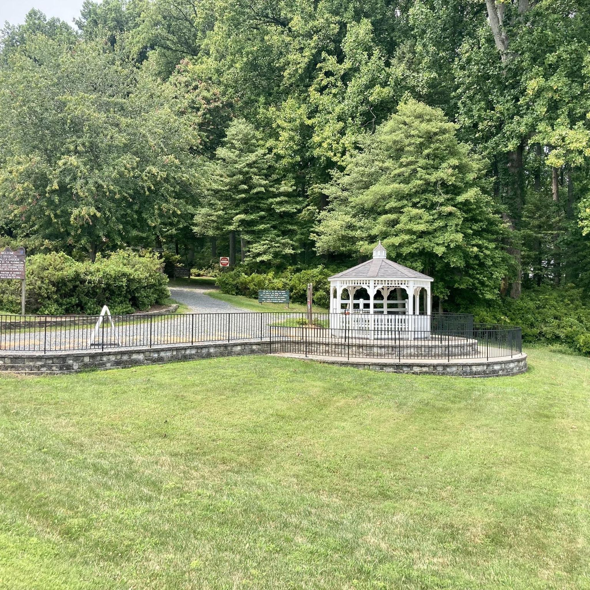
Cyclists can enjoy expansive views of the Triadelphia Reservoir itself, which is a significant natural feature. The area is rich with wildlife, including herons, deer, and frequently sighted bald eagles. You'll also pass through lush wooded areas. A notable attraction is a 5-acre woodland garden near Brighton Dam, famous for its 20,000 azaleas that bloom spectacularly each May.
Are there any circular touring cycling routes in the Triadelphia Reservoir Recreation Area?
Yes, many of the touring cycling routes in the area are designed as loops. For example, the popular Scenic view loop from Glenelg High School is a 27.2-mile circular route offering varied terrain and scenic vistas. Another option is the Bike loop from Clarksville, a 27.5-mile trail through the surrounding countryside.
What are the typical distances and elevations for touring cycling routes here?
The touring cycling routes in the Triadelphia Reservoir Recreation Area vary in length and elevation. For instance, the Scenic view loop from Glenelg High School covers 27.2 miles (43.8 km) with an elevation gain of about 1,240 feet (378 meters). A shorter option like the Rock Creek Trail – Lake Needwood Southeast Shore loop from Hallowell is 17.7 miles (28.4 km) with around 820 feet (250 meters) of elevation gain.
What do other touring cyclists enjoy most about the Triadelphia Reservoir Recreation Area?
The area is highly rated by the komoot community, with an average score of 3.3 stars from over 3 reviews. Touring cyclists often praise the scenic views of the reservoir, the rolling hills that provide a good workout, and the opportunity to experience the region's natural beauty on mostly well-paved public roads.
Is a permit required for cycling in the Triadelphia Reservoir Recreation Area?
While general recreational activities like hiking and horseback riding on WSSC property require a WSSC Water Use Permit for individuals aged 16 and older, touring cycling on public roads surrounding the reservoir typically does not require a specific permit. However, if you plan to engage in other activities on WSSC property, permits can be obtained at the Brighton Dam Visitor Center or online.
What are the best times of year to go touring cycling in this region?
The watershed properties are generally open from mid-March through November, from sunrise to sunset. Spring offers the beauty of blooming azaleas, while autumn provides vibrant fall foliage. Summer is also popular, but be prepared for warmer temperatures. Winter cycling is possible, but conditions may vary, and some facilities might be closed.
Are there any options for advanced touring cyclists seeking a challenge?
Yes, for advanced touring cyclists, there are routes categorized as 'difficult'. These routes typically feature more significant elevation changes and longer distances. For example, the Hawlings River – Patuxent River State Park loop from Upper Rock Creek Local Park is a moderate route, but exploring the full range of options will reveal more challenging terrain for experienced riders.
Where can I find parking for touring cycling routes in the Triadelphia Reservoir Recreation Area?
Parking is generally available at various points along the public roads that form the starting points for many routes. For example, routes like the Scenic view loop from Glenelg High School often utilize school parking lots or designated public parking areas nearby. It's advisable to check the specific route details on komoot for recommended parking locations.
Can I bring my dog on touring cycling routes in the Triadelphia Reservoir Recreation Area?
While the WSSC-managed property has specific rules regarding pets on trails, cycling on public roads generally allows for dogs, provided they are leashed and you adhere to local regulations. However, it's important to consider your dog's comfort and safety, especially on longer rides or routes with traffic. Always ensure you have water for your pet.
Most popular routes in Triadelphia Reservoir Recreation Area

Get inspired with the komoot mobile app


Explore more
Browse the best Cycling routes in other regions.
