Shawangunk Grasslands National Wildlife Refuge
Shawangunk Grasslands National Wildlife Refuge
The best cycling routes in Shawangunk Grasslands National Wildlife Refuge
4.9
(7)
122
riders
10
rides
Touring cycling in Shawangunk Grasslands National Wildlife Refuge features routes across open grasslands and former paved runways, offering accessible terrain. The refuge spans 597 acres, providing flat surfaces ideal for cycling. Riders can experience views of the Shawangunk Ridge to the west. The area also connects to longer routes like the Wallkill Valley Rail Trail, expanding touring cycling options.
Best touring cycling routes in Shawangunk Grasslands National Wildlife Refuge
- The most popular touring cycling route is Springtown Truss Bridge – Nice old railway bridge with a view loop from Wallkill, a 42.1 miles (67.8 km) trail that takes 4 hours 24 minutes to complete. This moderate route features an old railway bridge and scenic views.
- Another top favourite among local touring cyclists is View of the Shawangunk Kill loop from Watchtower, an easy 11.6 miles (18.7 km) path. This route offers views of the Shawangunk Kill and surrounding natural landscapes.
- Local touring cyclists also love the Mountain view – Amazing View Of The Shawgunks loop from Town of Gardiner, an 18.2 miles (29.3 km) trail leading through varied terrain with views of the Shawangunks, often completed in about 1 hour 51 minutes.
- Touring cycling in Shawangunk Grasslands National Wildlife Refuge is defined by open grasslands, former paved runways, and views of the Shawangunk Ridge. The network offers options for different ability levels, from easy loops to more challenging routes.
- The routes in Shawangunk Grasslands National Wildlife Refuge are highly rated by the komoot community with an average score of 4.6 stars from over 5 reviews. More than 87 touring cyclists have used komoot to explore Shawangunk Grasslands National Wildlife Refuge's varied terrain.
Last updated: September 28, 2026
3
riders
18.7km
01:09
140m
140m
Easy bike ride. Great for any fitness level. Mostly paved surfaces. Suitable for all skill levels.
5.0
(1)
20
riders
18.5km
01:10
80m
80m
Easy bike ride. Great for any fitness level. Mostly paved surfaces. Suitable for all skill levels.

91.5km
05:41
580m
580m
Hard bike ride. Very good fitness required. Mostly paved surfaces. Suitable for all skill levels.
5.0
(2)
41
riders
Moderate bike ride. Good fitness required. Mostly paved surfaces. Suitable for all skill levels.
4.5
(2)
21
riders
17.1km
01:05
70m
70m
Easy bike ride. Great for any fitness level. Mostly paved surfaces. Suitable for all skill levels.
Get access to more routes and recommendations from other explorers.
Already have an account?
Our route recommendations are based on thousands of hikes, rides, and runs completed by other people on komoot.
Start today with a free account
Your next adventure awaits.
Popular around Shawangunk Grasslands National Wildlife Refuge

Tips from the Community


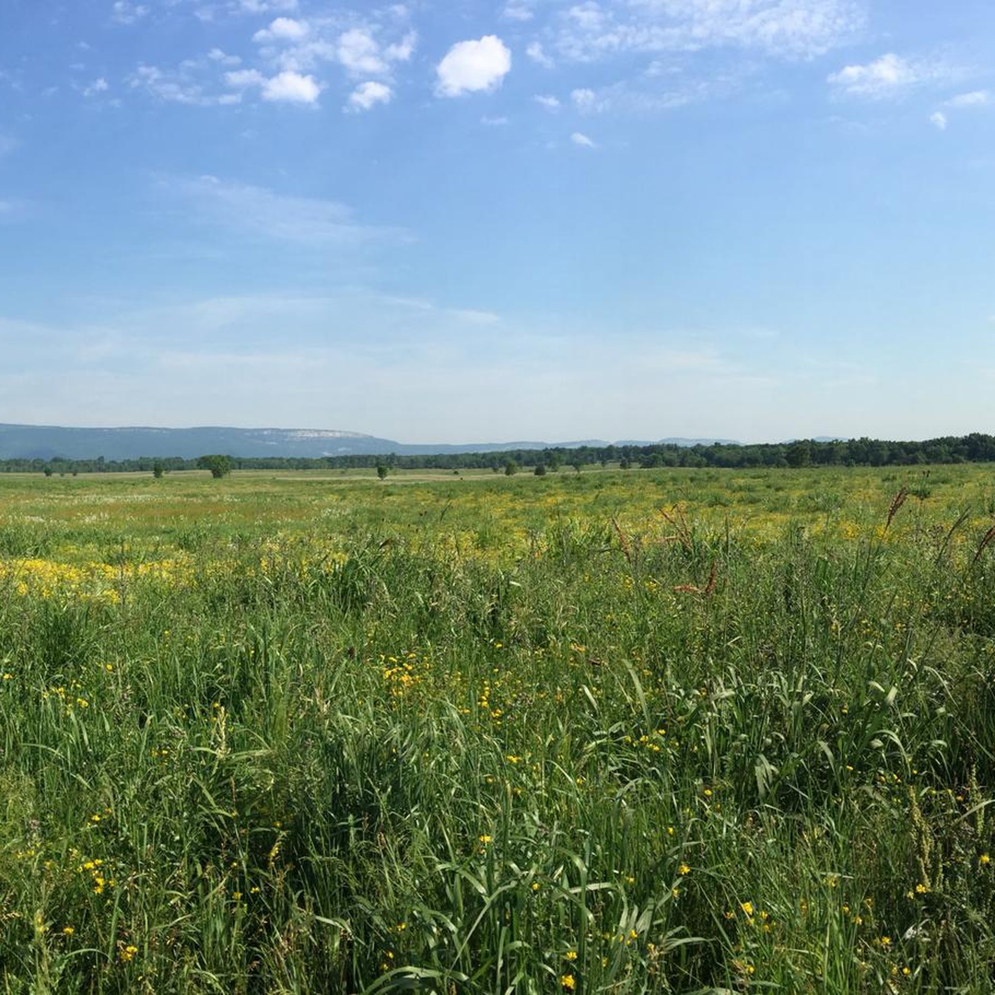
The Shawangunk Grasslands National Wildlife Refuge covers an area of 597 acres. It was initiated to support migratory birds and wintering raptors. It has great views of the stunning Shawangunk Ridge. It is a beautiful area to cycle around.
0
0

This is the part of the Wallkill Valley Rail Trail which passes through New Paltz. The whole trail is approximately 22 miles in length and was the former Wallkill Valley Railroad. The railroad was closed in 1977 and the first section of trail opened in 1993. This is a multi-user trail, so please respect other trail users.
1
0

The Rosendale Trestle Bridge is a famous bridge crossing along the Wallkill Valley Rail Trail between Joppenbergh Mountain Park and Hardenbergh Park. This wooden boards making the base of the bridge are a little weathered, so watch your footing as you cross.
0
0
The Springtown Truss Bridge crosses the Wallkill River. It was once part of the Wallkill Valley Railroad, running between Ulster County and New York city. The bridge was originally built in 1870 and made of wood, but was rebuilt using iron in the early 1880s.
0
0
The trails here have been created by the Gardiner Trail Alliance since 2021. There is a great group of volunteers that have been working on adding new trails. There are not many facilities here, but a new dedicated parking area is now open.
1
0

Shawangunk Kill is a 47.2-mile-long stream that flows through several counties in New York. This point provides a nice view of the stream from a small bridge, making it an ideal spot for a quick break before you continue.
0
0
Frequently Asked Questions
How many touring cycling routes are available in Shawangunk Grasslands National Wildlife Refuge?
There are over 10 touring cycling routes available in the Shawangunk Grasslands National Wildlife Refuge, catering to various skill levels. You'll find a mix of easy, moderate, and challenging options to explore the area.
What kind of terrain can I expect when cycling in the Shawangunk Grasslands National Wildlife Refuge?
The refuge features unique terrain, primarily open grasslands with remnants of former airport runways and taxiways. This means you'll encounter flat, largely paved surfaces ideal for touring cycling, especially within the 400-acre core grassland. There are also 3.6 miles of internal trails, including two interconnected loops that wind through the grasslands, offering generally flat and easy-to-follow routes.
Are there routes suitable for beginners or families?
Yes, the Shawangunk Grasslands National Wildlife Refuge offers several easy routes perfect for beginners and families. For instance, the View of the Shawangunk Kill loop from Watchtower is an easy 11.6-mile path that provides scenic views without significant elevation changes. The flat, paved sections of the former runways also offer a very accessible cycling experience.
Can I connect to longer cycling routes from the refuge?
Absolutely. The Shawangunk Grasslands National Wildlife Refuge is conveniently located near the Wallkill Valley Rail Trail, which provides excellent opportunities for longer cycling adventures. You can explore segments like the Wallkill Valley Rail Trail (18.5 km) for an easy ride or challenge yourself with the Wallkill Valley Rail Trail (91.5 km) for a more difficult, extended tour.
What are the best times of year to go touring cycling in the refuge?
The refuge is open daily from sunrise to sunset, making it accessible year-round. However, for touring cycling, spring and fall generally offer the most pleasant weather conditions. These seasons also provide excellent opportunities for birdwatching, as the refuge is a critical habitat for migratory birds. Winter cycling is possible, especially for snowshoeing or cross-country skiing, but conditions can vary.
What kind of wildlife can I expect to see while cycling?
The Shawangunk Grasslands National Wildlife Refuge is a vital 'Biodiversity Focus Area' and 'Important Bird Area.' Cyclists often spot a diverse array of grassland-dependent migratory birds and wintering raptors, including species like Red-tailed hawks, Northern Harriers, and Eastern Meadowlarks. White-tailed deer and spotted turtles are also present. Five wildlife observation blinds are located along the trails for enhanced viewing opportunities.
Are there any specific viewpoints or natural features to look out for?
Yes, while cycling through the refuge, you'll be treated to impressive and majestic views of the Shawangunk Ridge to the west. The open grasslands themselves offer a unique landscape, and routes like the Mountain view – Amazing View Of The Shawgunks loop from Town of Gardiner are specifically designed to highlight these stunning vistas.
What are the rules and regulations for cyclists within the Shawangunk Grasslands National Wildlife Refuge?
The refuge is managed by the U.S. Fish and Wildlife Service. While specific cycling rules are generally posted on-site, it's important to respect wildlife, stay on designated trails, and pack out everything you pack in. For detailed regulations and visitor guidelines, you can consult the official FWS website for the refuge: Shawangunk Grasslands National Wildlife Refuge.
Is there parking available at the Shawangunk Grasslands National Wildlife Refuge?
Yes, parking is available at the refuge. Cyclists should look for designated parking areas, which are typically well-marked. It's always a good idea to arrive early, especially on busy days, to secure a spot.
Are there any facilities like restrooms or water sources in the refuge?
There is a public restroom available at the Shawangunk Grasslands National Wildlife Refuge. However, potable water sources are not available within the refuge, so cyclists should plan accordingly and bring their own water to stay hydrated during their ride.
What do other touring cyclists enjoy most about cycling in Shawangunk Grasslands National Wildlife Refuge?
The area is highly rated by the komoot community, with an average score of 4.6 stars. Reviewers often praise the peaceful setting, the unique experience of cycling on former runways, the abundant wildlife observation opportunities, and the beautiful backdrop of the Shawangunk Ridge. The variety of routes, from easy loops to connections with longer rail trails, is also frequently highlighted.
Are there any challenging routes for experienced touring cyclists?
Yes, for experienced touring cyclists seeking a challenge, the refuge and its vicinity offer more demanding options. The longer Wallkill Valley Rail Trail (91.5 km), for example, is rated as difficult and provides a significant distance to cover. Some routes in the surrounding area may also incorporate unpaved segments, requiring good fitness and bike handling skills.
Most popular routes in Shawangunk Grasslands National Wildlife Refuge

Get inspired with the komoot mobile app


Explore more
Browse the best Cycling routes in other regions.
