Shawangunk Grasslands National Wildlife Refuge
Shawangunk Grasslands National Wildlife Refuge
The best road cycling routes in Shawangunk Grasslands National Wildlife Refuge
4.0
(2)
231
riders
57
rides
Road cycling in Shawangunk Grasslands National Wildlife Refuge offers routes through expansive open grasslands and meadows, providing wide views. The refuge is characterized by its flat to gently rolling terrain, with the majestic Shawangunk Ridge forming a backdrop to the east. Many routes feature paved surfaces suitable for various skill levels, with some longer options including significant elevation changes. The area provides a mix of easy and moderate paths for road cyclists.
Best road cycling routes in Shawangunk Grasslands National…
Last updated: October 2, 2026
6
riders
63.1km
03:18
520m
520m
Moderate road ride. Good fitness required. Mostly well-paved surfaces and easy to ride.
7
riders
Moderate road ride. Great for any fitness level. Some segments of this route may be unpaved and difficult to ride.

4
riders
65.5km
03:28
670m
670m
Moderate road ride. Good fitness required. Mostly well-paved surfaces and easy to ride.
4
riders
15.8km
00:43
130m
130m
Easy road ride. Great for any fitness level. Mostly well-paved surfaces and easy to ride.
6
riders
47.8km
02:25
400m
400m
Moderate road ride. Good fitness required. Mostly well-paved surfaces and easy to ride.
Get access to more routes and recommendations from other explorers.
Already have an account?
Our route recommendations are based on thousands of hikes, rides, and runs completed by other people on komoot.
Start today with a free account
Your next adventure awaits.
Popular around Shawangunk Grasslands National Wildlife Refuge

Tips from the Community

The windiest piece of rail trail I've ever seen
0
0

This longer section of the Walden-Wallkill Rail Trail is completely paved and is pretty flat. Since it follows an old train line, it technically climbs slightly uphill in one direction and is completely downhill when traveling in the other direction.
0
0

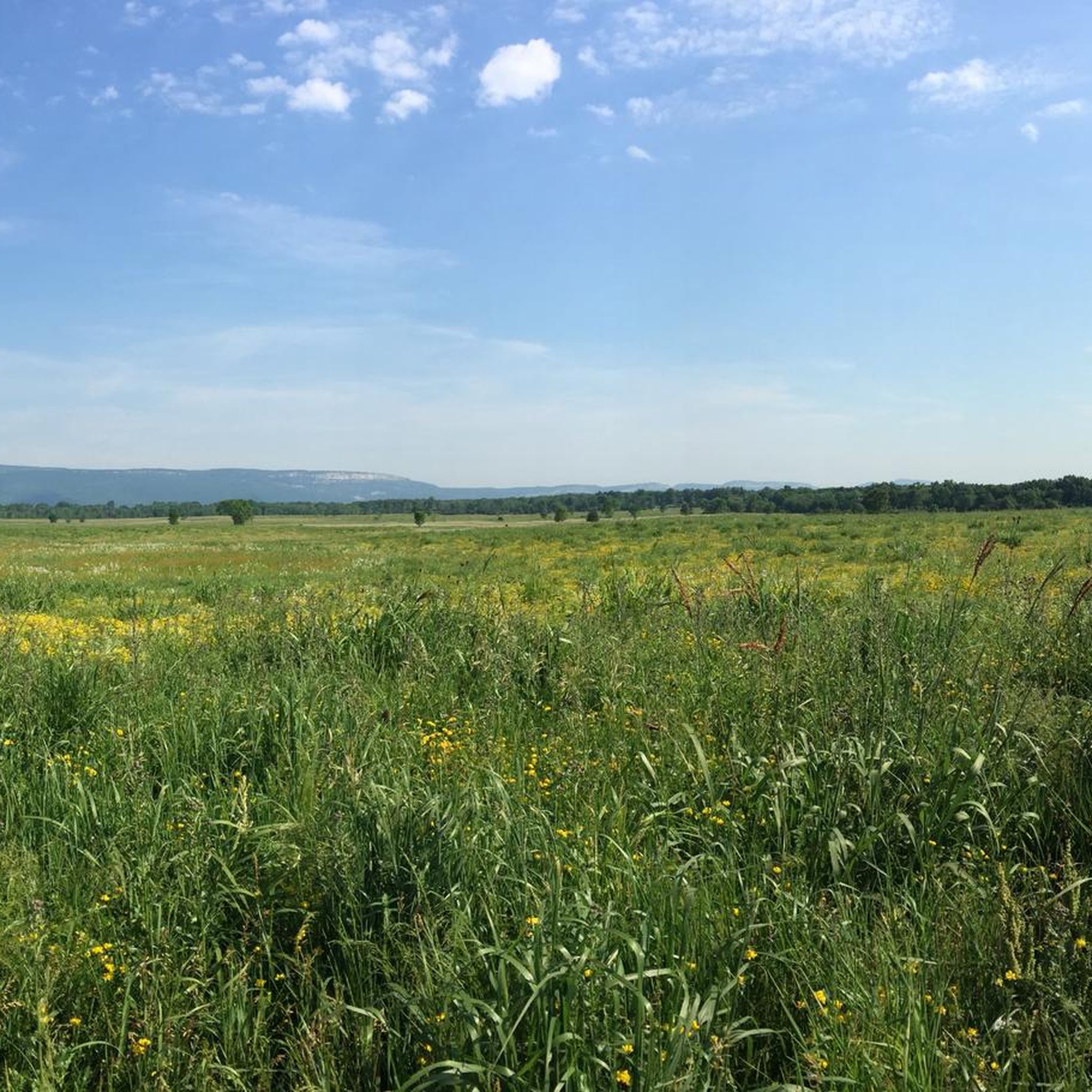
The Shawangunk Grasslands National Wildlife Refuge covers an area of 597 acres. It was initiated to support migratory birds and wintering raptors. It has great views of the stunning Shawangunk Ridge. It is a beautiful area to cycle around.
0
0

Shawangunk Kill is a 47.2-mile-long stream that flows through several counties in New York. This point provides a nice view of the stream from a small bridge, making it an ideal spot for a quick break before you continue.
0
0

Great view of the Minnewaska State Park Preserve and the Adirondack Mountains in the distance.
0
0

View of the Shawgunks and the River To Ridge Trail
0
0
Public parking. Public bike tools and tire pumps are available. Trash bins. Picnic tables.
0
0
Bring some coffee and enjoy the view. Benches are available.
0
0
Frequently Asked Questions
How many road cycling routes are available in Shawangunk Grasslands National Wildlife Refuge?
There are nearly 60 road cycling routes available in Shawangunk Grasslands National Wildlife Refuge. These routes cater to various skill levels, with about 25 easy routes, 30 moderate routes, and a few more challenging options.
What kind of terrain can I expect on road cycling routes in Shawangunk Grasslands National Wildlife Refuge?
You can expect mostly paved surfaces that wind through expansive open grasslands and meadows, offering wide, tranquil views. The terrain is generally flat to gently rolling, with the majestic Shawangunk Ridge providing a scenic backdrop to the east. While most routes are paved, some longer or more challenging segments might include unpaved sections.
Are there any easy road cycling routes suitable for beginners or families?
Yes, the refuge offers several easy road cycling routes. For instance, the Roadbike loop from Watchtower is an easy 14.2-mile (22.8 km) trail that takes about 1 hour 35 minutes to complete, leading through open grasslands. Another easy option is the Roadbike loop from Wallkill, which covers 30.0 km.
What are some longer or more challenging road cycling routes in the area?
For those seeking a longer ride, the View of the Shawangunk Kill loop from Wallkill is a moderate 39.2-mile (63.1 km) route with over 500 meters of elevation gain, typically taking around 3 hours 18 minutes. Another substantial option is the Roadbike loop from Wallkill River, a moderate 65.5 km route with significant elevation changes.
What natural features or wildlife can I observe while cycling?
The refuge is renowned for its open grasslands and meadows, which are crucial for conserving the biological diversity of the Wallkill Valley. It's an Important Bird Area (IBA), so you might spot grassland-dependent migratory birds and wintering raptors, including endangered species like the Short-eared Owl and Northern Harrier. During blooming seasons, wildflowers attract numerous butterflies, adding to the scenic beauty. Five wildlife observation blinds are also available along the trails for closer viewing.
Is the Wallkill Valley Rail Trail accessible for road cyclists from the refuge?
Yes, the Wallkill Valley Rail Trail is noted as a cycling option within the broader Shawangunk area, offering additional opportunities for road cyclists. While the refuge itself features its own network of trails, the rail trail provides another accessible route for exploring the region.
What do other road cyclists say about the routes in Shawangunk Grasslands National Wildlife Refuge?
The road cycling routes in Shawangunk Grasslands National Wildlife Refuge are highly rated by the komoot community, with an average score of 5.0 stars. Cyclists often praise the expansive open grasslands, wide views, and the sense of tranquility found on these routes.
Are there any permits required for cycling in Shawangunk Grasslands National Wildlife Refuge?
Generally, no specific permits are required for cycling on the designated trails within the Shawangunk Grasslands National Wildlife Refuge. However, it's always a good idea to check the official U.S. Fish & Wildlife Service website for any updated regulations or special conditions before your visit. You can find more information at fws.gov/refuge/shawangunk-grasslands.
When is the best time of year to go road cycling in the refuge?
The refuge offers different experiences throughout the year. Spring and fall are often ideal for comfortable cycling temperatures and vibrant natural displays, such as wildflowers in spring or changing foliage in autumn. Birdwatching is particularly rewarding during migratory seasons. Summer can be pleasant, but be prepared for warmer weather. Always check local weather conditions before heading out.
Are there any loop routes available for road cycling?
Yes, many of the road cycling routes in Shawangunk Grasslands National Wildlife Refuge are designed as loops. Examples include the Overlook loop from Watchtower, a moderate 20.5-mile (33.1 km) path, and the Roadbike loop from Watchtower, an easy 14.2-mile (22.8 km) route.
Where can I find information about parking for road cycling in the refuge?
While specific parking areas for cyclists are not detailed in the route descriptions, the Shawangunk Grasslands National Wildlife Refuge is managed by the U.S. Fish & Wildlife Service, and information regarding visitor access and facilities, including parking, can typically be found on their official website. We recommend checking fws.gov/refuge/shawangunk-grasslands/visit-us/trails for visitor information.
Can I bring my dog on the road cycling routes?
The Shawangunk Grasslands National Wildlife Refuge has specific regulations regarding pets to protect wildlife and ensure visitor safety. While some areas may permit leashed dogs, it's essential to verify the current pet policy directly with the U.S. Fish & Wildlife Service before bringing your dog on the trails. Please consult their official website for the most up-to-date guidelines.
Most popular routes in Shawangunk Grasslands National Wildlife Refuge

Get inspired with the komoot mobile app


Explore more
Browse the best Road cycling routes in other regions.
