West Thompson Dam Recreation Area
West Thompson Dam Recreation Area
The best walks and hikes in West Thompson Dam Recreation Area
5.0
(1)
15
hikers
8
hikes
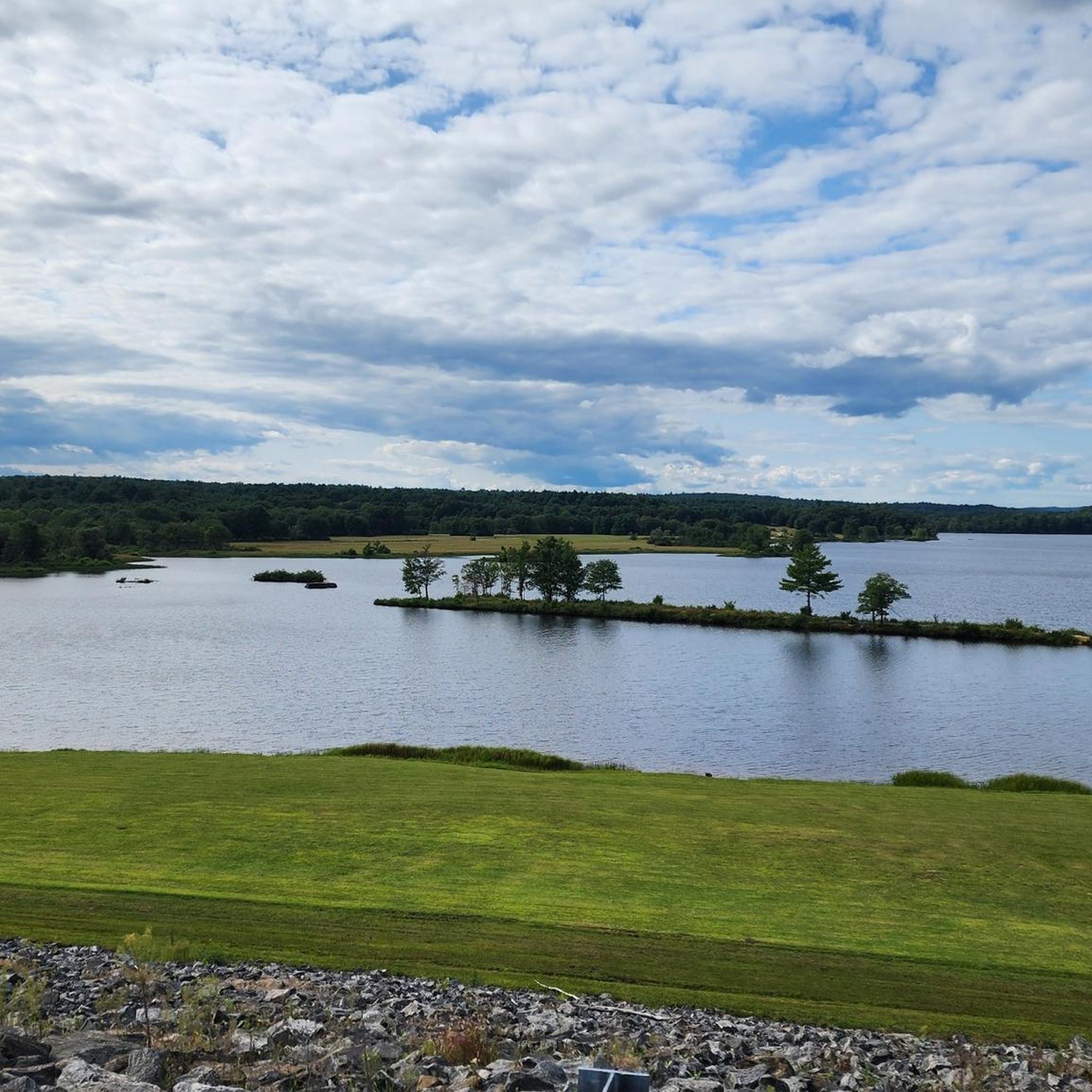
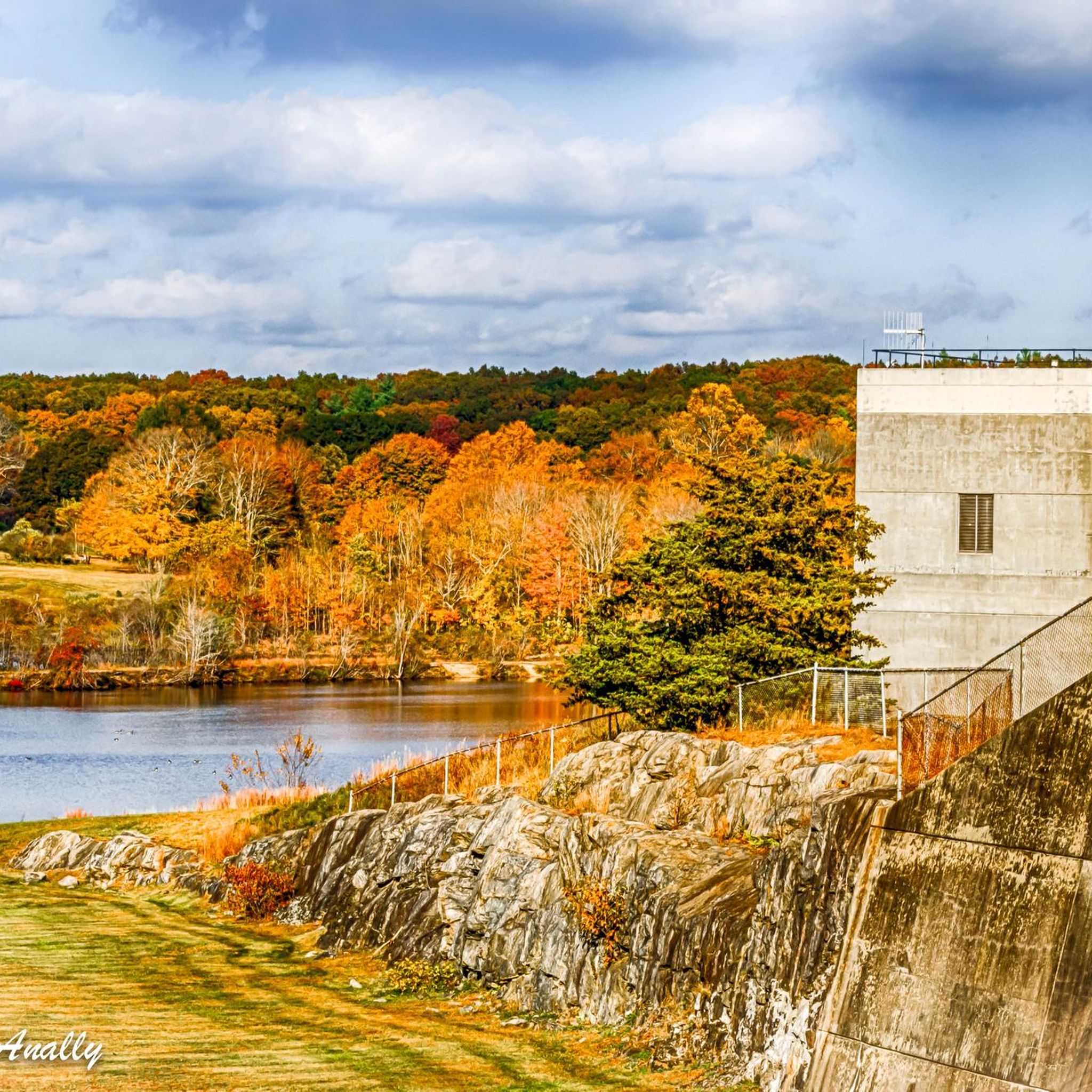
Hikes in West Thompson Dam Recreation Area are centered around the 200-acre West Thompson Lake and the Quinebaug River. The landscape is characterized by a mix of forested wetlands, open fields, and serene pine stands. The trail system, managed by the U.S. Army Corps of Engineers, offers routes with minimal elevation change, making it suitable for a range of abilities.
Best hiking trails in West Thompson Dam Recreation Area
- The most popular hiking route is West Thompson Lake loop from Mechanicsville, a 2.4 mile (3.9 km) trail that takes about 1 hour to complete. This easy route follows the shoreline of the lake.
- Another top favourite among local hiking enthusiasts is West Thompson Dam loop from Mechanicsville, a moderate 7.7 mile (12.4 km) path. The trail provides a more extensive exploration of the area around the dam and lake.
- Local hiking enthusiasts also love the Putnam River Trail — Windham County, a 3.5 mile (5.7 km) trail leading through woodlands along the river, often completed in about 1 hour 30 minutes.
- Hiking in West Thompson Dam Recreation Area is defined by lakeside paths, riverside trails, and quiet woodland walks. The network provides accessible options for different fitness levels, from short family-friendly hikes to longer routes.
- The routes in West Thompson Dam Recreation Area are highly rated by the komoot community. More than 20 hikers have used komoot to explore West Thompson Dam Recreation Area's varied terrain.
Last updated: October 10, 2026
2
hikers
9.81km
02:33
50m
70m
Moderate hike. Good fitness required. Easily-accessible paths. Suitable for all skill levels.
24.1km
06:14
140m
140m
Hard hike. Very good fitness required. Easily-accessible paths. Suitable for all skill levels.

915m
00:14
10m
0m
Easy hike. Great for any fitness level. Easily-accessible paths. Suitable for all skill levels.
5
hikers
5.70km
01:27
20m
20m
Easy hike. Great for any fitness level. Easily-accessible paths. Suitable for all skill levels.
1.61km
00:25
10m
10m
Easy hike. Great for any fitness level. Easily-accessible paths. Suitable for all skill levels.
Get access to more routes and recommendations from other explorers.
Already have an account?
Our route recommendations are based on thousands of hikes, rides, and runs completed by other people on komoot.
Start today with a free account
Your next adventure awaits.
Popular around West Thompson Dam Recreation Area

Tips from the Community

Depending on the route you take last part of the trail can be considered a moderate hike.
1
0

The northern section of the Air Line Trail is particularly captivating, featuring an old bridge and the intriguing "Hermit Cave," and culminating at the tri-point marker where Connecticut, Massachusetts, and Rhode Island meet. This boundary is identified by a 4-foot granite monument (with an additional 5 feet underground) situated in a small hilltop clearing. The marker, 14 inches square with a 6-inch pyramidal top, is inscribed with "MASS 1883" on the north side, "R.I. 1883" on the south, and "CONN" on the west—Connecticut's side lacks a date due to disagreements over the boundary. This monument was installed by a commission from Massachusetts and Rhode Island in late 1883.
0
0

The Putnam River Trail is a 1.8 mile long paved trail. It is part of the East Coast Greenway Trail. As the name suggests, it follows along the Putnam River and gives you great views of the water.
0
0

At Cargill Falls, you'll find a dam and cascades right in the heart of the city. From the Pomfret Bridge on US-44, you can see the wide dam and several flowing channels clearly. An island splits the Quinebaug River and the dam, creating a beautiful display of cascades below as the river rushes to reconnect.
0
0

The Air Line was once a high-speed passenger railroad line connecting New York to Boston. Today, it has been transformed into a 55-mile trail that caters to hikers, runners, and bikers, passing by parks and several bodies of water.
1
0

This granite monument marks the border of Connecticut, Massachusetts and Rhode Island. It was set over 130 years ago. The mountain bike trails in the area are great too.
1
0

No matter which path you take to the marker, its a pretty rough uphill climb. Most likely you will need to carry your bike or leave your bike at the bottom of the climb.
0
0
This granite monument marks the border of Connecticut, Massachusetts and Rhode Island. It was set over 130 years ago. The mountain bike trails in the area great too.
1
0
Frequently Asked Questions
Are dogs allowed in the West Thompson Dam Recreation Area?
Yes, dogs are generally welcome in the recreation area but must be kept on a leash at all times. Please be sure to clean up after your pet to help keep the trails beautiful for everyone.
What are the best family-friendly trails in the area?
The area is great for families due to its mostly flat terrain. For a pleasant and easy walk, consider the Carl Erickson Covered Bridge loop from Pulaski State Park. It's a gentle path that offers a nice taste of the local scenery without being too strenuous for little legs.
Where can I park when visiting for a hike?
There are several parking areas available throughout the West Thompson Dam Recreation Area. The main lots are located near the dam itself and provide convenient access to the Shoreline Trail and other popular routes. It's best to arrive early on weekends, as spots can fill up.
Is camping available at West Thompson Dam?
Yes, there is a well-regarded campground available for visitors. The West Thompson Lake Campground offers 24 sites in a quiet, wooded setting, including options with electric and water hookups. It's a popular choice, so booking in advance is recommended.
Can I go swimming in West Thompson Lake?
No, swimming is not permitted in West Thompson Lake. The area is managed for flood control and wildlife habitat, and for safety reasons, swimming is prohibited. However, activities like boating and fishing are allowed.
What are the options for boating and fishing?
West Thompson Lake is a popular spot for fishing and boating. A public boat ramp provides access to the 200-acre lake for kayaks, canoes, and other small boats. The Quinebaug River also offers excellent opportunities for paddling.
Are there any good viewpoints for photos?
For a panoramic view of West Thompson Lake and the surrounding landscape, head to the top of the West Thompson Dam. It's a favorite spot for sightseers and photographers. The trails themselves also offer many scenic moments as they wind through forests and along the water's edge.
What is the Tripoint Marker and how can I get there?
The Tripoint Marker is a stone monument that marks the point where Connecticut, Massachusetts, and Rhode Island meet. It's a unique destination for dedicated hikers. You can reach it via a challenging 15-mile (24 km) trek along the Tripoint marker via Air Line Trail — Windham County, which connects from the local trail network.
Are there picnic areas or playgrounds for children?
Yes, the recreation area is well-equipped for a family day out. You'll find designated picnic areas, a children's play area, a basketball court, and horseshoe pits, making it easy to combine a hike with other fun activities.
I heard there's a disc golf course. Can you tell me more?
That's right! The West Thompson Dam Recreation Area features an 18-hole disc golf course that is free for public use. It's a great way to enjoy the outdoors and offers a fun challenge for both beginners and experienced players.
What do other hikers enjoy most about this area?
The area is highly rated by the komoot community. Hikers often praise the well-maintained, easy-to-follow trails and the peaceful atmosphere. The mix of lakeside paths, quiet woodlands, and open fields provides a varied and relaxing outdoor experience.
How many trails are there to choose from?
The recreation area features a diverse network of trails with approximately 17 miles of marked paths. On komoot, you can explore around 7 curated routes, ranging from short, easy walks to longer, more challenging hikes, ensuring there's a suitable option for every fitness level.
Most popular routes in West Thompson Dam Recreation Area

Get inspired with the komoot mobile app


Explore more
Browse the best Hikes in other regions.
