The best running trails in Ashland State Park
4.8
(4)
459
runners
56
runs
Jogging in Ashland State Park is centered around the Ashland Reservoir, a prominent natural feature within the park's 470 acres. The landscape primarily consists of lush forests, wetlands, and gentle hills surrounding the reservoir. The park offers a diverse trail system with varying terrains, from well-maintained paths to more uneven, rooty sections. These features provide a range of running experiences for different fitness levels.
Best jogging routes in Ashland State Park
- The most popular jogging route is Ashland Reservoir Dam – Ashland Reservoir loop from Ashland State Park, a 4.4 miles (7.0 km) trail that takes about 50 minutes to complete. This route offers continuous views of the reservoir and its dam.
- Another top favourite among local runners is Running loop from Cold Spring Farm, a moderate 4.0 miles (6.4 km) path. This route features mostly paved surfaces, making it accessible for various skill levels.
- Local runners also love the Upper Charles Trail loop from Cedar Street Lot, a 13.9 miles (22.3 km) trail leading through varied suburban and natural landscapes, often completed in about 2 hours 20 minutes.
- Jogging in Ashland State Park is defined by its serene reservoir, lush forests, and diverse trail surfaces. The network offers options for different ability levels, from easy loops to more challenging, longer runs.
- The routes in Ashland State Park are highly rated by the komoot community with an average score of 4.7 stars from over 5 reviews. More than 400 runners have used komoot to explore Ashland State Park's varied terrain.
Last updated: October 2, 2026
3
runners
5.60km
00:35
50m
50m
Moderate run. Good fitness required. Mostly paved surfaces. Suitable for all skill levels.
17
runners
22.3km
02:20
100m
100m
Hard run. Very good fitness required. Mostly paved surfaces. Suitable for all skill levels.

4
runners
6.37km
00:40
40m
40m
Moderate run. Good fitness required. Mostly paved surfaces. Suitable for all skill levels.
5
runners
13.4km
01:26
140m
140m
Moderate run. Good fitness required. Mostly paved surfaces. Suitable for all skill levels.
8
runners
34.8km
03:45
230m
230m
Hard run. Very good fitness required. Mostly paved surfaces. Suitable for all skill levels.
Get access to more routes and recommendations from other explorers.
Already have an account?
Our route recommendations are based on thousands of hikes, rides, and runs completed by other people on komoot.
Start today with a free account
Your next adventure awaits.


Tips from the Community

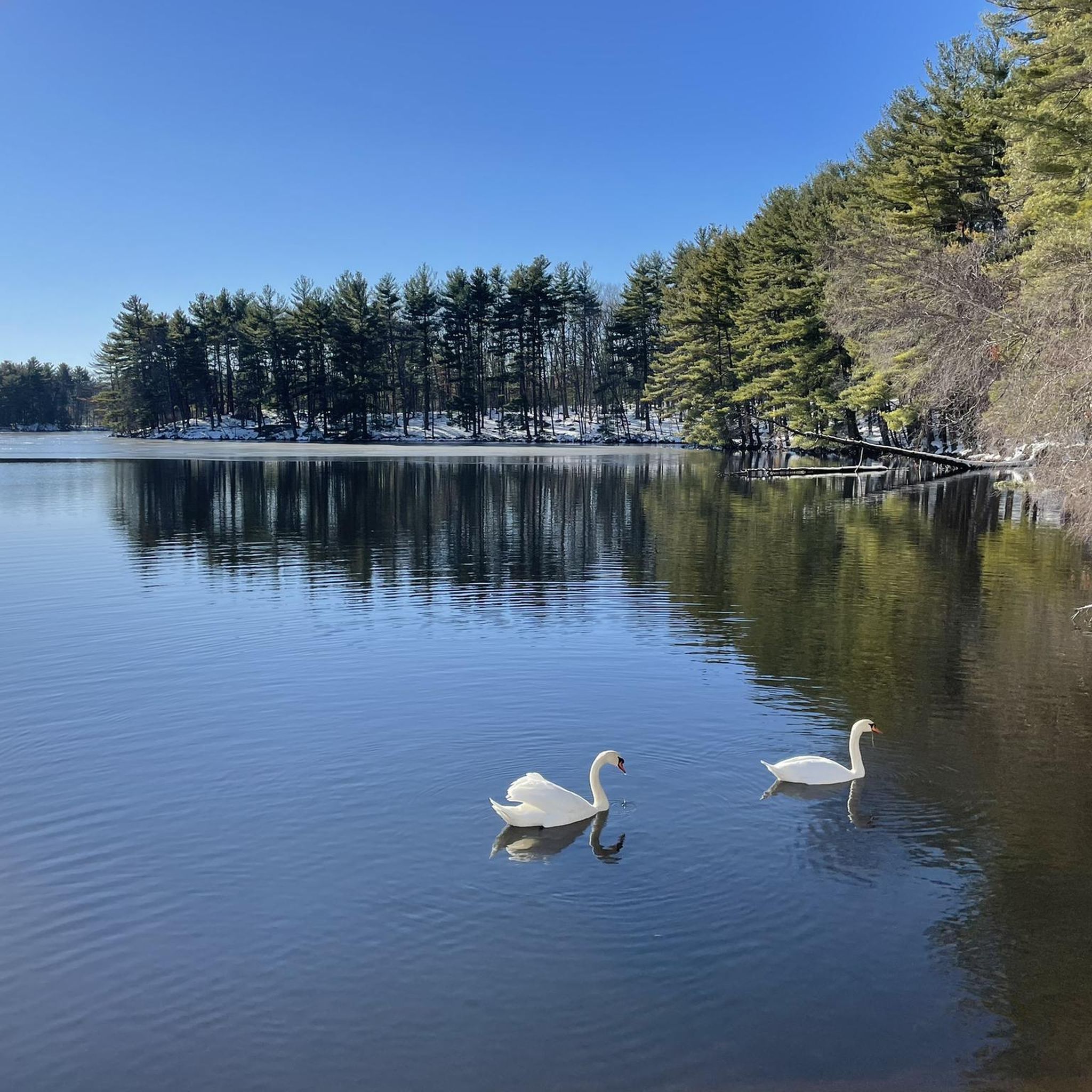
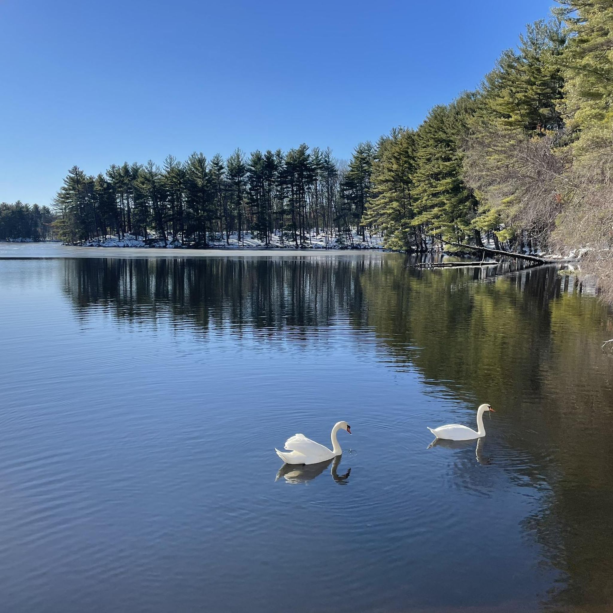
Ashland Reservoir is a 157-acre lake that serves as the centerpiece of Ashland State Park. There is a 3.5-mile trail that circles the lake that is a popular hiking path that offers continuous views of the water. Fishing and boating is popular all year long, and a small beach area is open for swimming during the warmer months.
0
0

The views of the reservoir from this road are lovely, and particularly so in the warmer months with the green leaves of the trees. Ashland State Park, located in Ashland, Massachusetts, encompasses the Ashland Reservoir, spanning 157 acres (64 hectares). This public recreation area offers a scenic and inviting environment for outdoor activities.
0
0

Ashland is one of the younger towns in the region, as it was initially divided between the towns of Hopkinton and Framingham, which were founded before it. It was not until 1846 that it was given the name Ashland and several rail lines passed through it. Numerous mills were built along the Sudbury River and a thriving shoe industry developed. However, the construction of three reservoirs brought the industry to a halt and the mills had to close. Today you will find several restaurants and the beautiful Ashland State Park for hiking and recreation.
0
0
The Upper Charles Rail Trail is a 13.5-mile rail trail that consists of a packed dirt and cinder path the entire time. This section of the trail passes through the Wenakeening Woods and offers access to their singletrack hiking trail network.
0
0

Former railroad track the Upper Charles Trail is currently over 13 miles long. It eventually plans to connect the communities of Milford, Ashland, Sherborne, Holliston, Framingham and Hopkinton. It will then do more than 24 miles in total when fully completed.
0
0
Ashland is one of the younger towns in the region, as it was initially divided between the towns of Hopkinton and Framingham, which were founded before it. It was not until 1846 that it was given the name Ashland and several rail lines passed through it. Numerous mills were built along the Sudbury River and a thriving shoe industry developed. However, the construction of three reservoirs brought the industry to a halt and the mills had to close. Today you will find several restaurants and the beautiful Ashland State Park for hiking and recreation.
0
0

The rail trail here is nice. It goes by a waterfall and through downtown Milford. The trail eventually extends to Holliston which was not paved and not as nice.
0
1
Frequently Asked Questions
How many running routes can I find in Ashland State Park?
Ashland State Park offers a wide variety of running experiences, with over 50 routes available. These range from easy loops to more challenging, longer runs, catering to different ability levels.
What are the typical trail conditions and terrain like for jogging in Ashland State Park?
The park's trails offer diverse terrains. While the popular loop around the Ashland Reservoir is generally considered fairly easy, some sections may contain roots and rocks, requiring appropriate footwear. Other trails within the 470 acres of forest can offer varying elevations and surfaces, from mostly paved to more uneven, rooty paths.
Are there any circular running routes in Ashland State Park?
Yes, circular routes are a highlight for runners in Ashland State Park. A popular option is the Ashland Reservoir – Ashland State Park loop from Ashland, which is about 5.0 miles (8.1 km) and offers continuous views of the reservoir. Another great choice is the Ashland Reservoir Dam – Ashland Reservoir loop from Ashland State Park, a moderate 4.4-mile (7.0 km) path.
What kind of natural features or landmarks can I expect to see while running in the park?
The centerpiece of Ashland State Park is the serene Ashland Reservoir, which you'll enjoy views of throughout many runs. The park also features lush forests with towering pines, wetland areas, and a sandy beach. You might also spot rustic stone walls, large boulders, and various wildlife such as ducks, swans, deer, and beavers.
Are the running trails in Ashland State Park suitable for families?
Yes, Ashland State Park has trails suitable for families. The primary loop around the Ashland Reservoir is a popular choice for its relatively easy terrain and scenic views. While some sections may have roots, many paths are well-maintained, making them accessible for a family outing. Consider routes like the Running loop from Cold Spring Farm for a moderate, enjoyable experience.
Is Ashland State Park dog-friendly for runners?
Yes, Ashland State Park is dog-friendly! Leashed pets are allowed on the trails, making it a great place to enjoy a run with your canine companion. Just remember to keep your dog on a leash and clean up after them to ensure a pleasant experience for all park visitors.
What is the best time of year to go running in Ashland State Park?
Ashland State Park is accessible year-round for activities like running. However, the lush forests and reservoir views are particularly vibrant in spring and fall. Summer offers the chance to combine your run with a swim at the sandy beach, while winter provides opportunities for cross-country skiing, though trail conditions for running may vary with snow and ice.
Where can I park when visiting Ashland State Park for a run?
Ashland State Park provides accessible parking facilities for visitors. While specific lot names aren't detailed, there are designated parking areas available to accommodate runners and other park users. For longer runs, you might consider routes that start from convenient parking spots, such as the Upper Charles Trail loop from Cedar Street Lot, which offers a substantial 13.9-mile (22.3 km) run.
How do other runners rate the trails in Ashland State Park?
The running routes in Ashland State Park are highly rated by the komoot community, with an average score of 4.8 stars from 6 reviews. Over 380 runners have used komoot to explore the park's varied terrain, often praising the serene reservoir, lush forests, and diverse trail surfaces.
Are there any longer, more challenging running routes in the park?
For those seeking a more challenging and longer run, Ashland State Park and its vicinity offer options. The Upper Charles Trail loop from Cedar Street Lot is a significant 13.9-mile (22.3 km) trail that leads through varied suburban and natural landscapes, typically completed in about 2 hours 20 minutes. Another moderate, longer option is the Mighton Woods – Cold Spring Farm loop from Ashland, spanning 13.3 miles (21.4 km).
Can I access Ashland State Park using public transportation?
Ashland State Park is generally accessible, and while direct public transport to the park entrance might be limited, the town of Ashland is served by the MBTA Commuter Rail. From the Ashland station, you may need to arrange for a short taxi ride or check local bus schedules for connections to the park, as it's not directly adjacent to the station.
Most popular routes in Ashland State Park

Get inspired with the komoot mobile app


Explore more
Browse the best Running Trails & Routes in other regions.
