The best MTB trails in Distrito De Conservación De Suelos Alto Del Nudo
4.8
(680)
1,207
riders
62
rides
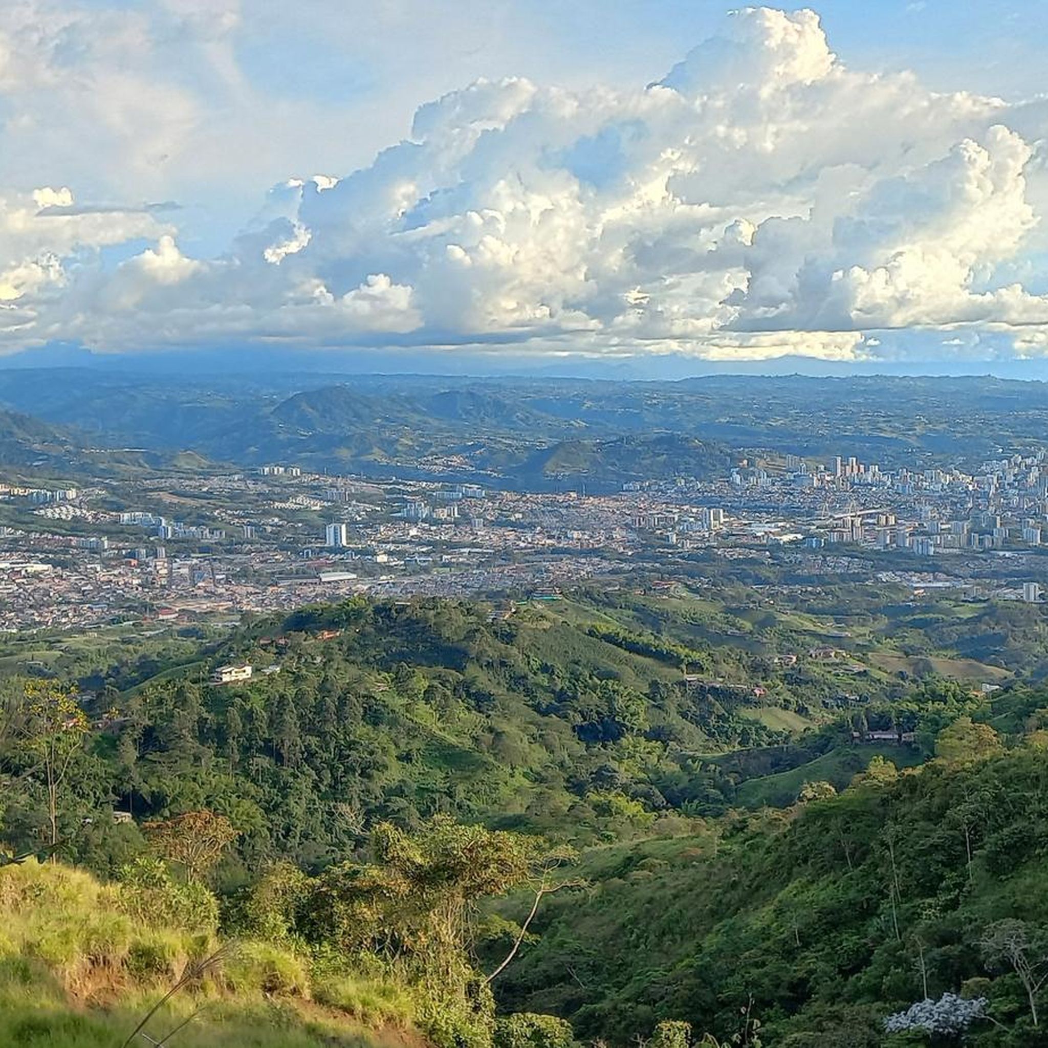
Mountain bike trails in Distrito De Conservación De Suelos Alto Del Nudo traverse Andean foothills and cloud forests, offering varied terrain for riders. Situated at altitudes between 1700 and 2100 meters, the region features challenging ascents and descents. Routes often wind through extensive coffee plantations, providing a unique agricultural landscape experience. The area is also characterized by significant water resources and biodiversity, contributing to diverse natural environments.
Best mountain bike trails in Distrito De Conservación De Suelos Alto Del Nudo
…Last updated: July 11, 2026
4.4
(9)
28
riders
54.9km
03:52
1,030m
1,030m
Hard mountain bike ride. Very good fitness required. Suitable for all skill levels.
5.0
(4)
18
riders
97.6km
08:41
2,680m
2,680m
Hard mountain bike ride. Very good fitness required. Suitable for all skill levels.

Sign up for free
4.9
(15)
19
riders
45.6km
03:34
1,140m
1,140m
Hard mountain bike ride. Very good fitness required. Suitable for all skill levels.
4.6
(77)
12
riders
25.4km
01:42
430m
430m
Moderate mountain bike ride. Good fitness required. Suitable for all skill levels.
5.0
(32)
7
riders
34.5km
02:33
760m
760m
Moderate mountain bike ride. Good fitness required. Suitable for all skill levels.
Get access to more routes and recommendations from other explorers.
Sign up for free
Already have an account?
Our route recommendations are based on thousands of hikes, rides, and runs completed by other people on komoot.
Start today with a free account
Your next adventure awaits.
Login or Signup
Popular around Distrito De Conservación De Suelos Alto Del Nudo

Tips from the Community

Section for MTB, with many wetlands with bamboo groves around it, with good climbs, on the left there is another path but it is a blind path, along this path you reach a private gate, but you can pass, it has good climbs with several technical parts, you must pay attention to the map because there are several detours, the path ends on the road to Guacas
0
0
Short stretch for MTB, it is a crossing before the Tarapacá 1 toll, previously vehicles used this road to avoid paying tolls and the other road was just under construction
0
0
During the nineties of the twentieth century, a peasant leader from Filandia named FLAMINIO MARÍA PARRA GALINDO, a resident of the village "La Palmera", began to develop a dream of creating a tourist viewpoint on the hill known as "El bizco" with a great panoramic view, and from this idea the MIRADOR COLINA ILUMINADA arose, although he was not able to see his dream come true, this construction is a tribute to his memory.
0
0

Slope hill force on pedal and be careful when descending good view ... recommended
0
0
The Alto de la Mina village is located 14 km from Chinchiná, on the Vía a Marsella, passing through Alto Curacao, the Manuel Mejía Foundation and the Naranjal Bankruptcy. They are also part of the declaration of the Coffee Cultural Landscape in 2011 made by UNESCO. Some petroglyphs dating back more than 10,000 years ago, made by prehistoric ancestors from the Neolithic period, have been found within the path. As for the history of the top of the mine, the path was generated as such with the Gómez family, owners of the Sinaí hacienda, this family from Antioquia who arrived in search of gold and took this area as a reference with the name of the "top of the mine." Some time later, this activity was abandoned because it was not so profitable and they dedicated themselves to growing coffee, especially coffee, this being their main livelihood today. Currently, the founders of the village are in their fifth generation, and the tourism service is also available.
1
0
Lake Balsora or Cameguadua Reservoir was built in 1952 to supply the power generating plants of Insula, La Esmeralda and San Francisco. Over time, the lake became a problem as it received a lot of sediment from the basins that supplied the reservoir. It was then divided into three lakes; and the CHEC, in alliance with the Government, the Mayor's Office, Empocaldas and Corpocaldas began with work to decontaminate and dredge the lake. In 2010, the north lake was isolated and in 2012, the construction of the pipeline to supply water from the Campoalegre River was completed, thinking of converting the place into a tourist site with great natural and landscape wealth. Today it has the capacity for 300 or 400 people, parking areas for cars and motorcycles, in addition, it has a 600 meter path and a special roundabout for bird watching, it has sport fishing, and a boat service.
0
0

Ascent for MTB, it crosses the street of the La Reina neighborhood (it has a very good unevenness)
0
0
Frequently Asked Questions
How many mountain bike trails are available in Distrito De Conservación De Suelos Alto Del Nudo?
There are over 60 mountain bike trails in Distrito De Conservación De Suelos Alto Del Nudo. These routes traverse diverse landscapes, including Andean foothills, cloud forests, and coffee plantations, offering a wide range of experiences for riders.
What kind of terrain and elevation can I expect on mountain bike trails in Alto Del Nudo?
Mountain bike trails in Alto Del Nudo are characterized by significant elevation changes, with routes situated between 1700 and 2100 meters above sea level. You'll encounter challenging ascents and descents through varied terrain, from dense cloud forests to winding paths through coffee plantations.
Are there any family-friendly mountain bike trails in Distrito De Conservación De Suelos Alto Del Nudo?
While many trails in Alto Del Nudo are rated moderate to difficult due to significant elevation changes, there are a few easier options available. The region has 3 easy routes, which might be suitable for families with some mountain biking experience. Always check the specific trail details for suitability before heading out.
What natural features and viewpoints can I discover along the trails?
The region is rich in natural beauty. You can explore lush cloud forests, extensive coffee plantations, and areas crucial for water conservation. Notable viewpoints, such as the 'mirador de los 8 pueblos', offer panoramic vistas. The Cacique Nona Nature Trail is particularly beautiful, though it can be challenging for bikers.
Are there any dedicated mountain biking trails or parks in the area?
Yes, the area features dedicated mountain biking spots. For instance, the Monte Tabor MTB Trail is explicitly designed for mountain biking. You can also find areas like Nueva Independencia which is listed as an MTB park.
What is the best time of year for mountain biking in Alto Del Nudo?
Alto Del Nudo experiences a humid climate due to its cloud forest environment. While specific seasonal recommendations aren't provided, the consistent humidity suggests that trails can be wet or muddy at times. It's advisable to check local weather conditions before your ride and be prepared for varying trail surfaces.
Are there any long-distance or challenging loop trails for experienced riders?
Yes, experienced riders will find several challenging loop trails. The Colina Iluminada Viewpoint – Don Miguel Demonstration Farm loop from Empresa Arauca S.A. is a difficult 97.7 km path with significant elevation changes. Another option is the Remate Chaquiro – Boquerón Viewpoint loop from La Romelia, which covers nearly 70 km and features substantial climbing.
What kind of wildlife might I encounter on the trails?
Distrito De Conservación De Suelos Alto Del Nudo is recognized for its significant biodiversity. While riding through the cloud forests and natural areas, you might encounter various flora and fauna, including cusumbos and armadillos. The region is also excellent for birdwatching.
What do other mountain bikers enjoy most about the trails in Alto Del Nudo?
The trails in Distrito De Conservación De Suelos Alto Del Nudo are highly rated by the komoot community, with an average score of 4.9 stars from over 600 reviews. Riders often praise the challenging climbs, technical descents, and the breathtaking natural scenery, including the unique experience of riding through coffee plantations and cloud forests.
Are there any trails that pass through coffee plantations?
Yes, many routes in Alto Del Nudo wind through the region's characteristic coffee plantations, offering a unique cultural and natural immersion. For example, the San Andrés Trails include a section leading to a coffee farm with a challenging 12.3% incline.
What are some moderate difficulty mountain bike trails in the area?
For riders looking for a moderate challenge, the Restaurante Don Lolo – Colina Iluminada Viewpoint loop from El Jazmín is a good option. This 25.5 km route offers a balanced experience without the extreme demands of the most difficult trails.
Where can I find more information about ecotourism and local attractions?
The Distrito De Conservación De Suelos Alto Del Nudo promotes ecotourism, focusing on recreation and education. The Visitors Center Las Hortensias serves as a hub for accessing ecotourism resources, including trails, viewpoints, and even pre-Hispanic petroglyphs. You can also explore highlights like La Cima Alta – Quimbaya Trail – Filobonito for more local insights.
Most popular routes in Distrito De Conservación De Suelos Alto Del Nudo
Most popular attractions in Distrito De Conservación De Suelos Alto Del Nudo

Get inspired with the komoot mobile app


Explore more
Browse the best MTB trails in other regions.
