The best MTB trails in Parque Natural Regional Unidad Biogeográfica Siscunsí Ocetá
4.9
(258)
1,205
riders
8
rides
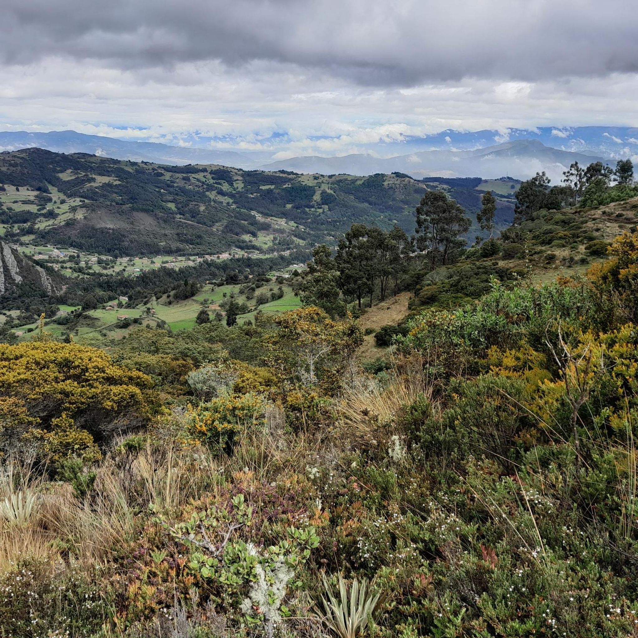
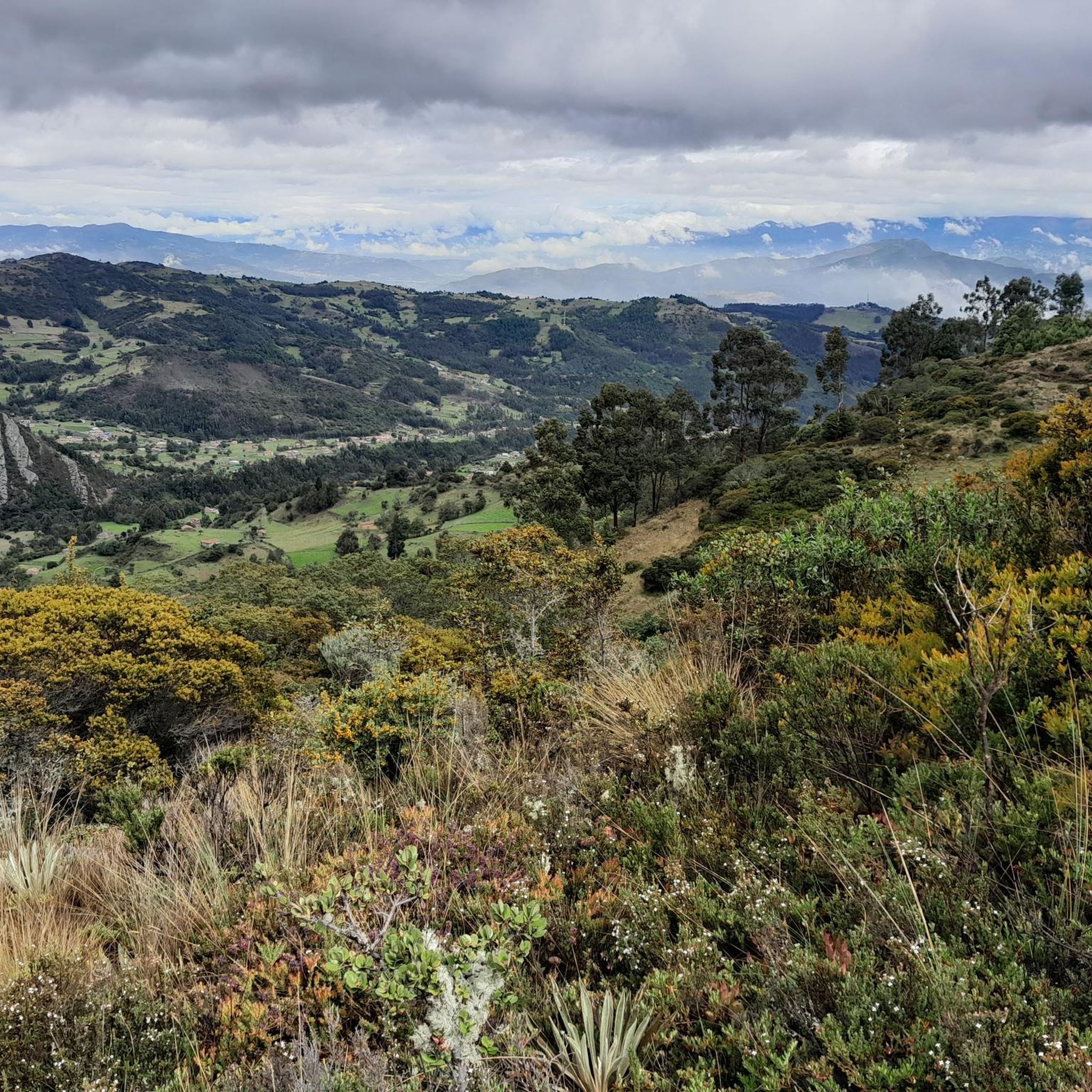
Parque Natural Regional Unidad Biogeográfica Siscunsí Ocetá mountain bike trails traverse a unique high-mountain landscape in the Eastern Cordillera of the Andes. The region is characterized by extensive páramo ecosystems, high Andean forests, and grasslands, offering varied terrain for mountain biking. Riders can explore valleys filled with frailejones, an iconic plant species, and encounter picturesque high-altitude lagoons. This diverse environment provides a range of routes suitable for exploring the natural features of Boyacá, Colombia.
Best mountain bike trails in Parque…
Last updated: July 1, 2026
5.0
(2)
3
riders
26.2km
02:36
710m
710m
Hard mountain bike ride. Good fitness required. Advanced riding skills necessary. Some portions of the route may require you to push your bike.
5.0
(2)
10
riders
23.2km
01:46
500m
500m
Moderate mountain bike ride. Good fitness required. Suitable for all skill levels.

Sign up for free
5.0
(1)
9
riders
17.6km
01:23
320m
320m
Moderate mountain bike ride. Good fitness required. Suitable for all skill levels.
7
riders
33.1km
02:59
860m
860m
Moderate mountain bike ride. Good fitness required. Suitable for all skill levels.
4.0
(1)
4
riders
35.0km
03:23
1,120m
1,120m
Hard mountain bike ride. Very good fitness required. Suitable for all skill levels.
Get access to more routes and recommendations from other explorers.
Sign up for free
Already have an account?
Our route recommendations are based on thousands of hikes, rides, and runs completed by other people on komoot.
Start today with a free account
Your next adventure awaits.
Login or Signup
Popular around Parque Natural Regional Unidad Biogeográfica Siscunsí Ocetá
Tips from the Community

Old house located next to the banks of the Monquirá River
0
0
View to "The Pyramid". Unpaved road in relatively good condition
0
0
El Laguito Park and Iwoka Shopping Center. Meeting point for rides.
0
0
Reference point in Monquirá for bike outings, either to take to La Pirámide or El Azufre.
0
0
Church to the Virgin of the "O" of Morcá. Located in the eastern sector of Sogamoso. From Mochacá there is a paved road in perfect condition. Since the ramada is mostly unpaved. Massively frequented by pilgrims on the first Saturday of each month.
0
0
Altar to the Virgin of Morcá. Just above the altar there is a footprint plate for the final shot before Morcá. 15% incline
0
0
Road that leads to Morcá from La Ramada. Unpaved road. Segments with slopes of up to 15%. Just before reaching Morcá there is a plaque-footprint
0
0
The segment from the Gustavo Jimenez school to Monguí is paved in good condition.
0
0
Frequently Asked Questions
How many mountain bike trails are available in Parque Natural Regional Unidad Biogeográfica Siscunsí Ocetá?
There are 8 mountain bike trails documented in Parque Natural Regional Unidad Biogeográfica Siscunsí Ocetá. These routes traverse diverse landscapes, including extensive páramo ecosystems and high Andean forests.
What kind of terrain can I expect on the mountain bike trails?
The terrain is characterized by high-mountain ecosystems, primarily páramo, high Andean forests, and grasslands. You'll encounter challenging ascents and descents, often through valleys filled with iconic frailejones plants, offering a visually striking and varied riding experience.
What are the difficulty levels of the mountain bike trails in the park?
The trails cater to intermediate and advanced riders. There are 5 moderate routes and 3 difficult routes. There are no easy routes listed, so riders should be prepared for challenging conditions and significant elevation changes.
Are there any circular mountain bike routes available?
Yes, many of the routes are designed as loops. For example, you can explore the Calicanto Bridge of Monguí loop from Monguí, a difficult 16.3-mile (26.2 km) trail, or the moderate Mountainbike loop from Chicamocha, which covers 14.4 miles (23.2 km).
Can I see any natural landmarks or features along the trails?
Absolutely. The park is renowned for its natural beauty. You can ride through valleys of frailejones, encounter high-altitude lagoons like Laguna de Siscunsí, and even pass by features such as La Pirámide Waterfall on the Piqueteadero La Horqueta – La Pirámide Waterfall loop from Chicamocha.
What is the best time of year for mountain biking in Siscunsí Ocetá?
While specific seasonal data isn't provided, the region is known for its high-mountain páramo ecosystems, which can experience cold temperatures. Generally, the dry season would offer more favorable trail conditions, but always be prepared for variable weather and cooler temperatures at altitude.
Are there any family-friendly mountain bike trails?
Given that all listed routes are either moderate or difficult, and the terrain involves significant elevation changes and high-mountain conditions, the trails in Parque Natural Regional Unidad Biogeográfica Siscunsí Ocetá are generally not considered suitable for young children or beginner families. Riders should have prior mountain biking experience.
What do other mountain bikers enjoy most about the trails in this park?
The area is highly rated by the komoot community, with an average score of 4.9 stars from over 200 reviews. Riders frequently praise the unique high-mountain landscapes, the stunning views of the Eastern Cordillera, and the experience of riding through valleys filled with frailejones.
Are there any permits required for mountain biking in Parque Natural Regional Unidad Biogeográfica Siscunsí Ocetá?
The region is a Natural Regional Park, and while specific mountain biking permits are not detailed, it's advisable to check with local authorities or park management regarding current access rules and any required permits before your visit. Hiring a local guide is also recommended as paths may not always be clearly marked.
Can I expect to see any wildlife while mountain biking?
Yes, the park is home to diverse flora and fauna. You might spot sabanero rabbits, various frogs, eagles, and white-tailed deer. The majestic Andean condor also inhabits the area, offering opportunities for unique wildlife observation during your rides.
What is the longest mountain bike trail in the park?
The longest route currently listed is the Gustavo Jiménez School loop from Chicamocha, a difficult trail covering 35.0 miles (35.0 km) with over 1,100 meters of elevation gain and descent.
Is public transport available to reach the trailheads?
While the guide does not specify direct public transport options to all trailheads, the park is accessible from towns like Monguí. It's recommended to research local transport services or consider arranging private transport to reach specific starting points for your mountain biking adventures.
Most popular routes in Parque Natural Regional Unidad Biogeográfica Siscunsí Ocetá

Get inspired with the komoot mobile app


Explore more
Browse the best MTB trails in other regions.
