The best walks and hikes in Cypress Island Natural Resources Conservation Area
4.7
(6)
187
hikers
20
hikes
Hikes in Cypress Island Natural Resources Conservation Area explore a largely undeveloped island in Washington's San Juan Islands. The region is characterized by second-growth forests dominated by Douglas fir, tranquil lakes, and a rocky coastline on the Salish Sea. Trails traverse a landscape shaped by unique geology, with routes ascending to viewpoints over the surrounding islands.
Best hiking trails in Cypress Island Natural Resources Conservation Area
- The most popular hiking route is North Loop — Cypress Island Natural Resources Conservation Area, a 12.8 mile (20.7 km) trail that takes about 6 hours 20 minutes to complete. This is a challenging route that covers a significant portion of the island's trail network.
- Another top favourite among local hiking enthusiasts is Washington Park loop — Anacortes Community Forest Lands, an easy 2.7 mile (4.3 km) path. This route offers a gentle walk with minimal elevation change, suitable for most abilities.
- Local hiking enthusiasts also love the View of Orca Islands loop from Clearidge, a 3.1 mile (5.0 km) trail leading through forested areas, often completed in about 1 hour 20 minutes.
- Hiking in Cypress Island Natural Resources Conservation Area is defined by forested paths, lakeside loops, and coastal viewpoints. The trail network provides options for both short, easy walks and longer, more difficult hikes.
- The routes in Cypress Island Natural Resources Conservation Area are highly rated by the komoot community with an average score of 4.8 stars from a number of reviews. More than 100 hikers have used komoot to explore Cypress Island Natural Resources Conservation Area's varied terrain.
Last updated: September 27, 2026
20.7km
06:20
730m
730m
Hike the difficult 12.8-mile North Loop on Cypress Island, gaining 2389 feet with panoramic views and diverse terrain.
4.7
(3)
45
hikers
4.33km
01:11
70m
70m
The Washington Park loop in Anacortes offers a delightful coastal hiking experience, primarily following a paved road that winds through shaded sections and opens up to breathtaking views. You'll gaze out over the sparkling waters of Burrows Bay and the distant San Juan Islands, with specific viewpoints providing excellent opportunities to spot wildlife like eagles or even whales near the Orca Islands. It's an easy 2.7-mile (4.3 km) loop, making it a perfect choice for a relaxed outing.
Planning your visit is simple, as the loop is easily accessible and well-maintained. The park is a popular spot, so while parking is generally available, arriving earlier in the day might offer a quieter experience, especially during peak seasons. There are no specific permits or fees mentioned for hiking the loop, and the park provides various amenities like picnic areas, making it convenient for a day trip.
This trail stands out for its unique blend of accessibility and stunning natural beauty, offering a quick escape into the Pacific Northwest's coastal environment. Beyond the main loop, you can explore the 1.5-mile Fidalgo Head Loop Trail for a more traditional hiking feel. The park's versatility, with options for camping and other recreational activities, makes it a true gem for locals and visitors alike.

5.0
(1)
43
hikers
Easy hike. Great for any fitness level. Easily-accessible paths. Suitable for all skill levels.
6
hikers
Easy hike. Great for any fitness level. Easily-accessible paths. Suitable for all skill levels.
5
hikers
4.00km
01:06
60m
60m
The Little Cranberry Lake and Trail 100 Loop offers a delightful escape into the Pacific Northwest's natural beauty, circling the serene Little Cranberry Lake. As you hike, you'll be enveloped by a lush forest of madronas, cedars, and firs, with ferns and mosses creating a vibrant green understory. The trail provides continuous tranquil lake views, and you might even spot fascinating carnivorous plants on the boggy islands within the lake.
This easy hiking route is a quick adventure, covering 2.5 miles (4.0 km) with only 202 feet (61 metres) of elevation gain, typically taking about 1 hour and 5 minutes. While the terrain is mostly gentle, be prepared for some rocky patches and roots, so sturdy footwear is recommended. The trail is family-friendly and allows dogs on-leash, making it a great option for a casual outing.
Part of the extensive Anacortes Community Forest Lands, this loop offers a feeling of remoteness despite its accessibility. Historically, the lake basin was once a 10-mile wilderness corridor, and the lake itself was deepened by a dam in the 1930s. Keep an eye out for diverse wildlife, including various birds, beavers, and deer, adding to the trail's natural charm.
Get access to more routes and recommendations from other explorers.
Already have an account?
Our route recommendations are based on thousands of hikes, rides, and runs completed by other people on komoot.
Start today with a free account
Your next adventure awaits.
Popular around Cypress Island Natural Resources Conservation Area
Tips from the Community

Nestled beneath towering cliffs, a serene cove on the island's northern edge harbors a 15 × 15 cabin, with a plaque, echoing the tale of reclusive Mrs. Zoe Hardy, who found solace here in the 1930s.
0
0
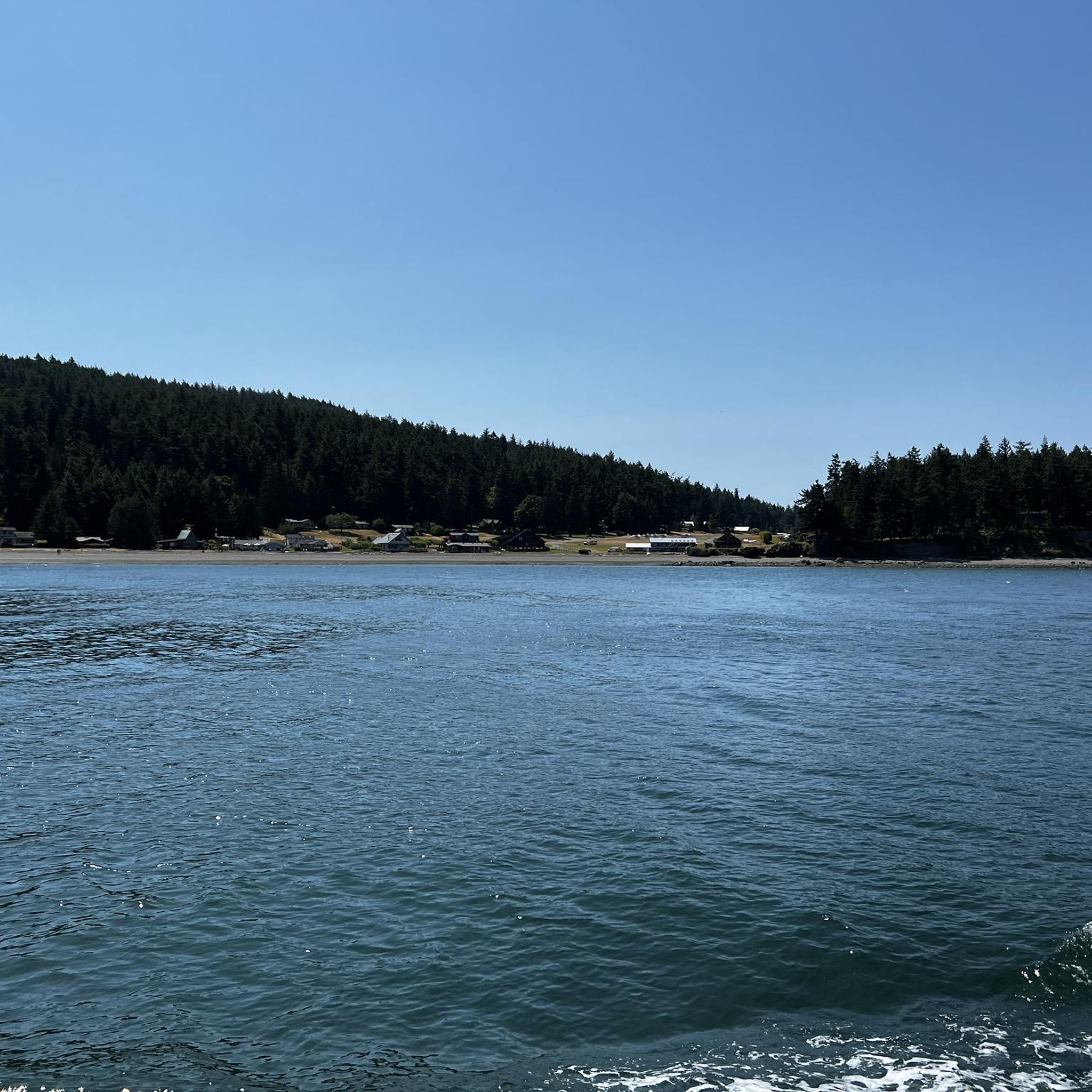
A quiet harbor nestled into the eastern shore of Cypress Island, Eagle Harbor is a great place to dinghy to shore and get a good run. You will have to make arrangements to make it to the Island by watercraft.
0
0
This unique spot boasts a tombolo connecting islands, forming a picturesque bay. High campsites offer mesmerizing views. You will have to make arrangements to make it to the Island by watercraft.
0
0
A quiet harbor nestled into the eastern shore of Cypress Island, Eagle Harbor is a great place to dinghy to shore and get a good hike. You will have to make arrangements to make it to the Island by watercraft.
0
0
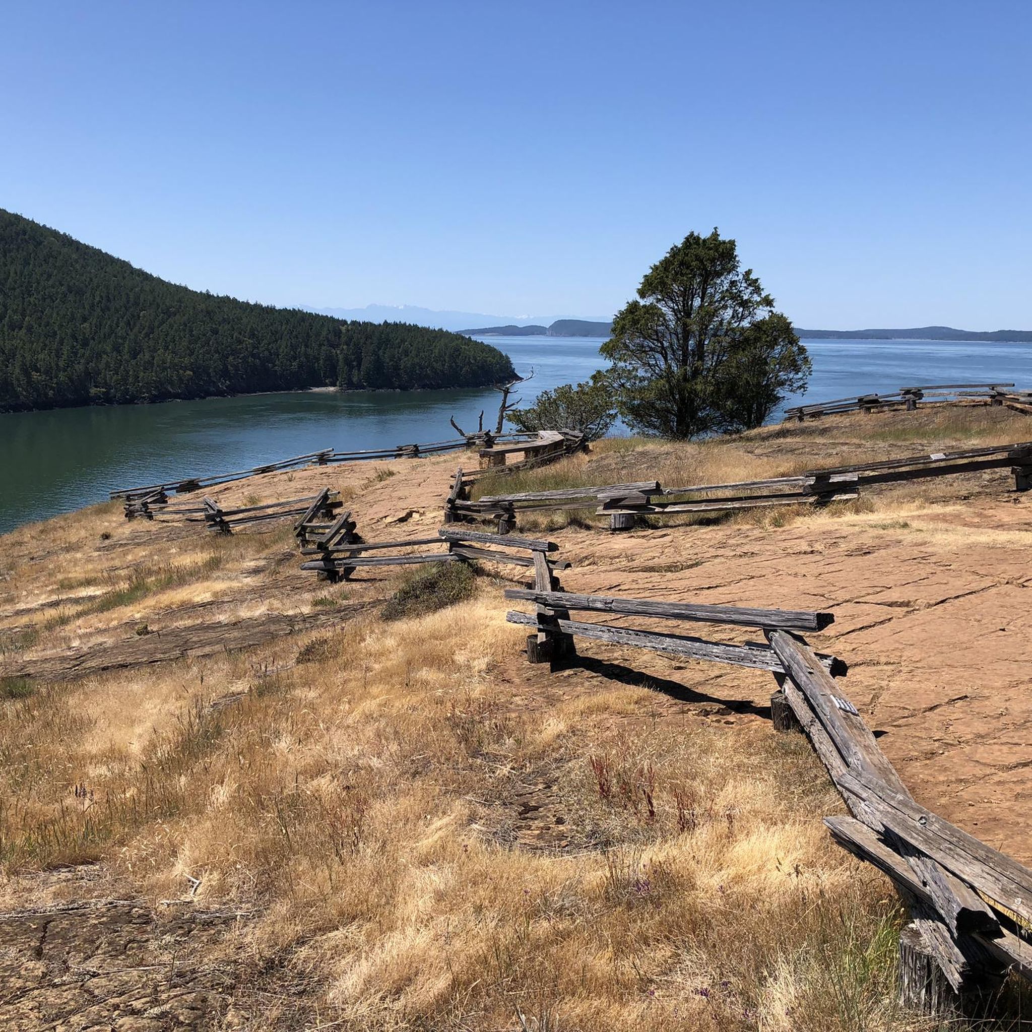
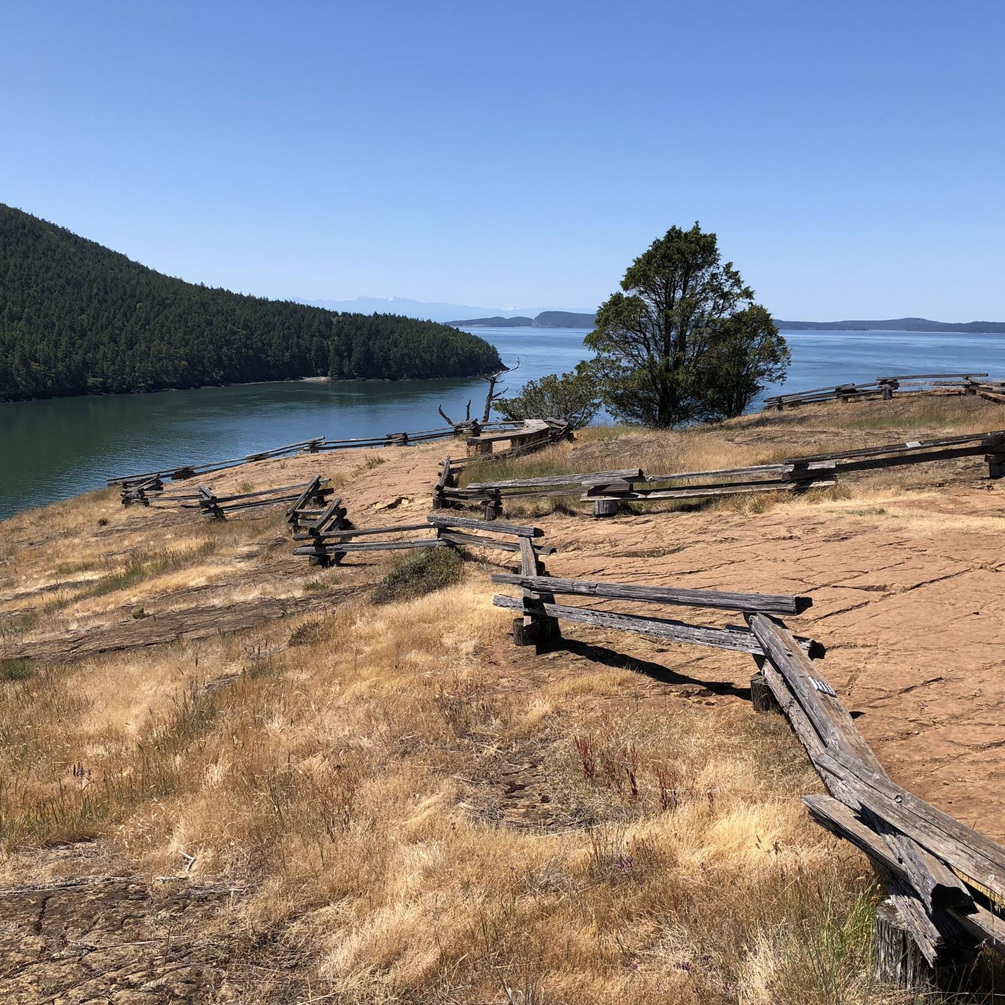
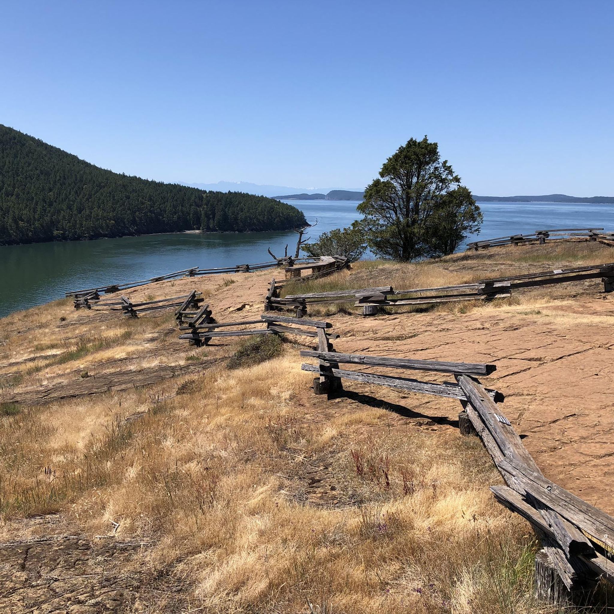
Amid ancient granite and weathered rocks, Rosario Strait's grandeur unfolded, distant islands painting the horizon. Ascending further, a breathtaking panorama revealed itself, a true maritime marvel.
0
0
Nestled beneath towering cliffs, a serene cove on the island's northern edge harbors a 15 x 15 cabin, with a plaque, echoing the tale of reclusive Mrs. Zoe Hardy, who found solace here in the 1930s.
1
0
Burrows Bay, a tranquil inlet near Washington's Fidalgo Island, holds a rich history. Charted by explorers with evolving names, it shares tales of European footsteps and the echoes of its maritime past.
2
0
Orcas Island, a haven of enchantment. Vast wilderness, emerald lakes, and a flourishing artisanal community. It cradles you in its magic, a quintessential gem of Washington state.
0
0
Frequently Asked Questions
How do I get to Cypress Island for hiking?
Cypress Island is accessible only by private boat or a chartered water taxi, as there is no public ferry service. You must arrange your own transportation to one of the island's coves, like Pelican Beach or Cypress Head, to access the trail system. Kayaking to the island is also a popular option for experienced paddlers.
Are there any easy, family-friendly hikes on Cypress Island?
Yes, while the island is rugged, it offers some gentler options. The trails around Duck Lake and Reed Lake provide a peaceful woodland experience without significant elevation gain. For a very easy, accessible walk nearby on the mainland, consider the Washington Park loop — Anacortes Community Forest Lands, which is a flat coastal path.
What are the camping options on Cypress Island?
There are primitive, first-come, first-served campgrounds at Pelican Beach and Cypress Head. These sites are basic and do not have public utilities like running water. Campers must pack in all supplies, including water, and pack out all trash to help preserve the island's natural state.
Are dogs allowed on the trails?
Yes, dogs are generally permitted on the trails in the Cypress Island Natural Resources Conservation Area, but they must be kept on a leash at all times to protect the sensitive ecosystem and wildlife.
What kind of wildlife might I see while hiking?
Cypress Island is a haven for wildlife. Hikers often spot bald eagles, ospreys, and herons. The surrounding Salish Sea is home to marine life, and you might see seals or even orcas from coastal viewpoints. On the island itself, it's common to see deer and hear coyotes.
How many hiking trails are in the Cypress Island area?
There are over 15 designated hiking routes in and around the Cypress Island Natural Resources Conservation Area. These range from short, easy walks to challenging, full-day treks, covering approximately 20 miles of trail in total.
Which hike offers the best ocean views?
The trail to Eagle Cliff is renowned for its spectacular, nearly 360-degree panoramic views of the Salish Sea, the San Juan Islands, and the distant Cascade and Olympic mountains. For a different coastal perspective, the Reef Point trail at the island's southern tip also provides exceptional vistas.
Are there any important regulations I should know before visiting?
Yes, the most critical regulation is the seasonal closure of the upper trail to Eagle Cliff from February 1st to July 15th to protect nesting peregrine falcons. Additionally, the island is a pack-in, pack-out area with no public services. For a full list of rules, it's best to check the official Washington Department of Natural Resources website.
What do other hikers think of the trails in Cypress Island Natural Resources Conservation Area?
The area is highly rated by the komoot community, with an average score of 4.8 stars. Hikers frequently praise the sense of remote wilderness, the well-maintained trails through lush forests, and the stunning coastal viewpoints.
Is there a long, challenging hike for a full day out?
Absolutely. The North Loop — Cypress Island Natural Resources Conservation Area is a difficult 12.8-mile (20.7 km) circuit that covers a large portion of the island's northern trail network. It involves significant elevation gain and is a rewarding challenge for experienced hikers.
Are there any circular walks or loops available?
Yes, the island has several loop options. The trails around Duck Lake and Reed Lake can be combined for a peaceful woodland loop. For a shorter loop with great views on the mainland before you depart, the View of Orca Islands loop from Clearidge is a popular choice.
What should I bring for a day of hiking on Cypress Island?
Since there are no public services, you must be self-sufficient. Essential items include plenty of water, food, a trail map, a first-aid kit, and appropriate layers for changing weather. It is also crucial to have a plan for packing out all of your trash.
Most popular routes in Cypress Island Natural Resources Conservation Area

Get inspired with the komoot mobile app


Explore more
Browse the best Hikes in other regions.
