The best cycling routes in Fraser River Delta -- Ramsar
4.6
(820)
12,145
riders
181
rides
Touring cycling in Fraser River Delta -- Ramsar is characterized by its flat alluvial plains, extensive dike networks, and diverse estuarine marshes. The region is formed by the Fraser River, creating a landscape of intertidal mud and sandflats, floodplains, and river channels. This topography provides accessible routes for cyclists of all fitness levels, often traversing agricultural lands and natural habitats. Many routes utilize dedicated cycling paths and quiet roads, offering views of the river and surrounding natural areas.
Best touring cycling routes in Fraser River Delta -- Ramsar
- The most popular touring cycling route is Mud Bay Park – Boundary Bay Gravel Path loop from Tsawwassen, a 27.5 miles (44.3 km) trail that takes 3 hours 44 minutes to complete. This moderate route offers scenic views along the Boundary Bay shoreline.
- Another top favourite among local touring cyclists is Centennial Beach – Eagle View Farms Ltd loop from Maple Beach, an easy 14.3 miles (23.1 km) path. This route traverses flat terrain near Centennial Beach and agricultural areas.
- Local touring cyclists also love the Mud Bay Park – Delta Heritage Air Park loop from , a 7.7 miles (12.4 km) trail leading through the flat landscapes around Mud Bay Park, often completed in about 1 hour 9 minutes.
- Touring cycling in Fraser River Delta -- Ramsar is defined by flat alluvial plains, extensive dike networks, and estuarine marshes. The network offers options for different ability levels, from easy loops to more challenging moderate routes.
- The routes in Fraser River Delta -- Ramsar are highly rated by the komoot community with an average score of 4.5 stars from over 830 reviews. More than 12,000 touring cyclists have used komoot to explore Fraser River Delta -- Ramsar's varied terrain.
Last updated: July 9, 2026
4.6
(12)
99
riders
44.3km
03:44
50m
50m
Moderate bike ride. Good fitness required. Mostly paved surfaces. Suitable for all skill levels.
4.3
(3)
25
riders
23.6km
01:54
30m
30m
Easy bike ride. Great for any fitness level. Mostly paved surfaces. Suitable for all skill levels.

Sign up for free
17
riders
12.4km
01:09
10m
10m
Easy bike ride. Great for any fitness level. Mostly paved surfaces. Suitable for all skill levels.
5.0
(2)
12
riders
15.0km
01:11
20m
20m
Easy bike ride. Great for any fitness level. Mostly paved surfaces. Suitable for all skill levels.
4.1
(11)
8
riders
Moderate bike ride. Good fitness required. Mostly paved surfaces. Suitable for all skill levels.
Get access to more routes and recommendations from other explorers.
Sign up for free
Already have an account?
Our route recommendations are based on thousands of hikes, rides, and runs completed by other people on komoot.
Start today with a free account
Your next adventure awaits.
Login or Signup
Tips from the Community

So need to use a gravel bike ? Would it be too challenge with road bike?
0
0

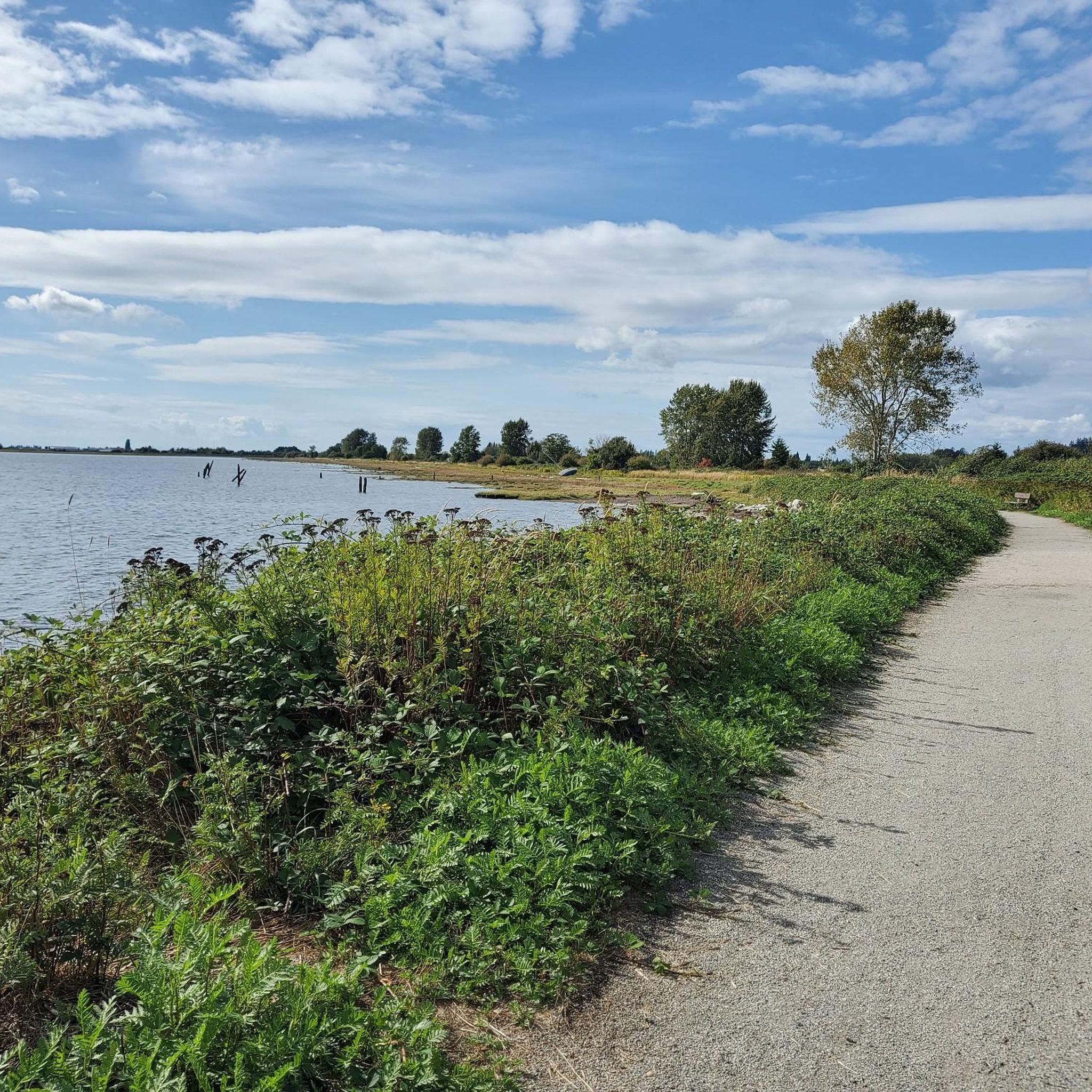
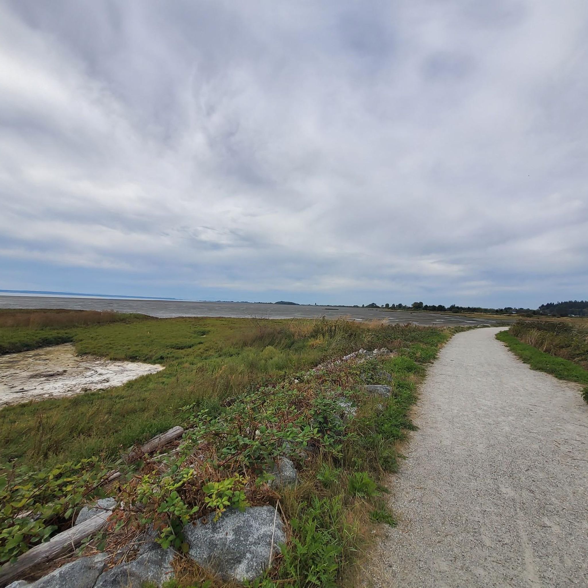
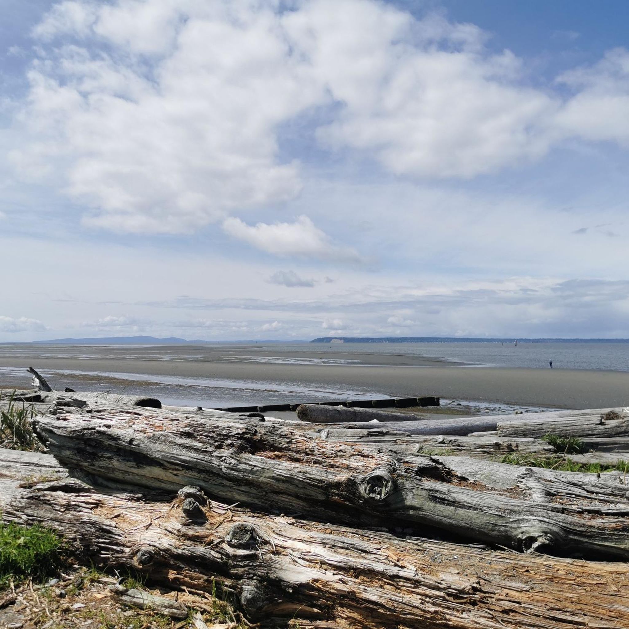
Boundary Bay Dyke Trail is a long, flat route along the shoreline, with uninterrupted views across mudflats and the open water. Its wide gravel surface is ideal for walking and cycling, with plenty of benches and access points along the way. Set along a major migratory route, the trail is especially known for birdlife and beautiful, expansive coastal scenery.
1
0
Beach Grove Park is a lovely mix of open lawns with pockets of mature trees, with flat, well-kept paths that wind through the park, connecting playgrounds, sports courts, picnic areas, and off-leash spaces. Its laid-back, neighbourhood feel makes it a convenient spot for a quick stroll or casual time outdoors.
0
0

Be mindful of equestrians and give them as much space as possible.
0
0

Smooth gravel. Beautiful views of Boundary Bay and Mount Baker.
0
0

The Highway 99 underpass in Delta, BC, is a crucial part of the region's cycling infrastructure, offering a safe and convenient route for cyclists and pedestrians to cross beneath the highway. This underpass is especially significant during the construction phase of the new Fraser River Tunnel, as it helps maintain connectivity for active transportation users in the area.
0
0
Early Industry: Oyster harvesting and shucking have been part of BC's coastal history since the late 19th century, initially focusing on the native Olympia oyster. Pacific Oyster Introduction: The introduction of the larger Pacific oyster in the early 20th century spurred the growth of the industry, leading to the establishment of dedicated shucking plants. Delta Example: One early significant plant was the BC Packers Limited shucking plant in Delta, operating from 1941 until its closure due to pollution in 1963. This plant processed both local and oysters from other BC farms. Hand Shucking: Traditionally, oyster shucking in BC was done entirely by hand, a labor-intensive process under strict sanitary regulations.
0
0
Watershed Park, located at 11600 Kittson Parkway in Delta, BC, is a large natural area with 11+ kilometers of gravel trails popular for walking, cycling, jogging, and horseback riding. Extensive trail system: Suitable for various activities. The Meadow: A central open area with picnic tables and a viewpoint offering views of Mud Bay. Artesian water source: The parkland sits on top of an artesian water supply, historically used for the Ladner area. Picnic pavilion: Available for booking. It's a significant wilderness community park in North Delta.
0
0
Frequently Asked Questions
What is the typical terrain and difficulty level of cycling routes in the Fraser River Delta?
The Fraser River Delta is characterized by its flat alluvial plains, extensive dike networks, and estuarine marshes. This topography makes most routes accessible for cyclists of all fitness levels. You'll find a mix of easy and moderate routes, with some segments on paved surfaces and others potentially unpaved or gravel paths. For example, the Mud Bay Park – Boundary Bay Gravel Path loop from Tsawwassen is a moderate route, while the Centennial Beach – Eagle View Farms Ltd loop from Maple Beach is an easy option.
How many touring cycling routes are available in the Fraser River Delta -- Ramsar region?
There are over 200 touring cycling routes available in the Fraser River Delta -- Ramsar region. These routes cater to various skill levels, with 83 easy routes, 103 moderate routes, and 14 more challenging options.
What natural features can I expect to see along the cycling routes?
The Fraser River Delta is a designated Ramsar Wetland of International Importance, offering diverse natural features. You can expect to see intertidal mud and sandflats, estuarine marshes, floodplains, sloughs, and river channels. It's a critical habitat for migratory birds, including vast numbers of Western Sandpipers, and supports numerous waterfowl and shorebirds. Key natural areas include Burns Bog, Sturgeon Bank, South Arm Marshes, Boundary Bay, and the Alaksen National Wildlife Area.
Are there family-friendly cycling routes in the Fraser River Delta?
Yes, the flat topography of the Fraser River Delta makes it ideal for family-friendly cycling. Many routes are easy and offer paved surfaces, suitable for various skill levels. The Centennial Beach loop from 72nd Street Trail Access is an easy, paved option that families often enjoy.
Can I bring my dog on cycling routes in the Fraser River Delta?
While many outdoor areas in the Fraser River Delta are dog-friendly, specific regulations can vary by park or trail. It's always best to check the local park rules for the specific route you plan to cycle. Generally, dogs are welcome on leash in many regional parks and on dikes, but some sensitive ecological areas, especially bird sanctuaries, may have restrictions.
What landmarks or viewpoints can I discover while cycling?
While cycling, you can discover various landmarks and viewpoints. Notable attractions include the historic Terra Nova Cannery and Sea Island Japanese Community History, the Delta Heritage Air Park, and the scenic White Rock Pier and Waterfront. You might also encounter the unique Eagle's Nest Labyrinth or enjoy views from Iona Beach.
Are there circular cycling routes available in the Fraser River Delta?
Yes, many cycling routes in the Fraser River Delta are designed as loops, offering convenient circular tours. Examples include the Mud Bay Park – Delta Heritage Air Park loop from and the Highway 99 Underpass, Delta – Massey Tunnel Bike Underpass loop from Ladner. The broader Delta Cycling Trail Loop (c33a & c33b) is also a well-known 68 km day ride that explores various features of the delta.
What do other touring cyclists enjoy the most about cycling in the Fraser River Delta?
The komoot community highly rates the cycling experience in the Fraser River Delta, with an average score of 4.5 stars from over 830 reviews. Cyclists often praise the flat, accessible terrain, the extensive dike networks, and the diverse natural habitats, especially the opportunities for bird watching. The scenic views of the Fraser River, agricultural lands, and the transition from urban to natural landscapes are also frequently highlighted.
What is the best time of year to cycle in the Fraser River Delta?
The Fraser River Delta offers good cycling opportunities throughout much of the year due to its mild coastal climate. Spring and fall are particularly pleasant, with comfortable temperatures and vibrant natural scenery, including migratory bird activity. Summer is also popular, though it can be warmer. Winter cycling is possible, but be prepared for cooler temperatures and potential rain.
How can I access the cycling routes using public transport or by car?
Many cycling routes in the Fraser River Delta are accessible by car, with parking available at various regional and district parks, such as Mud Bay Park or Centennial Beach. For public transport, TransLink serves the Metro Vancouver area, including parts of the Fraser River Delta. Cyclists can often combine bus or SkyTrain services with their rides, though it's advisable to check TransLink's bike policies and schedules for specific routes and times.
Are there places to eat or rest along the cycling routes?
Yes, depending on your chosen route, you will find various amenities. The village of Ladner, for instance, is a good rest stop with cafes and services, especially if you're undertaking a longer ride like the Delta Cycling Trail Loop. Many routes pass through or near communities where you can find places to eat, drink, and resupply. It's always a good idea to plan your stops in advance, especially on more remote sections of the dikes or trails.
Most popular routes in Fraser River Delta -- Ramsar
Most popular attractions in Fraser River Delta -- Ramsar

Get inspired with the komoot mobile app


Explore more
Browse the best Cycling routes in other regions.
