Attractions and Places To See in Nairn Falls Provincial Park - Top 6
Best attractions and places to see in Nairn Falls Provincial Park, located near Pemberton, British Columbia, primarily feature its natural landscapes and accessible trails. The park is characterized by its significant Green River, which forms the prominent Nairn Falls, and a diverse forest ecosystem of cedar, hemlock, and Douglas fir. This area holds cultural significance as a traditional route and spiritual site for the Lil'wat Nation.
Best attractions and places to see in Nairn Falls Provincial Park
- The most popular attractions is Nairn Falls, a waterfall that cascades approximately 60 meters down the Green River. Visitors can view the powerful force of the falls and the turbulent waters flowing through potholes from various viewing platforms.
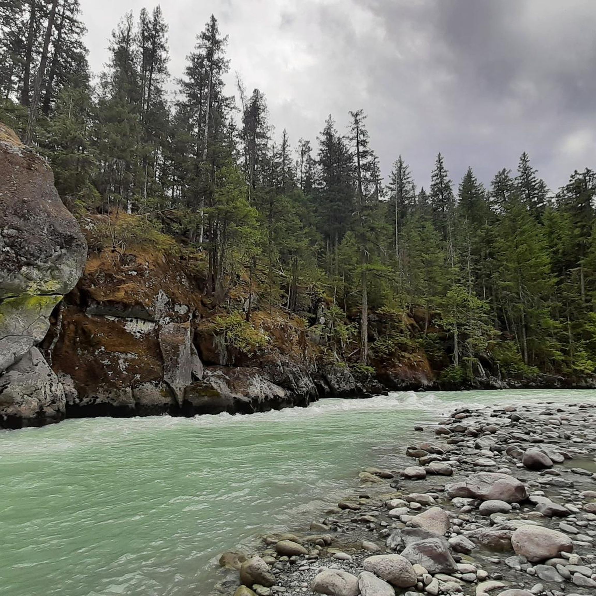
- Another must-see spot is Green River in Nairn Falls Provincial Park, a river that originates in Green Lake and flows through the park, forming the Nairn Falls. The river's course is followed by the British Columbia Highway 99, offering glimpses of its rushing waters.
- Visitors also love Nairn Falls Trailhead Parking, the starting point for a short, relatively flat hike to the waterfalls. This parking lot is located directly on Highway 99, approximately 30 km from Whistler.
- Nairn Falls Provincial Park is known for its waterfalls, rivers, and trails. The park offers a variety of natural attractions to explore, including forested areas and viewpoints.
- The attractions in Nairn Falls Provincial Park are appreciated by the komoot community, with more than 90 upvotes and 90 photos shared by visitors.
Last updated: October 9, 2026
Nairn Falls
Highlight • Waterfall
Translated by Google •
Tip by

Green River in Nairn Falls Provincial Park
Highlight • River
Translated by Google •
Tip by

Sign up now to discover places like this
Get recommendations on the best single tracks, peaks, & plenty of other exciting outdoor places.
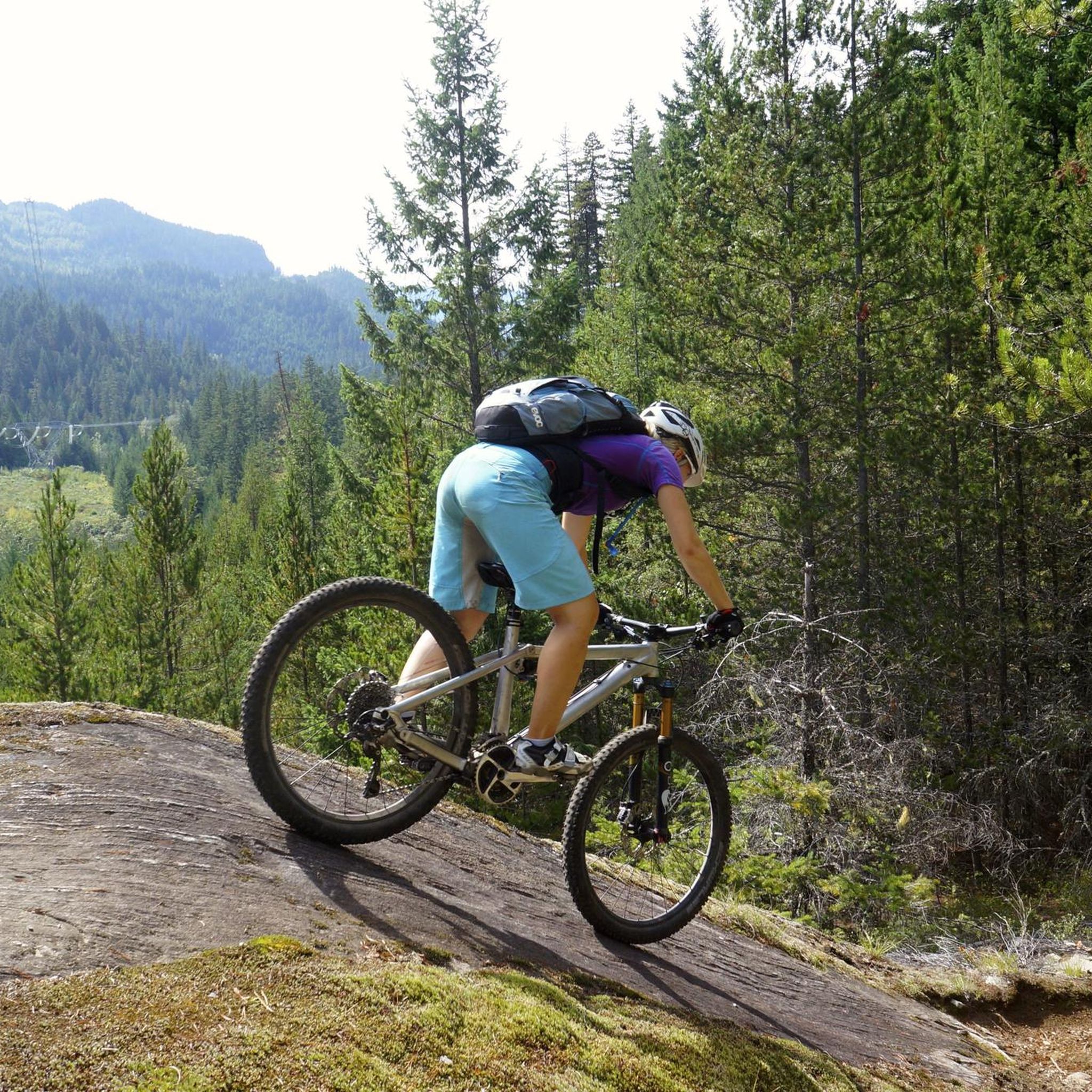
Lumpy’s Epic Trail
Highlight • Trail
trailforks.com/trails/lumpy-s-epic-8691
Tip by

Nairn Falls Trailhead Parking
Highlight • Parking
Tip by
Small Beach on the River
Highlight • Beach
Tip by
Sign up for free to discover even more attractions in Nairn Falls Provincial Park.
Already have an account?
Start today with a free account
Your next adventure awaits.

Other adventures in Nairn Falls Provincial Park

Tips from the Community

The Green River in the Nairn Falls area is known for its strong currents. Therefore, swimming is not permitted in the Green River in Nairn Falls Provincial Park. Visitors are advised to stay on the trails.
2
0
The Nairn Falls parking lot is located directly on Highway 99 / Sea-to-Sky, about 30 km from Whistler and 4 km before the town of Pemberton – near a cliff that drops 15 meters to the Green River.
2
0

Starting point of a short, fairly flat hike
0
0
Lumpy's Epic is a loop trail south of Pemberton for mountain bikers and hikers. Part of the trail runs high on the rocky cliffs above the Green River - outside Nairn Falls Park, with views of Mount Currie in the distance. We ascended from Nairn Falls via the Tower of Power Trail, continued north for a section of Lumpy's Epic, and enjoyed the view of the mountains and the wide valley of the Lillooet River in bright sunshine. (Visit May 27, 2025) https://www.trailforks.com/trails/lumpy-s-epic-8691/
2
1
On the trail to Nairn Falls from the parking lot on Highway 99, there are many opportunities to catch a glimpse of the rushing Green River. Occasionally, speedboats carrying tourists pass by on their way to the waterfall.
2
0
A few kilometers before the town of Pemberton, the Green River cascades down a gorge to form Nairn Falls. Access to the falls is via Highway 99, about 25 km east of Whistler. From the large parking lot, the falls are reached after 1,500 meters on a beautiful, almost level forest trail. The water cascades approximately 36 meters into the gorge in two stages. https://www.worldwaterfalldatabase.com/waterfall/Nairn-Falls-2062 Nairn Falls are popular and attract numerous visitors, partly due to the convenient location of the parking lot directly on Highway 99. https://bcparks.ca/nairn-falls-park/
2
1

The trail can be incorporated as a break on the way to Clearwater (Wells Gray Regional Park), picnic areas are available at the parking lot.
2
0

The hiking trail to the waterfalls is a small highlight We recommend
1
0
Frequently Asked Questions
What are the main natural attractions in Nairn Falls Provincial Park?
The primary natural attraction is Nairn Falls itself, where the Green River cascades approximately 60 meters. The park also features the powerful Green River, a diverse forest ecosystem of cedar, hemlock, and Douglas fir, and various viewpoints along the trails.
What kind of trails can I find in Nairn Falls Provincial Park?
The main trail is the Nairn Falls Trail, an easy and relatively flat 3-kilometer round-trip walk to the waterfalls. It takes about 30 minutes to an hour and is suitable for most hikers. Additionally, a shorter walk from the campground leads to Coudre Point, offering views along the Green River. For more challenging options outside the immediate park, trails like Lumpy’s Epic Trail offer mountain biking and hiking with views of Mount Currie.
Is the Nairn Falls Trail suitable for families and children?
Yes, the Nairn Falls Trail is considered family-friendly. It is an easy, relatively flat 3-kilometer round-trip walk to the falls, making it accessible for most ages and fitness levels. The viewing platforms at the falls are fenced for safety.
Are there any specific viewpoints for Nairn Falls?
Yes, visitors can experience the powerful force of Nairn Falls up close from several fenced-in viewing platforms. These platforms offer different vantage points of the double waterfalls and the turbulent waters flowing through potholes.
Can I go swimming in the Green River at Nairn Falls Provincial Park?
No, swimming is not permitted in the Green River within Nairn Falls Provincial Park due to strong currents. Visitors are advised to stay on the designated trails for safety.
What wildlife might I encounter in the park?
The park is home to various wildlife, including the unique rubber boa, which is one of the most cold-tolerant snake species. While specific sightings are not guaranteed, the forest ecosystem supports a range of local fauna.
What are the parking options for visiting Nairn Falls?
The primary parking area is Nairn Falls Trailhead Parking, located directly on Highway 99, approximately 30 km from Whistler and 4 km before Pemberton. This parking lot serves as the starting point for the hike to the waterfalls.
Do I need a permit to hike the trails in Nairn Falls Provincial Park?
No, permits are generally not required for day hiking on the trails within Nairn Falls Provincial Park. Access to the Nairn Falls Trail is free.
When is the best time of year to visit Nairn Falls Provincial Park?
The park is generally accessible year-round, but the best time to visit for hiking and enjoying the falls is typically during the warmer months, from late spring to early fall (May to October), when the trails are clear and the weather is pleasant. The falls are particularly impressive during spring runoff.
Are dogs allowed on the trails in Nairn Falls Provincial Park?
Dogs are generally permitted in Nairn Falls Provincial Park, including on the trails, but must be kept on a leash at all times. Please remember to clean up after your pet.
What other outdoor activities can I do near Nairn Falls Provincial Park?
Beyond hiking to the falls, the area offers a variety of outdoor activities. You can explore mountain biking trails like Lumpy’s Epic, enjoy road cycling routes such as the Soo River – Green Lake loop, or find running trails like the One Mile Lake loop. For more details on these activities, refer to the MTB Trails in Nairn Falls Provincial Park, Road Cycling Routes in Nairn Falls Provincial Park, and Running Trails in Nairn Falls Provincial Park guides.
Are there mountain biking trails close to Nairn Falls Provincial Park?
Yes, there are mountain biking trails in the vicinity. One notable option is the Lumpy’s Epic Trail, which is a loop trail south of Pemberton, with parts running high above the Green River. You can find more information on these routes in the MTB Trails in Nairn Falls Provincial Park guide.
What running routes are available in the vicinity of Nairn Falls Provincial Park?
Nearby running routes include the One Mile Lake loop, which can be accessed from Nairn Falls Provincial Park or Pemberton. Other options like the Menzel Slough loop are also available. For detailed information on these and other running trails, consult the Running Trails in Nairn Falls Provincial Park guide.
What is the cultural significance of Nairn Falls Provincial Park?
The Nairn Falls Trail holds historical and cultural significance as a traditional route used by the Lil'wat Nation to access the falls and Mount Currie. The landscape is recognized as a spiritual site for the Indigenous community, reflecting a deep connection to the land.
Are there any facilities like cafes or accommodation near the park?
Nairn Falls Provincial Park itself features a day-use area with picnic tables and pit toilets. While there are no cafes or pubs directly within the park, the nearby town of Pemberton, just a few kilometers away, offers various dining and accommodation options. The park also has a campground for overnight stays.
Most popular routes in Nairn Falls Provincial Park

Get inspired with the komoot mobile app


Explore more
Still not found the Highlight you’re looking for? See guides of the top attractions in other regions:
