The best cycling routes in Showh Lakes-Ancient Cedars Trail Recreation Site
4.4
(22)
950
riders
14
rides
Touring cycling in Showh Lakes-Ancient Cedars Trail Recreation Site offers routes through a landscape characterized by rocky dry forest, small lakes, and ancient cedar groves. The area features natural landmarks such as the Ancient Cedars Grove, with trees estimated to be hundreds of years old, and views of Showh Lake. While the region is known for its rugged terrain, the touring cycling routes provide access to these natural features.
Best touring cycling routes in Showh Lakes-Ancient Cedars Trail Recreation Site
…Last updated: July 8, 2026
25
riders
17.3km
01:05
150m
150m
Easy bike ride. Great for any fitness level. Mostly paved surfaces. Suitable for all skill levels.
4.7
(6)
158
riders
20.8km
01:27
190m
190m
Moderate bike ride. Good fitness required. Mostly paved surfaces. Suitable for all skill levels.

Sign up for free
5.0
(6)
131
riders
35.5km
02:22
440m
440m
Hard bike ride. Good fitness required. You may need to push your bike for some segments of this route.
5.0
(1)
30
riders
61.4km
04:14
940m
940m
Hard bike ride. Very good fitness required. Mostly paved surfaces. Suitable for all skill levels.
27
riders
20.8km
01:21
230m
230m
Moderate bike ride. Good fitness required. Mostly paved surfaces. Suitable for all skill levels.
Get access to more routes and recommendations from other explorers.
Sign up for free
Already have an account?
Our route recommendations are based on thousands of hikes, rides, and runs completed by other people on komoot.
Start today with a free account
Your next adventure awaits.
Login or Signup
Popular around Showh Lakes-Ancient Cedars Trail Recreation Site
Tips from the Community

There is very little of Nairn Falls to be seen from the roadside. If you want to see the falls, go into the provincial park parking lot and take a hike.
0
0

The Cheakamus River is known for its blue and turquoise water and the dramatic canyon it thunders through. The color comes from glacial melt from the nearby Coast Mountains. Hikers and bikers will pass rock cliffs and gorges carved by centuries of rushing water. The Cheakamus River is often dotted with fly fishers fishing for rainbow trout and bull trout. When the water is flowing strongly, whitewater paddlers brave the cold waters. In the fall, the surrounding trees turn amazing colors.
1
0
Parking for Bears 'n Ugliness Trail is just a pull-off on the highway, where you can park right by the "Whistler Welcome Sign", which says "Whistler Host Mountain Resort 2010 Olympic and Paralympic Winter Games Bienvenue".
0
0

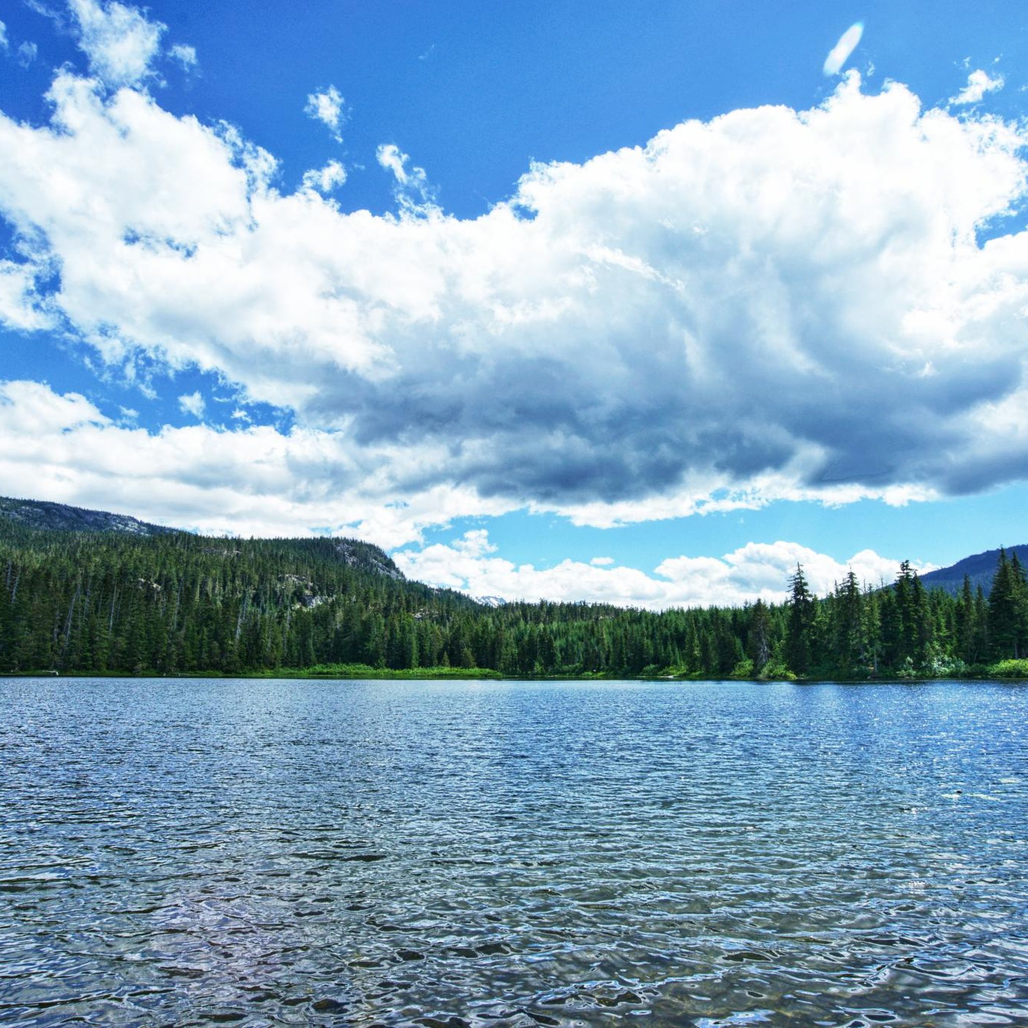
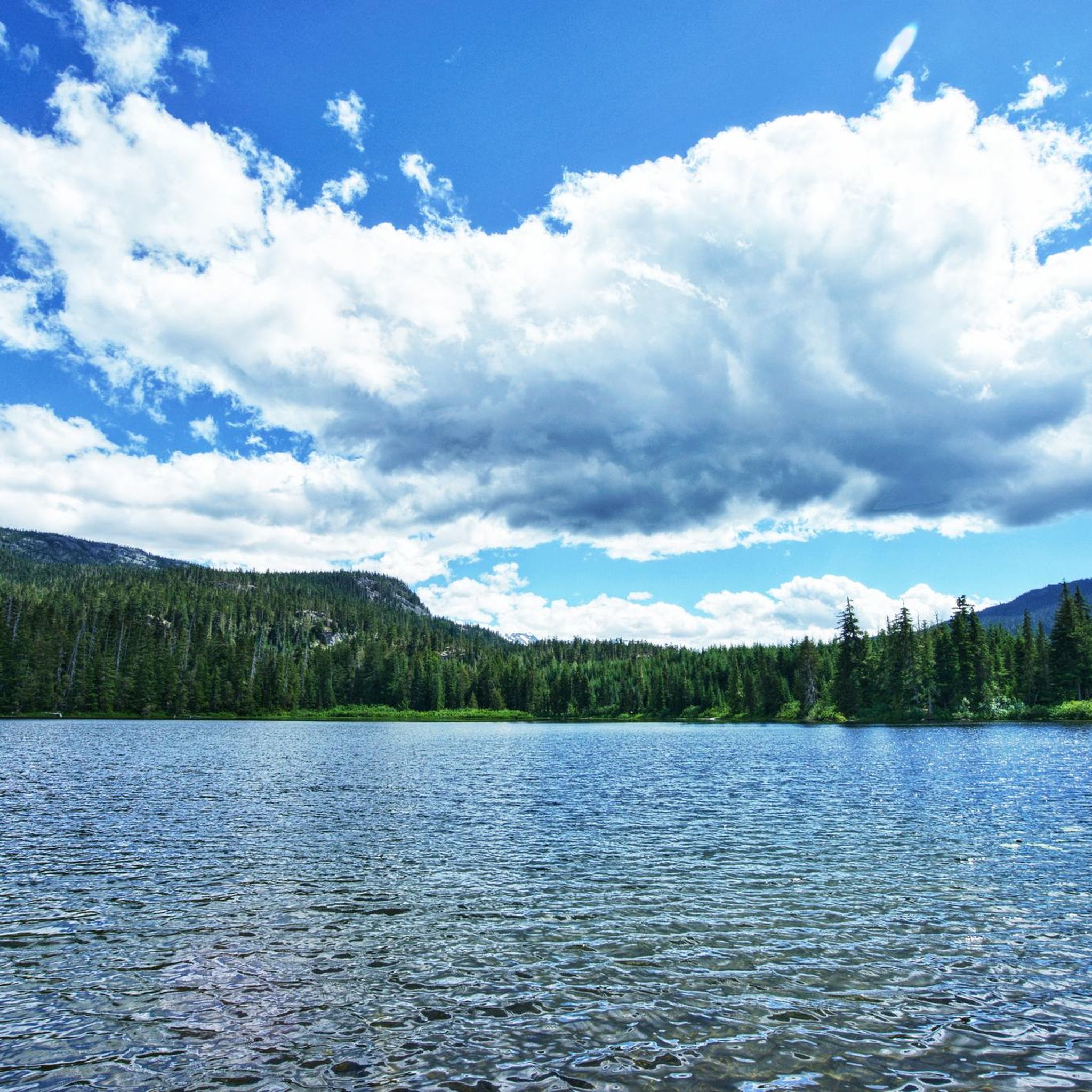
Tucked in the forest just outside Whistler Village, Lost Lake is a beautiful, quiet spot surrounded by tall evergreens and mountain views. It’s a popular spot for swimming and paddleboarding in summer, with trails around its perimeter perfect for hiking and biking. In winter, the area transforms into a snowy network of cross-country ski and snowshoe trails, offering a quiet escape just minutes from town.
1
0

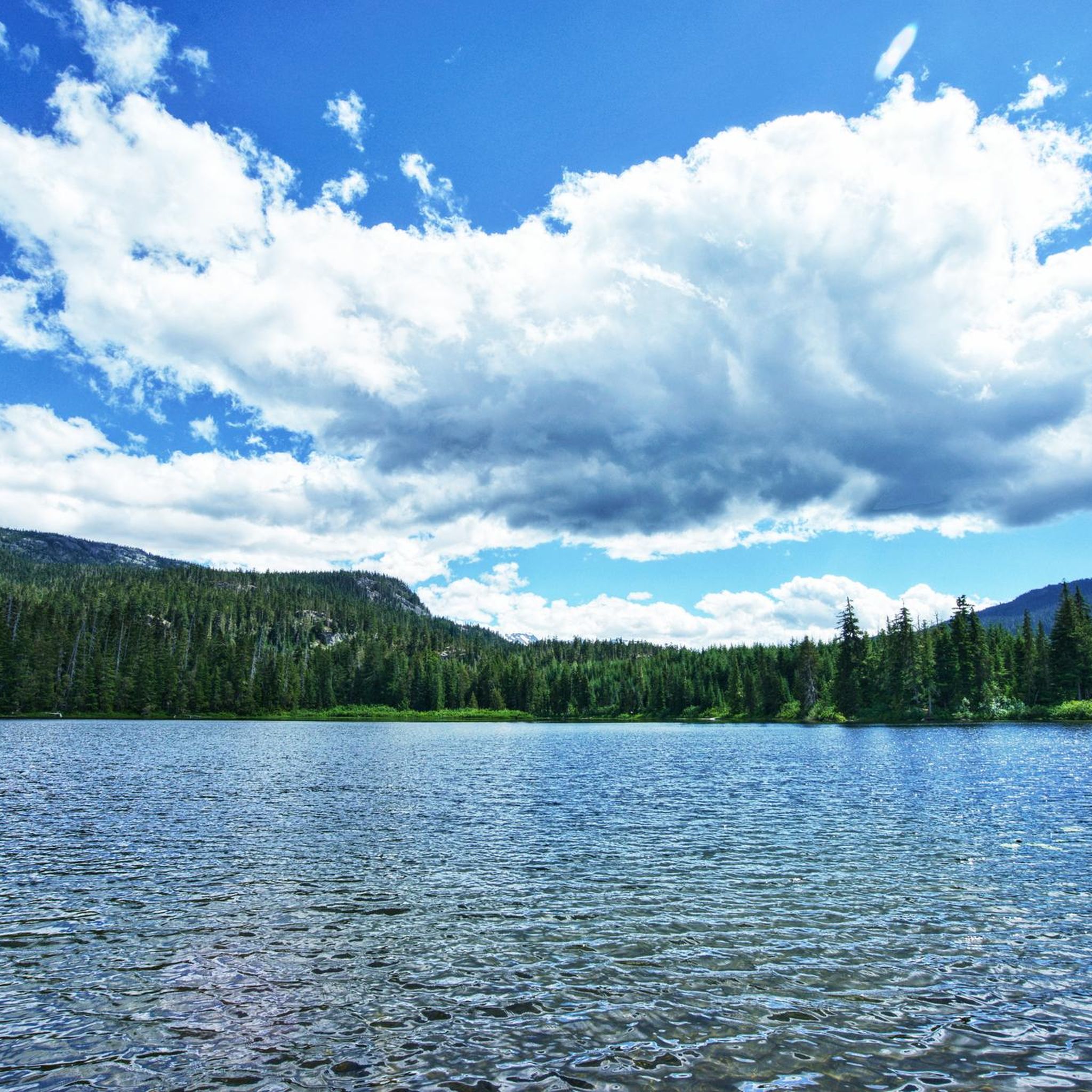
The lakes around Whistler, Alta Lake, Nita Lake, and Lost Lake, aren't that great to look at: swimming lakes, built-up areas, etc. Canada has something completely different to offer.
0
0

On the trail to Nairn Falls from the parking lot on Highway 99, there are many opportunities to catch a glimpse of the rushing Green River. Occasionally, speedboats carrying tourists pass by on their way to the waterfall.
2
0
Alta Lake was formed by glacial retreat and subsequent sediment deposition, creating depressions that filled with meltwater. Alta Lake and other nearby lakes, such as Green Lake, are part of a large watershed whose waters flow north to the Lillooet River and south to the Cheakamus River. Historically, water flowed both north and south from Alta Lake, which lies at the top of the pass. This natural dual drainage system of the lake ended with the arrival of settlers. https://fireandicegeoregion.ca/geosite/whistler-valley-lakes-and-watershed-divide/
2
0
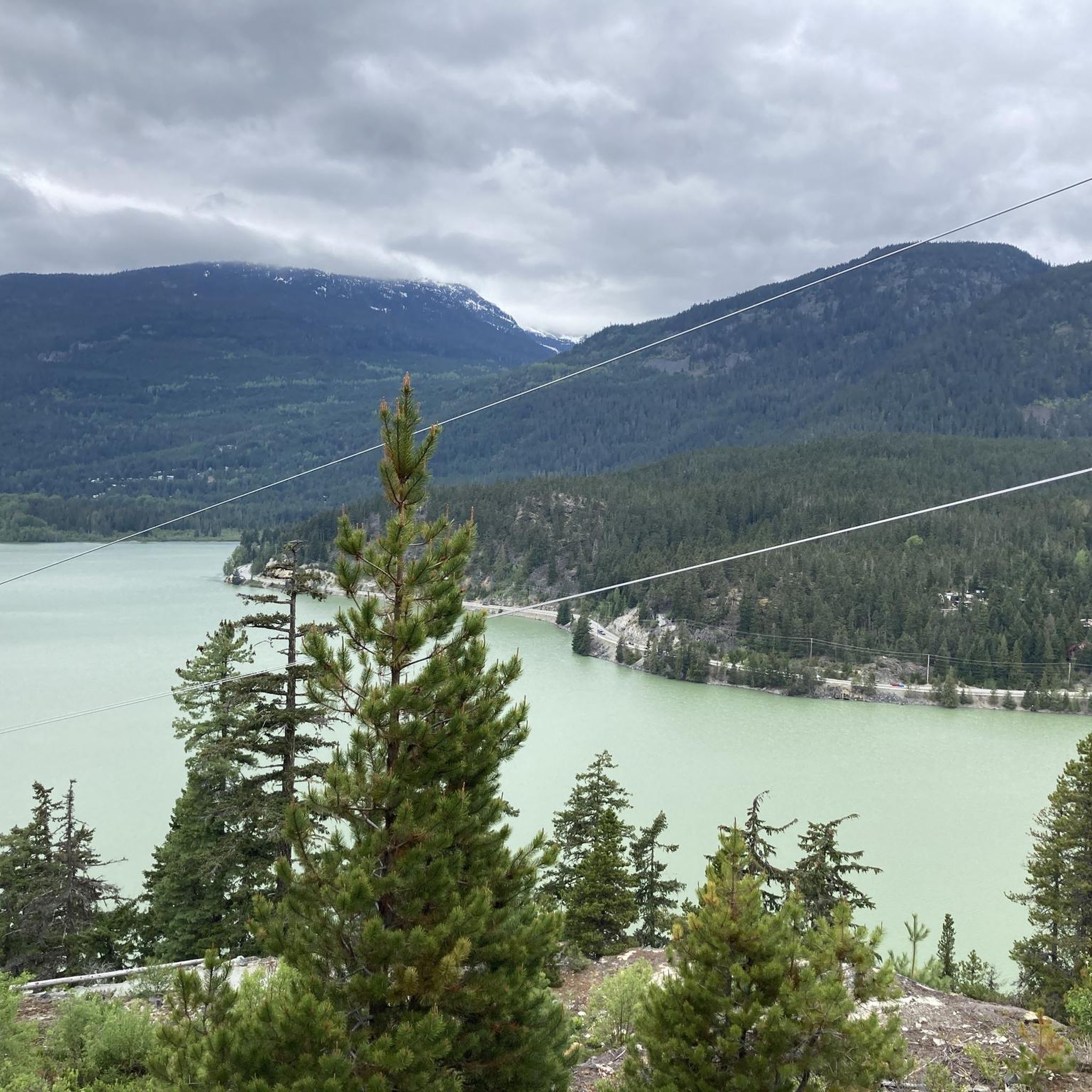
Green Lake is the largest lake in the Whistler region. To the north, it is the source of the Green River, which drains into the Lillooet River. Green Lake was formed during the last Ice Age, when sediment was deposited in the U-shaped valley, forming lake basins. The lake's green color is due to the glacial silt of Fitzsimmons Creek. From the wooden boardwalk on the southwest shore, we have a magnificent view of the lake and the seaplane landing. In the background, we can see the peaks of the Garibaldi Range, from Wedge Mountain to Mount Currie, including Mount Weart with the Armchair Glacier. https://www.piquenewsmagazine.com/local-news/naturespeak-awesome-geology-sites-around-whistlergreen-lake-part-2-7576124
2
0
Frequently Asked Questions
What kind of terrain can I expect for touring cycling in Showh Lakes-Ancient Cedars Trail Recreation Site?
The Showh Lakes-Ancient Cedars Trail Recreation Site features a landscape of rocky dry forest, small lakes, and ancient cedar groves. While the area is popular for mountain biking, traditional touring cycling may find the terrain challenging due to very rough, unpaved, and often potholed dirt roads, such as Cougar Mountain Road. These conditions are more suited for 4x4 vehicles or mountain bikes rather than typical touring bikes.
Are there any easy touring cycling routes suitable for beginners?
Yes, there are routes suitable for varying skill levels. For an easier experience, consider the Lost Lake Beach loop from SPA Parking. This route is 10 km long with moderate elevation gain, making it a good option for those looking for a less strenuous ride.
What natural attractions can I see along the touring cycling routes?
The region is rich in natural beauty. You can explore the remarkable Ancient Cedars Grove, home to old-growth red and yellow cedars, some estimated to be over 750 years old. There are also three small lakes, including Showh Lake and Newt Lake, and a picturesque small waterfall along the Ancient Cedars Trail. Views of Showh Lake are also accessible from dedicated lookout points.
Are there any circular touring cycling routes in the area?
Yes, many of the touring cycling routes in the Showh Lakes-Ancient Cedars Trail Recreation Site are designed as loops. For example, the popular Lost Lake Beach – Lost Lake loop from Rainbow Estates offers a 20.7 km circular path exploring the vicinity of Lost Lake. Another option is the Alta Lake – Whistler Village Stroll loop from Rainbow, which is a longer 36.2 km loop.
What do other touring cyclists enjoy most about the routes here?
The touring cycling routes in Showh Lakes-Ancient Cedars Trail Recreation Site are highly rated by the komoot community, with an average score of 4.3 stars from over 20 reviews. Cyclists often praise the opportunity to traverse rocky dry forests, pass by small lakes, and catch glimpses of ancient cedar groves, appreciating the unique natural features of the area.
Are the touring cycling routes suitable for families with children?
While some routes are easier, the overall terrain, characterized by rough and unpaved roads, might be challenging for younger children or those on less robust touring bikes. It's advisable to check the difficulty grade and surface descriptions for specific routes. For a family-friendly experience, consider shorter, easier loops like the Lost Lake Beach loop from SPA Parking, keeping in mind the general ruggedness of the area.
Can I bring my dog on the touring cycling routes?
The Showh Lakes-Ancient Cedars Trail Recreation Site is generally dog-friendly for hikers, particularly on trails like the Ancient Cedars Trail. When cycling, ensure your dog is well-behaved, on a leash where required, and that you are prepared for the rugged terrain, which may not be suitable for all dogs, especially on longer or more challenging routes.
What are some of the longer or more challenging touring cycling routes available?
For experienced touring cyclists seeking a challenge, the Sea to Sky trail – Nairn Falls Lookout loop from Alpine Meadows is a difficult 59.9 km trail that typically takes over 4 hours to complete, featuring significant elevation changes. Another moderate option is the Alta Lake – Whistler Village Stroll loop from Rainbow, spanning 36.2 km.
Is there public transport access to the touring cycling routes, or is parking available?
The Showh Lakes-Ancient Cedars Trail Recreation Site is a remote area with limited cell service, suggesting that public transport options are scarce or non-existent. Visitors typically access the site by vehicle. While specific parking areas for cyclists are not detailed, it's generally expected that parking is available at trailheads or designated recreation site access points. Always be prepared for remote conditions.
When is the best time of year to go touring cycling in this region?
The best time for touring cycling in the Showh Lakes-Ancient Cedars Trail Recreation Site is typically during the warmer months when the roads are free of snow and ice. The area transforms into a destination for snowmobiling and snowshoeing in winter, making cycling impractical. Always check local weather conditions before planning your trip, as the unpaved roads can become very muddy or difficult to navigate after heavy rain.
Are there any routes that offer views of the Ancient Cedars Grove?
While the Ancient Cedars Trail itself is primarily a hiking trail, some mountain biking trails link into the Showh Lakes old road system, which could provide access to the vicinity of the grove. For touring cyclists, routes traversing the rocky dry forests will offer glimpses of the ancient cedars and the unique forest environment. The main Ancient Cedars Trail is a moderate hike, taking about 45 minutes one way to reach the grove.
Most popular routes in Showh Lakes-Ancient Cedars Trail Recreation Site

Get inspired with the komoot mobile app


Explore more
Browse the best Cycling routes in other regions.
