The best MTB trails in Barrancs Carrasca-Gatillo
4.0
(4)
127
riders
8
rides
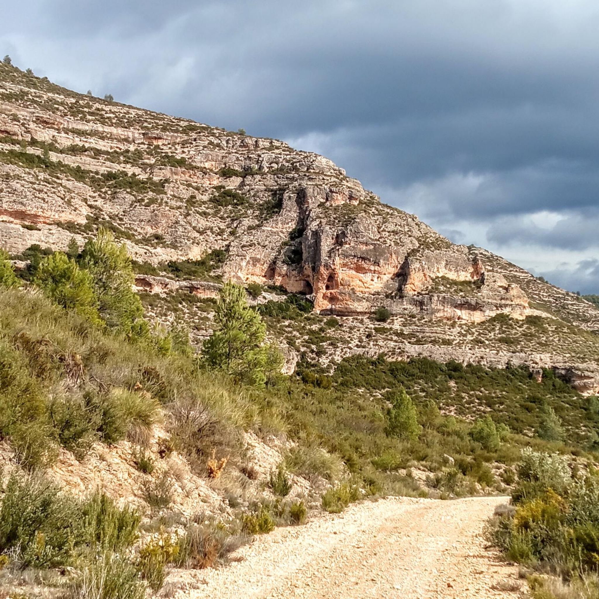
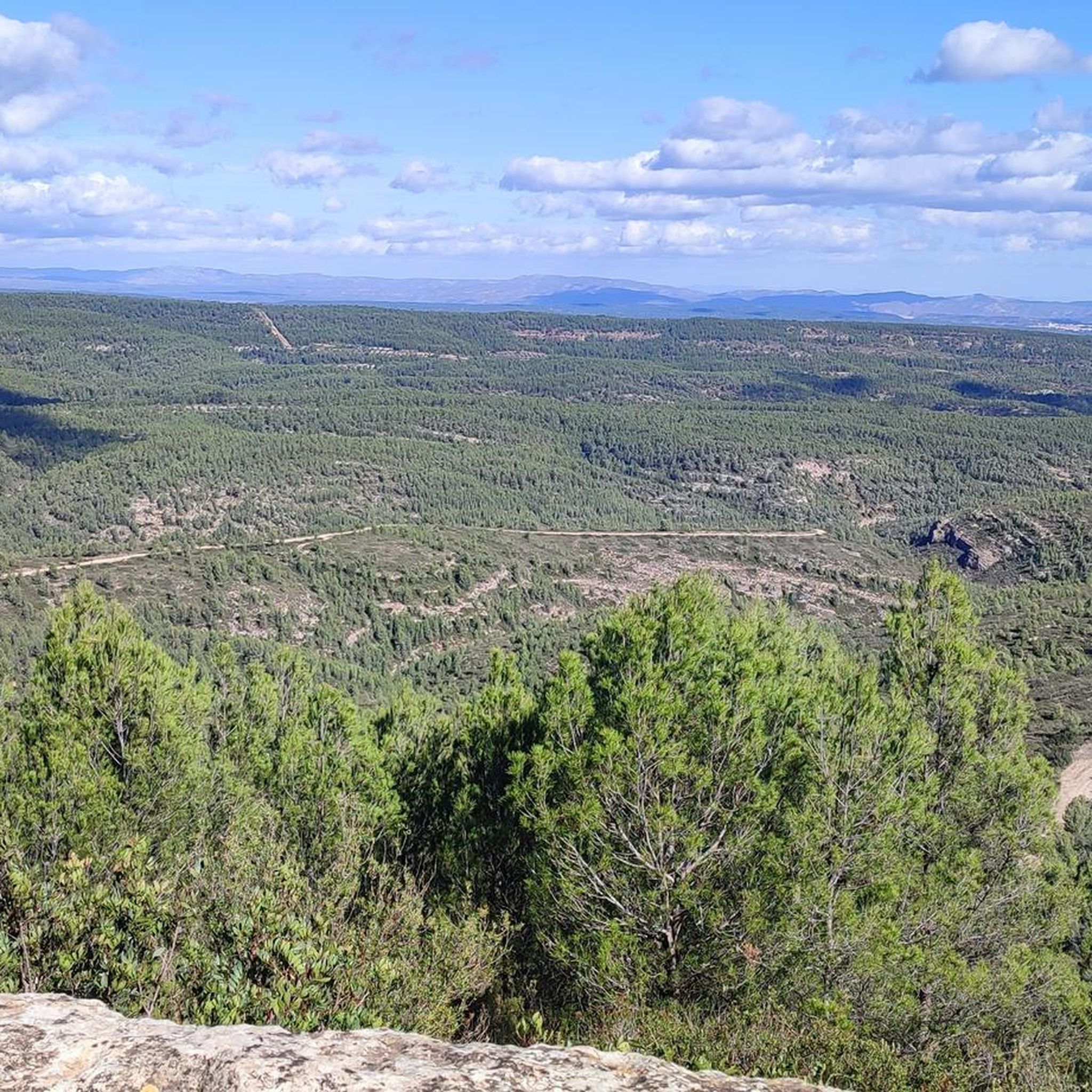
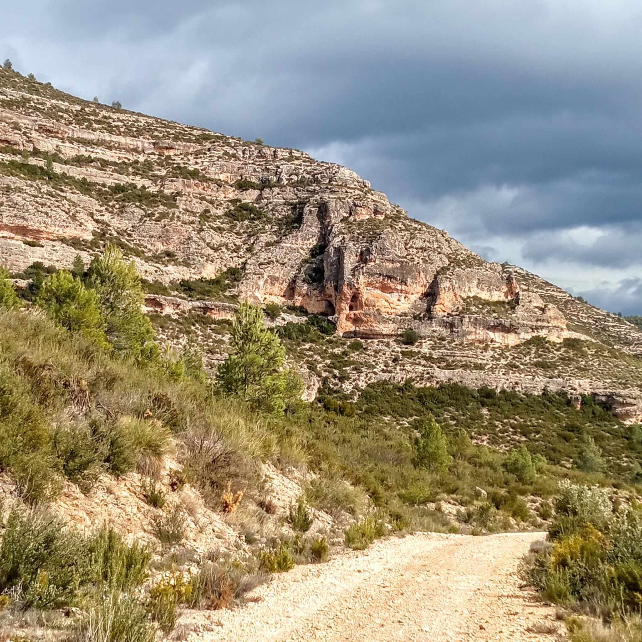
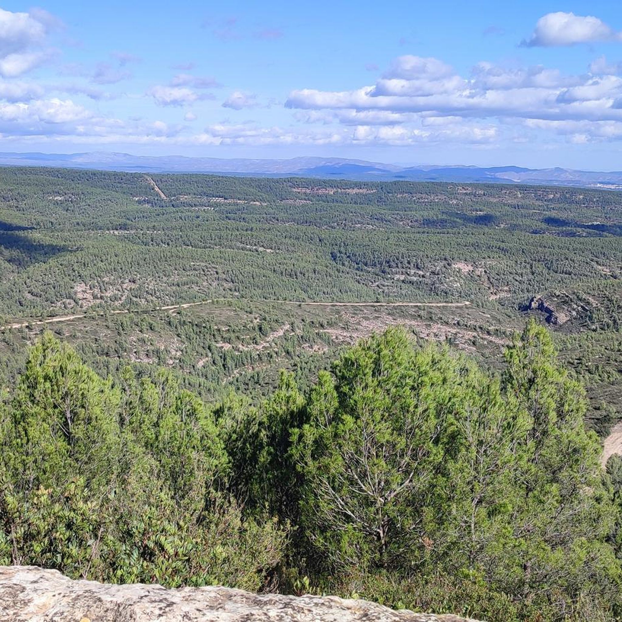
Mountain biking in Barrancs Carrasca-Gatillo offers routes through a landscape shaped by water erosion, featuring deep canyons and flat-topped mountains. While the most rugged barranco trails are primarily for hiking, the surrounding area provides wider forest tracks and paths suitable for cycling. The region is characterized by extensive Aleppo pine forests, contributing to a diverse environment for outdoor activities. These routes often traverse areas with geological and botanical richness, providing varied terrain for mountain bikers.
Best mountain bike trails in…
Last updated: August 21, 2026
2
riders
20.7km
01:54
330m
330m
Moderate mountain bike ride. Good fitness required. Suitable for all skill levels.
2
riders
18.8km
01:38
370m
370m
Moderate mountain bike ride. Good fitness required. Suitable for all skill levels.

Sign up for free
5.0
(2)
1
riders
31.1km
02:28
550m
550m
Moderate mountain bike ride. Good fitness required. Advanced riding skills necessary.
1
riders
33.2km
02:56
510m
510m
Moderate mountain bike ride. Good fitness required. Suitable for all skill levels.
6
riders
80.0km
07:18
1,550m
1,550m
This difficult 49.7-mile mountain biking route from Enguera explores the Canal de Navarrés, featuring waterfalls and diverse terrain.
Get access to more routes and recommendations from other explorers.
Sign up for free
Already have an account?
Our route recommendations are based on thousands of hikes, rides, and runs completed by other people on komoot.
Start today with a free account
Your next adventure awaits.
Login or Signup
Tips from the Community

After Benalí, the Río Grande trail begins. It's surrounded by nature at an altitude of 800 meters. A great spot to enjoy the views from this height.
0
0

The starting point is closed, you have to walk around the campsite, first part is on a gravel path down. The second part through the valley and the third part up again is a nice path.
1
0

Beautiful facility. We stayed there on our long-distance hike from Tarifa to Switzerland and can highly recommend the accommodation and the excellent cuisine.
3
0

This was a technical climb, but they’ve renovated the whole way. So now a simple long climb.
1
0

Beautiful area located in the term of Enguera in the vicinity of the village of Navalón, nestled in a pine forest area. It has toilets, a fountain, tables, pans and a bar.
0
0
Impressive ravine which you can explore with your bike along a path in good condition. It will take a while because every so often you will want to stop and take photos. Highly recommended!
0
0
The so-called Ceja del Río Grande is the side of the river that runs along the road that bears the same name. This is a route of exceptional beauty that allows you to appreciate the impressive mass of forests and pine groves and aromatic bushes of the aforementioned river. An extraordinary orchard, with an impressive biodiversity, the Río Grande welcomes the wild fauna that enters Quesa from the Barranco del Lobo and comes to the river to quench its thirst.
0
0
Passage over the spectacular Fraile River.
0
0
Frequently Asked Questions
How many mountain bike trails are available in Barrancs Carrasca-Gatillo?
There are 13 mountain bike routes recorded in Barrancs Carrasca-Gatillo on komoot. These routes offer a range of experiences, from moderate forest tracks to more challenging paths.
What is the general difficulty level of mountain biking in Barrancs Carrasca-Gatillo?
The mountain biking routes in Barrancs Carrasca-Gatillo are predominantly moderate, with 10 routes falling into this category. There are also 3 difficult routes for more experienced riders. While the core barranco trails are generally for hiking, the surrounding area offers suitable wider forest tracks for cycling.
Are there any family-friendly mountain bike trails in Barrancs Carrasca-Gatillo?
While the most rugged barranco trails are better suited for hiking, the broader area around Barrancs Carrasca-Gatillo, particularly routes with mostly paved surfaces or wider forest tracks, can be suitable for families. Look for routes described as moderate, which often have more manageable terrain. For example, the Fuente Los Bujes – Barranco de la Hoz loop from Sierra Natura is a moderate option that explores the natural beauty of the barranco area.
What kind of terrain can I expect on mountain bike trails in Barrancs Carrasca-Gatillo?
You can expect varied terrain shaped by water erosion, featuring deep canyons and flat-topped mountains. The routes often traverse extensive Aleppo pine forests and wider forest tracks. While some sections might be rugged, many routes offer enjoyable cycling through this geologically and botanically rich landscape.
What do other mountain bikers enjoy most about Barrancs Carrasca-Gatillo?
The area is highly rated by the komoot community, with an average score of 5.0 stars. Mountain bikers often praise the diverse terrain, the serene environment of the Aleppo pine forests, and the scenic beauty of the canyons and flat-topped mountains.
Are there any circular mountain bike routes available?
Yes, many of the mountain bike routes in Barrancs Carrasca-Gatillo are loops. Examples include the Gorgo Catalán – Albufera de Anna loop from Enguera, which offers varied terrain, and the Enguera – Casa La Venta (Cañada Negra) loop from Enguera, which leads through pine forests and historical tracks.
What are some notable landmarks or points of interest I might encounter on the trails?
While riding, you might encounter historical elements such as the Cañada Real de Almansa, a historic wide forest track. Other points of interest in the broader park area include the ruins of Casa La Venta, the 'Cuco de agua', and the Cueva de la Teresa. These add cultural and historical context to the natural beauty.
Is Barrancs Carrasca-Gatillo suitable for advanced mountain bikers?
Yes, Barrancs Carrasca-Gatillo offers routes for advanced mountain bikers. There are 3 difficult routes available, such as the challenging Casa La Venta (Cañada Negra) – Enguera loop from Enguera, which features significant elevation changes and covers over 54 km.
What is the best time of year for mountain biking in Barrancs Carrasca-Gatillo?
The region generally offers good conditions for mountain biking outside of the hottest summer months. Spring and autumn provide pleasant temperatures and often lush scenery. Winter can also be suitable, though conditions may vary, especially in higher or more shaded areas.
Are there any long-distance mountain bike routes in the area?
Yes, there are several longer routes. For example, the Enguera – Casa La Venta (Cañada Negra) loop from Enguera is nearly 50 km long, and the Casa La Venta (Cañada Negra) – Enguera loop from Enguera extends over 54 km, offering substantial rides for those looking for a longer adventure.
Can I find routes that connect natural features or towns?
Absolutely. Many routes are designed to showcase the region's natural beauty and connect different points of interest. For instance, the Gorgo Catalán – Albufera de Anna loop from Enguera connects natural features while traversing the Enguera region.
What kind of natural environment will I experience while mountain biking here?
You will ride through a landscape characterized by extensive Aleppo pine forests, dramatic canyons, and impressive flat-topped mountains (muelas). The area's geological and botanical richness provides a diverse and picturesque backdrop for your rides, offering a serene and natural experience.
Most popular routes in Barrancs Carrasca-Gatillo

Get inspired with the komoot mobile app


Explore more
Browse the best MTB trails in other regions.
