The best walks and hikes in Las Navas De Malagón
4.7
(6)
50
hikers
10
hikes
Hiking trails in Las Navas De Malagón traverse a landscape characterized by rolling hills and varied terrain within the Montes Norte region. The area features ascents to elevated points like the Sierra de Malagón, alongside gentler paths near water features such as the Canal de Gasset. Hikers can expect a mix of open country and routes that explore local historical points.
Best hiking trails in Las Navas De Malagón
- The most popular hiking route is Sierra de Malagón, a…
Last updated: July 5, 2026
4.5
(2)
26
hikers
8.23km
02:38
340m
330m
Moderate hike. Good fitness required. Easily-accessible paths. Suitable for all skill levels.
Easy hike. Great for any fitness level. Easily-accessible paths. Suitable for all skill levels.

Sign up for free
4.5
(2)
7
hikers
Easy hike. Great for any fitness level. Easily-accessible paths. Suitable for all skill levels.
1
hikers
Hard hike. Very good fitness required. Easily-accessible paths. Suitable for all skill levels.
5
hikers
6.73km
01:43
20m
20m
Easy hike. Great for any fitness level. Easily-accessible paths. Suitable for all skill levels.
Get access to more routes and recommendations from other explorers.
Sign up for free
Already have an account?
Our route recommendations are based on thousands of hikes, rides, and runs completed by other people on komoot.
Start today with a free account
Your next adventure awaits.
Login or Signup

Tips from the Community

The "Sancho and Rucio" statue is located in the town of Malagón, in the Montes Norte region. This sculpture represents Sancho Panza, Don Quixote's faithful squire, riding on his donkey, Rucio. These characters are immortalized in Miguel de Cervantes' work, Don Quixote de la Mancha. The statue is located in Malagón's Plaza del Santo and pays tribute to these iconic characters of Spanish literature. It is a point of interest for both literature lovers and those who enjoy cultural tourism and Cervantes routes.
28
0
The Malagón Bullring is a place with a rich history and significance. The bullring owes its name to a wooden cross with greenish pigments that was found on one of the facades of the old houses surrounding the area. Although its exact origin is unknown, its existence has been documented since the 18th century. This green cross was an emblem of the Inquisition and led the processions held on the eve of an auto-da-fé. It symbolized the hope of eternal salvation for heretics reconciled with the Catholic Church.
18
0
In 1941, with the nationalization of the Iberian gauge railways, the facilities passed into the hands of RENFE. In January 1988, the facilities and most of the Madrid-Ciudad Real line were closed due to the construction of the New Railway Access to Andalusia. Currently the travelers building is preserved, which has been converted into a bar.
25
0
If you're in Malagón, you might want to visit Amores Lounge Bar to enjoy their atmosphere and try some of their tapas! 😊🍻
16
0
The Bañuelos River Bridge from Roman times surprises us with its ten eyes, today battered awaiting rehabilitation, formed by brick vault arches, joined with lime and sand mortar. On the right bank of the river next to the bridge is the Carrillo Mill, named after its first owner. It is a construction from 1713, made with masonry walls and thick cylindrical buttresses, covered with wooden trusses and curved tiles that preserve the original machinery.
35
0
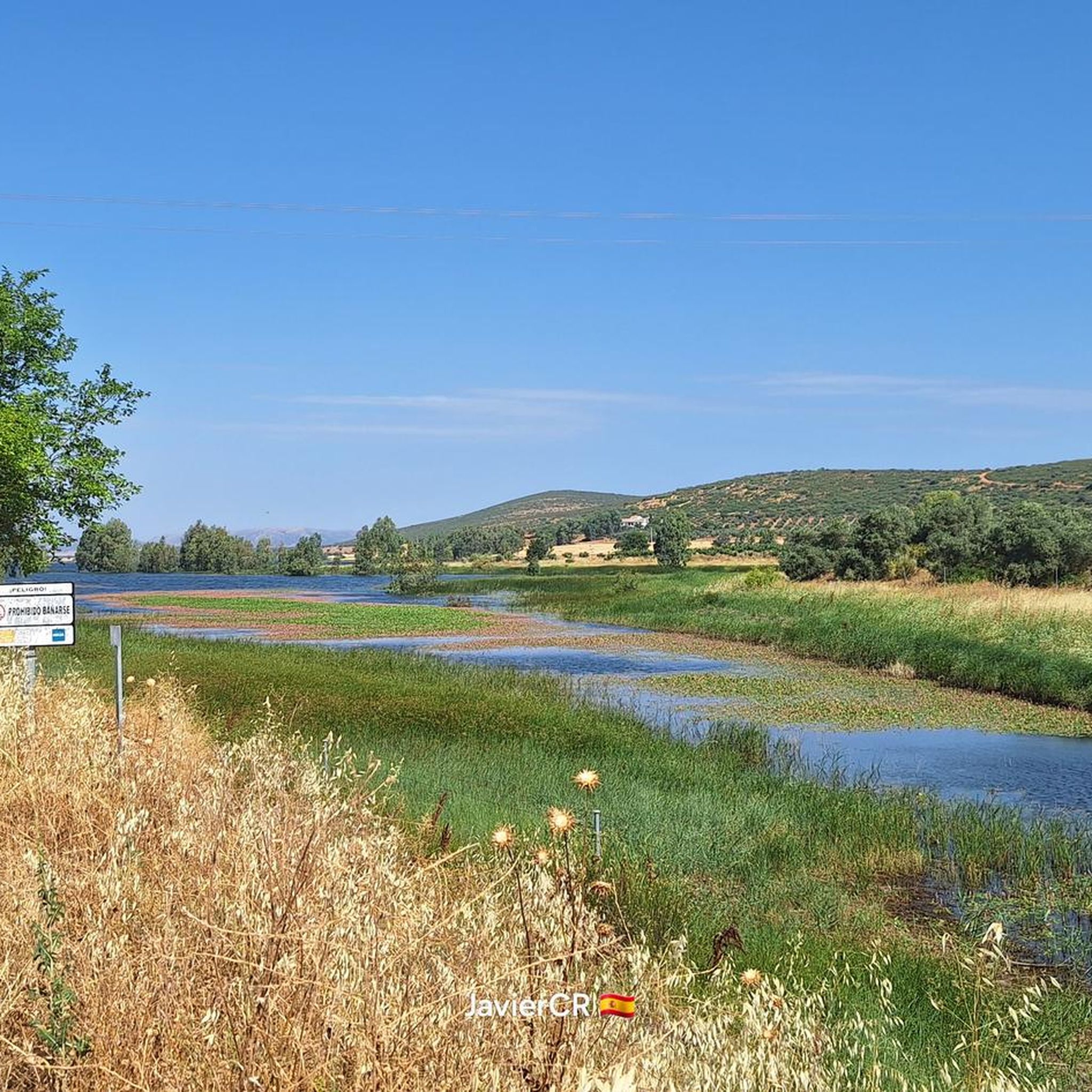
In the area, known as El Chaparral, there is a recreation area, ideal for walking, watching water birds and for children and pets to play safely, with magnificent views of the Malagón mountain range.
19
0
The Bañuelos River Bridge from Roman times surprises us with its ten eyes, today battered awaiting rehabilitation, formed by brick vault arches, joined with lime and sand mortar. On the right bank of the river next to the bridge is the Carrillo Mill, named after its first owner. It is a construction from 1713, made with masonry walls and thick cylindrical buttresses, covered with wooden trusses and curved tiles that preserve the original machinery.
17
0
In 1941, with the nationalization of the Iberian gauge railways, the facilities passed into the hands of RENFE. In January 1988, the facilities and most of the Madrid-Ciudad Real line were closed due to the construction of the New Railway Access to Andalusia. Currently the travelers building is preserved, which has been converted into a bar.
29
0
Frequently Asked Questions
How many hiking trails are available in Las Navas De Malagón?
There are 9 hiking trails documented in Las Navas De Malagón on komoot, offering a variety of experiences for different skill levels.
Are there easy hiking trails suitable for beginners in Las Navas De Malagón?
Yes, Las Navas De Malagón offers 4 easy hiking routes. A great option for beginners is the Puente del Molino Carrillo por el Canal de Gasset — circular desde Malagón, which is 4.5 miles (7.3 km) long and follows the gentle paths alongside the Canal de Gasset.
Are there any circular hiking routes in Las Navas De Malagón?
Yes, many of the trails in the area are circular. For example, the Plaza de los Moros Summit – Cerro Amarillo loop from Cerro de San Pantaleón is a 3.2-mile (5.2 km) loop that takes you through hilly terrain. Another option is the Ascent to the Plaza de los Moros via the Sierra de Malagón — circular from Malagón, a longer 13.9-mile (22.4 km) route for more experienced hikers.
What is the best time of year to go hiking in Las Navas De Malagón?
The best time for hiking in Las Navas De Malagón is typically during spring (April-May) and autumn (September-October) when temperatures are milder and the landscape is vibrant. Summers can be very hot, making early morning or late afternoon hikes preferable, while winters are generally mild but can have occasional cold snaps.
Are the hiking trails in Las Navas De Malagón suitable for families with children?
Yes, there are family-friendly options. The easier routes, particularly those with less elevation gain like the Old Station (Malagon) – Statue of Sancho and Rucio loop from Malagón, are suitable for families. These paths often follow gentler terrain and are shorter in duration.
Can I bring my dog on the hiking trails in Las Navas De Malagón?
Generally, dogs are welcome on trails in rural Spain, but it's always advisable to keep them on a leash, especially near livestock or in protected natural areas. Ensure you carry water for your dog and clean up after them. Specific regulations may vary, so check local signage.
What should I wear for hiking in Las Navas De Malagón?
Given the varied terrain and potential for sun exposure, wear comfortable, layered clothing suitable for the season. Sturdy hiking shoes with good grip are essential, especially for routes with ascents like Sierra de Malagón. Always bring water, sun protection (hat, sunscreen), and a map or GPS device.
Is there public transport available to reach the hiking trailheads in Las Navas De Malagón?
Public transport options to specific trailheads in rural areas like Las Navas De Malagón can be limited. It's often more convenient to reach the starting points by car. Check local bus schedules from Malagón to nearby villages if you plan to rely on public transport, but direct access to all trailheads might not be available.
Are there parking facilities near the hiking trails?
Parking is generally available in or near the main town of Malagón, which serves as a common starting point for many routes. For trails beginning outside the town, roadside parking might be an option, but always ensure you park safely and legally, respecting local regulations and private property.
What do other hikers enjoy most about hiking in Las Navas De Malagón?
The area is highly rated by the komoot community, with an average score of 5.0 stars. Reviewers often praise the varied terrain, from rolling hills to paths alongside canals, and the scenic views offered by routes like Sierra de Malagón.
Are there any challenging hikes in Las Navas De Malagón?
Yes, for those seeking a more demanding experience, there is 1 difficult route. The Ascent to the Plaza de los Moros via the Sierra de Malagón — circular from Malagón is a 13.9-mile (22.4 km) trail with significant elevation gain, offering a good challenge and rewarding views.
Most popular routes in Las Navas De Malagón

Get inspired with the komoot mobile app


Explore more
Browse the best Hikes in other regions.
