The best walks and hikes in Saarsteilhänge/ Lutwinuswald
4.6
(11346)
47,119
hikers
18
hikes
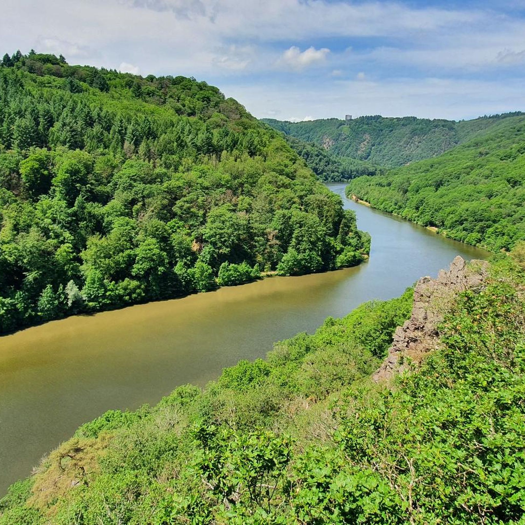
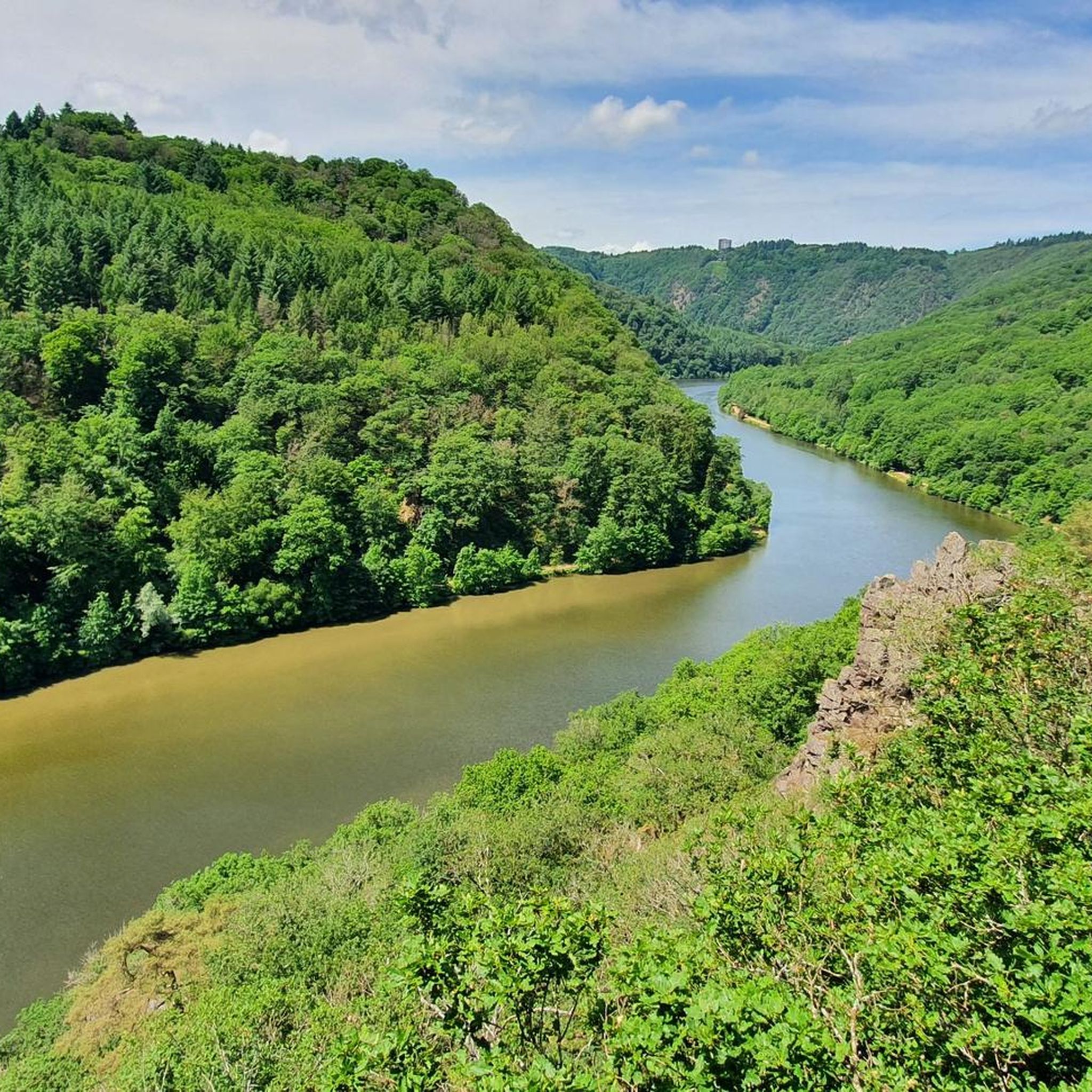
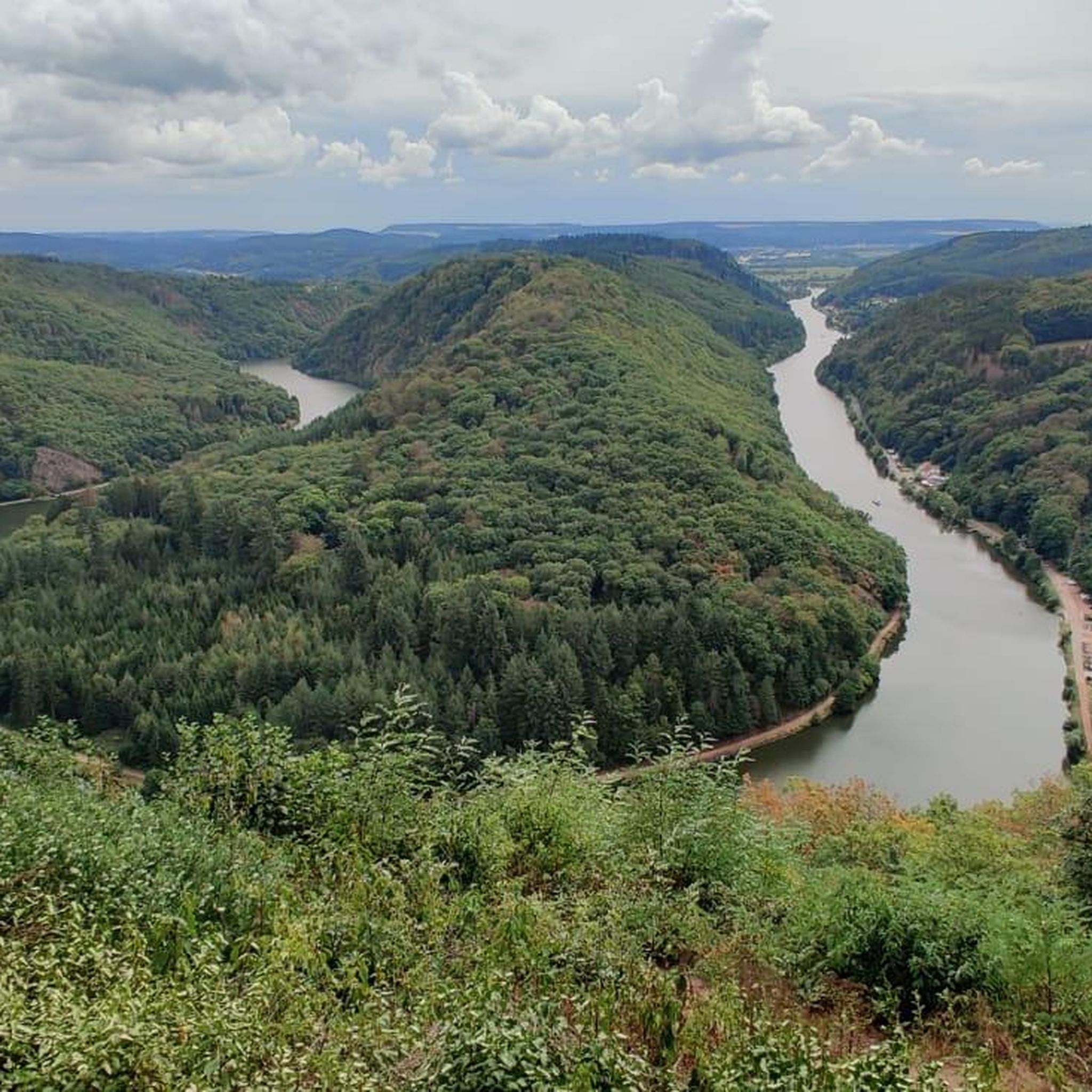
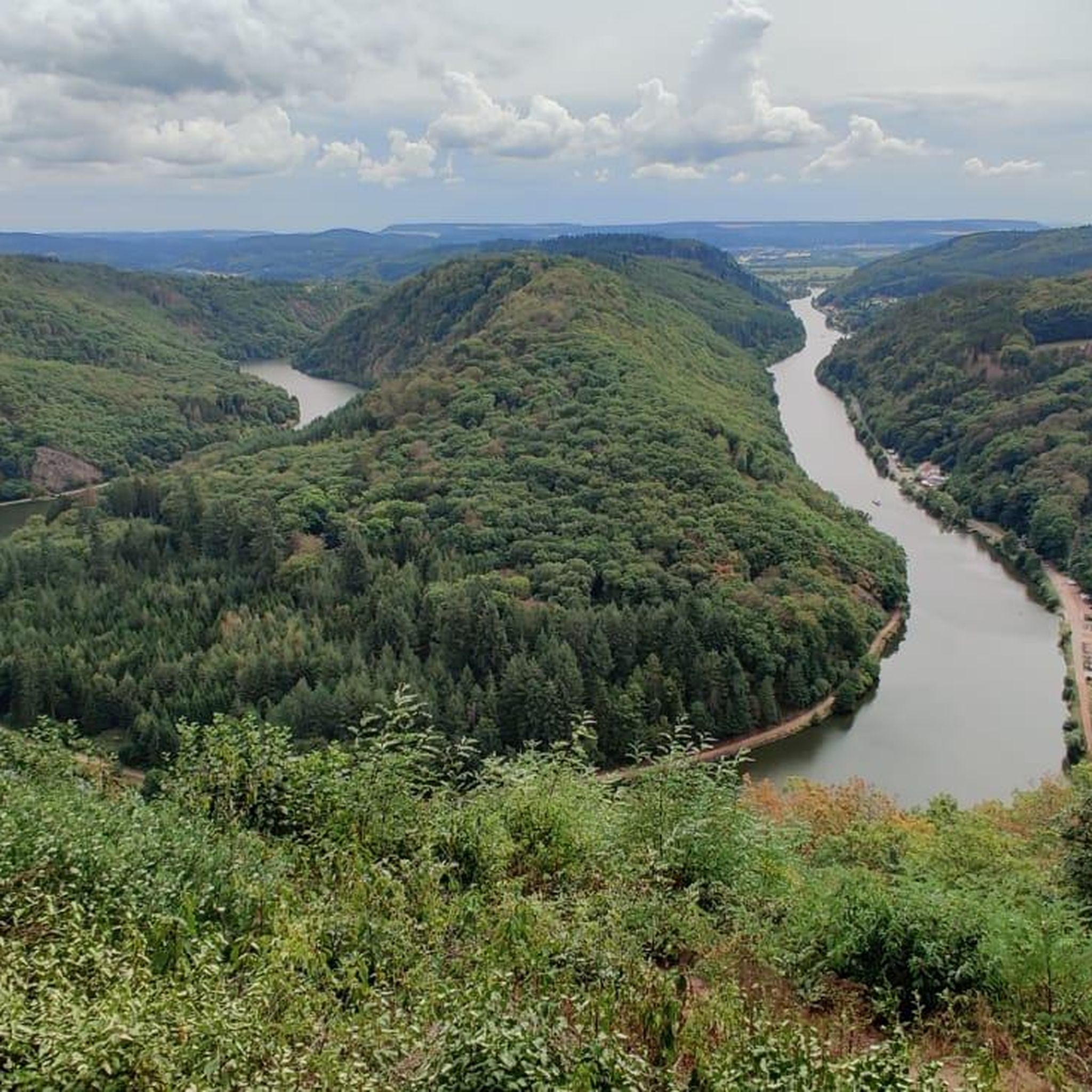
Hiking in Saarsteilhänge/ Lutwinuswald offers diverse landscapes centered around the dramatic Saar Loop, where the Saar River carves through steep, wooded hillsides. The region is characterized by dense woodlands, deep valleys, and elevated viewpoints providing panoramic vistas of the river and surrounding terrain. Trails often feature natural paths and lead through areas like the Steinbachtal nature reserve.
Best hiking trails in Saarsteilhänge/ Lutwinuswald
- The most popular hiking route is Path along the rock – Little Cloef Viewpoint loop from Mettlach…
Last updated: May 12, 2026
4.8
(39)
184
hikers
8.19km
02:23
210m
210m
Moderate hike. Good fitness required. Easily-accessible paths. Suitable for all skill levels.
5.0
(6)
30
hikers
6.11km
01:45
150m
150m
Easy hike. Great for any fitness level. Easily-accessible paths. Suitable for all skill levels.

Sign up for free
5.0
(3)
18
hikers
5.72km
01:34
90m
90m
Easy hike. Great for any fitness level. Easily-accessible paths. Suitable for all skill levels.
5.0
(4)
17
hikers
4.86km
01:22
100m
100m
Easy hike. Great for any fitness level. Easily-accessible paths. Suitable for all skill levels.
10
hikers
4.47km
01:15
80m
80m
Easy hike. Great for any fitness level. Easily-accessible paths. Suitable for all skill levels.
Get access to more routes and recommendations from other explorers.
Sign up for free
Already have an account?
Our route recommendations are based on thousands of hikes, rides, and runs completed by other people on komoot.
Start today with a free account
Your next adventure awaits.
Login or Signup
Popular around Saarsteilhänge/ Lutwinuswald


Other adventures in Saarsteilhänge/ Lutwinuswald

Tips from the Community


Beautiful plaque with the history of the Petschbach blacksmith. Great view with a bench to rest on.
0
0

Here you are standing under the electricity pylon on a large rock. You can look into the Saar Valley and on the other side you can see the beautiful fields between Mettlach and Saarhölzbach. Be careful, there is a steep descent ahead of you.
1
0

It's a Dream
3
1

Simply a lovely, relaxing round!
0
0

Great view of Saarhölzbach. But be careful: in wet weather the stones are very slippery. ⚠️
0
0

1st stage Germany Tour 2023 Mettlach
0
0
Nice stream to accompany you when you go down, when it flows towards you, all the best
3
0
Frequently Asked Questions
How many hiking trails are available in Saarsteilhänge/Lutwinuswald?
There are 16 hiking trails in Saarsteilhänge/Lutwinuswald, offering a variety of experiences. These include 8 easy routes and 8 moderate routes, catering to different fitness levels.
What makes hiking in Saarsteilhänge/Lutwinuswald unique?
The region is defined by the dramatic Saarschleife (Saar Loop), where the Saar River carves through steep, wooded hillsides. You'll find enchanting forests, deep valleys, and elevated viewpoints offering panoramic vistas, creating a diverse and captivating landscape for hikers.
What do other hikers say about the trails in Saarsteilhänge/Lutwinuswald?
The trails in Saarsteilhänge/Lutwinuswald are highly rated by the komoot community, with an average score of 4.6 stars from over 2,200 reviews. More than 11,000 hikers have explored the varied terrain, often praising the natural paths and scenic beauty, especially around the Saarschleife.
Are there family-friendly hiking options in the area?
Yes, there are several easy routes suitable for families. For instance, the Hiking loop from Weiten is an easy 4.5 km trail that takes about 1 hour 15 minutes, perfect for a leisurely family outing. Many trails offer gentle gradients and well-maintained paths.
Are dogs allowed on the hiking trails in Saarsteilhänge/Lutwinuswald?
Generally, dogs are welcome on the hiking trails in Saarsteilhänge/Lutwinuswald. However, it's always recommended to keep them on a leash, especially in nature reserve areas or when encountering wildlife. Ensure you carry water for your dog, particularly on longer routes.
What are the main attractions or viewpoints I can see while hiking?
Hikers can enjoy stunning views of the Saar Loop from the famous Cloef Viewpoint. The Treetop Walk Saarschleife also offers a unique perspective. You can also explore historical sites like Montclair Castle, which is accessible via trails such as the Mettlach Saar Bridge – Montclair Castle loop from Mettlach.
Are there any circular hiking routes in Saarsteilhänge/Lutwinuswald?
Yes, many of the trails in the region are circular, allowing you to start and end at the same point. Examples include the Path along the rock – Little Cloef Viewpoint loop from Mettlach and the View of the Saarschleife – Saar Steep Slopes loop from Mettlach, both offering scenic round trips.
What is the best time of year to go hiking in this region?
The Saarsteilhänge/Lutwinuswald region is beautiful year-round. Spring brings blooming flora, including orchid fields, while autumn offers vibrant foliage. Summer is ideal for longer days, and even winter hiking can be picturesque, though some paths might be slippery. Always check local weather conditions before heading out.
Can I access the hiking trails using public transport?
Yes, the region is accessible by public transport, particularly to towns like Mettlach, which serves as a common starting point for many trails. From Mettlach, you can often reach trailheads on foot or via local bus services. It's advisable to check local bus schedules in advance.
Is there parking available near the trailheads?
Parking is generally available at key access points and popular attractions like the Cloef Viewpoint and in towns such as Mettlach. Some trailheads may have designated parking areas, but these can fill up quickly during peak season. Arriving early is recommended.
Are there options for long-distance hiking in the area?
Yes, the region is part of the renowned Saar-Hunsrück-Steig, a premium long-distance hiking trail known for its natural paths and scenic beauty. This offers opportunities for multi-day adventures, with dedicated trekking camps available along the route.
Are there places to eat or stay near the hiking trails?
The nearby town of Mettlach offers various options for dining and accommodation, ranging from cafes and restaurants to hotels and guesthouses. You'll find places to refuel and rest after your hikes, often with local culinary delights.
Most popular routes in Saarsteilhänge/ Lutwinuswald
Most popular attractions in Saarsteilhänge/ Lutwinuswald

Get inspired with the komoot mobile app


Explore more
Browse the best Hikes in other regions.
