Trockengebiete Vor Der Rhön
Trockengebiete Vor Der Rhön
The best road cycling routes in Trockengebiete Vor Der Rhön
4.7
(223)
2,045
riders
187
rides
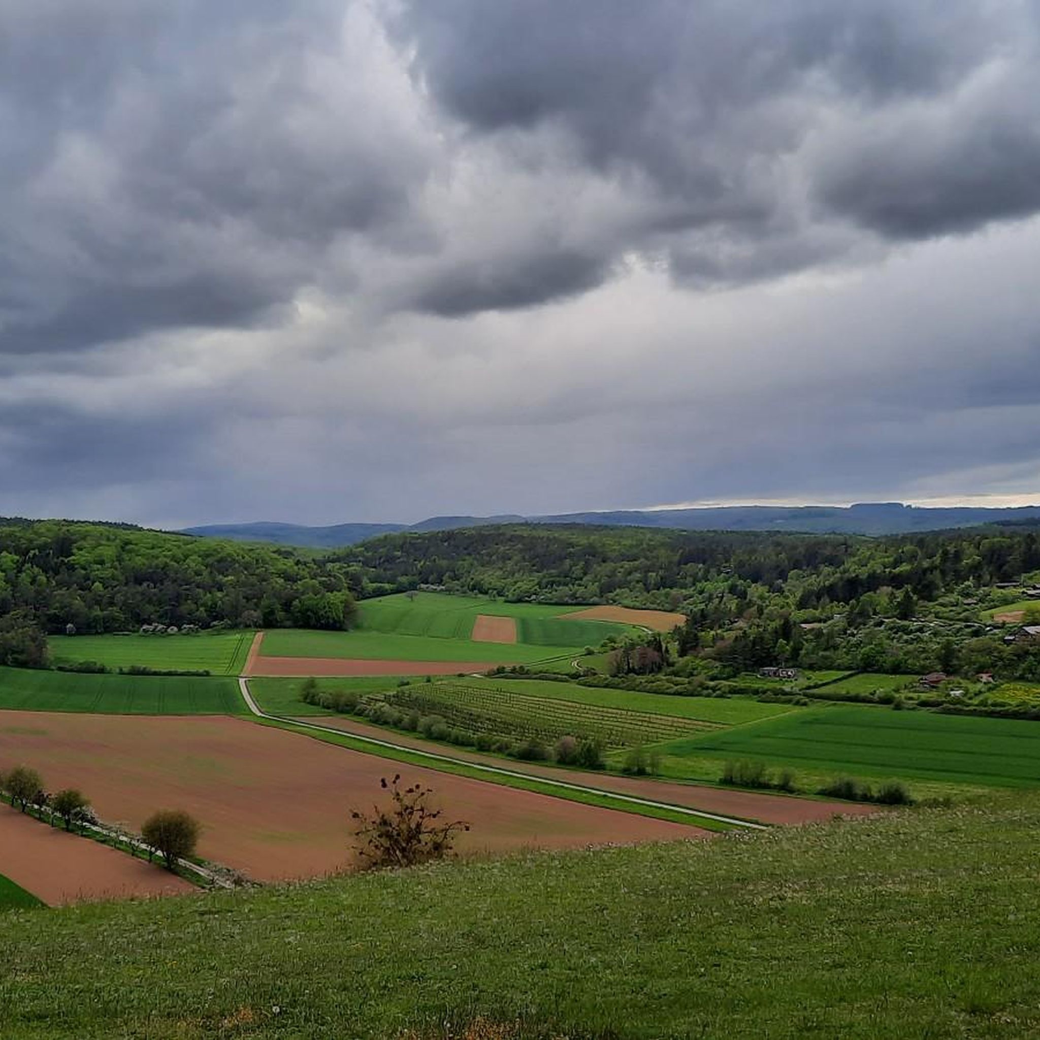
Road cycling routes in Trockengebiete Vor Der Rhön traverse open high plateaus and rolling hills, offering expansive panoramic views across a landscape shaped by volcanic origins. The region features dry grasslands and follows idyllic river valleys, such as those along the Fränkische Saale. This diverse terrain provides varied cycling experiences, from gentle paths to challenging ascents.
Best road cycling routes in Trockengebiete Vor Der Rhön
- The most popular road cycling route is Cycle Path in the Elstal Valley – Mittelstreu–Unsleben cycle path loop from Nordheim vor der Rhön, a 27.8 miles (44.7 km) trail that takes 1 hour 59 minutes to complete. This route offers a moderate cycling experience through the Elstal Valley.
- Another top favourite among local road cyclists is Historic centre of Fladungen – Cycle Path in the Elstal Valley loop from Nordheim vor der Rhön, a moderate 40.3 miles (64.8 km) path. This route explores historical areas and scenic river valleys.
- Local road cyclists also love the View of Kreuzberg – Wasserkuppe Gliding Airfield loop from Fladungen, a 55.7 miles (89.6 km) trail leading through challenging volcanic terrain, often completed in about 4 hours 40 minutes.
- Road cycling in Trockengebiete Vor Der Rhön is defined by open high plateaus, rolling hills, and river valleys. The network offers options for different ability levels, from easy paths to more challenging climbs.
- The routes in Trockengebiete Vor Der Rhön are highly rated by the komoot community with an average score of 4.7 stars from over 200 reviews. More than 2000 road cyclists have used komoot to explore Trockengebiete Vor Der Rhön's varied terrain.
Last updated: July 12, 2026
5.0
(24)
91
riders
Moderate road ride. Good fitness required. Some segments of this route may be unpaved and difficult to ride.
5.0
(1)
60
riders
Moderate road ride. Good fitness required. Some segments of this route may be unpaved and difficult to ride.

Sign up for free
4.0
(2)
36
riders
89.7km
04:41
1,650m
1,650m
Hard road ride. Very good fitness required. Mostly well-paved surfaces and easy to ride.
38
riders
Easy road ride. Great for any fitness level. Mostly well-paved surfaces and easy to ride.
5.0
(2)
22
riders
Moderate road ride. Good fitness required. Some segments of this route may be unpaved and difficult to ride.
Get access to more routes and recommendations from other explorers.
Sign up for free
Already have an account?
Our route recommendations are based on thousands of hikes, rides, and runs completed by other people on komoot.
Start today with a free account
Your next adventure awaits.
Login or Signup

Other adventures in Trockengebiete Vor Der Rhön

Tips from the Community

Absolutely the best bratwurst in the area. Price stable at 3.50, so it tastes even better.
0
0

The best Thuringian food "outside" of Thuringia :-)
0
0
It's beautiful at the Streu. Great for a short relaxing walk
0
0

See alpacas Coffee Simonshof, good cakes
0
0
Always beautiful and full of memories...
0
0

good idea from the metal guild.
0
0
very good real Thuringian Bratwurst
0
0

...be sure to take some time for a break in Fladungen! There's a historic railway, a museum, and even a beer garden for a refreshing drink.
0
0
Frequently Asked Questions
What kind of terrain can I expect on road cycling routes in Trockengebiete Vor Der Rhön?
Road cycling in Trockengebiete Vor Der Rhön features a diverse landscape. You'll encounter open high plateaus and rolling hills, offering expansive panoramic views. The region is also characterized by dry grasslands and idyllic river valleys, such as those along the Fränkische Saale, Streu, and Brend. This mix provides varied cycling experiences, from gentle paths to challenging ascents through volcanic terrain.
How many road cycling routes are available in Trockengebiete Vor Der Rhön?
There are nearly 200 road cycling routes available in Trockengebiete Vor Der Rhön. These routes cater to various fitness levels, with 17 easy, 130 moderate, and 50 difficult options.
What is the best time of year for road cycling in Trockengebiete Vor Der Rhön?
Spring and summer are particularly recommended for road cycling in Trockengebiete Vor Der Rhön. During these seasons, nature is in full bloom, and temperatures are pleasantly warm, providing optimal conditions for tours and allowing you to fully appreciate the region's unique flora and open landscapes.
Are there challenging road cycling routes for experienced riders?
Yes, Trockengebiete Vor Der Rhön offers challenging routes for experienced road cyclists. For instance, the View of Kreuzberg – Wasserkuppe Gliding Airfield loop from Fladungen is a difficult 55.7-mile (89.6 km) trail that leads through demanding volcanic terrain, including impressive passes like the Kreuzberg Pass, rewarding cyclists with spectacular views.
What are some family-friendly road cycling options in the region?
For families looking for easier rides, routes like the Stockheim Wet Meadow – Gate Bridge, Ostheim vor der Rhön loop from Nordheim vor der Rhön offer a gentle experience. This easy 16.2-mile (26.1 km) route provides a pleasant ride through the scenic landscape with minimal elevation gain.
What kind of natural features and landmarks can I see along the routes?
Road cycling routes in Trockengebiete Vor Der Rhön offer views of unique natural features and historical landmarks. You might pass by the Weyhershauk Summit Cross, the ancient Twin Oak, or the Celtic Burial Mounds on the Cycle Path. The region's dry grasslands, or 'Kalkmagerrasen,' are also biodiversity hotspots with unique flora.
Are there any historical sites to explore while road cycling?
Yes, the region is rich in history. You can explore historical towns and sites such as the St. Gangolf Chapel (Gangolfskapelle) Fladungen or the Sebastianskapelle Nordheim vor der Rhön. The Historic centre of Fladungen – Cycle Path in the Elstal Valley loop from Nordheim vor der Rhön is a moderate route that specifically explores these historical areas.
What do other road cyclists enjoy most about the routes here?
The road cycling routes in Trockengebiete Vor Der Rhön are highly rated by the komoot community, with an average score of 4.7 stars. Reviewers often praise the expansive panoramic views from the open high plateaus, the diverse terrain, and the well-maintained paths that traverse both river valleys and challenging volcanic landscapes.
Are there any routes that follow river valleys?
Yes, many road cycling routes in Trockengebiete Vor Der Rhön follow idyllic river valleys. For example, the Cycle Path in the Elstal Valley – Mittelstreu–Unsleben cycle path loop from Nordheim vor der Rhön offers a moderate cycling experience through the scenic Elstal Valley, providing a less challenging ride compared to mountain climbs.
Where can I find more information about the Rhön region in general?
For broader information about the Rhön region, which encompasses Trockengebiete Vor Der Rhön, you can visit the official tourism website for Hessen: hessen-tourismus.de. This can provide additional context on the area's natural beauty and cultural significance.
Are there any routes that offer good viewpoints?
Absolutely. The open high plateaus of Trockengebiete Vor Der Rhön are known for their expansive panoramic views. You can find excellent vistas from spots like the Viewpoint on Großer Lindenberg, offering far-reaching sights across the landscape, often extending to the Thuringian Forest and Spessart on clear days.
What is the typical elevation gain on road cycling routes in this region?
The elevation gain varies significantly depending on the route's difficulty. Easy routes, such as the Stockheim Wet Meadow – Gate Bridge, Ostheim vor der Rhön loop, have minimal climbs around 120 meters. Moderate routes, like the Cycle Path Unsleben–Heustreu – Mittelstreu–Unsleben cycle path loop, feature around 340 meters of ascent. Difficult routes can involve substantial climbs, with some exceeding 1600 meters of elevation gain.
Most popular routes in Trockengebiete Vor Der Rhön
Most popular attractions in Trockengebiete Vor Der Rhön

Get inspired with the komoot mobile app


Explore more
Browse the best Road cycling routes in other regions.
