Nsg Hetter-Millinger Bruch
Nsg Hetter-Millinger Bruch
The best walks and hikes in Nsg Hetter-Millinger Bruch
4.4
(4733)
24,884
hikers
817
hikes
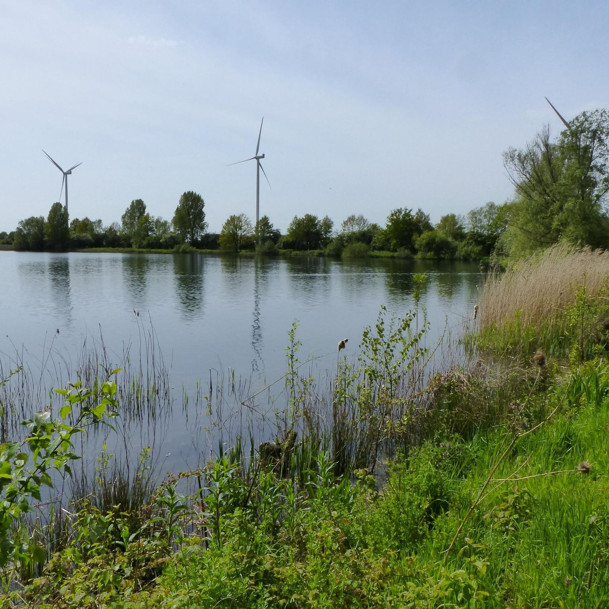
Hiking trails in Nsg Hetter-Millinger Bruch are characterized by low-lying landscapes, often featuring wetlands, agricultural fields, and small water bodies. The region's terrain is generally flat, with minimal elevation changes, making it suitable for accessible walks. These areas provide opportunities to observe local flora and fauna within a tranquil setting.
Best hiking trails in Nsg Hetter-Millinger Bruch
- The most popular hiking route is MU Café Ristorante-Pizzeria – Fatima Chapel loop from Netterden, a 4.4 miles (7.1 km) trail that…
Last updated: September 28, 2026
4
hikers
Easy hike. Great for any fitness level. Easily-accessible paths. Suitable for all skill levels.
6
hikers
Easy hike. Great for any fitness level. Easily-accessible paths. Suitable for all skill levels.

4
hikers
7.12km
01:47
10m
10m
Easy hike. Great for any fitness level. Easily-accessible paths. Suitable for all skill levels.
4.5
(2)
18
hikers
Easy hike. Great for any fitness level. Easily-accessible paths. Suitable for all skill levels.
4.0
(1)
6
hikers
Moderate hike. Good fitness required. Easily-accessible paths. Suitable for all skill levels.
Get access to more routes and recommendations from other explorers.
Already have an account?
Our route recommendations are based on thousands of hikes, rides, and runs completed by other people on komoot.
Start today with a free account
Your next adventure awaits.

Tips from the Community

On the rolling Achterhoek soil, some 14,000 vines grow here, divided over two vineyards near Gendringen and Stokkum. Since 2004, Leon and Magda Masselink have been producing award-winning wines of high quality here, with medals from Berlin and Vienna, among others.
0
0
There is a special house at the Asbroek in the Achterhoek Megchelen. An emergency home, built immediately after the Second World War. Tiny and with a special history. “When you look around this emergency home, you become silent and you are impressed by how people lived here. A piece of unknown war history is attached to the Moezeköttel, as the house is called. For a few years now, there has been a shed (cart shed) at the emergency home with facilities such as a toilet, a charging point for the batteries of electric bicycles and a coffee corner. That is also a piece of hospitality from agriculture. Here they want to make the visitors feel at home. The cart shed is also the starting point for guided tours and for school children who participate in an educational program about the emergency home and the war.
0
0

And now Café La Vie [as of April 2025] is apparently permanently closed...what a pity...
1
0

Very easy to drive. Beautiful nature.
4
0

It's really fun to cycle through the Rhine meadows.
10
0
Now closed. A new café will be opening there soon.
0
0

Please hurry. The cafe is closing soon...
0
0

The cycle path over the dike leads from Bienen to Emmerich, away from the car traffic. You also get to see some of the scenery. Unfortunately the cycle path over the dike behind Dornick is closed due to renovation work on the dike.
7
0
Frequently Asked Questions
How many hiking trails are available in Nsg Hetter-Millinger Bruch?
Nsg Hetter-Millinger Bruch offers a wide variety of hiking experiences, with over 720 trails recorded on komoot. These range from easy strolls through wetlands to slightly more challenging routes exploring the agricultural landscapes.
What is the general difficulty of hiking trails in Nsg Hetter-Millinger Bruch?
The trails in Nsg Hetter-Millinger Bruch are predominantly easy to moderate, reflecting the region's flat, low-lying terrain. Out of over 720 routes, more than 470 are classified as easy, making it an ideal destination for relaxed walks. There are also around 230 moderate trails and a small number of more challenging options for those seeking a bit more exertion.
Are there family-friendly hiking options in Nsg Hetter-Millinger Bruch?
Yes, Nsg Hetter-Millinger Bruch is very suitable for family outings due to its generally flat and accessible terrain. Many trails are short and easy, perfect for children. For example, the Bench with a view of the pond – Geese by the Water loop from Klein-Netterden is a short 1.0-mile (1.6 km) loop that's great for a quick family stroll.
Can I bring my dog on the hiking trails in Nsg Hetter-Millinger Bruch?
Many trails in Nsg Hetter-Millinger Bruch are dog-friendly, offering open spaces and natural paths for your canine companion. However, as it's a nature reserve and agricultural area, always keep your dog on a leash, especially near livestock or sensitive wildlife habitats. Be sure to check local signage for any specific restrictions.
Are there any circular hiking routes in Nsg Hetter-Millinger Bruch?
Yes, many of the trails in Nsg Hetter-Millinger Bruch are designed as circular routes, allowing you to start and end at the same point. A popular example is the MU Café Ristorante-Pizzeria – Fatima Chapel loop from Netterden, which offers a pleasant 4.4-mile (7.1 km) walk through the local countryside.
What is the best time of year to hike in Nsg Hetter-Millinger Bruch?
Nsg Hetter-Millinger Bruch is enjoyable year-round, but spring and autumn are particularly pleasant. In spring, the wetlands come alive with migrating birds and blooming flora. Autumn offers beautiful colors and comfortable temperatures. Summer can be warm, so early mornings or late afternoons are best, while winter provides a quiet, serene landscape, though some paths might be muddy.
What kind of wildlife can I expect to see while hiking?
As a nature reserve, Nsg Hetter-Millinger Bruch is home to diverse wildlife, particularly birds. You might spot various waterfowl in the wetlands, as well as raptors soaring overhead. Keep an eye out for small mammals and insects. The tranquil environment provides excellent opportunities for nature observation.
Are there any historical or cultural landmarks to explore near the trails?
While the focus of Nsg Hetter-Millinger Bruch is its natural landscape, the surrounding region offers historical points of interest. For instance, the Hueth Castle – Hueth Castle loop from Praest takes you past the ruins of Hueth Castle, offering a glimpse into the area's past. The nearby villages also feature charming churches and traditional architecture.
What do other hikers say about Nsg Hetter-Millinger Bruch?
The komoot community highly rates Nsg Hetter-Millinger Bruch, with an average score of 4.4 stars from over 3,900 reviews. Hikers frequently praise the peaceful atmosphere, the well-maintained paths, and the opportunities for birdwatching. Many appreciate the flat terrain, making it accessible for all fitness levels.
Are there options for refreshments or cafes near the hiking routes?
Yes, several routes pass by or are close to local establishments where you can find refreshments. For example, the MU Café Ristorante-Pizzeria – Fatima Chapel loop from Netterden starts near a café, providing a convenient stop before or after your hike. Many nearby villages also offer cafes and restaurants.
What should I wear for hiking in Nsg Hetter-Millinger Bruch?
Given the region's flat terrain and potential for wetlands, comfortable, waterproof or water-resistant footwear is highly recommended, especially after rain. Layered clothing is advisable to adapt to changing weather conditions. In summer, light, breathable fabrics are best, while in cooler months, a windproof and waterproof outer layer will be beneficial.
Are the trails in Nsg Hetter-Millinger Bruch accessible for wheelchairs or strollers?
Due to the generally flat terrain, many paths in Nsg Hetter-Millinger Bruch are suitable for strollers and some are accessible for wheelchairs. However, as it's a natural area, some sections might be unpaved or have uneven surfaces, especially after wet weather. It's best to check specific route details on komoot for the most accurate accessibility information.
Most popular routes in Nsg Hetter-Millinger Bruch

Get inspired with the komoot mobile app


Explore more
Browse the best Hikes in other regions.
