Rheinaue Bislich-Vahnum
Rheinaue Bislich-Vahnum
The best MTB trails in Rheinaue Bislich-Vahnum
4.6
(486)
1,884
riders
207
rides
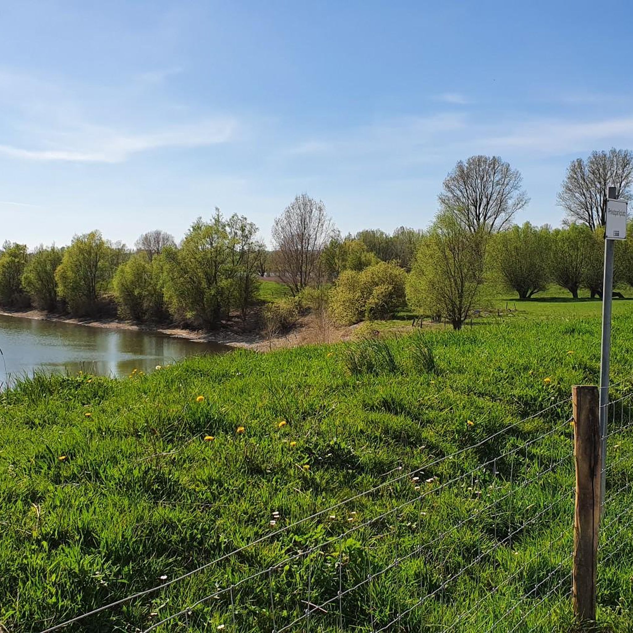
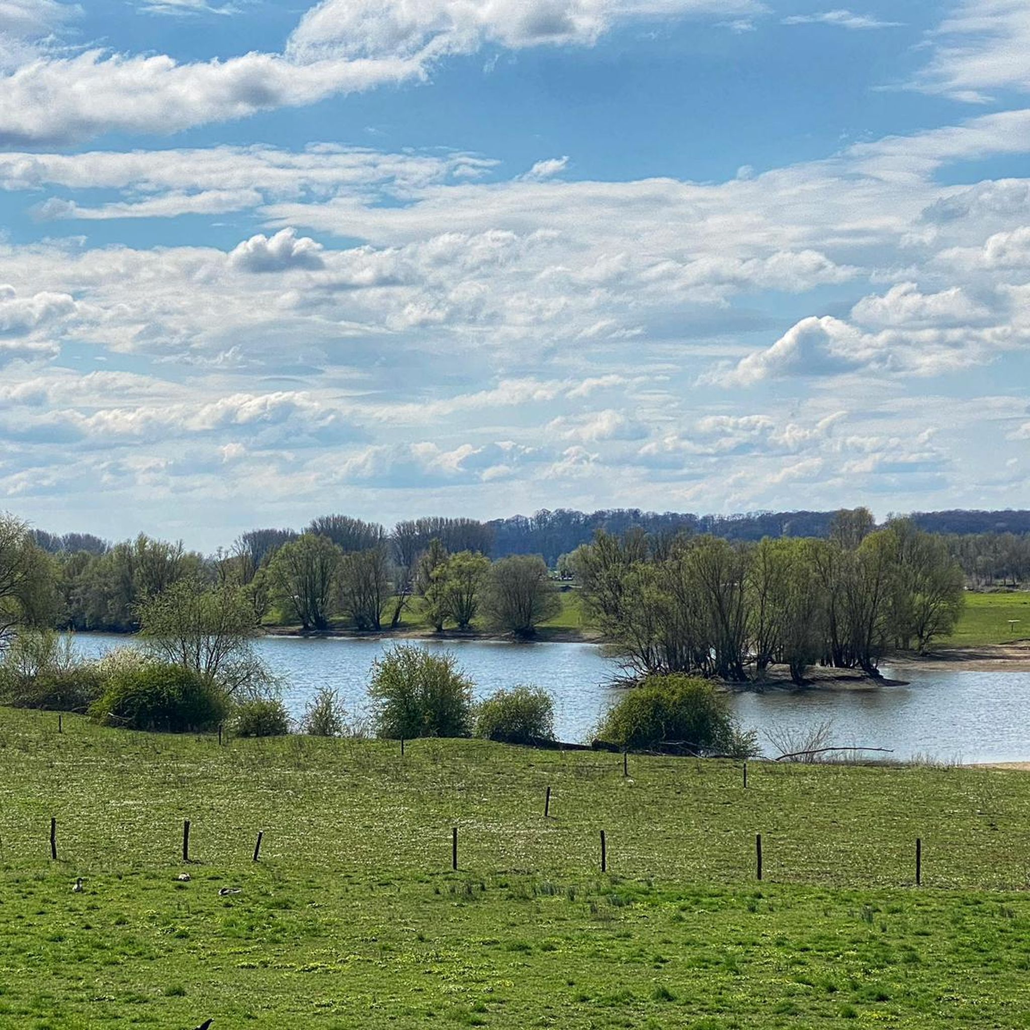
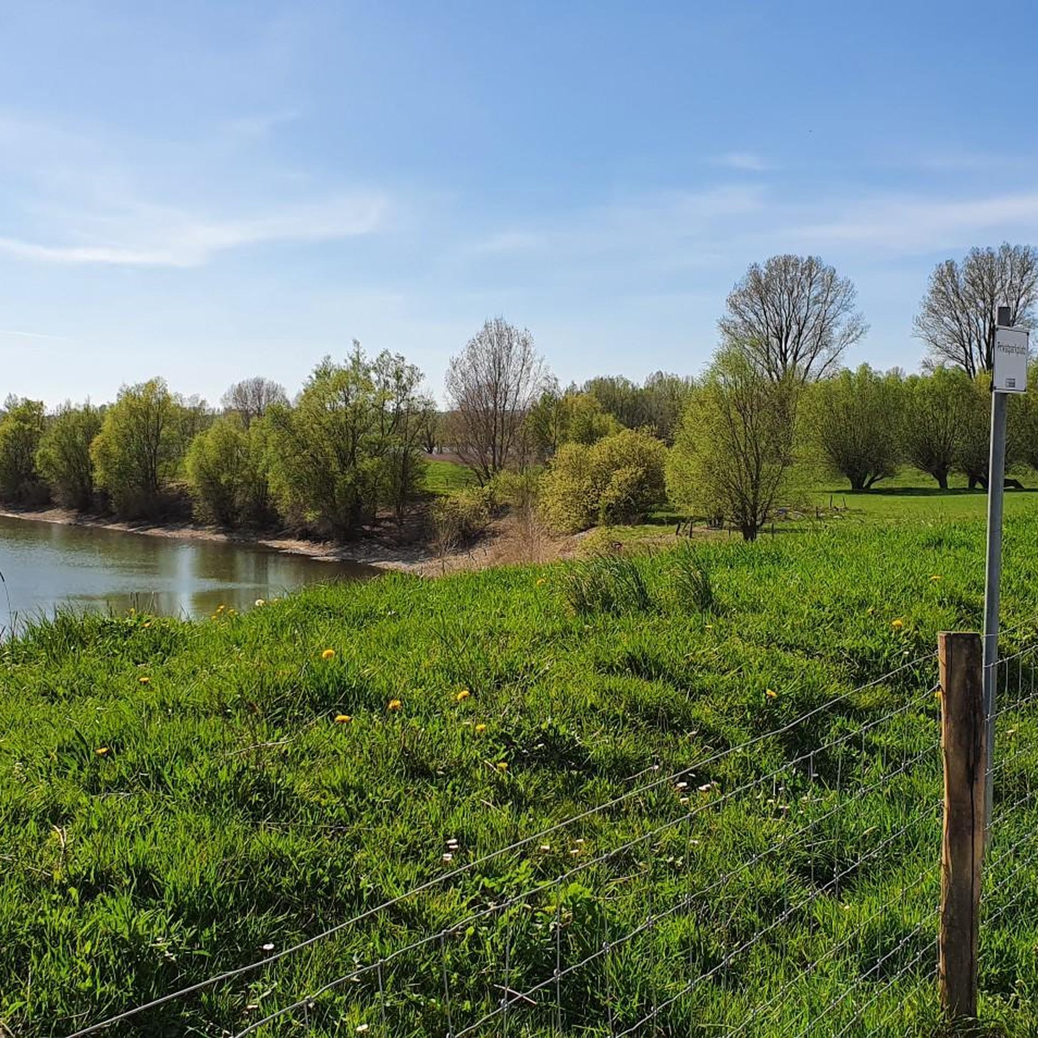
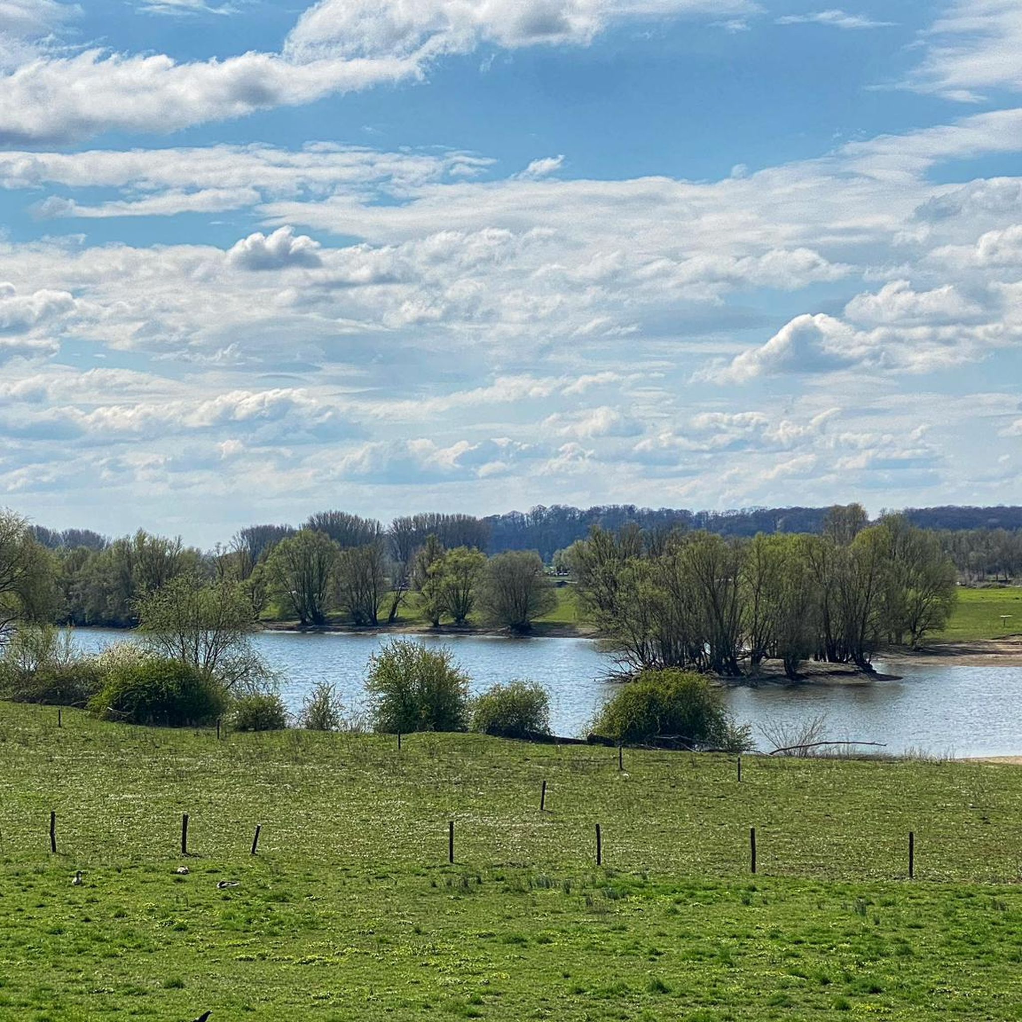
Mountain bike trails in Rheinaue Bislich-Vahnum are characterized by the flat, expansive Rhine floodplains and a network of well-maintained paths. The landscape features fore-dike areas, a gravel pit lake, and re-established river channels, offering a unique natural setting. Poplar and willow thickets, alongside extensive grasslands, define the terrain. While the area is generally flat, it provides diverse routes suitable for recreational cycling and nature exploration.
Best mountain bike trails in Rheinaue Bislich-Vahnum
- The most popular mountain bike trail is Rhine…
Last updated: July 4, 2026
5.0
(1)
7
riders
29.2km
01:38
100m
100m
Moderate mountain bike ride. Great for any fitness level. Advanced riding skills necessary.
8
riders
Easy mountain bike ride. Great for any fitness level. Suitable for all skill levels.

Sign up for free
4.9
(27)
73
riders
23.1km
01:51
200m
200m
Easy mountain bike ride. Great for any fitness level. Suitable for all skill levels.
4.8
(12)
24
riders
Easy mountain bike ride. Great for any fitness level. Suitable for all skill levels.
4.9
(17)
43
riders
47.2km
02:27
60m
60m
Moderate mountain bike ride. Good fitness required. Suitable for all skill levels.
Get access to more routes and recommendations from other explorers.
Sign up for free
Already have an account?
Our route recommendations are based on thousands of hikes, rides, and runs completed by other people on komoot.
Start today with a free account
Your next adventure awaits.
Login or Signup
Tips from the Community

The „Heeswald“ (often simply called „Die Hees“) is a popular, hilly forest area in Xanten-Birten. It is known for its historic hiking trails, extends to the Sonsbecker Schweiz, and holds the ruins of a former air force ammunition depot (Muna) from World War II.
0
0

Beautiful view over the lake.
0
0
Past the Roman thermal baths.
0
0
Rental boats, food, e-bike charging stations, boat trip etc.
0
0


Nice playground - especially if you're traveling with children and grandchildren.
1
0

The 3.4 km long and 6 m high city wall was built starting in 105 AD and featured a parapet walk or earthworks on its inner side. The top of the wall was crowned with battlements, and a double ditch ran along three sides of the fortifications, while only a simple V-shaped ditch existed on the harbor side. Nevertheless, the wall was primarily intended to demonstrate Roman power. The fortifications had a total of 22 towers and three impressive main gates with double passageways on the main roads: the North Gate (also known as the Burginatum Gate), the Maastor Gate, and the Vetera Gate. Since there was no main gate on the Rhine side, some of the towers, such as the Harbor Gate, the Molentor Gate, and the Small Harbor Gate, had simple passageways. Today, the eastern corner of the Roman city wall near the amphitheater, the North Gate, and the nine towers between the North Gate and the main entrance to the city center have been partially reconstructed. To create a continuous facade, the remaining spaces between the towers are planted with hedges. The city wall is to be gradually reconstructed and sections of it are now open to the public. The North Gate, also known as the Burginatium Gate, was the main northern gate leading towards the Roman fort of Burginatium (in Altkalkar). It was reconstructed to its full height. Like the other two main gates, it had a double passageway, was flanked by gate towers, and consisted of three stories. The gate is now open to the public and houses the exhibition "Death & Burial." The harbor of Roman Xanten was located at the Harbor Gate (or East Gate). This gate had a single passageway and is now open to the public. In front of the Molen Gate, which also had a single passageway, the Rhine harbor mole was located in Roman times. However, the Rhine silted up around 300 BC, necessitating the construction of a new mole further north. The gate tower is now open to the public and serves as the entrance to the Harbor Temple park. Source: roemer-tour.de/roemerwegen/deutschland/northrhein-westfalen/xanten-colonia-ulpia-traiana/stadtmauer-tore-xanten
2
0
Frequently Asked Questions
What is the general terrain like for mountain biking in Rheinaue Bislich-Vahnum?
The Rheinaue Bislich-Vahnum region is characterized by flat, expansive Rhine floodplains and well-maintained paths. While not offering rugged, technical mountain biking terrain, it's ideal for recreational cycling and nature exploration. The landscape features fore-dike areas, a gravel pit lake, and re-established river channels, with poplars, willow thickets, and extensive grasslands.
How many mountain bike trails are available in Rheinaue Bislich-Vahnum?
There are over 220 mountain bike routes in Rheinaue Bislich-Vahnum. These include a mix of easy, moderate, and a few more challenging options, catering to various skill levels.
Are there family-friendly mountain bike routes in Rheinaue Bislich-Vahnum?
Yes, the area is well-suited for family-friendly cycling. Many paths are paved and secure, making them ideal for leisurely bike tours. Routes like the Bislich Gravel Lake – Diersfordter Waldsee loop from Rheinaue Bislich-Vahnum are rated as easy and explore natural features suitable for all ages.
What kind of natural features and viewpoints can I expect to see along the trails?
You'll encounter diverse natural features including the Rhine floodplains, a gravel pit lake, and re-established side arms of the Rhine. The area is rich in wildlife, including overwintering and breeding birds, and beavers. Scenic viewpoints offer expansive views of the Rhine and the historic town of Xanten, including its prominent cathedral. Consider exploring highlights like the Bislich Rhine Dyke or the Stork Nest at Rheinaue Bislich-Vahnum.
Are there any circular mountain bike routes in the region?
Yes, Rheinaue Bislich-Vahnum offers numerous circular routes. Many tours incorporate scenic elements like the Rhine dikes and can extend to nearby towns like Xanten and Rees, often including picturesque ferry crossings for a unique experience. An example is the Rhine Ferry Bislich–Xanten – Landgut Hochwald loop from Xanten.
What do other mountain bikers enjoy most about the trails in Rheinaue Bislich-Vahnum?
The routes in Rheinaue Bislich-Vahnum are highly rated by the komoot community, with an average score of 4.7 stars from over 450 reviews. Reviewers often praise the scenic Rhine floodplains, the well-maintained paths, and the opportunity for nature observation, especially along the dike paths and around the gravel pit lakes.
Is Rheinaue Bislich-Vahnum suitable for advanced mountain bikers seeking technical challenges?
The terrain in Rheinaue Bislich-Vahnum is generally flat and characterized by well-maintained paths, making it less suitable for technical mountain biking or significant elevation challenges. While there are a few moderate routes, the area is primarily geared towards recreational cycling and enjoying the natural landscape rather than demanding off-road experiences.
Can I bring my dog on the mountain bike trails?
While the region is a nature reserve, specific rules for dogs on mountain bike trails can vary. It's generally advisable to keep dogs on a leash, especially in areas with wildlife or near livestock, and to respect local signage. Always ensure your dog is well-behaved and doesn't disturb other users or wildlife.
What is the best time of year to go mountain biking in Rheinaue Bislich-Vahnum?
The Rheinaue Bislich-Vahnum area is enjoyable for cycling throughout much of the year. Spring and autumn offer pleasant temperatures and beautiful scenery. Summer is also popular, though it can be warmer. Winter cycling is possible, but be mindful of potential flooding in the fore-dike areas due to the Rhine's water levels, which can affect trail conditions.
Are there places to eat or drink near the mountain bike trails?
Yes, the region has various options for refreshments. You can find cafes and restaurants in nearby towns like Bislich, Xanten, and Rees. Some routes, especially those incorporating ferry crossings, might pass by establishments where you can stop for a break and a meal.
Where can I park my car when visiting the mountain bike trails?
Parking facilities are typically available in the villages and towns surrounding the Rheinaue Bislich-Vahnum, such as Bislich, Xanten, and Wesel. Look for designated parking areas near trailheads or popular starting points for tours. Specific parking information is often available on local tourism websites or within komoot tour descriptions.
Can I reach the mountain bike trails using public transport?
Public transport options to the Rheinaue Bislich-Vahnum area are available, primarily connecting to nearby towns like Wesel or Xanten. From these towns, you might be able to cycle directly to the trails or use local bus services that allow bikes, though availability can vary. Planning your route in advance with public transport schedules is recommended.
Most popular routes in Rheinaue Bislich-Vahnum
Most popular attractions in Rheinaue Bislich-Vahnum

Get inspired with the komoot mobile app


Explore more
Browse the best MTB trails in other regions.
