The best walks and hikes in Büngernsche Und Dingdener Heide
4.5
(4350)
18,979
hikers
987
hikes
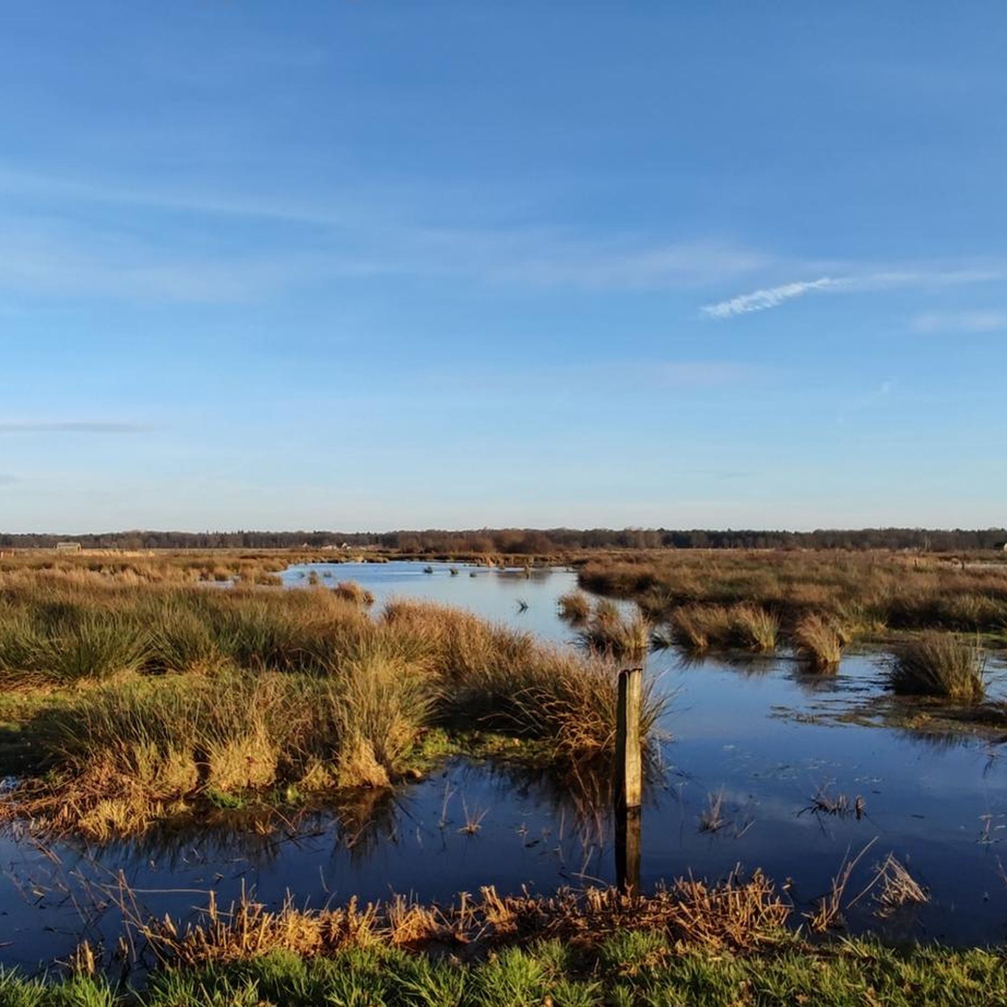
Hiking in Büngernsche Und Dingdener Heide offers a diverse landscape characterized by dense forests, gentle hills, and expansive heathlands. This region, situated at the border of Münsterland and Lower Rhine, features a mosaic of natural elements including wet and damp grasslands, ancient moors, and small lakes. Hikers can explore areas with shady pine forests, native deciduous forests, and flowering meadows. The terrain provides varied experiences across its well-preserved ecosystems.
Best hiking trails in Büngernsche Und Dingdener Heide
- The most popular…
Last updated: September 28, 2026
4.8
(4)
13
hikers
6.14km
01:33
10m
10m
Easy hike. Great for any fitness level. Easily-accessible paths. Suitable for all skill levels.
4.7
(3)
16
hikers
4.55km
01:09
10m
10m
Easy hike. Great for any fitness level. Easily-accessible paths. Suitable for all skill levels.

5.0
(1)
12
hikers
Moderate hike. Good fitness required. Easily-accessible paths. Suitable for all skill levels.
4.5
(4)
11
hikers
Easy hike. Great for any fitness level. Easily-accessible paths. Suitable for all skill levels.
5.0
(2)
13
hikers
6.93km
01:45
10m
10m
Easy hike. Great for any fitness level. Easily-accessible paths. Suitable for all skill levels.
Get access to more routes and recommendations from other explorers.
Already have an account?
Our route recommendations are based on thousands of hikes, rides, and runs completed by other people on komoot.
Start today with a free account
Your next adventure awaits.
Tips from the Community

The newly created small biotope at Raßingvenn is protected behind a hedgerow and may not be entered. 🚶♂️⛔
2
0
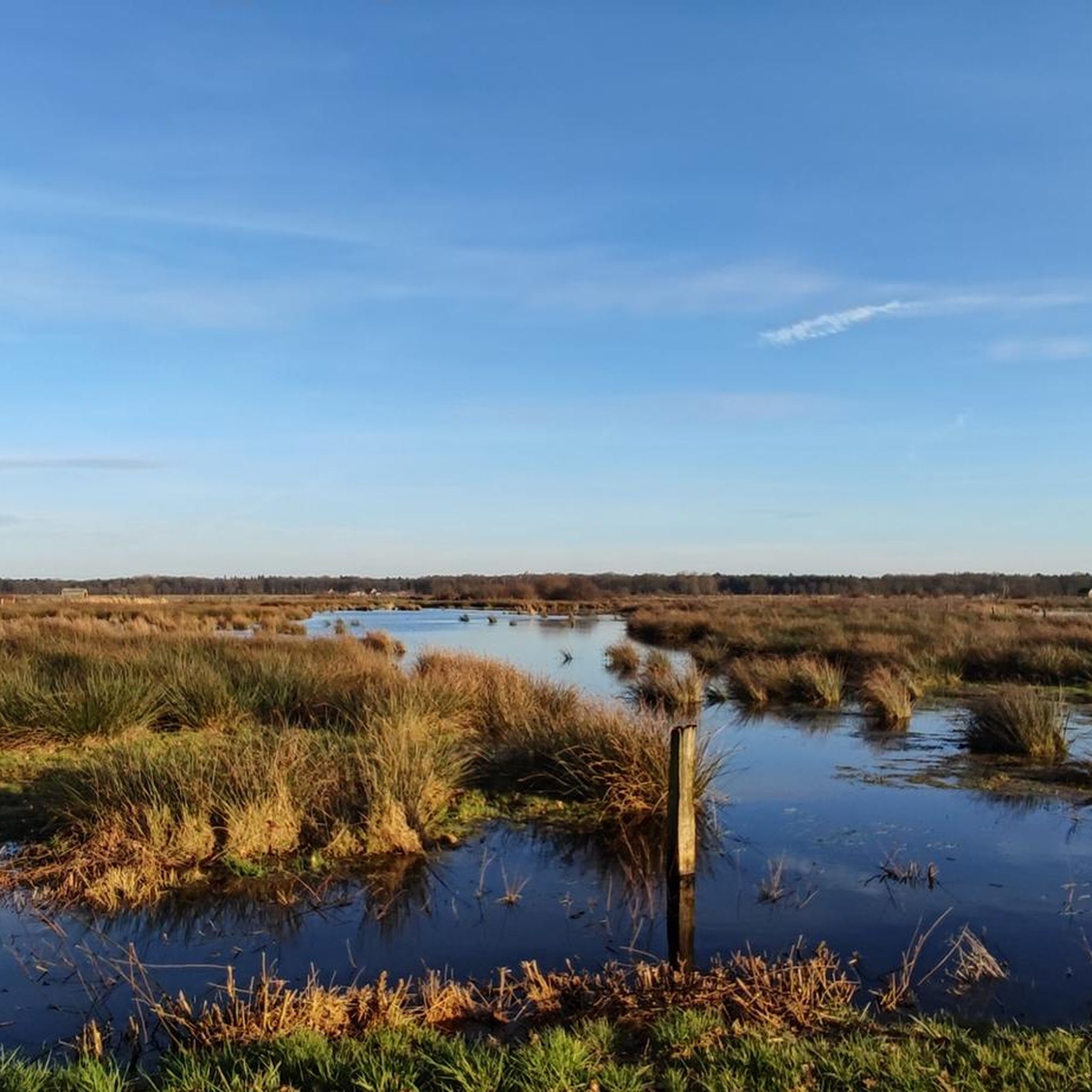
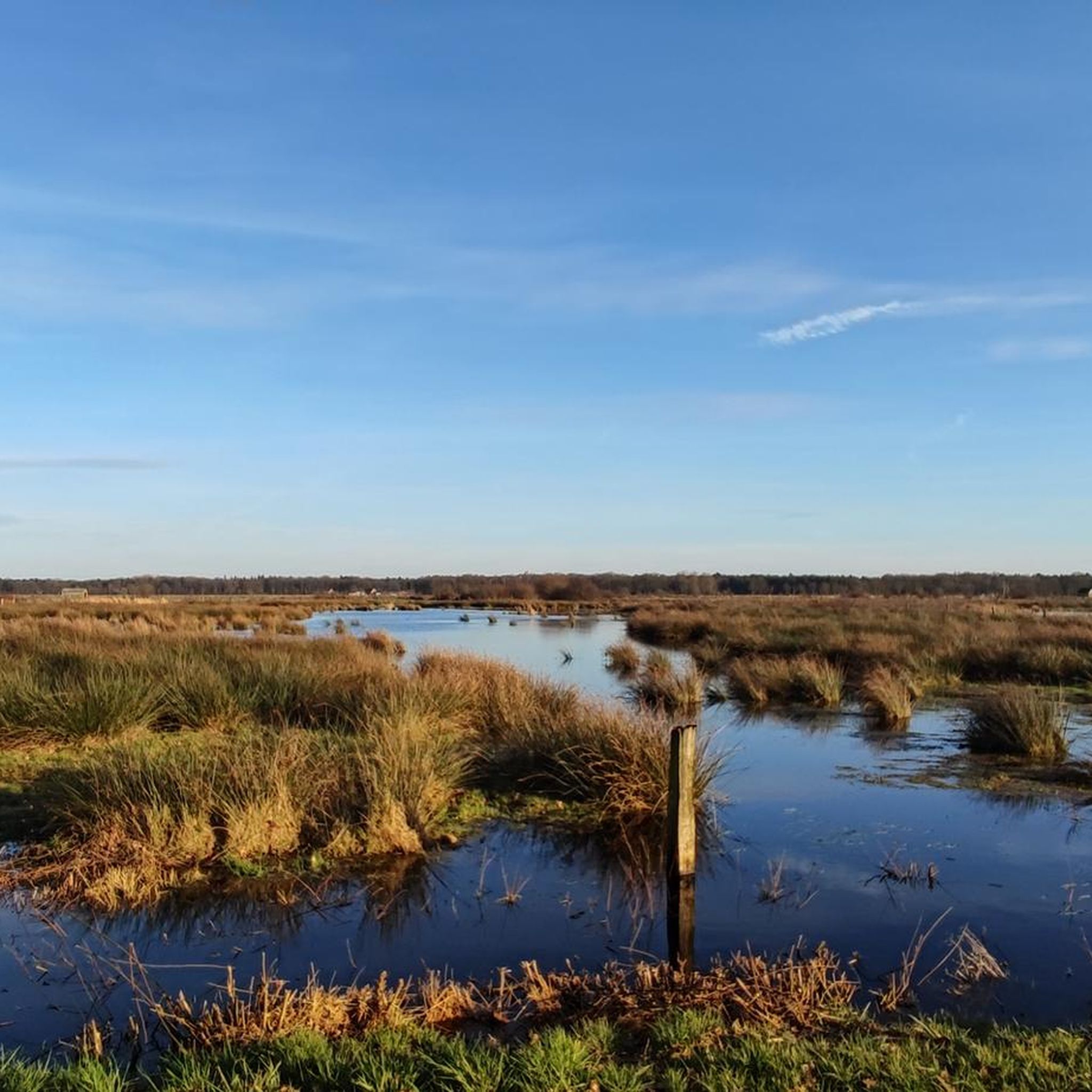
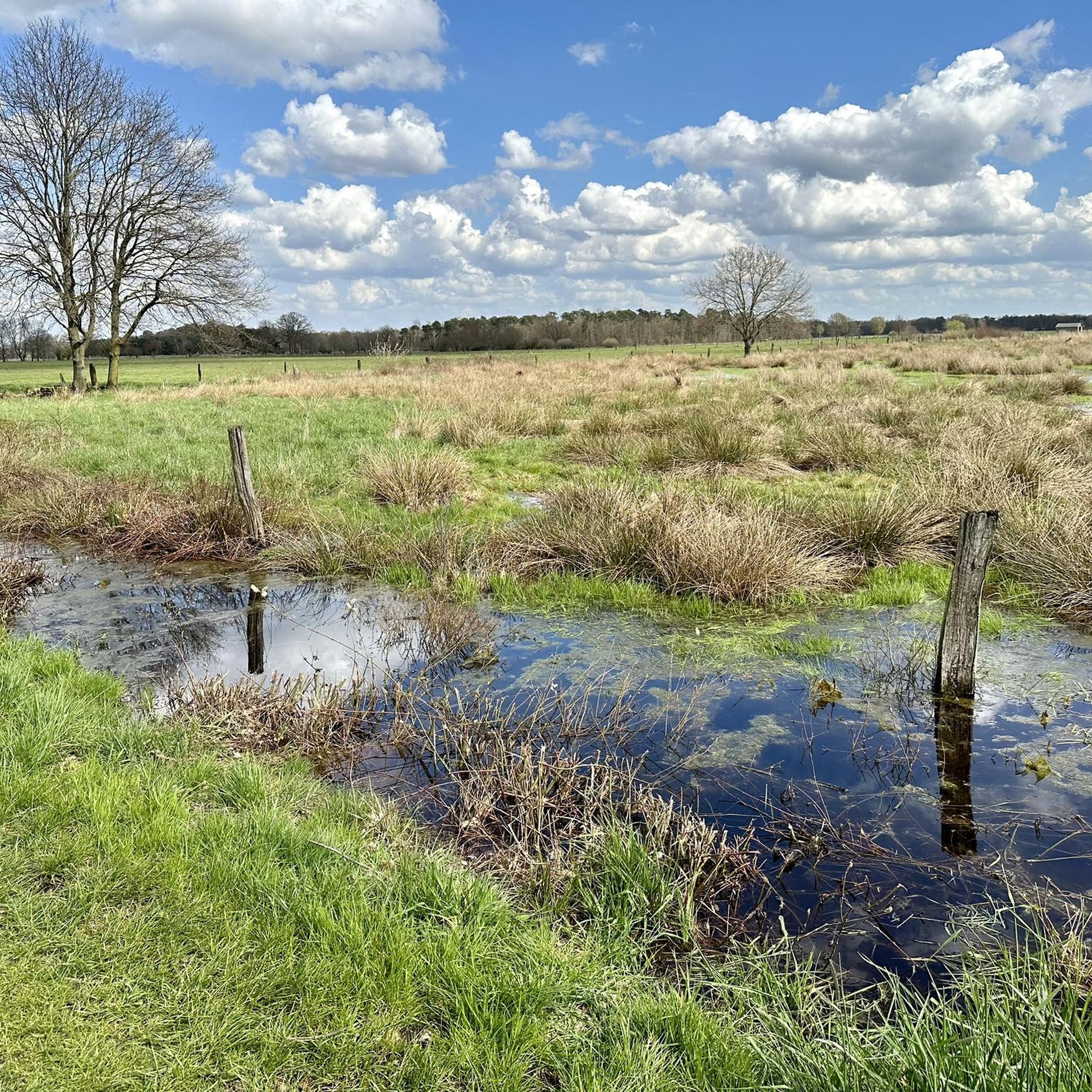
Beautiful wet meadows and boggy hollows can be seen here in the large Büngerner-Dingdener Heath. A large, valuable biotope worthy of protection.
1
0

Unfortunately, the path is impassable. It's a shame we had to take a detour, as it's unfortunately on asphalt.
0
0
This comfortable bench is located at the Raßingvenn/Hoogenkamp fork in the road. It is ideal for taking a short break and enjoying the view.
2
0
At the Hoogenkamp/Raßingvenn junction is the hub of the Büngerner Dingdener Heide, which is designated as a nature reserve. The Fääne project (with an area of around 9 hectares) is part of the Hohe Mark Nature Park (with a total of 1978 sq km). The area/meadows towards the southeast are the so-called Fääne (dialect = Fän/Vän = Venn). By purchasing this area, a connection was created between the western and eastern areas of the Büngerner Dingdener Heide and the areas were divided and redesigned. 2.1 hectares of arable land and 2.9 hectares of INTENSIVE grassland became 5 hectares of EXTENSIVE grassland with plants from moist and poor meadows and pastures. 4 hectares of mixed pine-oak forest became 4 hectares of mixed birch-oak forest. If you follow the Raßingvenn further towards the forest (harder for bicycles - better to walk), you will see the first measures of the intended forest conversion. Here, mixed coniferous forest is to be converted into mixed oak forest. The honorary chairwoman of the "Fääne" foundation at the time was Gisela Klingler. A memorial stone stands at this spot in her honor.
4
0
This fork in the road is a good place to take a break and enjoy the view. There is also space to park your bikes.
2
1
Nice bench under the trees away from the road. Idyllic and quiet location. Diagonally opposite is a historic draw well on the meadow.
2
0
There is a stork's nest nearby. In summer, when the storks have offspring, you can see the parents busily searching for food.
1
0
Frequently Asked Questions
How many hiking trails are available in Büngernsche Und Dingdener Heide?
Büngernsche Und Dingdener Heide offers a wide variety of hiking experiences with over 980 routes. These trails cater to different preferences, ranging from easy strolls to more challenging excursions through diverse landscapes.
What kind of terrain can I expect when hiking in Büngernsche Und Dingdener Heide?
The region features a diverse landscape, including dense forests, gentle hills, and expansive heathlands. You'll encounter a mosaic of natural elements like shady pine forests, native deciduous forests, flowering meadows, wet and damp grasslands, and remnants of ancient moors and small lakes. This variety ensures a rich and engaging hiking experience.
Are there any family-friendly hiking routes in Büngernsche Und Dingdener Heide?
Yes, many trails in Büngernsche Und Dingdener Heide are suitable for families. For an easy and engaging walk, consider the Little Dingden Heath – Mumbecker Bach loop from Kleine Dingdener Heide, which is just over 3 km long and explores the heath's natural beauty. The area's gentle terrain and varied scenery make it ideal for outings with children.
Can I bring my dog on the hiking trails in Büngernsche Und Dingdener Heide?
Many trails in Büngernsche Und Dingdener Heide are dog-friendly, allowing you to enjoy the natural surroundings with your canine companion. It's always recommended to keep dogs on a leash, especially in nature reserve areas, to protect local wildlife and ensure a pleasant experience for all hikers. A good option for a walk with your dog is the Little Dingden Heath loop from Kleine Dingdener Heide.
What interesting natural features or wildlife can I see along the trails?
Büngernsche Und Dingdener Heide is rich in natural features and wildlife. You can spot rare birds like curlews and lapwings from viewing platforms, and observe water buffalo grazing in expansive meadows, particularly at the Water Buffalo in the Dingdener Heide or the Water Buffalo Pasture at Büffelhof Kragemann. The area also boasts rare plants such as orchids and sundew, and even reptiles like the smooth snake in the heathland. Don't miss the Dingdener Heide Nature Reserve for concentrated natural beauty.
Are there any circular hiking routes in the region?
Yes, Büngernsche Und Dingdener Heide offers numerous circular hiking routes, perfect for exploring the area without retracing your steps. A popular choice is the Dingdener Heide Wetlands – Split Pollard Willow loop from Kleine Dingdener Heide, which is about 6.1 km long and takes you through wetlands and heathland.
What is the best time of year to go hiking in Büngernsche Und Dingdener Heide?
The region offers unique beauty throughout the year. Spring brings flowering meadows, while autumn showcases vibrant forest colors. The heathlands are particularly stunning when in bloom during late summer. Even winter hiking is possible, offering a tranquil experience through the frosty landscapes. The diverse ecosystems ensure there's always something to appreciate.
Are there places to eat or drink along the hiking trails?
Yes, you'll find several huts, small cafes, and restaurants conveniently located along the trails in Büngernsche Und Dingdener Heide. These spots provide opportunities for refreshment and a break during your hike, allowing you to enjoy local hospitality amidst nature.
What do other hikers enjoy most about hiking in Büngernsche Und Dingdener Heide?
The area is highly rated by the komoot community, with an average score of 4.6 stars from over 3,500 reviews. Hikers often praise the diverse and well-preserved natural landscapes, the peaceful atmosphere of the heathlands and forests, and the well-marked trails that cater to all ability levels. The chance to observe wildlife, like water buffalo, is also a frequently mentioned highlight.
Is there a historical or cultural trail in Büngernsche Und Dingdener Heide?
Yes, a unique feature of the area is the "LandStreifer-Rundweg 'Zeitreise'" (Time Travel trail). This 5.2-kilometer path guides visitors through five historical "time zones," illustrating how the landscape has evolved over 700 years due to human use, from dense mixed forests to heathland. It offers fascinating insights into the region's past.
Are there any longer, more challenging routes for experienced hikers?
While many trails are easy to moderate, there are options for longer excursions. The Nordbrock Chapel – Dingdener Heide Wetlands loop from Büngernsche und Dingdener Heide is a moderate 11.7 km trail that takes you through wetlands and past historical points, offering a more extended hiking experience.
Most popular routes in Büngernsche Und Dingdener Heide
Most popular attractions in Büngernsche Und Dingdener Heide

Get inspired with the komoot mobile app


Explore more
Browse the best Hikes in other regions.
