The best walks and hikes in Finowtal-Pregnitzfließ
4.6
(13154)
45,090
hikers
27
hikes
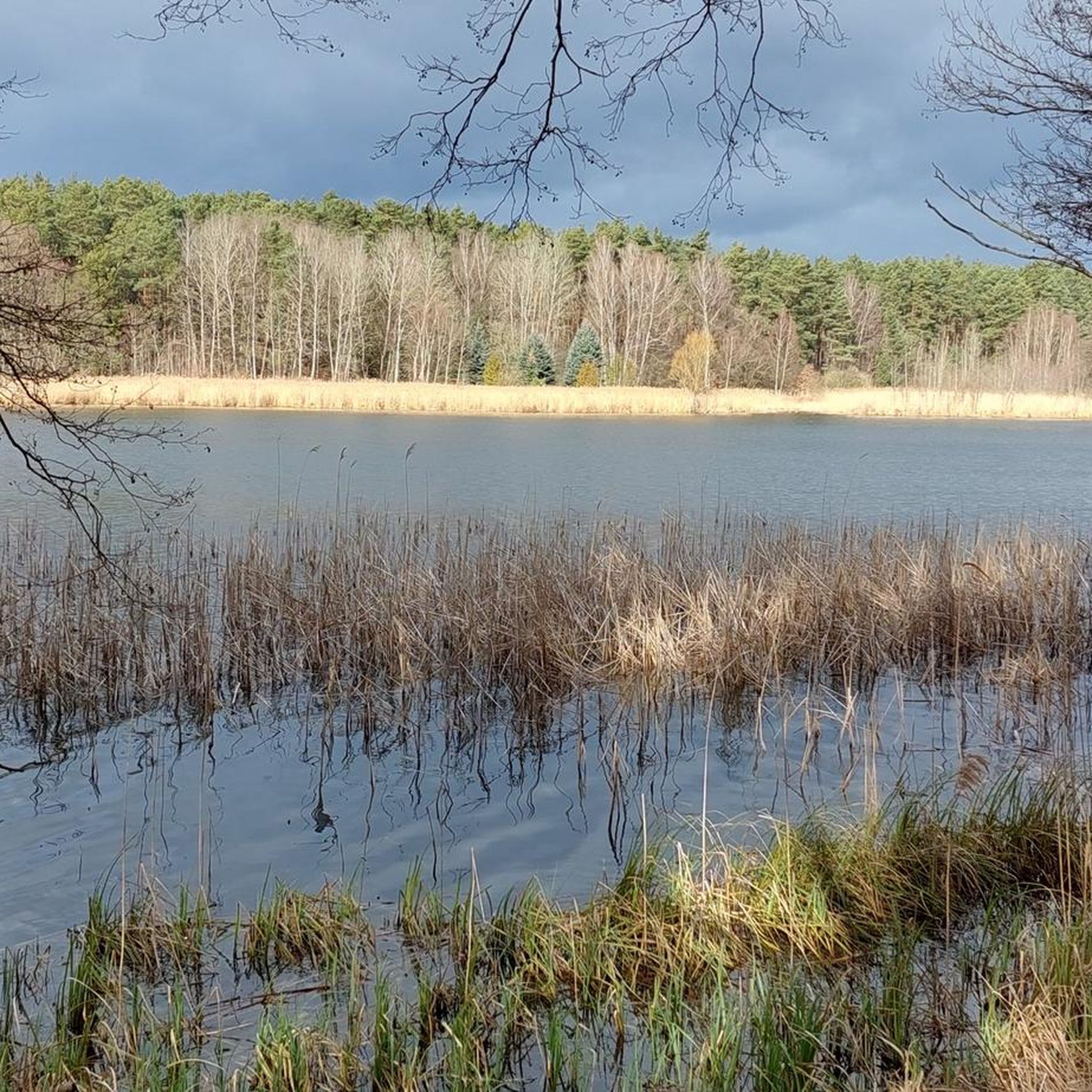
Hiking in Finowtal-Pregnitzfließ offers diverse natural landscapes within the Barnim Nature Park, shaped by an ice-age glacier tongue basin, inland dunes, and a meltwater drainage channel. The region features extensive wetlands, lush forests, and picturesque meadows, with the tranquil Finow Stream and Pregnitz River forming central elements. The terrain around the Finowbach is generally flat, making it suitable for various activity levels.
Best hiking trails in Finowtal-Pregnitzfließ
- The most popular hiking route is Bathing Area Kleiner Wukensee – Großer Wukensee…
Last updated: October 7, 2026
4.7
(107)
314
hikers
Easy hike. Great for any fitness level. Easily-accessible paths. Suitable for all skill levels.
4.8
(113)
338
hikers
Easy hike. Great for any fitness level. Easily-accessible paths. Suitable for all skill levels.

4.9
(19)
63
hikers
16.0km
04:08
80m
80m
Moderate hike. Good fitness required. Easily-accessible paths. Suitable for all skill levels.
4.7
(6)
29
hikers
28.3km
07:15
110m
110m
Hard hike. Very good fitness required. Easily-accessible paths. Suitable for all skill levels.
4.9
(20)
85
hikers
13.8km
03:36
100m
100m
Moderate hike. Good fitness required. Easily-accessible paths. Suitable for all skill levels.
Get access to more routes and recommendations from other explorers.
Already have an account?
Our route recommendations are based on thousands of hikes, rides, and runs completed by other people on komoot.
Start today with a free account
Your next adventure awaits.

Other adventures in Finowtal-Pregnitzfließ

Tips from the Community

With a great sitting/break opportunity by the roadside.
2
0

The relatively new bridge on the Berlin-Usedom cycle path is a pleasant place to linger. A short distance beyond it is a nice rest area.
1
0

Beautiful natural circular route with partial flowing landscape.
4
0

Active beaver at the lake
0
2

The Hellsee is a two-kilometer-long channel lake surrounded by mixed forest. It has an area of 42.91 hectares. The width varies between 40 and 300 meters. The average depth is 3 meters, the maximum depth is said to be 11 meters. The average visibility is almost 2 meters. At the northern tip of the lake there is a marshland, caused by the inflows from the Obersee and the Krummen Lanke, which is crossed by a footbridge. Another marshland can be found in the southeast of the lake. The lake drains at Hellmühle via the Hellmühler Fließ, which runs northwards, into the Finow and further towards the Oder. Source Wikipedia
0
0
The Hellsee is a two-kilometer-long channel lake surrounded by mixed forest. It has an area of 42.91 hectares. The width varies between 40 and 300 meters. The average depth is 3 meters, the maximum depth is said to be 11 meters. The average visibility is almost 2 meters. At the northern tip of the lake there is a marshland, caused by the inflows from the Obersee and the Krummen Lanke, which is crossed by a footbridge. Another marshland can be found in the southeast of the lake. The lake drains at Hellmühle via the Hellmühler Fließ, which runs northwards, into the Finow and further towards the Oder. Source Wikipedia
0
0
The Hellsee is a two-kilometer-long channel lake surrounded by mixed forest. It has an area of 42.91 hectares. The width varies between 40 and 300 meters. The average depth is 3 meters, the maximum depth is said to be 11 meters. The average visibility is almost 2 meters. At the northern tip of the lake, due to the inflows from the Obersee and the Krummen Lanke, there is a marshland that is crossed by a footbridge. Another marshland can be found in the southeast of the lake. The lake drains at Hellmühle via the Hellmühler Fließ, which runs northwards, into the Finow and further towards the Oder. Source Wikipedia
0
2
The Hellsee is a two-kilometer-long channel lake surrounded by mixed forest. It has an area of 42.91 hectares. The width varies between 40 and 300 meters. The average depth is 3 meters, the maximum depth is said to be 11 meters. The average visibility is almost 2 meters. At the northern tip of the lake there is a marshland, caused by the inflows from the Obersee and the Krummen Lanke, which is crossed by a footbridge. Another marshland can be found in the southeast of the lake. The lake drains at Hellmühle via the Hellmühler Fließ, which runs northwards, into the Finow and further towards the Oder. Source Wikipedia
0
1
Frequently Asked Questions
What kind of terrain can I expect when hiking in Finowtal-Pregnitzfließ?
The Finowtal-Pregnitzfließ region, shaped by the Ice Age, offers a varied landscape. You'll find extensive wetlands, lush forests, picturesque meadows, and even ice-age glacier tongue basins and inland dunes. The terrain around the Finow Stream is generally flat, making it accessible for many hikers, while other areas may feature gentle inclines associated with the glacial shifting sand dunes.
Are there easy or family-friendly hiking routes in Finowtal-Pregnitzfließ?
Yes, Finowtal-Pregnitzfließ is well-suited for easy and family-friendly walks. The generally flat terrain, especially around the Finowbach, makes it ideal for leisurely strolls. Many trails are developed and accessible. For example, the Wukensee Beach – Großer Wukensee loop from Biesenthal is an easy 1.7-mile (2.7 km) trail perfect for a shorter outing.
What natural features or landmarks can I see along the hiking trails?
The region is rich in natural and historical features. You can explore the tranquil Finow Stream in the Finowtal–Pregnitzfließ Nature Reserve, which is a central element of the area. Historical sites like the Wehrmühle Biesenthal are also along some routes. Additionally, you'll encounter beautiful lakes such as Bauersee and Eiserbuder Lake, which are popular spots for recreation.
Are there opportunities for wildlife observation in Finowtal-Pregnitzfließ?
Absolutely. The extensive wetlands and forests of the Finowtal-Pregnitzfließ Nature Reserve create a rich habitat for wildlife. You might spot various bird species like white storks and kingfishers, as well as Elbe beavers and Eurasian otters. Spring and summer are particularly ideal for wildlife spotting, offering a chance to see diverse species including butterflies and fish.
Are there circular hiking routes available?
Yes, many of the trails in Finowtal-Pregnitzfließ are designed as circular routes, allowing you to start and end at the same point. An example is the Bathing Area Kleiner Wukensee – Großer Wukensee loop from Biesenthal, which circles two lakes and offers scenic views.
What is the best time of year to go hiking in Finowtal-Pregnitzfließ?
Spring and summer are particularly ideal for hiking in Finowtal-Pregnitzfließ, especially if you're interested in wildlife spotting. The lush greenery and active wildlife make these seasons very appealing. However, the diverse landscapes of wetlands and forests offer beauty throughout the year, with autumn providing vibrant colors and winter offering tranquil, frosty scenes.
Can I bring my dog on the hiking trails?
Yes, the Finowtal-Pregnitzfließ Nature Reserve generally offers dog-friendly options. Many trails are suitable for walks with your canine companion. Always remember to keep your dog on a leash, especially in nature reserve areas, and clean up after them to protect the local wildlife and environment.
Are there places to swim after a hike?
Yes, there are excellent spots for recreation and swimming. Eiserbuder Lake is noted as a great place for swimming. Additionally, the Rest area and swimming spot at Bauersee provides another refreshing option to cool off after your hike.
How can I get to the hiking trails in Finowtal-Pregnitzfließ by public transport?
The region is accessible, and many trails can be reached via public transport. Specific routes often have starting points near bus stops or train stations in towns like Biesenthal. It's advisable to check local public transport schedules for the most convenient connections to your chosen trailhead.
Is parking available near the trailheads?
Yes, parking is generally available near popular trailheads and attractions within the Finowtal-Pregnitzfließ area. Towns like Biesenthal, which serve as common starting points for many hikes, typically offer designated parking facilities for visitors.
What do other hikers enjoy most about hiking in Finowtal-Pregnitzfließ?
The area is highly rated by the komoot community, with an average score of 4.6 stars from over 4,000 reviews. Hikers often praise the diverse and well-preserved natural landscapes, the tranquility of the Finow Stream, and the variety of routes that cater to different ability levels. The opportunities for wildlife observation and the presence of beautiful lakes are also frequently highlighted.
How many hiking trails are there in Finowtal-Pregnitzfließ?
There are over 25 hiking routes available in Finowtal-Pregnitzfließ, ranging from easy strolls to more moderate excursions. This variety ensures options for different preferences and fitness levels, allowing you to explore the region's unique natural beauty.
Most popular routes in Finowtal-Pregnitzfließ
Most popular attractions in Finowtal-Pregnitzfließ

Get inspired with the komoot mobile app


Explore more
Browse the best Hikes in other regions.
