The best mountain hikes in Wildruhefläche Ahrnbach
4.9
(45)
396
hikers
24
hikes
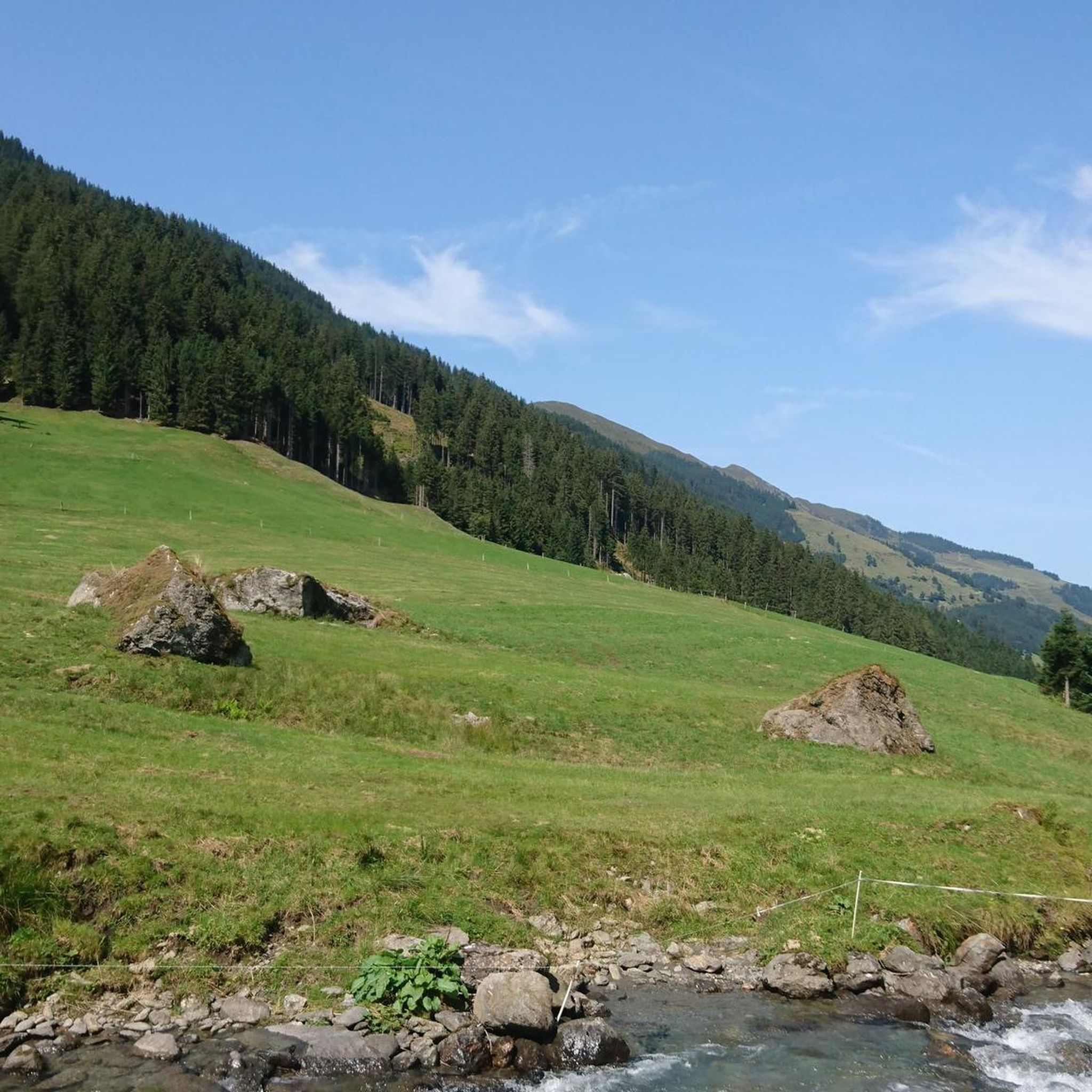
Mountaineering routes in Wildruhefläche Ahrnbach traverse a diverse alpine landscape within the scenic Puster Valley in South Tyrol. The region is characterized by dramatic waterfalls, expansive forests, and alpine meadows, set against the backdrop of the Zillertal Alps and the Rieserferner-Ahrn Nature Park. Numerous peaks, some exceeding 3,000 meters, offer panoramic views and challenging ascents. This area provides a blend of rugged wilderness and traditional alpine cultural elements.
Best mountaineering routes in Wildruhefläche Ahrnbach
- The most popular mountaineering route is Torhelm Summit (2,494 m) loop from Schutzzone Birkhuhn/Auerhuhn, a 12.2 miles (19.7 km) trail that takes about 7 hours 55 minutes to complete. This difficult route offers extensive high alpine terrain and summit views.
- Another top favourite among local mountaineers is Gressensteinalm – Sonnjoch Summit Cross loop from Schutzzone Gams/Steinbock, a difficult 4.8 miles (7.8 km) path. This route features alpine pastures and a summit cross, providing rewarding vistas.
- Local mountaineers also love the Lower Wildalm Lake – Schafsiedel Summit loop from Neue Bamberger Hütte, a 4.6 miles (7.4 km) trail leading through alpine lakes and towards a summit, often completed in about 3 hours 50 minutes.
- Mountaineering in Wildruhefläche Ahrnbach is defined by dramatic waterfalls, high alpine peaks, and extensive forests. The network offers options for various ability levels, from moderate ascents to difficult summit challenges.
- The routes in Wildruhefläche Ahrnbach are highly rated by the komoot community with an average score of 4.8 stars from over 40 reviews. More than 500 mountaineers have used komoot to explore Wildruhefläche Ahrnbach's varied terrain.
Last updated: September 28, 2026
10
hikers
20.1km
08:02
1,230m
1,220m
Hard mountaineering route. Very good fitness required. Mostly accessible paths. Sure-footedness required.
3
hikers
7.82km
03:44
620m
620m
Hard mountaineering route. Good fitness required. Sure-footedness, sturdy shoes and alpine experience required.

4.8
(5)
36
hikers
7.37km
03:49
620m
620m
Moderate mountaineering route. Good fitness required. Mostly accessible paths. Sure-footedness required.
5.0
(1)
25
hikers
18.3km
07:36
1,240m
1,240m
Hard mountaineering route. Very good fitness required. Sure-footedness, sturdy shoes and alpine experience required.
16
hikers
9.29km
04:02
790m
790m
Moderate mountaineering route. Good fitness required. Mostly accessible paths. Sure-footedness required.
Get access to more routes and recommendations from other explorers.
Already have an account?
Our route recommendations are based on thousands of hikes, rides, and runs completed by other people on komoot.
Start today with a free account
Your next adventure awaits.
Tips from the Community

The alpine pasture is no longer managed and parking is no longer permitted there due to rockfall. The last parking option is 800m before the alpine pasture as a proper hiking parking lot!
0
0

A beautiful summit with a 360-degree view. Still considered a hidden gem in Alpbachtal!
1
0

Driving to Wildschönau for 15 years, we have never seen a campsite there. The Breiteggalm slightly above is definitely worth a visit. Suuuuper nice alpine host, cool drinks, great snack, we always like to stop by again.
1
0
A beautiful chapel to reflect. Please note that candles are not permitted here (there are artificial candles with LED lights).
1
0

The Tiefentalalm is a very, very old, rustic alpine pasture, but has been deserted for years and is no longer managed. The parking lot that used to belong to it has since been relocated about 1 km further down into the valley.
0
0

A very beautifully situated alpine pasture.
1
0

We didn't see the campsite, but the chapel is nice to look at
1
0

Directly below the Schafsiedel summit lies the upper of the three Wildalm lakes. A magnificent panorama is naturally included.
1
0
Frequently Asked Questions
How many mountaineering routes are available in Wildruhefläche Ahrnbach?
Wildruhefläche Ahrnbach offers a diverse network of around 30 mountaineering routes. These range from moderate ascents to challenging summit expeditions, catering to various skill levels.
What kind of natural features can I expect to see along the mountaineering routes?
The region is rich in natural beauty. You'll encounter dramatic waterfalls, expansive forests, and vibrant alpine meadows. The routes often provide breathtaking views of the Zillertal Alps and the Rieserferner-Ahrn Nature Park, with many peaks exceeding 3,000 meters.
Are there any routes that feature waterfalls?
Yes, Wildruhefläche Ahrnbach is known for its impressive waterfalls. For a route that highlights this feature, consider the difficult Gressenstein Waterfall – Gressensteinalm loop from Schutzzone Birkhuhn/Auerhuhn, which takes you past the Gressenstein Waterfall.
What is the best time of year for mountaineering in Wildruhefläche Ahrnbach?
The best time for mountaineering typically spans from late spring through early autumn (May to October), when trails are generally clear of snow and weather conditions are more stable. However, some lower elevation routes might be accessible earlier or later, depending on snowmelt and conditions.
Are there any family-friendly mountaineering options?
While many routes are challenging, there are options suitable for families or those seeking a less strenuous experience. The region offers trails that traverse forests and meadows, providing a gentler introduction to the alpine environment. Always check the difficulty and elevation profile before setting out with children.
Can I bring my dog on the mountaineering trails?
Many trails in the region are dog-friendly, but it's always advisable to check specific regulations for individual routes or protected areas within Wildruhefläche Ahrnbach. Ensure your dog is well-behaved, kept on a leash where required, and that you carry waste bags.
What are the difficulty levels of the mountaineering routes?
The routes in Wildruhefläche Ahrnbach cater to a range of abilities. There is 1 easy route, 11 moderate routes, and 18 difficult routes. Difficult routes demand good physical fitness, sure-footedness, sturdy footwear, and alpine experience.
Are there any circular routes available for mountaineering?
Yes, many of the mountaineering routes in Wildruhefläche Ahrnbach are designed as loops, allowing you to start and finish at the same point. An example of a challenging circular route is the difficult Markkirchl at Salzachjoch – Nadernachjoch loop from Schutzzone Objektschutzwald.
What do other mountaineers say about the routes in Wildruhefläche Ahrnbach?
The routes in Wildruhefläche Ahrnbach are highly rated by the komoot community, with an average score of 4.8 stars from over 40 reviews. Mountaineers often praise the diverse alpine landscape, the well-maintained paths, and the stunning panoramic views of the Zillertal Alps.
What kind of wildlife might I encounter?
The diverse ecosystem of the broader Tyrolean alpine regions, including Wildruhefläche Ahrnbach, is home to various wildlife. Keep an eye out for marmots, chamois, foxes, and deer. If you're lucky, you might even spot a golden eagle soaring overhead.
Are there any specific landmarks or points of interest along the trails?
Beyond the natural beauty, the landscape features traditional Alpine cultural elements, including scattered mountain huts and cultivated pastures. Specific routes might lead to summit crosses or offer views of notable peaks like Wolfskofl.
What gear should I bring for mountaineering in Wildruhefläche Ahrnbach?
For difficult routes, sturdy footwear with good ankle support, appropriate layers of clothing for changing weather, a map and compass or GPS device, sufficient water and snacks, and sun protection are essential. For all routes, checking the weather forecast before you go is crucial.
Most popular routes in Wildruhefläche Ahrnbach

Get inspired with the komoot mobile app


Explore more
Browse the best Mountain Hikes & Routes in other regions.
