The best road cycling routes in Naujojo Lentvario Botaninis Draustinis
4.6
(16)
521
riders
11
rides
Road cycling routes in Naujojo Lentvario Botaninis Draustinis traverse a landscape characterized by woodlands, meadows, and wetland areas. The region features the Vokė River, with routes often incorporating bridges over it, and offers varied terrain suitable for road bikes. While the overall elevation changes are moderate, some routes provide enough ascent to challenge experienced riders. The area's natural features include the Dirkliškės forest and ancient oak groves, providing a visually engaging backdrop for cycling.
Best road cycling routes in Naujojo…
Last updated: July 12, 2026
4
riders
26.9km
01:19
250m
250m
Moderate road ride. Great for any fitness level. Some segments of this route may be unpaved and difficult to ride.
21
riders
39.7km
01:48
350m
350m
Moderate road ride. Good fitness required. Mostly well-paved surfaces and easy to ride.

Sign up for free
6
riders
23.3km
01:05
150m
150m
Easy road ride. Great for any fitness level. Mostly well-paved surfaces and easy to ride.
24
riders
71.1km
02:57
310m
310m
Moderate road ride. Good fitness required. Some segments of this route may be unpaved and difficult to ride.
5.0
(1)
10
riders
64.5km
02:47
410m
410m
Moderate road ride. Good fitness required. Some segments of this route may be unpaved and difficult to ride.
Get access to more routes and recommendations from other explorers.
Sign up for free
Already have an account?
Our route recommendations are based on thousands of hikes, rides, and runs completed by other people on komoot.
Start today with a free account
Your next adventure awaits.
Login or Signup
Popular around Naujojo Lentvario Botaninis Draustinis

Tips from the Community

The route leads along the clear, calm lake, whose glittering surface shimmers in the sun. The peaceful atmosphere of the lake, combined with the fresh air and the gentle sound of the water, created an almost meditative ride. It was an experience that highlighted the beauty and tranquility of nature. A particular highlight of the route was the view of a nearby castle that towered majestically over the landscape. The historic architecture of the castle, embedded in the natural surroundings, offered an impressive contrast to the tranquil lake surroundings. The combination of medieval architecture and natural landscape made the trip a journey through time through the history and culture of the region. In addition to the castle, the road also offered a beautiful view of an adjacent park, which added to the beauty of the route with its lush greenery and diverse flora. Cycling through this idyllic landscape was a treat for the senses and provided a perfect opportunity to enjoy the beauty of the surroundings.
0
0
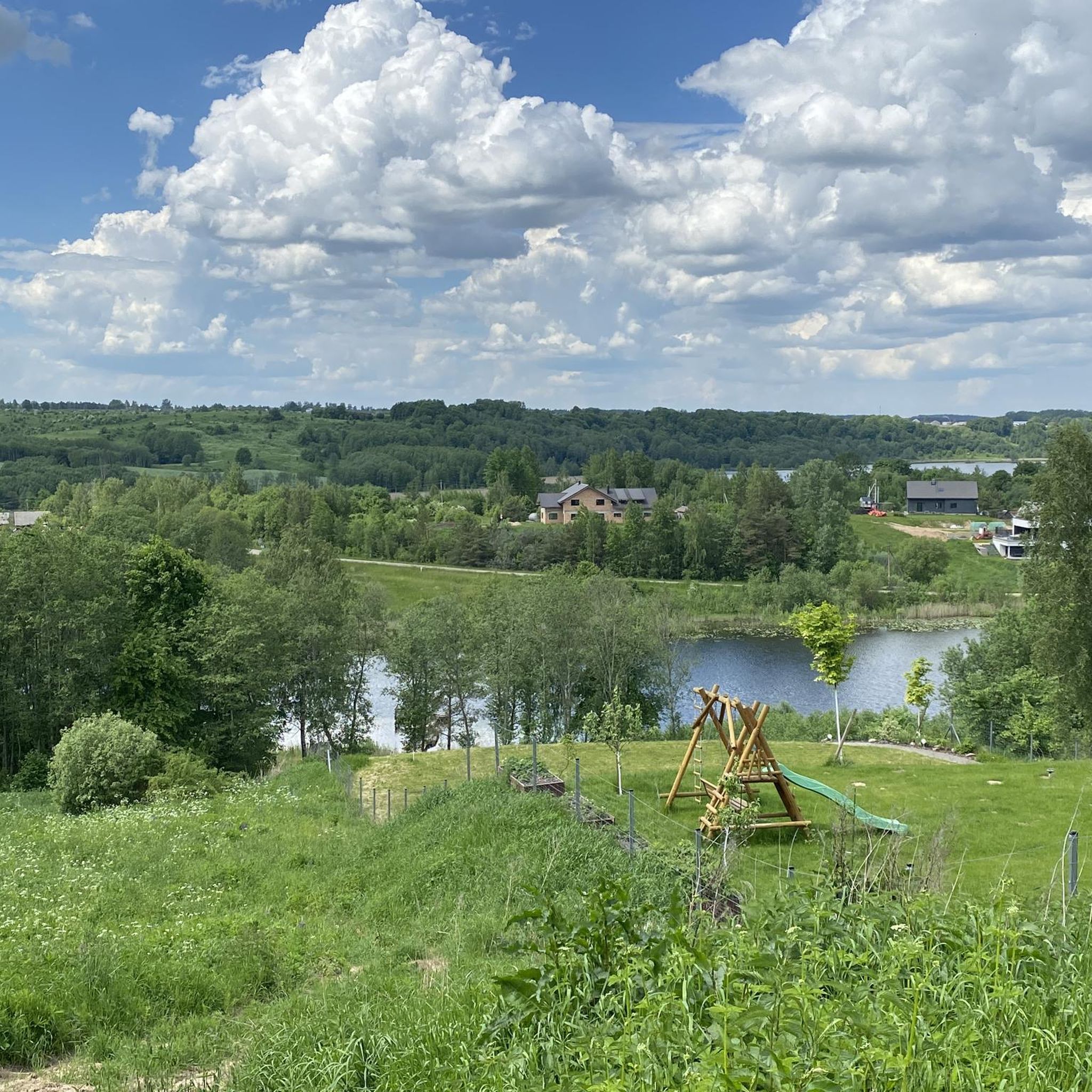
The hill, known for its collection of wooden angels carved in the local style, offers a fascinating insight into Lithuanian folk art. Each sculpture is unique and embodies the deep cultural and spiritual meaning that angels have in Lithuanian culture. An interesting aspect of Engelsberg is its geographical shape, which from a bird's eye view resembles an angel with wings. The lakes of Galvė, Totoriškės and Luka form the body and feet of the angel, while the lakes of Skaistis and Akmena represent the outstretched wings and the hill itself is the head of the angel. This natural formation gives the place an almost mystical aura. In addition to its artistic and natural beauty, Engelsberg is also a popular location for wedding ceremonies.
0
0
The Liepų alėja, an avenue of small lime trees that stretches between the park's event stage and the 7.5-hectare Vingio section of the Vilnius University Botanical Garden, is simply breathtaking. The avenue, which was declared a protected botanical natural heritage site in 1996, was created on the site of a former manor house. A summer spa house was built here in 1857 on the initiative of the military governor of Vilnius, V. Nazimov, and the large park created at that time still gives the place a special flair today. For cyclists and nature lovers alike, this location offers a perfect opportunity to experience Vilnius' urban culture in a relaxed and natural environment.
0
0
The Vokė, a picturesque left tributary of the Neris, flows quietly under the rickety bridge. Despite its narrowness and noticeable instability when crossing, the bridge offered a unique and exciting experience. The bridge's location in an unexpected place, embedded in the natural beauty of the Lithuanian landscape, makes it a special highlight. For me, the bridge's narrowness and wobbling were part of its charm. As I drove across the river, I felt the movement of the bridge beneath me, which got my adrenaline pumping. It was a balancing act that I was happy to master.
0
0


A small highlight on the EV11 route - a rather shaky bridge. At our time (07/23) there was even construction going on along the way and everything was silted up, which means impassable.
2
1
The Neris (Lithuanian Neris, Polish Wilia, Belarusian Вілія, Wilija) is a river in Belarus and Lithuania. It rises in northern Belarus, flows through the Lithuanian capital Vilnius and the medium-sized town of Jonava and flows into the Neman in Kaunas. On the Belarusian side, it is dammed up at Vileyka to form the Vileiskoye reservoir. In Vilnius, the river is partly concreted in, but otherwise natural and not straightened. In Kernavė, on the banks of the Neris, are the remains of the old Lithuanian ruler's residence, which are under UNESCO protection (Wikipedia).
2
1

Frequently Asked Questions
How many road cycling routes are available in Naujojo Lentvario Botaninis Draustinis?
There are 14 road cycling routes available in Naujojo Lentvario Botaninis Draustinis, offering a variety of experiences for different skill levels.
What are the typical difficulty levels of the road cycling routes?
The routes cater to various fitness levels. You'll find 3 easy routes, 10 moderate routes, and 1 difficult route. For example, the Mūrinės Vokės tv. loop from Kalvų slėnis is an easy option, while the Mūrinės Vokės tv. – Bebrų sala loop from Kalvų slėnis is considered moderate.
Are there any circular road cycling routes in the area?
Yes, many of the road cycling routes in Naujojo Lentvario Botaninis Draustinis are designed as loops, allowing you to start and finish at the same point. Examples include the Roadbike loop from Lentvaris and the Vokė Suspension Bridge loop from Vokė.
What natural features or landmarks can I expect to see along the routes?
The routes traverse a landscape rich in natural beauty. You can expect to see diverse ecotypes including woodlands, meadows, and wetland areas. The Vokė River is a prominent feature, with routes often incorporating bridges over it. The area also includes the Dirkliškės forest, ancient oak groves, and the unique Ilgelis Bog, providing a visually engaging backdrop for your ride.
Are there routes suitable for families or beginners?
Yes, there are 3 easy routes perfect for families or beginners looking for a gentler ride. The Mūrinės Vokės tv. loop from Kalvų slėnis is an excellent choice, offering a pleasant experience through varied terrain without significant elevation challenges.
What is the best time of year to go road cycling in Naujojo Lentvario Botaninis Draustinis?
The region is generally pleasant for cycling from spring through autumn. These seasons offer mild temperatures and lush scenery, making for ideal riding conditions. While specific weather conditions can vary, avoiding the colder winter months is generally recommended for road cycling.
How long do the road cycling routes typically take to complete?
Route durations vary depending on distance and difficulty. For instance, an easy route like the Mūrinės Vokės tv. loop from Kalvų slėnis (23.6 km) takes approximately 1 hour. Longer, moderate routes such as the Bonobo Outdoor Bouldering Wall loop from Lentvaris (55.4 km) can take around 2 hours 40 minutes.
What do other cyclists say about road cycling in Naujojo Lentvario Botaninis Draustinis?
The road cycling routes in Naujojo Lentvario Botaninis Draustinis are highly rated by the komoot community, with an average score of 4.6 stars from over 30 reviews. Cyclists often praise the varied terrain, the scenic beauty of the woodlands and meadows, and the well-maintained paved surfaces suitable for road bikes.
Are there options for more experienced riders seeking a challenge?
Yes, while the overall Lithuanian landscape is not overly hilly, this region offers enough elevation changes to provide varied cycling experiences. There is one difficult route, and several moderate routes feature significant elevation gain, such as the Bonobo Outdoor Bouldering Wall loop from Lentvaris, which includes over 465 meters of ascent.
What kind of terrain can I expect on the road cycling routes?
The road cycling routes primarily feature paved surfaces, making them ideal for road bikes. The terrain itself is varied, traversing different environments from dense woodlands to open meadows and wetland areas, ensuring a constantly changing and engaging environment for cyclists.
Is public transport available to reach the trailheads, or is parking provided?
While specific public transport connections to every trailhead can vary, the area around Lentvaris is generally accessible. For those traveling by car, parking options are typically available near the starting points of popular routes, though it's always advisable to check local signage upon arrival.
Most popular routes in Naujojo Lentvario Botaninis Draustinis

Get inspired with the komoot mobile app


Explore more
Browse the best Road cycling routes in other regions.
