Attractions and Places To See in Finse Biotopvernområde - Top 3
Attractions and places to see in Finse Biotopvernområde are characterized by a high-mountain landscape in southern Norway. This region is known for its natural features, including glacial lakes and expansive mountain plateaus. It also holds cultural significance as a route for the historic Bergen Line railway and the Rallarvegen. The area offers diverse natural and historical points of interest for visitors.
Best attractions and places to see in Finse Biotopvernområde
- The most popular attractions is Rallarvegen, a cycle_way that…
Last updated: May 25, 2026
Finsevatnet Lake and Cabins
Highlight • Lake
Tip by

Rallarvegen
Highlight • Cycleway
Tip by

Sign up now to discover places like this
Get recommendations on the best single tracks, peaks, & plenty of other exciting outdoor places.
Sign up for free
Rallarvegen
Highlight (Segment) • Cycleway
Tip by

Finse Biotope Protected Area – Rallarvegen Summit
Highlight (Segment) • Natural Monument
Translated by Google •
Tip by

Start today with a free account
Your next adventure awaits.
Login or Signup
Popular around Finse Biotopvernområde
Tips from the Community

Don't hike in mid-June! There's massive amounts of snow, so you can't see the trail most of the way, and you have to check the Komoot app to make sure you're not walking over a frozen lake covered in snow. It was snowing everywhere, so we more than doubled our time! Additionally, there were some very dangerous sections where we were forced to hike over steep, avalanche-prone sections over several meters of snow.
1
1

Finsevatnet is a high-altitude lake located right next to the tiny village of Finse, at 1,214 meters above sea level in the heart of southern Norway. The Bergen Line railway skirts its edge, offering passengers stunning views of this glacial-fed lake framed by snow-dusted peaks and sweeping mountain plateaus.
1
0

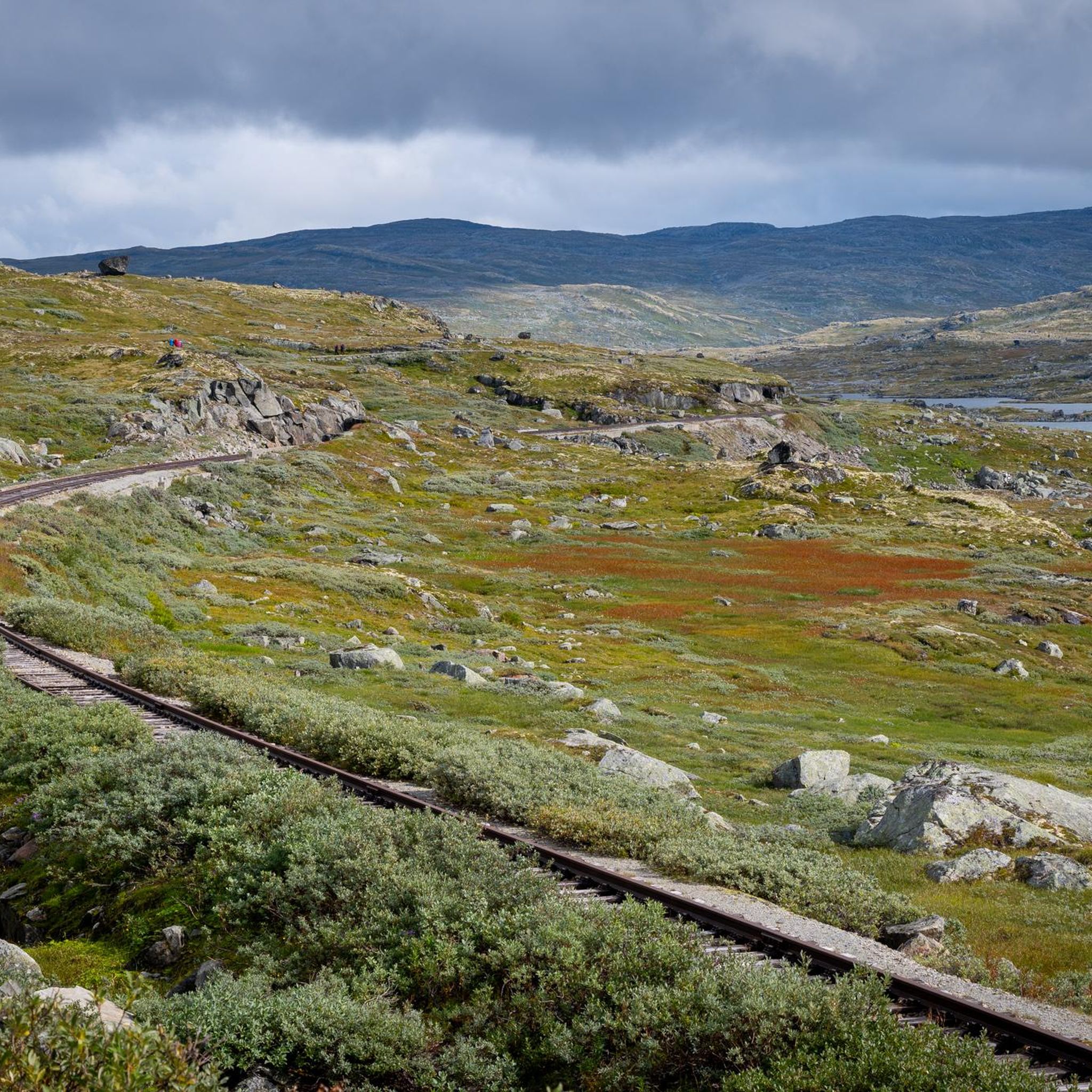
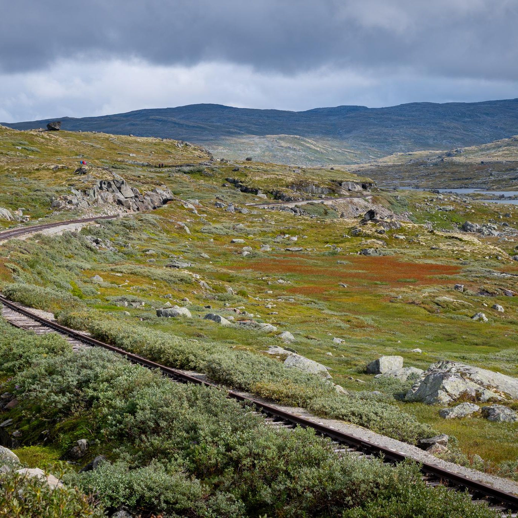
Rallarvegen, or the Navvies’ Road, is a historic and scenic cycling route in Norway. Originally built for the construction of the Bergen Line railway, it now offers a picturesque journey through diverse landscapes, including mountains, valleys, and waterfalls. The route spans from Haugastøl to Flåm, providing cyclists with a unique and immersive experience of Norway’s natural beauty and railroad history.
1
1

Rallarvegen the Navvies'Road) is the old construction road along the Bergen line from Haugastøl to Myrdal and further on to Flåm. A cultural, bicycle, and walking path, built in the years 1895-1902, the trip was named Norway's most beautiful bike path several times. Because of the altitude difference from Haugastøl, (988 m), round Taugevatn (1301m) to Flåm (2m), it is recommended for cyclists to travel westwards. The route is closed for vehicles approximately 15 km west of Haugastøl at Storurdivatnet (1140m), and it continues purely as a trail/cycle-track the rest of the way. Further along, at 1222 metres above sea level, you pass Finse, Norway's highest railway station. For the nerd in you - this is also where the scenes on Hoth, the ice planet, for "Star Wars - The Empire Strikes Back" were shot. The final 20 km goes through Flåmsdalen, a valley famous for its beauty and one of Northern Europe's most exciting railway journeys. The line falls 865 m over the course of the valley starting with 21 switchbacks next to an impressive waterfall.
1
0

What Uwe writes about cyclists is especially true on weekends. The Rallarvegen is a well-developed dirt road that was laid to supply the construction site when the first railway line between Oslo and Bergen was built. It's of course nice for cyclists, especially if you have time on the weekend.
2
1

Here in this section you should not get drifted by the other cyclists. You can stop every 500 meters and enjoy the new view.
4
0
Frequently Asked Questions
What natural features can I explore in Finse Biotopvernområde?
The region is characterized by a majestic high-mountain landscape. You can visit Finsevatnet Lake, a high-altitude glacial lake surrounded by snow-dusted peaks. The area also offers views of Hardangerjøkulen, Norway's sixth-largest glacier, known for its spectacular iced landscapes. The entire area provides powerful nature experiences.
Are there any historical sites or cultural attractions in Finse Biotopvernområde?
Yes, the area is rich in history related to the Bergen Line railway. The Rallarvegen, or Navvies' Road, is a historic cycling and walking route originally built for the railway's construction. You can also visit Finse 1222, Norway's highest railway station, which is only accessible by train, foot, or bike. The Rallar Museum at Finse tells the story of the railway's construction and the lives of its workers.
What outdoor activities are popular near these attractions?
Finse Biotopvernområde is ideal for various outdoor activities. Cycling along the historic Rallarvegen is a popular choice, offering picturesque journeys through mountains and valleys. For hiking, there are marked trails, including routes towards the Hardangerjøkulen glacier. You can find more details on specific routes in the cycling guide and hiking guide for the region.
What is the best way to experience the Rallarvegen?
The Rallarvegen is often called Norway's most beautiful bike path. It spans from Haugastøl to Flåm, with Finse as a natural stop. Due to the significant altitude difference, it's recommended for cyclists to travel westwards. The route is a well-developed dirt road, offering diverse views and a unique experience of Norway's natural beauty and railroad history.
What is the best time to visit Finse Biotopvernområde?
The summer months are generally the best time for cycling and hiking, as the Rallar Museum is open and trails are more accessible. However, be aware that even in mid-June, high-altitude areas like Finsevatnet Lake can still have massive amounts of snow, making some trails difficult to navigate and potentially dangerous. Winter offers opportunities for skiing and other snow activities.
How can I reach Finse, and is it accessible by car?
Finse is unique because it is only accessible by train, foot, or bike. It is not possible to reach Finse by car. The Bergen Line railway stops at Finse 1222, Norway's highest railway station, making the train a primary mode of transport to this remote location.
Are there any challenging trails for experienced hikers or cyclists?
Yes, the region offers challenging routes. For hikers, trails to Hardangerjøkulen Glacier and routes like 'Rallarvegen along the Bergen Railway from Finse to Hallingskeid' are considered difficult. Cyclists can also find difficult sections on the Rallarvegen, especially the full stretch from Haugastøl to Flåm. Always check current conditions, especially for snow, which can make trails significantly harder.
What makes Finsevatnet Lake a notable attraction?
Finsevatnet Lake is a prominent high-altitude lake situated at 1,214 meters above sea level, right next to the village of Finse. Its glacial-fed waters are framed by snow-dusted peaks and expansive mountain plateaus, offering stunning views, particularly for those traveling on the Bergen Line railway which skirts its edge.
What is the significance of the 'Planet Hoth' filming location?
For fans of science fiction, the area around Hardangerjøkulen glacier is notable as some scenes for the ice planet Hoth in 'Star Wars - The Empire Strikes Back' were filmed here. This adds a unique pop culture element to the region's already impressive natural landscape.
What should I pack for a visit to Finse Biotopvernområde?
Given the high-mountain environment, it's crucial to pack layers of clothing suitable for varying weather conditions, including waterproof and windproof outerwear. Sturdy hiking boots are essential for trails, and if visiting in early summer, be prepared for snow. Always carry sufficient water, snacks, and navigation tools. For cycling, appropriate gear for a long-distance dirt road is recommended.
Are there viewpoints to enjoy the scenery?
Absolutely. The entire region is known for its stunning vistas. Finse Biotope Protected Area – Rallarvegen Summit offers diverse views along the Rallarvegen. Many sections of the Rallarvegen and the Bergen Line railway provide panoramic views of glacial lakes, snow-dusted peaks, and mountain plateaus.
What kind of research is conducted at the Finse Alpine Research Center?
The Finse Alpine Research Center is an important facility that attracts biologists, geologists, geophysicists, and other researchers from Norway and internationally. Located in the northwestern part of the Hardangervidda plateau, it regularly hosts seminars, meetings, and university courses, focusing on areas like biology, geology, and natural geography, studying the unique high-mountain environment.
Most popular routes in Finse Biotopvernområde

Get inspired with the komoot mobile app


Explore more
Still not found the Highlight you’re looking for? See guides of the top attractions in other regions:
