The best walks and hikes in Ålfotbreen Landskapsvernområde
4.4
(697)
2,423
hikers
37
hikes
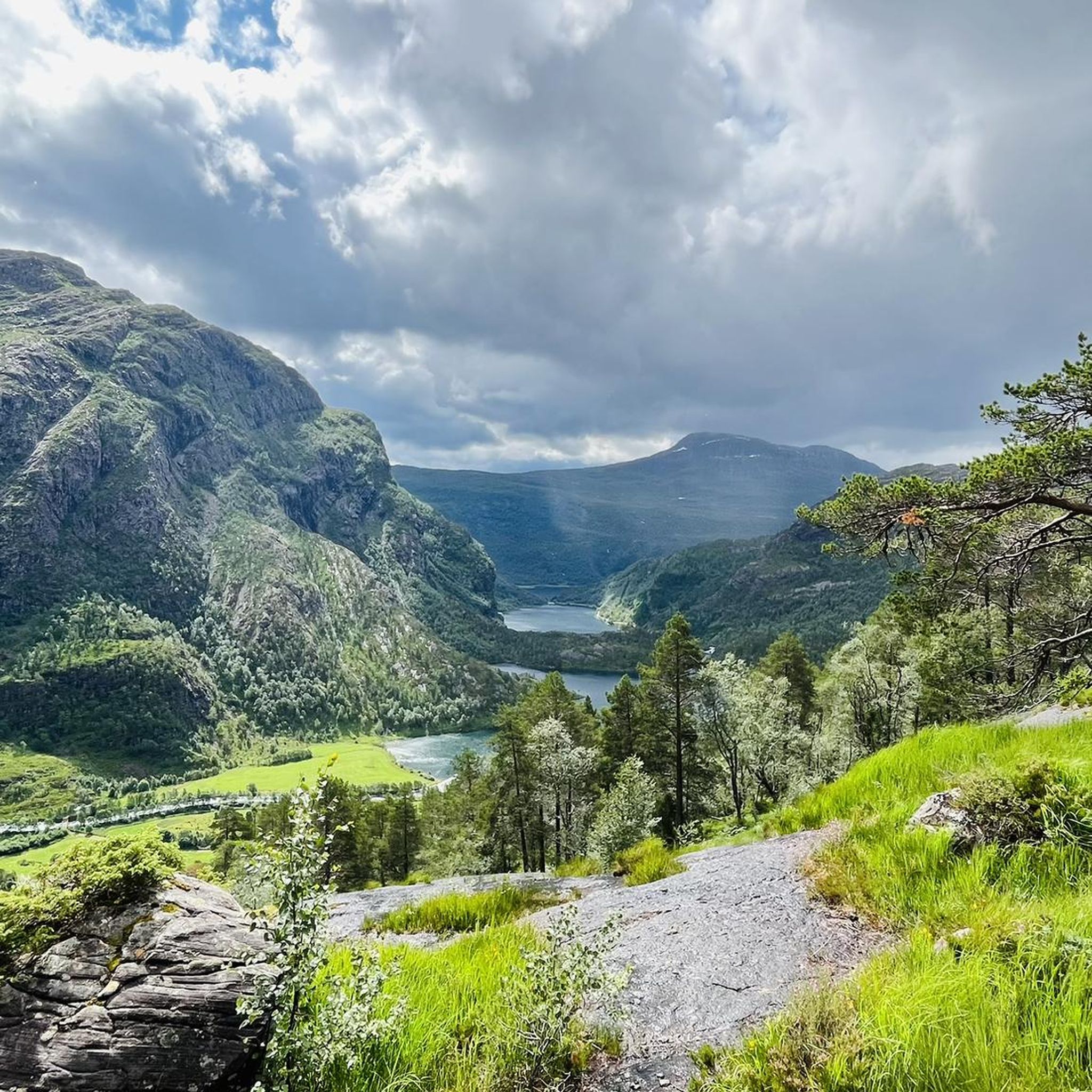
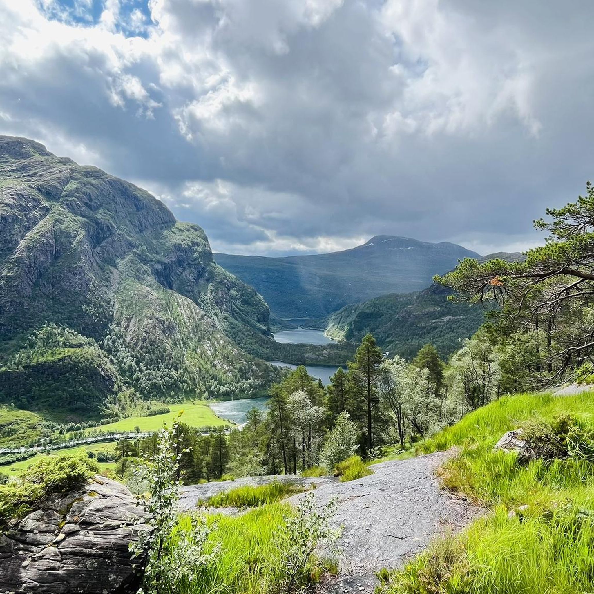
Hiking in Ålfotbreen Landskapsvernområde offers diverse terrain, from accessible lowland trails to challenging high mountain environments. This protected area features Norway's westernmost glaciers and distinctive Devonian period rock formations. The landscape includes barren high-altitude areas, fertile valleys, and steep mountain slopes along the Hyefjord. It is a water-rich region with numerous rivers, lakes, and waterfalls.
Best hiking trails in Ålfotbreen Landskapsvernområde
- The most popular hiking route is Grøndalen to Blåbrebu, a 7.6 miles (12.2 km) trail that takes 5…
Last updated: August 22, 2026
8
hikers
12.2km
05:26
720m
720m
Hard hike. Very good fitness required. Mostly accessible paths. Sure-footedness required.
4.5
(6)
16
hikers
4.20km
01:32
250m
250m
Easy hike. Great for any fitness level. Easily-accessible paths. Suitable for all skill levels.

Sign up for free
4.5
(51)
121
hikers
7.58km
02:55
480m
480m
Moderate hike. Good fitness required. Easily-accessible paths. Suitable for all skill levels.
4.1
(8)
38
hikers
7.07km
01:49
30m
30m
Easy hike. Great for any fitness level. Easily-accessible paths. Suitable for all skill levels.
4.5
(6)
19
hikers
3.26km
01:42
400m
400m
Moderate hike. Good fitness required. Easily-accessible paths. Suitable for all skill levels.
Get access to more routes and recommendations from other explorers.
Sign up for free
Already have an account?
Our route recommendations are based on thousands of hikes, rides, and runs completed by other people on komoot.
Start today with a free account
Your next adventure awaits.
Login or Signup
Popular around Ålfotbreen Landskapsvernområde
Tips from the Community

It is definitely worth walking here and looking at this beautiful city.
0
0
Trolls are part of Norway. You can find them everywhere.
0
0
No matter where you stand, you can look out at and enjoy your surroundings.
0
0
A museum for Viking fans of all ages. Definitely recommended. You learn a lot, and everything is hands-on.
0
0
Funny idea. You need the right angle, and then you can capture the name of the village.
0
0
A very good spot for a view of the fjord. You can see quite far.
0
0
Beautiful, well-preserved town. Delicious cinnamon rolls and simply stunning views of nature.
0
0

Frequently Asked Questions
How many hiking trails are available in Ålfotbreen Landskapsvernområde?
There are nearly 40 hiking trails in Ålfotbreen Landskapsvernområde, offering a wide range of experiences from easy lowland walks to challenging mountain expeditions. The komoot community has explored these routes over 2000 times.
What kind of terrain can I expect when hiking in Ålfotbreen Landskapsvernområde?
Ålfotbreen Landskapsvernområde features incredibly diverse terrain. You'll find everything from accessible lowland trails to rugged, challenging high mountain environments. The landscape includes barren high-altitude areas, fertile valleys, and steep mountain slopes along the Hyefjord, all shaped by unique Devonian period geology.
Are there easy trails suitable for families or beginners?
Yes, there are many accessible lowland trails perfect for families and beginners. For example, the Veten loop from Hanshjellen is an easy 4.2 km path suitable for various fitness levels. Another great option is the Nordfjord – Riverside Trail loop from Eid kyrkje, which is also an easy route.
Are there challenging routes for experienced hikers?
Absolutely. For experienced hikers seeking a demanding environment, the high mountains offer challenging terrain. The Grøndalen to Blåbrebu trail is a difficult 12.2 km route leading through high mountain terrain to a mountain cabin, requiring very good fitness and sure-footedness. The area's highest peak, Gjegnen (1,670 meters), also offers strenuous expeditions.
Can I find trails with waterfalls in Ålfotbreen Landskapsvernområde?
Yes, Ålfotbreen is a water-rich environment with numerous rivers, lakes, and waterfalls. The Ossætra Cabins and Lake – Waterfall loop from Eid kyrkje is a popular 7.6 km trail that specifically highlights these scenic water features.
Are there any circular hiking routes in the region?
Yes, several circular routes are available. The Veten loop from Hanshjellen is an easy circular path. For a moderate option, consider the Waterfall – Ossætra Cabins and Lake loop from Eid kyrkje, which offers varied terrain.
What natural features or landmarks can I see while hiking?
The region is known for its unique natural features. You can witness Norway's westernmost glaciers, distinctive Devonian period rock formations, and the dramatic contrast between barren high-altitude areas and lush, fertile valleys. The highest peak, Gjegnen, offers stunning panoramic views for those who reach its summit.
Are there mountain cabins for overnight stays?
Yes, there are unserviced mountain cabins available. Gjegnabu and Blåbrebu, operated by the Norwegian Trekking Association, serve as excellent destinations or starting points for summit expeditions. The Grøndalen to Blåbrebu route, for instance, leads directly to one of these cabins.
What is the best time of year to hike in Ålfotbreen Landskapsvernområde?
The best time to hike generally depends on your desired experience. Summer offers the most accessible conditions for high mountain trails. However, be prepared for rapid weather changes in the higher elevations. Lower elevation trails can be enjoyed for a longer season. Always check weather forecasts before heading out.
What safety precautions should I take for mountain hikes?
For high mountain areas, it's crucial to be well-prepared. Always check weather forecasts, bring extra equipment and food, and inform someone of your route. Cell phone coverage can be limited in remote areas. If crossing glaciers or snowdrifts, exercise extreme caution due to potential crevasses and snow bridges.
Is there wildlife to observe in Ålfotbreen Landskapsvernområde?
Yes, the area is part of the red deer's core habitat in Norway, offering opportunities to observe these animals in their natural environment. Keep an eye out for other local fauna as you explore the diverse landscapes.
How do other hikers rate the trails in Ålfotbreen Landskapsvernområde?
The routes in Ålfotbreen Landskapsvernområde are highly rated by the komoot community, with an average score of 4.3 stars from over 600 reviews. Hikers often praise the varied terrain, the stunning natural beauty, and the clear marking of paths.
What should I wear and bring for hiking in this region?
Given the diverse terrain and potential for rapid weather changes, especially in higher altitudes, it's recommended to wear sturdy hiking shoes and layered clothing. Always bring waterproof outer layers, sufficient water, snacks, and a map or GPS device. For challenging mountain expeditions, alpine experience and appropriate gear are essential.
Most popular routes in Ålfotbreen Landskapsvernområde

Get inspired with the komoot mobile app


Explore more
Browse the best Hikes in other regions.
