The best walks and hikes in Skorgeura Naturreservat
4.6
(25)
263
hikers
20
hikes
Hiking in Skorgeura Naturreservat offers trails through a landscape shaped by a significant ancient landslide, resulting in distinctive block fields, ridges, and mounds. The reserve is characterized by a diverse broadleaf forest, featuring birch, aspen, and hazel thickets, alongside a rich variety of plant and animal life. Paths often wind over stones alongside a rushing stream, bordered by ferns and mosses. This geological history and varied ecosystem provide a range of hiking experiences.
Best hiking trails in Skorgeura Naturreservat
- The…
Last updated: July 1, 2026
5.0
(4)
32
hikers
4.15km
02:07
330m
340m
Moderate hike. Good fitness required. Mostly accessible paths. Sure-footedness required.
4.0
(2)
9
hikers
5.20km
02:06
410m
410m
Moderate hike. Good fitness required. Easily-accessible paths. Suitable for all skill levels.

Sign up for free
5.0
(1)
13
hikers
9.24km
04:02
810m
810m
Moderate hike. Good fitness required. Easily-accessible paths. Suitable for all skill levels.
3.5
(2)
12
hikers
6.06km
02:57
660m
660m
Moderate hike. Good fitness required. Easily-accessible paths. Suitable for all skill levels.
5.0
(1)
10
hikers
4.71km
01:57
390m
390m
Moderate hike. Good fitness required. Easily-accessible paths. Suitable for all skill levels.
Get access to more routes and recommendations from other explorers.
Sign up for free
Already have an account?
Our route recommendations are based on thousands of hikes, rides, and runs completed by other people on komoot.
Start today with a free account
Your next adventure awaits.
Login or Signup
Popular around Skorgeura Naturreservat
Tips from the Community

Here, next to the shooting range, you can find a few parking spots and the trailhead for the hike up to Helgehornet. A sign at the entrance to the shooting range welcomes all hikers.
0
0
Helgehornet is the taller of the two peaks on the peninsula nestled between the Ørsta and Volda fjords. Standing 622 meters high, the summit is accessible via three different routes. Once you reach the top, you’ll find a large radio tower and a hut, alongside a traditional stone cairn marking the peak.
0
0
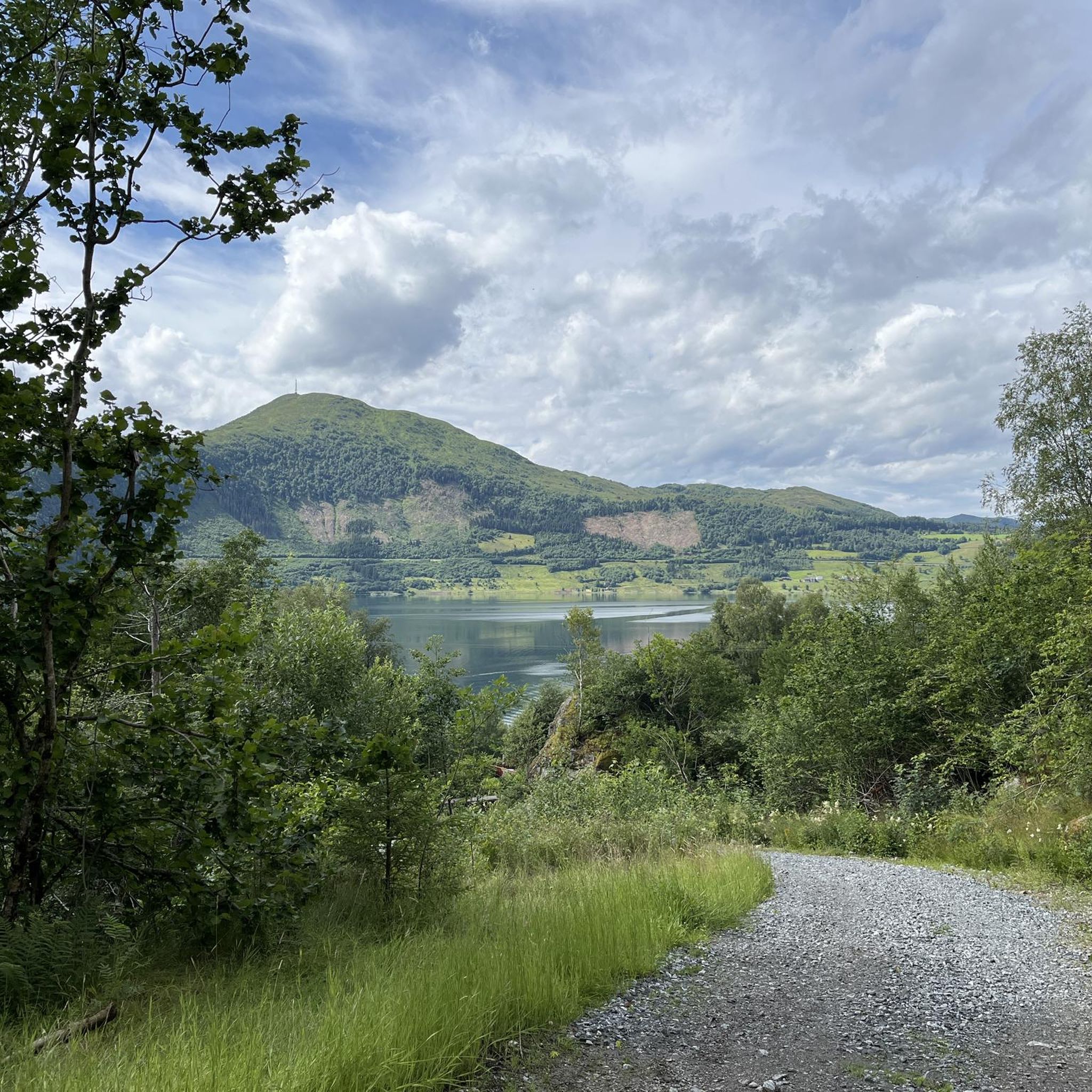
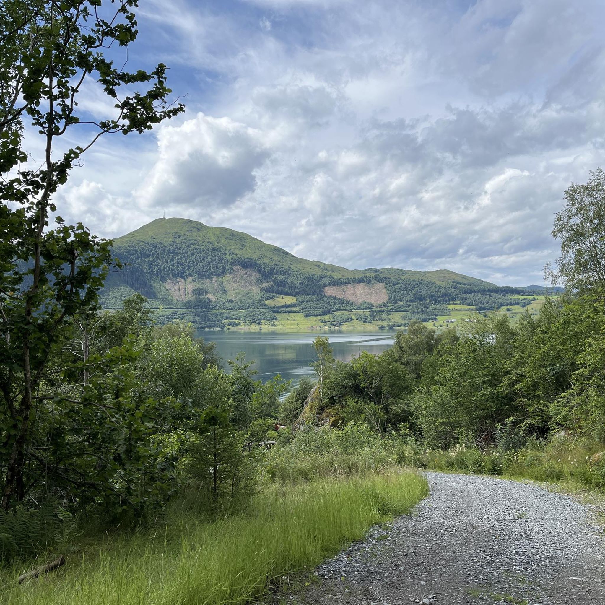
As you scale the 622-meter summit of Helgehornet, you’ll break through the tree line at around the 300-meter mark. From there, the forest gives way to sweeping views of the vast landscape and the stunning Ørsta and Volda fjords.
0
0

Free for all, beautiful view of Volda Airport and the fjord
0
0

Waterfall with pool. Definitely a nice way to cool off in the summer.
0
0
beautiful view of the valley and the mountains.
0
0

Frequently Asked Questions
How many hiking trails are available in Skorgeura Naturreservat?
Skorgeura Naturreservat offers a diverse network of over 20 hiking trails. These range from easy strolls to more challenging ascents, catering to various fitness levels.
What is the typical terrain like in Skorgeura Naturreservat?
The terrain in Skorgeura Naturreservat is unique, shaped by an ancient landslide. You'll encounter expansive block fields, ridges, and mounds. Paths often wind over stones alongside rushing streams, through dense, rainforest-like environments with ferns, mosses, and clover. Some sections, particularly on routes like Skorgesetra, can be wet or prone to river overflow, though wooden bridges are installed in challenging areas.
Are there family-friendly hiking options in Skorgeura Naturreservat?
Yes, Skorgeura Naturreservat has trails suitable for families. While some routes involve initial steep ascents, many sections, especially after the initial climb into areas like Skorgedalen, flatten out for a more relaxed walk. Look for trails described as 'easy' in the guide for the most suitable family options.
Can I bring my dog on the trails in Skorgeura Naturreservat?
Generally, dogs are welcome on hiking trails in Norway, but they must be kept on a leash, especially during nesting seasons for birds and when livestock might be present. Always ensure your dog is under control and that you clean up after them to preserve the natural environment of the reserve.
Are there any circular hiking routes in Skorgeura Naturreservat?
Yes, several circular routes are available. For example, the Loop to Helgehornet is a moderate 4.2 km trail. Another option is the Dinglavatnet Lake – Okla loop from Ørsta/Volda Airport, Hovden, which is a 5.2 km moderate path. The Volda Church – Vallahornet Summit loop from Ørsta kyrkje also offers a longer circular experience.
Where can I find parking for hiking in Skorgeura Naturreservat?
Specific parking information for trailheads within Skorgeura Naturreservat is often available locally or at the start of popular routes. For tours starting from specific locations like Ørsta/Volda Airport, Hovden, or Ørsta kyrkje, parking facilities are typically accessible nearby.
Are there any waterfalls to see along the hiking trails?
Yes, the region's landscape includes rushing streams, and some routes specifically highlight waterfalls. The Waterfall – Vallahornet Summit loop from Ørsta kyrkje and the Waterfall loop from Ørsta are examples of trails where you can experience these natural features.
What kind of wildlife and plant life can I expect to see?
Skorgeura Naturreservat is known for its rich biodiversity. The broadleaf forest features birch, aspen, hazel thickets, elm, and grey alder. Among the stone masses, you can find a profusion of species like woodruff, primrose, and honeysuckle. Various lichens also adorn the trees. The reserve is home to a wide array of plants and birds, making it a great spot for nature observation.
Do I need a permit to hike in Skorgeura Naturreservat?
No, hiking in Skorgeura Naturreservat does not typically require a permit. As a natural reserve, it is generally open for public access and recreation, following the principles of 'allemannsretten' (the right to roam) in Norway. However, always respect local regulations and conservation efforts.
What do other hikers enjoy most about Skorgeura Naturreservat?
The area is highly rated by the komoot community, with an average score of 4.5 stars from over 15 reviews. Hikers often praise the unique geological landscape, the diverse and lush forest environment, and the peaceful atmosphere, noting it's less crowded than other areas, allowing for an undisturbed connection with nature.
What is the best time of year to hike in Skorgeura Naturreservat?
The best time to hike in Skorgeura Naturreservat is generally during the warmer months, from late spring to early autumn (May to September). During this period, the trails are typically free of snow, and the diverse flora is in full bloom, offering vibrant scenery. Some sections can be wet, so waterproof footwear is advisable regardless of the season.
Are there any particularly challenging hikes in the reserve?
While many trails are moderate, there are more challenging options for experienced hikers. For instance, the Volda Church – Vallahornet Summit loop from Ørsta kyrkje is a longer route with significant elevation gain, taking around four hours to complete. The reserve offers one trail specifically rated as 'difficult' out of its 20 routes.

Get inspired with the komoot mobile app


Explore more
Browse the best Hikes in other regions.
