Attractions and Places To See in Lyngsalpan Landskapsvernområde / Ittugáissáid Suodjemeahcci - Top 8
Best attractions and places to see in Lyngsalpan Landskapsvernområde / Ittugáissáid Suodjemeahcci is a protected landscape in Northern Norway. The region is characterized by dramatic alpine scenery, featuring high mountains, glaciers, and deep valleys. It is also known for its cultural heritage, reflecting Sami, Norwegian, and Kven influences, with traces of ancient settlements. The area offers a diverse range of natural features and cultural sites to explore.
Best attractions and places to see in Lyngsalpan Landskapsvernområde / Ittugáissáid Suodjemeahcci
- The…
Last updated: August 29, 2026
Blåisvatnet
Highlight • Lake
Translated by Google •
Tip by

Steindalsbreen Glacier
Highlight • Natural Monument
Translated by Google •
Tip by

Sign up now to discover places like this
Get recommendations on the best single tracks, peaks, & plenty of other exciting outdoor places.
Sign up for free
Lyngstuva Lighthouse
Highlight • Monument
Tip by

Aspevatnet
Highlight • Lake
Translated by Google •
Tip by

River Near Blåisvatnet
Highlight • River
Translated by Google •
Tip by

Sign up for free to discover even more attractions in Lyngsalpan Landskapsvernområde / Ittugáissáid Suodjemeahcci.
Sign up for free
Already have an account?
Start today with a free account
Your next adventure awaits.
Login or Signup
Popular around Lyngsalpan Landskapsvernområde / Ittugáissáid Suodjemeahcci
Tips from the Community

Beautiful hike to the blue lake. The path is very rocky and partly goes over wooden planks.
0
0

This is the furthest point on the Lyngen Peninsula. It is the perfect spot to admire the midnight sun in summer and the northern lights in winter.
1
0

An absolutely beautiful lake with an almost unreal color. Extremely beautiful - especially in autumn when the birch trees start to turn yellow - which makes a great contrast with the intense blue waters of the lake. The hike is easy enough but somewhat annoying - 3km on a dry riverbed, walking on uneven ground and lots of rocks. Still, it's absolutely worth the view!
0
0

Foothills of the largest glacier on the European mainland. The path is challenging and hiking boots are essential. Moraines and rocks!
2
0


Translated it is the lake of blue ice water. The lake is fed by meltwater from the surrounding glaciers. It gets its blue color from stone particles, but it's not one blue, but thousands of shades of blue and turquoise that you can observe here throughout the day. An overnight stay is therefore worthwhile to be able to see all the shades of colour. You can even go for a swim in the lake if you dare. Of course the water is icy, but refreshing. As soon as you get pain in your extremities or head, you should leave the water.
1
1

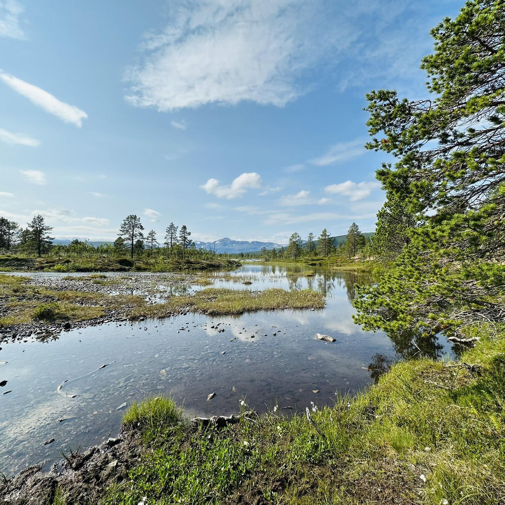
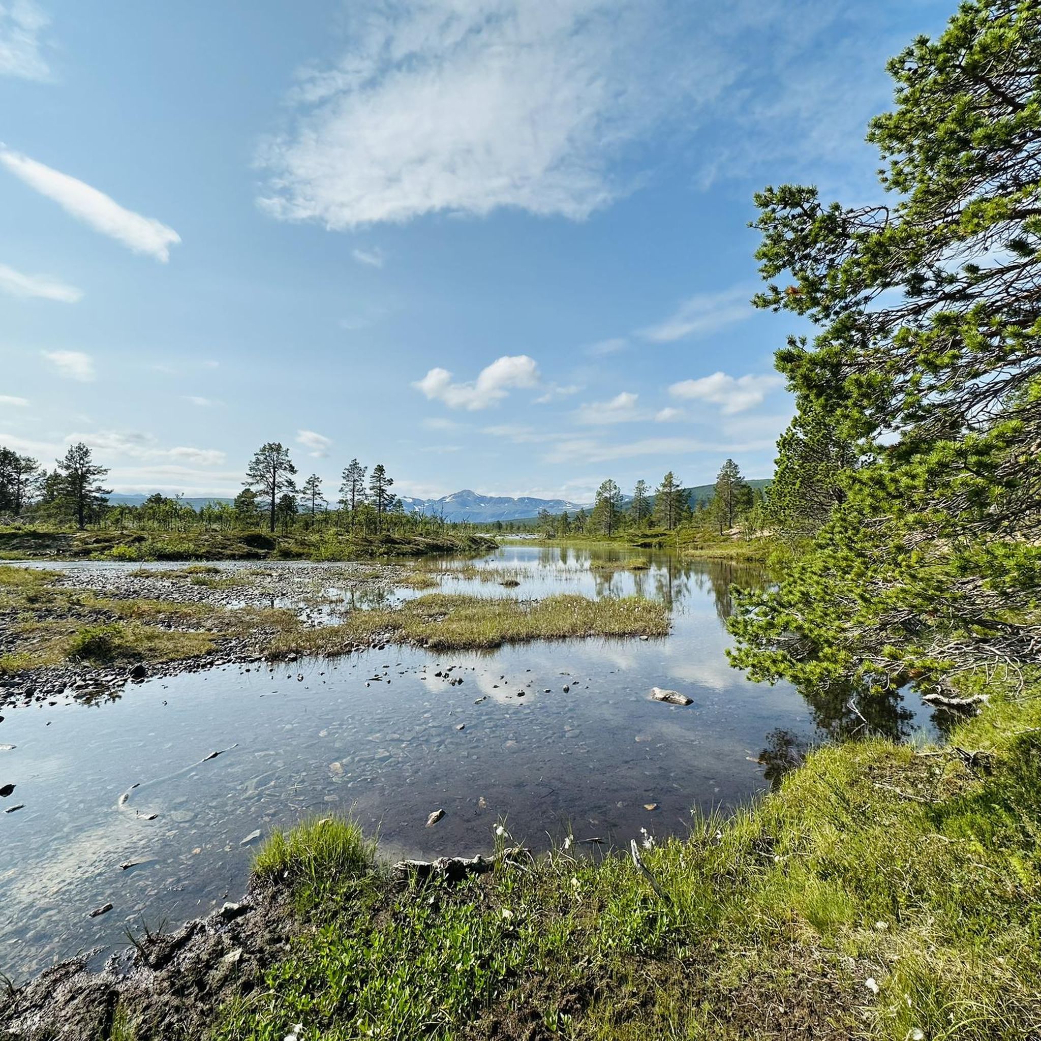
Nice place on the way to Blåisvatnet. Small river to linger. Also suitable as a northern light spot.
0
0
Nice hike. Only small inclines in between, but the scree field requires sure-footedness and sturdy shoes.
2
0
Frequently Asked Questions
What are some notable natural features to explore in Lyngsalpan Landskapsvernområde / Ittugáissáid Suodjemeahcci?
The region is famous for its dramatic alpine scenery. You can visit Blåisvatnet, known for its intensely turquoise-blue glacial meltwater, or the impressive Steindalsbreen Glacier, one of the largest on the European mainland. Another beautiful lake with striking blue water is Aspevatnet, offering a great mountain panorama.
Are there any cultural or historical sites in the area?
Yes, Lyngsalpan Landskapsvernområde / Ittugáissáid Suodjemeahcci is rich in cultural heritage. The region is a historical meeting place for Sami, Norwegian, and Kven cultures. You can find traces of ancient settlements, including Goahti ruins from Sámi settlements and other relics dating back to the early Stone Age. The Lyngstuva Lighthouse trail also features cultural remains from Sami and Norse habitation.
What kind of outdoor activities can I do near these attractions?
The area offers a variety of outdoor activities. For hiking, you can explore trails like the Blåisvatnet Trail or the Steindalsbreen Glacier Trail. There are also easy hikes available, such as the loop from Tindevangen to Aspevatnet. If you're interested in cycling, there are routes like the 'Road Along Sagelvvatnet' or the 'Stortua Wooden Shed' loop. You can find more details on these activities in the dedicated guides for hiking and cycling in the region.
Are there family-friendly options for visitors?
Yes, there are family-friendly options. The walk to Aspevatnet is considered an easier and family-friendly route, offering beautiful views without extreme difficulty. Many of the easy hiking trails, such as the 'Blåisvatnet Trailhead Parking – Aspevatnet loop', are suitable for families. You can find more easy hikes in the Easy Hikes guide.
What is the best time to visit Lyngsalpan Landskapsvernområde / Ittugáissáid Suodjemeahcci?
The best time to visit depends on your interests. In summer, you can experience the midnight sun, particularly at spots like Lyngstuva Lighthouse, and enjoy hiking to glacial lakes like Blåisvatnet. Winter offers opportunities to witness the northern lights, also visible from the lighthouse. Hiking conditions are generally best in the warmer months, but some trails can be challenging due to moraines and rocks, especially near glaciers.
What are the difficulty levels of the trails to attractions like Blåisvatnet or Steindalsbreen Glacier?
The trail to Blåisvatnet is generally considered intermediate, with small inclines but requiring sure-footedness and sturdy shoes due to scree fields. The path to Steindalsbreen Glacier is challenging, requiring appropriate hiking boots due to moraines and rocks. For an easier option, the walk to Aspevatnet is much flatter and simpler.
Can I swim in the glacial lakes?
Yes, you can swim in Blåisvatnet if you dare! The water is icy but refreshing. Visitors are advised to leave the water if they experience pain in their extremities or head due to the cold.
Where can I experience the midnight sun or northern lights?
The Lyngstuva Lighthouse, located at the furthest point of the Lyngen Peninsula, is an ideal spot to experience both the midnight sun in summer and the northern lights in winter. Additionally, the River Near Blåisvatnet is also noted as a suitable spot for viewing the northern lights.
What makes the water in Blåisvatnet so blue?
The intensely turquoise-blue color of Blåisvatnet is a result of meltwater from surrounding glaciers. The color comes from fine stone particles suspended in the water, which reflect sunlight in thousands of shades of blue and turquoise throughout the day.
Are there any unique cultural experiences related to the Sami people?
Yes, Sami culture and reindeer herding are integral to the protected landscape. You can experience this living culture through dedicated programs, such as those offered at the Lyngen Sami Camp. Here, visitors can feed reindeer, enjoy traditional Sami snacks, and listen to Sami storytelling and joik, often presented by Sami people in traditional dress.
What are some other significant natural landmarks besides the lakes and glaciers?
Beyond the glacial lakes and glaciers, the region boasts Jiehkkevárri, the highest mountain in Troms and Finnmark counties, popular with experienced summit climbers. The Gorsa Bridge offers an extraordinary view stretching 153 meters over the deep Sabetjohk Canyon. The entire area is characterized by a nearly 80-km long mountain range with about 50 peaks over 1300 meters and approximately 140 glaciers.
What do visitors enjoy most about Lyngsalpan Landskapsvernområde / Ittugáissáid Suodjemeahcci?
Visitors frequently praise the stunning natural beauty, particularly the vibrant blue waters of Blåisvatnet and the majestic mountain panoramas visible from places like Aspevatnet. The challenging yet rewarding hikes to sites like Steindalsbreen Glacier are also highly appreciated, along with the unique experience of witnessing the midnight sun or northern lights from Lyngstuva Lighthouse.
Most popular routes in Lyngsalpan Landskapsvernområde / Ittugáissáid Suodjemeahcci

Get inspired with the komoot mobile app


Explore more
Still not found the Highlight you’re looking for? See guides of the top attractions in other regions:
