The best walks and hikes in Lyngsalpan Landskapsvernområde / Ittugáissáid Suodjemeahcci
4.6
(668)
4,199
hikers
53
hikes
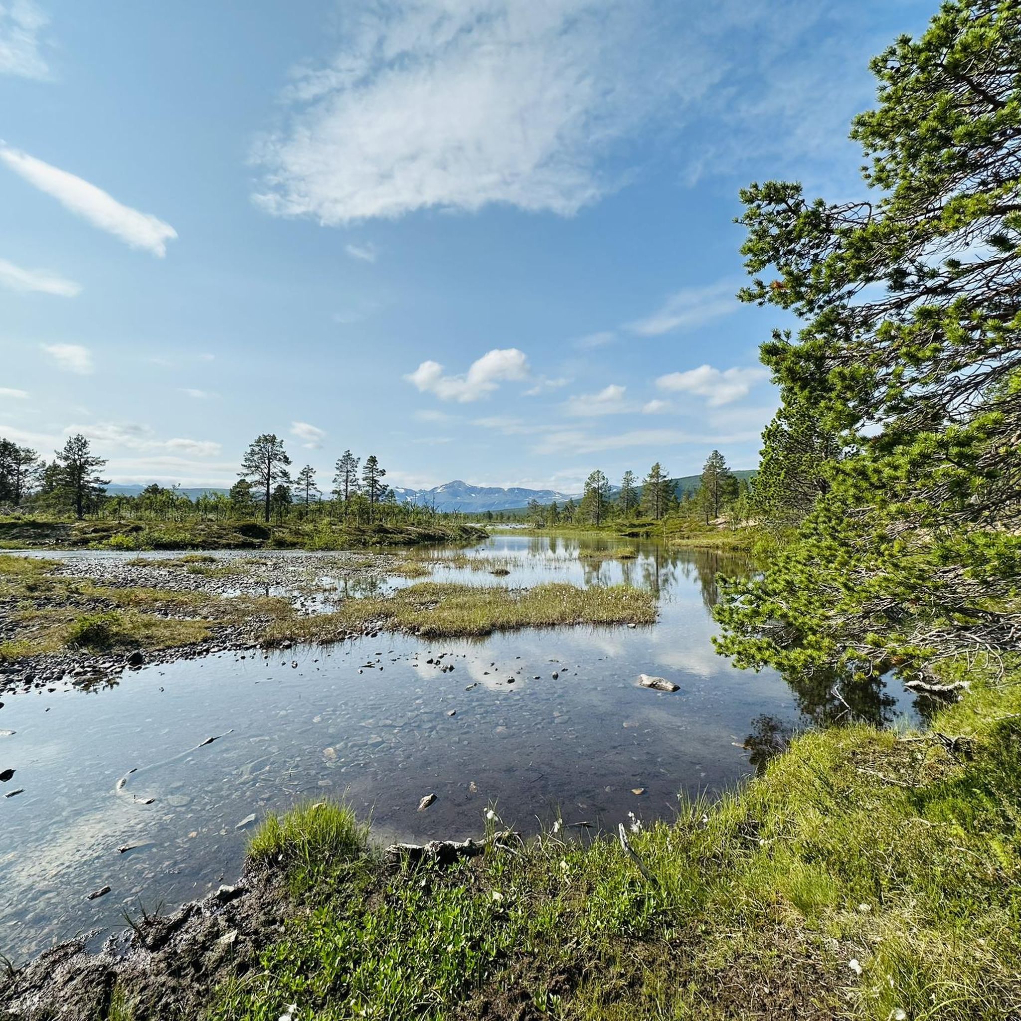
Hiking in Lyngsalpan Landskapsvernområde / Ittugáissáid Suodjemeahcci offers routes through a rugged mountain range characterized by sharp peaks, deep valleys, and glacial features. The region, located on the Lyngen peninsula, includes approximately 50 peaks over 1,300 meters and about 140 glaciers. Glacial rivers, moraine ridges, and lakes are prominent features, with hard gabbroid rocks forming the distinctive jagged terrain. The landscape provides diverse hiking experiences across varying elevations.
Best hiking trails in Lyngsalpan Landskapsvernområde / Ittugáissáid Suodjemeahcci
- The most popular hiking route is Blåisvatnet Trail, a 5.5 miles (8.8 km) moderate trail that takes 2 hours 56 minutes to complete. This route leads to a glacial lake known for its distinct blue color.
- Another top favourite among local hikers is Steindalsbreen Glacier Trail, a moderate 8.1 miles (13.1 km) path. This trail features views of the Steindalsbreen glacier.
- Local hikers also love the Wooden Bridge – River Near Blåisvatnet loop from Stormyra (Jægervatn) naturreservat, a 3.8 miles (6.1 km) trail leading through riverine landscapes near Blåisvatnet, often completed in about 1 hour 57 minutes.
- Hiking in Lyngsalpan Landskapsvernområde / Ittugáissáid Suodjemeahcci is defined by glacial valleys, high mountain peaks, and distinct blue glacial lakes. The network offers options for different ability levels, from easy rambles to challenging mountain ascents.
- The routes in Lyngsalpan Landskapsvernområde / Ittugáissáid Suodjemeahcci are highly rated by the komoot community with an average score of 4.6 stars from over 500 reviews. More than 3000 hikers have used komoot to explore Lyngsalpan Landskapsvernområde / Ittugáissáid Suodjemeahcci's varied terrain.
Last updated: September 3, 2026
4.6
(238)
1,614
hikers
8.80km
02:56
170m
170m
Hike the moderate Blåisvatnet Trail in Norway's Lyngen Alps to discover an intensely blue glacial lake amidst dramatic mountain scenery.
4.2
(5)
26
hikers
Moderate hike. Great for any fitness level. Mostly accessible paths. Sure-footedness required.

Sign up for free
4.0
(2)
20
hikers
Easy hike. Great for any fitness level. Easily-accessible paths. Suitable for all skill levels.
4.7
(3)
6
hikers
2.64km
00:46
70m
70m
Easy hike. Great for any fitness level. Easily-accessible paths. Suitable for all skill levels.
4.8
(138)
755
hikers
13.1km
04:06
490m
490m
Hike to the Steindalsbreen Glacier in Lyngsalpan, a moderate 8.1-mile (13.1 km) route with 1623 feet (495 metres) of elevation gain.
Get access to more routes and recommendations from other explorers.
Sign up for free
Already have an account?
Our route recommendations are based on thousands of hikes, rides, and runs completed by other people on komoot.
Start today with a free account
Your next adventure awaits.
Login or Signup
Popular around Lyngsalpan Landskapsvernområde / Ittugáissáid Suodjemeahcci
Tips from the Community

Beautiful hike to the blue lake. The path is very rocky and partly goes over wooden planks.
0
0

The view of the Steindalsbreen glacier is breathtaking, it invites you to carry on.
1
0
The Steindalshytta hut is a perfect place to take a break on the way to the glacier.
1
0

An absolutely beautiful lake with an almost unreal color. Extremely beautiful - especially in autumn when the birch trees start to turn yellow - which makes a great contrast with the intense blue waters of the lake. The hike is easy enough but somewhat annoying - 3km on a dry riverbed, walking on uneven ground and lots of rocks. Still, it's absolutely worth the view!
0
0

Thanks to the well-developed paths, even people with disabilities can reach this beautiful place! 👍🤗
0
0
Cross-running planks can be used to overtake or pass oncoming traffic.
0
0
The bridge is slightly offset from the path marked in Komoot. It may be relatively new.
0
0

Foothills of the largest glacier on the European mainland. The path is challenging and hiking boots are essential. Moraines and rocks!
2
0
Frequently Asked Questions
What is the general difficulty of hiking trails in Lyngsalpan Landskapsvernområde?
The trails in Lyngsalpan Landskapsvernområde offer a diverse range of difficulties. You'll find routes suitable for various fitness levels, from easy rambles to more challenging mountain ascents. Out of 48 total routes, 27 are classified as easy, and 21 are moderate, meaning there are options for most hikers.
Are there easy hiking options for beginners or families in Lyngsalpan Landskapsvernområde?
Yes, there are several easy options perfect for beginners or families. For instance, the Blåisvatnet Trailhead Parking – Aspevatnet loop from Tindevangen is an easy 1.9-mile (3 km) trail. The region's valleys, such as Elvevolldalen and Lyngsdalen, also offer less strenuous paths to explore the landscape.
When is the best time of year to go hiking in Lyngsalpan Landskapsvernområde?
The best period for hiking in Lyngsalpan Landskapsvernområde is generally from July to September. During these months, conditions are typically most favorable, allowing access to a wider range of trails and offering pleasant weather for exploring the dramatic mountain scenery.
What kind of terrain can I expect when hiking in the Lyngen Alps?
You can expect a rugged and diverse terrain defined by the majestic Lyngen Alps. This includes sharp, spiky peaks, deep valleys, and numerous glacial features like moraine ridges, fast-flowing rivers, and intensely blue glacial lakes. The geology is characterized by hard gabbroid rocks, contributing to the distinctive jagged peaks and steep sides.
What natural attractions can I see along the hiking trails in Lyngsalpan Landskapsvernområde?
The region is rich in natural attractions. You can hike to the stunning intensely blue glacial lake Blåisvatnet, or witness the impressive Steindalsbreen Glacier. Other notable features include the Aspevatnet lake and the River Near Blåisvatnet, all offering spectacular views of the glacial landscape.
Are there any circular hiking routes available in Lyngsalpan Landskapsvernområde?
Yes, there are circular routes to enjoy. One example is the Wooden Bridge – River Near Blåisvatnet loop from Stormyra (Jægervatn) naturreservat, a 3.8-mile (6.1 km) trail that takes you through riverine landscapes near Blåisvatnet. This offers a convenient way to experience the area without retracing your steps.
What do other hikers enjoy the most about hiking in Lyngsalpan Landskapsvernområde?
The area is highly rated by the komoot community, with an average score of 4.6 stars from over 500 reviews. Hikers often praise the dramatic and diverse natural landscape, including the sharp peaks, deep valleys, and stunning glacial features like the intensely blue lakes. The variety of trails catering to different abilities is also frequently highlighted.
Are there any specific landmarks or points of interest to look out for?
Beyond the natural wonders, you might encounter the Lyngstuva Lighthouse, which offers coastal views of the Arctic Ocean. The region's valleys also provide unique perspectives and access to various glacial formations, making every hike an opportunity to discover something new.
How many hiking trails are there in Lyngsalpan Landskapsvernområde?
There are 48 hiking routes available in Lyngsalpan Landskapsvernområde, offering a wide range of experiences from easy walks to more challenging mountain excursions. This provides ample choice for exploring the diverse landscapes of the Lyngen Alps.
Is it possible to go glacier hiking in the Lyngen Alps?
Yes, glacier hiking activities are available in the outer reaches of the conservation area. However, due to the technical nature and potential hazards, it is strongly advised that inexperienced individuals go with a qualified guide for safety.
What kind of wildlife might I encounter while hiking in Lyngsalpan Landskapsvernområde?
Lyngsalpan Landskapsvernområde supports a rich birdlife, including all nine species of daytime predators and all eight owl species found in Troms. Dispersed populations of wolverine and lynx, as well as the Eurasian elk, are also present, offering opportunities for wildlife spotting, especially in quieter areas.
Are there any trails that offer views of glaciers?
Absolutely. The Steindalsbreen Glacier Trail is a moderate 8.1-mile (13.1 km) path specifically designed to provide views of the impressive Steindalsbreen glacier. Many other trails in the region's valleys also offer glimpses of the numerous glaciers that define the Lyngen Alps.
Most popular routes in Lyngsalpan Landskapsvernområde / Ittugáissáid Suodjemeahcci
Most popular attractions in Lyngsalpan Landskapsvernområde / Ittugáissáid Suodjemeahcci

Get inspired with the komoot mobile app


Explore more
Browse the best Hikes in other regions.
