The best cycling routes in Craigieburn Grassland Nature Conservation Reserve
4.0
(5)
115
riders
4
rides
Touring cycling routes in Craigieburn Grassland Nature Conservation Reserve traverse a landscape primarily characterized by critically endangered volcanic plains grasslands. The reserve features the Merri Creek, which flows through a corridor with reedy pools and shallow gorges, including columnar basalt cliffs. Cyclists can also experience distant views of the Melbourne skyline from certain points along the trails. The area offers a mix of paved and unpaved surfaces, catering to various cycling preferences.
Best touring cycling routes in Craigieburn Grassland Nature Conservation Reserve
- The most popular touring cycling route is Craigieburn Railway Station – View of Melbourne Skyline loop from Craigieburn, a 24.0 miles (38.6 km) trail that takes 2 hours 24 minutes to complete. This route offers views of the Melbourne skyline.
- Another top favourite among local touring cyclists is Jacana Wetlands – Shankland Reserve loop from Roxburgh Park, a moderate 19.2 miles (30.9 km) path. This route features mostly paved surfaces through diverse landscapes.
- Local touring cyclists also love the View of Merri Creek – Brunswick Velodrome loop from Gowrie, an 18.4 miles (29.5 km) trail leading through the Merri Creek corridor, often completed in about 1 hour 43 minutes.
- Touring cycling in Craigieburn Grassland Nature Conservation Reserve is defined by volcanic plains grasslands, the Merri Creek, and distant city views. The network offers options for different ability levels, from easy paths to moderate rides.
- The routes in Craigieburn Grassland Nature Conservation Reserve are highly rated by the komoot community with an average score of 4.0 stars from over 4 reviews. More than 100 touring cyclists have used komoot to explore Craigieburn Grassland Nature Conservation Reserve's varied terrain.
Last updated: July 8, 2026
4.0
(1)
7
riders
Moderate bike ride. Good fitness required. Mostly paved surfaces. Suitable for all skill levels.
24
riders
30.9km
01:52
220m
220m
Moderate bike ride. Good fitness required. Mostly paved surfaces. Suitable for all skill levels.

Sign up for free
5.0
(2)
52
riders
28.6km
01:41
100m
100m
Easy bike ride. Great for any fitness level. Mostly paved surfaces. Suitable for all skill levels.
4.0
(1)
27
riders
27.0km
01:36
150m
150m
Easy bike ride. Great for any fitness level. Mostly paved surfaces. Suitable for all skill levels.
3.0
(1)
6
riders
68.4km
03:57
270m
270m
Moderate bike ride. Good fitness required. Mostly paved surfaces. Suitable for all skill levels.
Our route recommendations are based on thousands of hikes, rides, and runs completed by other people on komoot.
Start today with a free account
Your next adventure awaits.
Login or Signup
Popular around Craigieburn Grassland Nature Conservation Reserve
Tips from the Community

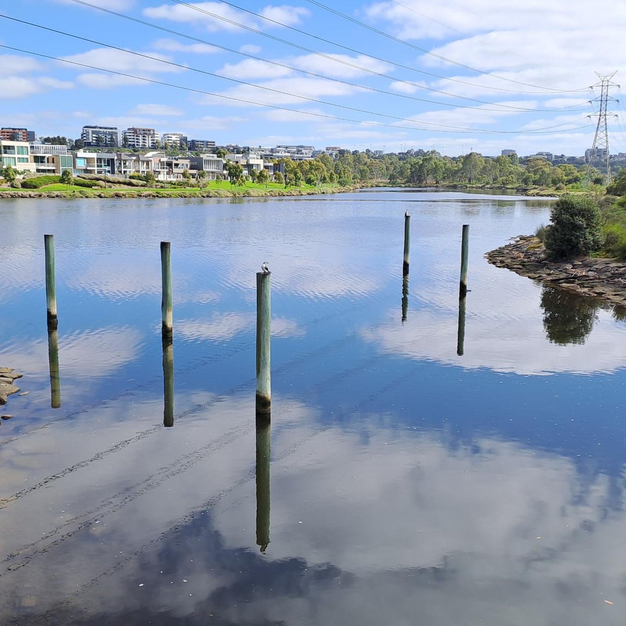
Kororoit Creek is the crown jewel of the Kororoit Creek Trail. This river winds through Melbourne’s western suburbs toward Port Phillip Bay and is home to restored bushland, grassy floodplains, and urban green spaces. The trail is flat and paved, but keep an eye on updated trail conditions, as sections may be prone to flooding after heavy rain.
0
1

As the Moonee Ponds Creek Trail passes through John Pascoe Fawkner Reserve, the setting opens into maintained parkland with paved shared paths running alongside the creek. This section feels more urban and organised, with large pavilion-style buildings and public facilities, including a drinking fountain near the main structures. The trail remains sealed and easy to follow, winding through scattered eucalypts and open grassed areas.
0
0
At Kingsford Smith Ulm Reserve, the Moonee Ponds Creek Trail passes beneath a striking elevated railway trestle, where trains run overhead on steel supports above open parkland. The sealed shared path curves through wide grassy space, with scattered trees offering limited shade.
0
0

This 4.5-hectare park in Brunswick East was transformed from a former rubbish dump into a thriving centre for urban farming, environmental education, and community life. You can wander garden paths, meet farm animals, browse the nursery and market spaces, or join workshops that explore everything from permaculture to renewable living. The park is built on Wurundjeri Woi-wurrung land next to Merri Creek.
0
0


Junction of Ring Road and Broadmeadows Valley tracks.
0
0

The address is Shankland Boulevard, along Shankland Drain, but this reserve is not to be confused with Shankland Reserve near Somerton Road.
0
0
Frequently Asked Questions
How many touring cycling routes are available in Craigieburn Grassland Nature Conservation Reserve?
There are 4 touring cycling routes available in Craigieburn Grassland Nature Conservation Reserve, offering a range of experiences for different skill levels.
What types of terrain can I expect on the cycling routes?
The routes feature a mix of paved and unpaved surfaces. You'll primarily traverse critically endangered volcanic plains grasslands, with some sections along the Merri Creek corridor which includes reedy pools and shallow gorges with columnar basalt cliffs.
Are there any easy touring cycling routes suitable for beginners or families?
Yes, there are easy routes available. For instance, the View of Merri Creek – Brunswick Velodrome loop from Gowrie and the View of Merri Creek – Coburg Lake Reserve loop from Glenroy are both rated as easy and are generally suitable for all skill levels.
What natural features or landmarks can I see while cycling in the reserve?
Cyclists can enjoy the unique volcanic plains grasslands, the scenic Merri Creek with its riffle sections and columnar basalt cliffs, and during spring, a vibrant display of wildflowers. Distant views of the Melbourne skyline are also visible from certain points, such as along the Craigieburn Bypass Trail near the Whittlesea Gardens Footbridge.
What is the best time of year to go touring cycling in Craigieburn Grassland Nature Conservation Reserve?
The region experiences mild temperatures and occasional rainfall, making it an enjoyable year-round destination. Spring is particularly beautiful with wildflowers in bloom, while other seasons offer pleasant conditions for exploring the grasslands.
Are dogs allowed on the cycling trails in the reserve?
The Craigieburn Grassland Nature Conservation Reserve, also known as *galgi ngarrk*, is a significant ecological site. For specific regulations regarding dogs on trails, especially concerning the protection of critically endangered fauna like the Golden Sun Moth or Striped Legless Lizard, it's best to check with Parks Victoria directly before your visit.
What do other touring cyclists enjoy most about the routes here?
The routes in Craigieburn Grassland Nature Conservation Reserve are highly rated by the komoot community, with an average score of 4.0 stars. Cyclists often praise the unique landscape of volcanic plains grasslands, the serene Merri Creek corridor, and the diverse options for different ability levels.
Are there any circular touring cycling routes in the area?
Yes, many of the routes are designed as loops. For example, the Craigieburn Railway Station – View of Melbourne Skyline loop from Craigieburn is a popular circular route that offers views of the city skyline.
How can I access the Craigieburn Grassland Nature Conservation Reserve by public transport for cycling?
The reserve is located in Melbourne's northern suburbs. While specific public transport connections to trailheads vary, Craigieburn Railway Station is a key access point mentioned in one of the routes, suggesting train services could be an option for reaching the general area.
Where can I find parking for the cycling routes?
While specific parking locations are not detailed for every trailhead, the reserve is accessible from various points within Melbourne's northern suburbs. It is advisable to check local council or Parks Victoria websites for designated parking areas near popular access points like those for the Craigieburn Bypass Trail or near Roxburgh Park for routes like the Jacana Wetlands – Shankland Reserve loop.
What is the approximate duration for a touring cycling route in the reserve?
Route durations vary depending on length and difficulty. For instance, the View of Merri Creek – Brunswick Velodrome loop from Gowrie, an 18.4-mile (29.5 km) trail, can be completed in about 1 hour 43 minutes, while longer routes like the Bike loop from Glenroy (69.4 km) take significantly longer.
Are there any cafes or amenities near the cycling trails?
The reserve is situated in Melbourne's northern suburbs, meaning there are likely cafes, pubs, and other amenities in the surrounding towns and suburbs like Craigieburn, Roxburgh Park, Gowrie, and Glenroy, which serve as starting points for many routes. It's recommended to plan your refreshment stops in these urban areas.
Most popular routes in Craigieburn Grassland Nature Conservation Reserve

Get inspired with the komoot mobile app


Explore more
Browse the best Cycling routes in other regions.
