The best cycling routes in Devilbend Natural Features Reserve
5.0
(18)
232
riders
13
rides
Touring cycling in Devilbend Natural Features Reserve offers routes through diverse landscapes, including lowland forest, grassy woodland, and wetland ecosystems. The reserve is characterized by its two central reservoirs, Devilbend and Bittern, which form the largest inland body of water on the Mornington Peninsula. Cyclists can navigate a network of trails that traverse bushland and open grassland, providing varied terrain for different skill levels. The area's natural features include significant remnant native vegetation and a rich biodiversity, making it a notable destination for outdoor activities.
Best touring cycling routes in Devilbend Natural Features Reserve
- The most popular touring cycling route is Bike loop from Mornington, an 8.7 miles (14.0 km) trail that takes about 50 minutes to complete. This easy loop offers a straightforward ride through the reserve's natural settings.
- Another top favourite among local touring cyclists is Balcombe Estuary – Fisherman's Beach loop from Mount Martha, a moderate 14.4 miles (23.2 km) path. This route provides scenic views along the estuary and towards the coast.
- Local touring cyclists also love the The Hidden Kitchen – The Boss' Daughter Café loop from Mornington, a 52.3 miles (84.2 km) trail leading through varied landscapes, often completed in about 4 hours 59 minutes.
- Touring cycling in Devilbend Natural Features Reserve is defined by its reservoirs, lowland forest, and grassy woodlands. The network offers options for easy, moderate, and difficult routes, catering to different ability levels.
- The routes in Devilbend Natural Features Reserve are highly rated by the komoot community with an average score of 4.96 stars from over 50 reviews. More than 400 touring cyclists have used komoot to explore Devilbend Natural Features Reserve's varied terrain.
Last updated: November 8, 2026
3
riders
14.0km
00:50
90m
90m
Easy bike ride. Mostly paved surfaces.
5.0
(2)
62
riders
84.9km
05:17
400m
400m
Hard bike ride. Very good fitness required. Mostly paved surfaces.

4.9
(9)
43
riders
Moderate bike ride. Good fitness required. Mostly paved surfaces.
5.0
(2)
19
riders
38.1km
02:26
180m
180m
Moderate bike ride. Good fitness required. Mostly paved surfaces.
12
riders
47.9km
03:03
390m
390m
Moderate bike ride. Good fitness required. Mostly paved surfaces.
Get access to more routes and recommendations from other explorers.
Already have an account?
Our route recommendations are based on thousands of hikes, rides, and runs completed by other people on komoot.
Start today with a free account
Your next adventure awaits.
Tips from the Community

The Pines Flora and Fauna Reserve protects 220 hectares of remnant heathland and bushland dunes, and is home to a diverse range of native wildlife, including kangaroos, echidnas, the southern brown bandicoot, and more than 100 species of birds. There is a network of multi-use gravel and sand tracks that are perfect for walking, running, and cycling, and picnic tables at the main Ballarto Road entrance. It’s a fantastic place to spend the day; however, please note that there are no drinking water taps, BBQs, or toilets, so plan accordingly before you explore.
0
0
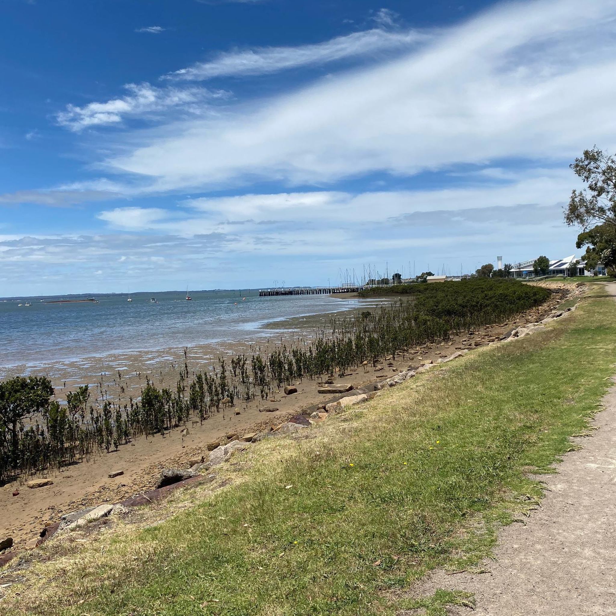
Mornington Peninsula Bay Trail is a 30-kilometre shared walking and cycling route that runs along the shores of Port Phillip Bay, stretching from Safety Beach to Portsea. There are several piers along the way, colourful bathing boxes, coastal banksia woodlands, historic landmarks, and vast stretches of sand, with constant views across the beautiful bay. It's a relaxing way to enjoy the coastal charm of the Mornington Peninsula, whether you choose to walk a single section or tackle the entire route.
0
0
Safety Beach is a long stretch of sandy coastline at the northern end of Dromana Bay, where calm waters make it a popular destination for swimming, paddling, and family outings. Backed by an expansive foreshore reserve with walking and cycling paths, and picnic areas, it’s a beautiful beach that’s easy to enjoy year-round.
0
0
Tassells Cove Dog Beach is a small beach at the northern end of Safety Beach, separated from the main beach at the entrance to Martha Cove Marina. Its calm, shallow water and off-leash area make it a favourite place for dog owners, and the sandy shoreline and rocky marina entrance offer great views of the boats entering and leaving the harbour. Despite its popularity with locals, it’s a peaceful spot and a lovely place to bring your pup to make a few friends during a lovely walk along the trail.
0
0
This platform sits above the entrance to the Martha Cove Underpass, for a bird’s-eye view across the marina entrance channel. From here, you can watch boats navigating between the marina and bay before the trail continues through the distinctive underpass to Tassells Cove, with stairs and an elevator leading down into the pedestrian tunnel.
0
0

The Edithvale-Seaford Wetlands Environment Area is along Melbourne's eastern corridor, and is an important protected birdlife habitat and seasonal water ecosystems. During the wet seasons, it's full of shallow lagoons, reed fields, and many native and migratory birds. It's very popular for birdwatching, walking, and riding.
0
0
The Down's Community Farm Mural, painted by Jimmy Dvate, is a stunning depiction of local birds and adds a colorful, artistic touch to what was once an ordinary building. The mural honors the ecological importance of the nearby Edithvale-Seaford Wetlands Environment Area.
0
0

Frequently Asked Questions
How many touring cycling routes are available in Devilbend Natural Features Reserve?
There are over 20 touring cycling routes available in Devilbend Natural Features Reserve, catering to various skill levels. You can find options ranging from easy loops to more challenging rides.
What kind of terrain can I expect on the touring cycling routes?
The routes in Devilbend Natural Features Reserve traverse diverse landscapes, including lowland forest, grassy woodland, and wetland ecosystems. You'll encounter a mix of bushland and open grassland, with well-maintained trails suitable for touring bikes.
Are there easy touring cycling routes suitable for beginners or casual riders?
Yes, Devilbend Natural Features Reserve offers several easy touring cycling routes. A great option is the Bike loop from Mornington, which is an 8.7-mile (14.0 km) trail that takes about 50 minutes to complete, offering a straightforward ride through natural settings.
Are there more challenging touring cycling routes for experienced cyclists?
For experienced cyclists seeking a challenge, routes like the Balcombe Estuary – Arthurs Seat loop from Mornington offer significant elevation changes over its 43.7 miles (70.3 km) distance. This route provides a more demanding experience with rewarding views.
What are some scenic viewpoints or landmarks to look out for while cycling?
The reserve is centered around the Devilbend and Bittern Reservoirs, which are the largest inland bodies of water on the Mornington Peninsula, offering stunning waterscapes. You can find scenic views from various birdwatching hides and platforms, as well as along the Western Shoreline Track. The Daangean Point Picnic Area also provides a pleasant spot with views.
Is Devilbend Natural Features Reserve suitable for family cycling?
Yes, the reserve is family-friendly, especially with its network of well-maintained trails. The Devilbend Circuit Track, an 11.5 km loop around the Devilbend Reservoir, is a popular choice for families due to its relatively flat terrain and scenic views. The Tuerong Track is also ideal for casual bike rides.
Can I bring my dog on the cycling trails?
While Devilbend Natural Features Reserve is a natural haven, dogs are generally not permitted on trails within the reserve to protect the abundant wildlife. It's always best to check the latest regulations on the Parks Victoria website before your visit.
Are there any cafes or places to eat near the cycling routes?
While the reserve itself has picnic facilities at Daangean Point, there are no cafes directly within the reserve. However, the nearby towns of Mornington and Moorooduc, which serve as starting points for some routes, offer various cafes and eateries. For example, the The Hidden Kitchen – The Boss' Daughter Café loop from Mornington route highlights some local options.
What is the best time of year to go touring cycling in Devilbend Natural Features Reserve?
Devilbend Natural Features Reserve is enjoyable for cycling year-round. Spring and autumn offer pleasant temperatures and vibrant natural scenery. Summer can be warm, so early morning or late afternoon rides are recommended. Winter cycling is also possible, with cooler, often crisp conditions.
What wildlife might I spot while cycling?
Devilbend Natural Features Reserve is an Important Bird Area, so you have a good chance of spotting diverse birdlife, including waterbirds like the Blue-billed Duck and the White-bellied Sea Eagle. Other sightings might include kangaroos, short-beaked echidnas, and various reptiles such as blue-tongue skinks, especially in the quieter areas of the reserve.
Are there circular touring cycling routes available?
Yes, many of the touring cycling routes in Devilbend Natural Features Reserve are circular, allowing you to start and end at the same point. The Devilbend Circuit Track is a prominent example, offering an 11.5 km loop around the reservoir. The Bike loop from Mornington is another popular circular option.
What do other touring cyclists enjoy the most about touring cycling in Devilbend Natural Features Reserve?
The area is highly rated by the komoot community, with an average score of 4.96 stars from over 50 reviews. Reviewers often praise the tranquil natural settings, the well-maintained trails, and the stunning views of the reservoirs and diverse wildlife.
Is there parking available for cyclists at Devilbend Natural Features Reserve?
Yes, parking is available at various access points within Devilbend Natural Features Reserve, including designated car parks near the main trailheads and picnic areas like Daangean Point. These facilities make it convenient to start your cycling tour.
Most popular routes in Devilbend Natural Features Reserve

Get inspired with the komoot mobile app


Explore more
Browse the best Cycling routes in other regions.
