The best walks and hikes in Moggill Conservation Park
4.6
(64)
615
hikers
31
hikes
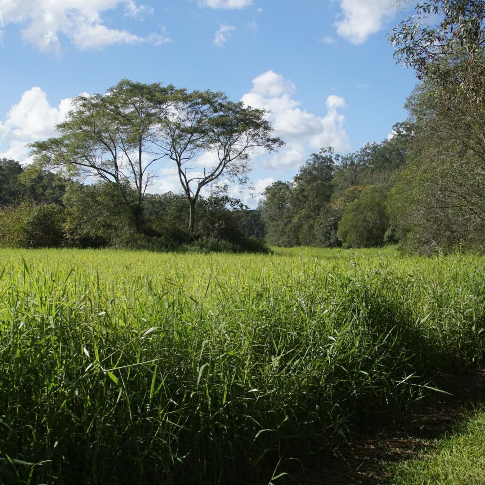
Hiking in Moggill Conservation Park features a network of trails traversing dry eucalypt forests, which transition to riparian rainforest along Pullen Creek. The park's terrain includes a mix of ridges and gullies, with moderately high hills providing varied topography. Elevations offer views of the surrounding bushland and glimpses of Brisbane City and Ipswich from higher points.
Best hiking trails in Moggill Conservation Park
- The most popular hiking route is Moggill Conservation Park loop from Anstead, a 4.1 miles (6.6…
Last updated: July 7, 2026
4.0
(1)
23
hikers
7.62km
02:15
220m
220m
Moderate hike. Good fitness required. Easily-accessible paths. Suitable for all skill levels.
7
hikers
6.64km
01:54
160m
160m
Easy hike. Great for any fitness level. Easily-accessible paths. Suitable for all skill levels.

Sign up for free
4.7
(3)
44
hikers
5.51km
01:33
90m
90m
Moderate hike. Great for any fitness level. Mostly accessible paths. Sure-footedness required.
5.0
(1)
16
hikers
11.6km
03:36
390m
390m
Moderate hike. Good fitness required. Easily-accessible paths. Suitable for all skill levels.
5.0
(1)
10
hikers
17.8km
05:21
510m
510m
Hard hike. Very good fitness required. Mostly accessible paths. Sure-footedness required.
Get access to more routes and recommendations from other explorers.
Sign up for free
Already have an account?
Our route recommendations are based on thousands of hikes, rides, and runs completed by other people on komoot.
Start today with a free account
Your next adventure awaits.
Login or Signup
Tips from the Community

Devils Break is a wide, multi-use doubletrack, climbing through thick eucalyptus forests. After heavy rain the track can become a bit washed out with some loose stones, but it's easy to follow even with a lack of signage. If tackling the track from south to north, there is a steep climb in the beginning, but take the track the opposite way, and there will be a steep descent.
0
0
Moggill Conservation Park stretches 491 hectares across eucalyptus woodlands and is open to bushwalking, mountain biking, and horseback riding. There is a good chance of seeing bees in the park, as commercial beekeeping has been allowed here since 1941. Bees love the spotted gum, grey ironbark, and protected wildflowers like the yellow parrot pea and grass trees that thrive here.
0
0
A wooden bench, supported by rocks, sits in a break in the eucalyptus forests created by a powerline clearing. The view is expansive, overlooking the urban Brisbane basin and extending toward the rolling hills in the distance. There are power lines obstructing the view a bit, but nothing takes away from the beauty too much.
0
0

Along the reservoir circuit, a small creek feeds into Gold Creek Reservoir. In warmer months, this section is often dry, leaving a rocky channel underfoot. After rainfall, however, water can flow through the gully and you may need to hop across the shallow stream using exposed stones. The surface is uneven and can be slippery when wet, so take care when crossing, especially after sustained rain.
0
0
Gold Creek Reservoir Walking Track, offers a rewarding bushwalk in Upper Brookfield with steady hills and plenty of birdlife along the water’s edge. The circuit begins near the top of the dam wall and can be walked in either direction. Expect a mix of shaded forest and more open sections overlooking the reservoir. Some descents involve loose, dry soil and small rocks, so take care on steeper stretches. Mobile reception is patchy, so download your map before setting out.
0
0
Gold Creek Reservoir, also known as Gold Creek Dam, sits on the edge of Brisbane’s western bushland and offers a quiet walking experience around a small, sheltered body of water. The reservoir was originally built to supply potable water for the region and now provides a peaceful backdrop for a loop walk of roughly five and a half kilometres through mixed wet and dry sclerophyll forest.
0
0

Fun little "track" -unmaintained - only about 20% of it is visible. Just try to keep close to the creek bed.
0
0
Nice spot for a picnic, and the start of a sweet little circuit around the reservoir. Nice bit of variety in the walk: dry rainforest and bushland
0
0
Frequently Asked Questions
How many hiking trails are available in Moggill Conservation Park?
Moggill Conservation Park offers a network of over 30 hiking trails, catering to various fitness levels. You'll find options ranging from easy strolls to more challenging moderate paths, allowing you to explore the park's diverse landscapes.
What kind of terrain can I expect on the trails in Moggill Conservation Park?
The park's terrain is characterized by a mix of dry eucalypt forests and riparian rainforest along Pullen Creek. Trails navigate through ridges and gullies, with moderately high hills providing varied topography. Some routes, like the Ugly Gully Loop Break, traverse less challenging terrain, while others, such as sections of the Devils Break Loop, can be steep.
Are there any family-friendly hiking options in Moggill Conservation Park?
Yes, Moggill Conservation Park has several easy trails suitable for families. For instance, the Moggill Conservation Park loop from Anstead is an easy 6.6 km path that offers a comprehensive experience of the park's diverse landscapes without being overly strenuous.
Can I bring my dog on the hiking trails in Moggill Conservation Park?
Moggill Conservation Park is a conservation area, and generally, dogs are not permitted on trails to protect native wildlife. It's always best to check the official park regulations for the most current information regarding pets. You can find more details on the Queensland Parks and Wildlife Service website: parks.qld.gov.au.
What are some notable natural features or landmarks to look out for?
Hikers can enjoy spectacular city and mountain views from higher elevations, with glimpses of Brisbane City and Ipswich. Along trails like the Devils Break Loop, you might spot rock cairns, potentially built by pre-World War II workers. The park also features diverse flora, including wildflowers in winter and spring, and tall grass trees.
What is the best time of year to visit Moggill Conservation Park for hiking?
Winter and spring are particularly rewarding times to visit Moggill Conservation Park. During these seasons, the park comes alive with wildflowers, including the vibrant yellow flowers of the vulnerable brush sophora and the delicate violet-purple flowers of Hovea lorata, adding extra beauty to your hike.
Are there any loop trails for hikers who prefer circular routes?
Yes, Moggill Conservation Park offers several excellent loop trails. The Hawkesbury Road Nature Refuge loop from Anstead is a popular moderate option, and the Hiking loop from Camerons Hill provides a longer, moderate challenge through eucalypt forests.
What kind of wildlife might I see while hiking in the park?
Moggill Conservation Park is a vital habitat for numerous bird species, including the vulnerable black-breasted button-quail and the shy eastern whipbird. You might also spot other wildlife such as bandicoots, koalas, and lace monitors, especially during quieter times.
Is there public transport access to Moggill Conservation Park?
Moggill Conservation Park is located approximately 30 minutes from Brisbane's CBD. While public transport options directly to the park entrance may be limited, it is generally accessible by car. For specific public transport routes, it's advisable to check local transport schedules.
Where can I park when visiting Moggill Conservation Park?
Access points to the park, such as the Chalcot Road gate for the Devils Break Loop or the Mill Road gate for the Tower Break Loop, typically have designated parking areas. It's recommended to check park signage upon arrival for specific parking instructions.
What do other hikers enjoy most about Moggill Conservation Park?
The area is highly rated by the komoot community, with an average score of 4.6 stars from over 60 reviews. Reviewers often praise the park's diverse landscapes, the variety of trails for different abilities, and the opportunity to experience tranquil bushland close to the city.
Are there any trails that offer scenic views of the surrounding area?
Yes, several trails provide excellent viewpoints. The Tower Break Loop, starting from the Mill Road gate, ascends into dry eucalypt forest and offers clearings with views to the south-west, including glimpses of Brisbane City and Ipswich from higher points.
Most popular routes in Moggill Conservation Park

Get inspired with the komoot mobile app


Explore more
Browse the best Hikes in other regions.
