The best road cycling routes in Mulligans Flat Woodland Sanctuary
4.5
(41)
2,485
riders
64
rides
Road cycling routes in Mulligans Flat Woodland Sanctuary traverse a landscape characterized by critically endangered Yellow Box–Blakely's Red Gum Grassy Woodland in north-eastern Canberra. The area features an open tree canopy and diverse undergrowth, providing a scenic backdrop for rides. While elevation gains are generally moderate, some routes include unpaved segments and significant climbs, catering to various fitness levels. The sanctuary, along with the adjoining Goorooyarroo Nature Reserve, forms an extensive protected area of over 18 square kilometers.
Best road…
Last updated: July 2, 2026
5.0
(2)
137
riders
39.4km
01:38
240m
240m
Easy road ride. Great for any fitness level. Mostly well-paved surfaces and easy to ride.
8
riders
27.3km
01:14
220m
220m
Easy road ride. Great for any fitness level. Mostly well-paved surfaces and easy to ride.

Sign up for free
5
riders
33.0km
01:31
250m
250m
Easy road ride. Great for any fitness level. Mostly well-paved surfaces and easy to ride.
5
riders
48.3km
02:11
310m
310m
Moderate road ride. Good fitness required. Some segments of this route may be unpaved and difficult to ride.
5
riders
26.6km
01:14
160m
160m
Easy road ride. Great for any fitness level. Mostly well-paved surfaces and easy to ride.
Get access to more routes and recommendations from other explorers.
Sign up for free
Already have an account?
Our route recommendations are based on thousands of hikes, rides, and runs completed by other people on komoot.
Start today with a free account
Your next adventure awaits.
Login or Signup


Tips from the Community

This is a lovely shared-use path that forms a continuous loop around Yerrabi Pond and is ideal for walking, running, and cycling. The mostly sealed track follows the shoreline, with beautiful views across the water and regular access points and rest areas. The path is relatively flat the entire way, and the scenic setting makes it an easy and enjoyable circuit for exploring the parklands around the pond.
0
0
Yerrabi Pond District Park is a large open parkland that surrounds Yerrabi Pond. You'll find a mix of recreation spaces, playgrounds, and picnic areas, making it an ideal destination that offers something for everyone looking to enjoy some time outdoors. The park includes beautifully landscaped lawns, wetlands, and shared pathways for walking and cycling. With its accessible design and amenities, it's a popular outdoor hub for the Gungahlin community.
0
0
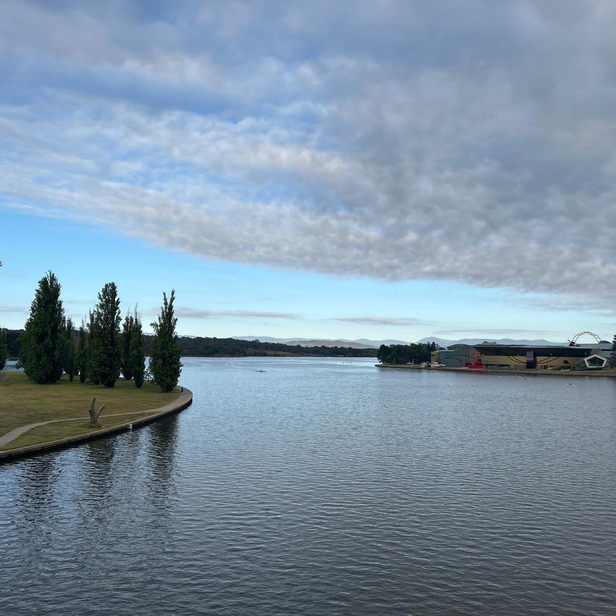
Scrivener Dam is a concrete gravity dam on the Molonglo River, completed in 1963, and is responsible for creating Lake Burley Griffin as a recreational and ornamental body of water. Named after surveyor Charles Scrivener, the dam is about 33 metres high and 319 metres long, with hydraulically operated fish‑belly flap gates that precisely control the lake levels and provide flood management capability. The dam also carries a roadway and the walking/cycling path, and helps form the backdrop to one of Canberra’s key engineering landmarks.
0
0
The Commonwealth Bridge is the major road crossing over Lake Burley Griffin, carrying six lanes of traffic plus a shared foot and cycle path between Canberra’s city centre and the Parliamentary Zone. It is an integral element of the lake’s heritage landscape, with beautiful views across the Molonglo River. The river runs roughly 115 kilometres from the Great Dividing Range through New South Wales into the Australian Capital Territory, where the Scrivener Dam impounds its waters to form Lake Burley Griffin. Historically rich in native fish and culturally important to local Aboriginal peoples, the river continues beyond Canberra to join the Murrumbidgee River as part of the larger Murray–Darling basin.
0
0
Canberra Peace Park is a beautiful memorial garden along Lake Burley Griffin in Canberra’s Parliamentary Triangle, near the National Library of Australia. The park was created during the United Nations International Year of Peace in 1986 and formally dedicated in 1990 as a place for reflection and commitment to peace. Its central monument features the word “Peace” inscribed in the official languages of the United Nations and the Ngunnawal language, set within formal gardens overlooking the lake formed by the Molonglo River.
0
0

In 1964, the Molonglo River was dammed, creating this wetland. Today, these 260 hectares of land, forest, and waterways are protected. Within this park are the Kells Swamp Loop, Woodland Walk, and Billabong Walk. Keep your eyes peeled for platypuses, rakali, and micro-bats, and from the bird blind, you may see a few of the 200 bird species that visit this wetland every year.
0
0

A lovely spot to stop for a break or picnic and enjoy the beauty of Lake Burley Griffin.
0
0

Great cafes all along Lonsdale Street (and a bike shop).
0
0
Frequently Asked Questions
How many road cycling routes are available in Mulligans Flat Woodland Sanctuary?
There are over 60 road cycling routes available in and around Mulligans Flat Woodland Sanctuary, catering to various fitness levels and preferences. The komoot community has explored these routes over 2,400 times, highlighting the area's popularity among cyclists.
What is the best time of year for road cycling in Mulligans Flat Woodland Sanctuary?
The sanctuary is open 24/7, making it accessible year-round. However, for optimal road cycling conditions, consider the milder seasons. Canberra's summers can be hot, and winters can be cool, so spring and autumn often provide the most comfortable temperatures for longer rides.
Are there family-friendly road cycling routes in the sanctuary?
Yes, there are several family-friendly road cycling options. Many routes feature mostly well-paved surfaces and gentle gradients suitable for a relaxed ride. For example, the Goorooyarroo Nature Reserve – Horse Park Drive Climb loop from Bonner is an easy 17-mile path that offers scenic views without excessive difficulty.
What kind of terrain and difficulty can I expect on road cycling routes here?
Road cycling routes in Mulligans Flat Woodland Sanctuary offer diverse terrain. You'll find easy rides on mostly well-paved surfaces, such as the Majura Parkway Cycle Path – Dairy Flat Bridge loop from Mapleton Avenue, which features gentle gradients. However, some routes include unpaved segments and significant elevation gains, requiring good to very good fitness for a more challenging experience. Overall, the network includes 39 easy routes, 27 moderate routes, and 1 difficult route.
Are there any notable landmarks or natural features to see along the cycling routes?
Absolutely. The sanctuary is renowned for protecting critically endangered Yellow Box–Blakely's Red Gum Grassy Woodland, providing a scenic backdrop for your rides. You might also spot reintroduced native fauna like Eastern Quolls and Bettongs, as the area is a significant biodiversity site. The Mulligans Flat Woodland Sanctuary itself is an extensive protected area, offering a sense of natural beauty.
What do other road cyclists enjoy most about the routes in Mulligans Flat Woodland Sanctuary?
The area is highly rated by the komoot community, with an average score of 4.8 stars from over 30 reviews. Cyclists often praise the protected woodlands, open landscapes, and the mix of paved and unpaved surfaces that offer variety. The opportunity to cycle through a significant conservation area with unique biodiversity is also a highlight.
Are there any rules or permits required for road cycling in the sanctuary?
Cycling within Mulligans Flat Woodland Sanctuary is generally permitted on designated management trails, which include sections of the Centenary Trail. While public access is free and open 24/7, it's always advisable to respect conservation efforts and stay on marked paths to protect the sensitive woodland and wildlife.
Where can I park when visiting Mulligans Flat Woodland Sanctuary for road cycling?
While specific parking areas for cyclists are not detailed, the sanctuary is accessible through various gates. It's recommended to check local signage upon arrival for designated parking zones that provide convenient access to the cycling routes.
Are there any circular road cycling routes available?
Yes, many of the road cycling routes in the area are designed as loops, allowing you to start and end at the same point. Examples include the Majura Parkway Cycle Path – Dairy Flat Bridge loop from Mapleton Avenue and the Yerrabi Pond Dirt Jumps loop from Bonner, offering convenient circular journeys.
What is the typical length and duration of road cycling routes in this region?
Road cycling routes in Mulligans Flat Woodland Sanctuary vary in length and duration to suit different preferences. You can find shorter rides, such as the Yerrabi Pond Dirt Jumps – 123 Sculpture loop from Manning Clark North, which is about 20.4 miles (32.8 km) and takes around 1 hour 31 minutes. Longer excursions, like the BentSpoke Brewing Co. – Scrivener Dam loop from Mapleton Avenue, can be up to 47.8 miles (77 km) and take over 2 hours.
Are there cafes, pubs, or accommodation options near the sanctuary for cyclists?
While the sanctuary itself is a natural area, the Wildbark Visitor Centre is located at its edge, offering amenities and information. For cafes, pubs, and accommodation, you would typically look to the surrounding areas of north-eastern Canberra, which provide various options for refreshments and overnight stays after your ride.
Most popular routes in Mulligans Flat Woodland Sanctuary

Get inspired with the komoot mobile app


Explore more
Browse the best Road cycling routes in other regions.
