The best walks and hikes in Machachi
4.9
(81)
1,017
hikers
10
hikes
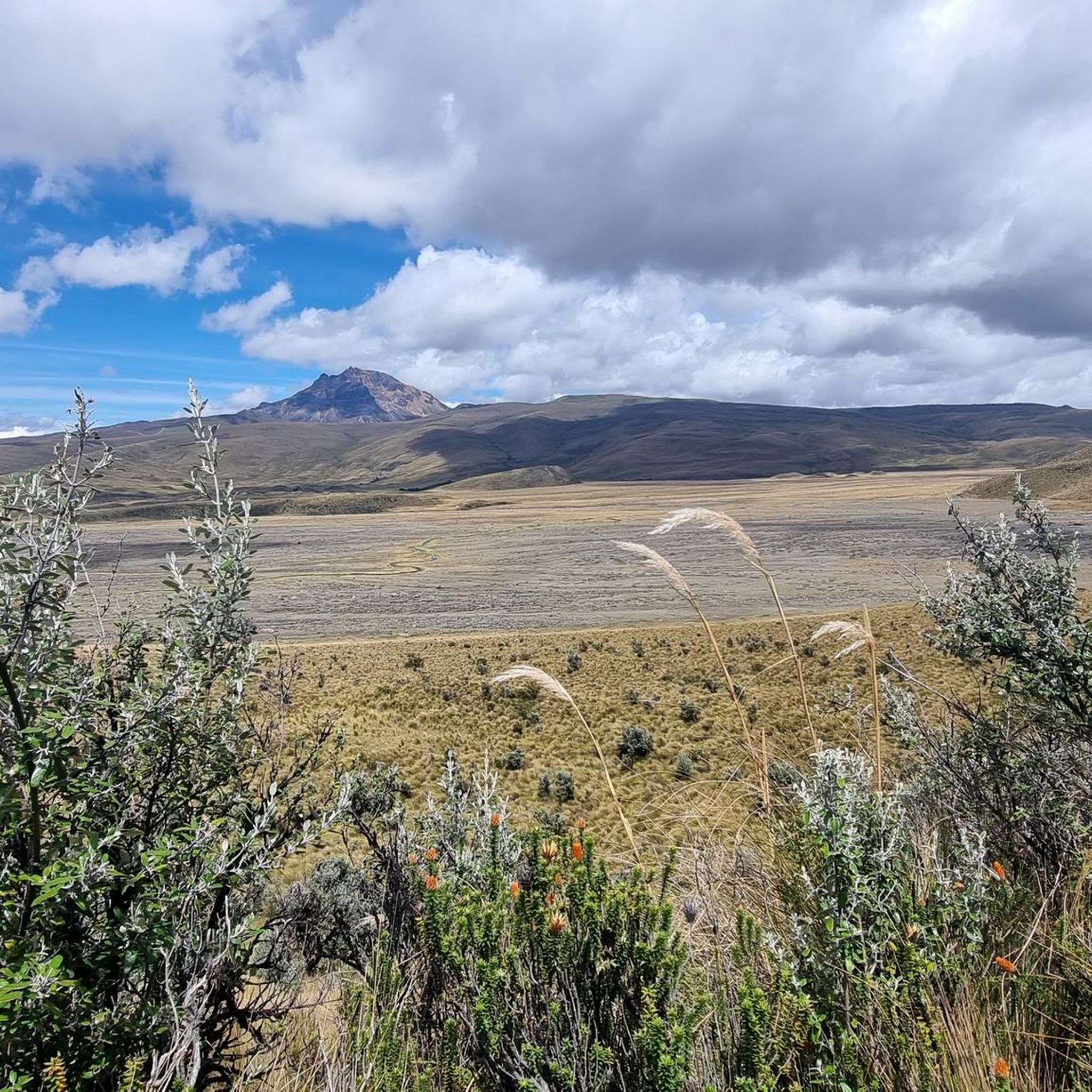
Hiking in Machachi offers access to Ecuador's "Avenue of Volcanoes," characterized by dramatic volcanic landscapes and diverse ecosystems. The region features prominent peaks such as Cotopaxi, Rumiñahui, and Sincholagua, providing a mountainous backdrop for outdoor activities. Trails range from high-altitude volcanic terrain to cloud forests, with elevations varying significantly across the area. This environment supports a variety of hiking experiences, from moderate walks around lagoons to challenging ascents of volcanic slopes.
Best hiking trails in Machachi
- The most popular hiking route is Limpiopungo Lagoon – View of Limpiopungo Lake loop from Möglicher Übernachtungsplatz, a 2.1 miles (3.4 km) trail that takes 1 hour 7 minutes to complete. This moderate path offers scenic views around Limpiopungo Lagoon, often with clear sightlines to Cotopaxi and Rumiñahui volcanoes.
- Another top favourite among local hikers is View of Limpiopungo Lake – Limpiopungo Lagoon loop from Möglicher Übernachtungsplatz, a moderate 6.4 miles (10.3 km) path. This route explores the wider surroundings of the lagoon, providing expansive views of the volcanic landscape.
- Local hikers also love the José Rivas Refuge – View from Cotopaxi loop from Tambopaxi, a 16.7 miles (26.8 km) trail leading through high-altitude volcanic terrain, often completed in about 9 hours 1 minute.
- Hiking in Machachi is defined by volcanic peaks, high-altitude lagoons, and cloud forests, offering a range of experiences from easy walks to challenging climbs. The network provides options for various ability levels, from short loops to strenuous multi-hour ascents.
- The routes in Machachi are highly rated by the komoot community with an average score of 4.9 stars from over 70 reviews. More than 900 hikers have used komoot to explore Machachi's varied terrain.
Last updated: July 11, 2026
4.7
(30)
359
hikers
Moderate hike. Great for any fitness level. Mostly accessible paths. Sure-footedness required.
4.9
(21)
261
hikers
Moderate hike. Good fitness required. Mostly accessible paths. Sure-footedness required.

Sign up for free
4.8
(5)
29
hikers
26.6km
09:09
1,240m
1,240m
Hard hike. Very good fitness required. Mostly accessible paths. Sure-footedness required.
5.0
(3)
16
hikers
13.5km
03:53
160m
160m
Moderate hike. Good fitness required. Mostly accessible paths. Sure-footedness required.
4
hikers
19.6km
07:10
690m
690m
Hard hike. Very good fitness required. Mostly accessible paths. Sure-footedness required.
Get access to more routes and recommendations from other explorers.
Sign up for free
Already have an account?
Our route recommendations are based on thousands of hikes, rides, and runs completed by other people on komoot.
Start today with a free account
Your next adventure awaits.
Login or Signup
Popular around Machachi
Tips from the Community

A wooden bridge, visible from afar, allows for a beautiful circular walk through partly very swampy areas.
0
0

It's an excellent viewpoint, both for Limpiopungo Lagoon and for Rumiñahui and Cotopaxi Volcano. Because of the cold, you'll need to wear a coat.
0
0

A beautiful circular path leads around the lagoon and great animal sightings are possible.
0
0

Easy, flat tour that circles the lagoon in the rather barren but beautiful landscape of Ecuador.
1
0

Nice circular hike around the lake
0
0

Take a quick breather at 3878 m
0
0

A beautiful lagoon that you can also walk around from the parking lot. When the weather is nice, you have a good view of the Cotopaxi.
2
0

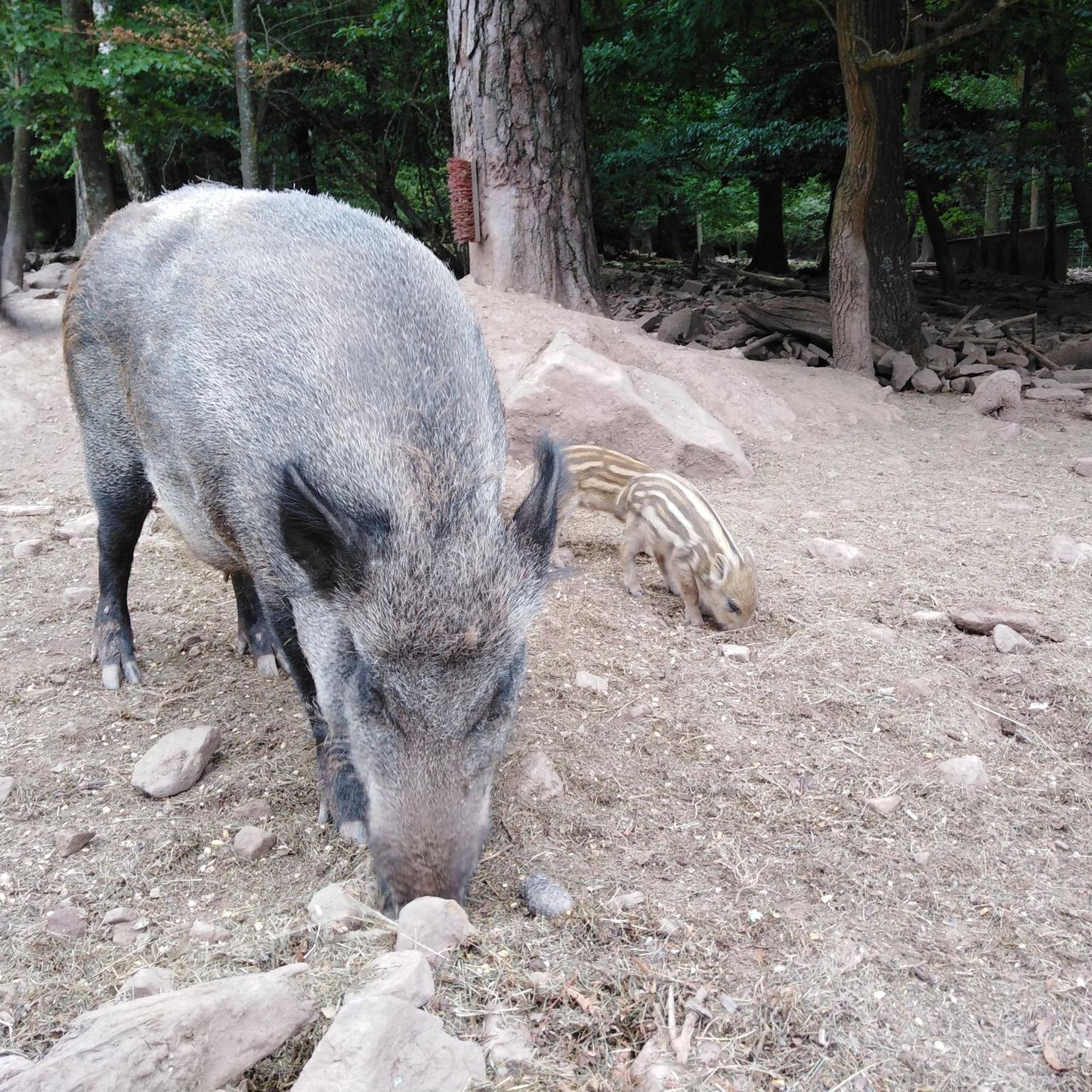
Nice to look at. Especially the mare with her twins. Very very rare!
0
0
Frequently Asked Questions
How many hiking trails are available in Machachi?
Machachi offers a diverse range of hiking experiences with 11 distinct trails. These routes cater to various skill levels, from easy walks around lagoons to challenging ascents of volcanic slopes.
What kind of landscapes can I expect to see while hiking in Machachi?
Hiking in Machachi immerses you in Ecuador's "Avenue of Volcanoes." You'll encounter dramatic volcanic landscapes, high-altitude lagoons like Limpiopungo Lagoon, and cloud forests. The region is dominated by majestic peaks such as Cotopaxi, Rumiñahui, and Sincholagua, offering breathtaking panoramic views.
Are there any easy hiking trails suitable for beginners in Machachi?
Yes, Machachi has several easy trails. For a scenic and accessible option, consider the routes around Limpiopungo Lagoon. These paths offer gentle terrain and stunning views of Cotopaxi and Rumiñahui volcanoes, perfect for a relaxed outing.
What are some challenging hikes for experienced trekkers in Machachi?
For experienced hikers seeking a challenge, the ascent to José Rivas Refuge on Cotopaxi is a demanding route, covering 16.7 miles (26.8 km) and typically taking around 9 hours. This trail leads through high-altitude volcanic terrain, offering a significant accomplishment for those up to the task.
Are there any circular hiking routes in Machachi?
Yes, many trails in Machachi are designed as loops. A popular circular route is the Limpiopungo Lagoon – View of Limpiopungo Lake loop, which is 2.1 miles (3.4 km) long and offers beautiful views of the surrounding volcanoes. Another option is the longer View of Limpiopungo Lake – Limpiopungo Lagoon loop, covering 6.4 miles (10.3 km).
What natural attractions or landmarks can I see along the hiking trails?
Machachi's trails offer access to several natural wonders. You can explore the serene Limpiopungo Lagoon, witness wild horses in Cotopaxi National Park, or challenge yourself to reach the José Rivas Refuge. The region also boasts stunning views of volcanoes like Cotopaxi, Rumiñahui, and Illinizas.
Is Machachi suitable for family-friendly hikes?
Machachi offers options for families, particularly around the Limpiopungo Lagoon. The trails here are generally moderate and provide a scenic environment for walks, allowing families to enjoy the volcanic landscapes and observe wildlife in a less strenuous setting.
What do other hikers say about the trails in Machachi?
The trails in Machachi are highly regarded by the komoot community, holding an impressive average rating of 4.9 stars from over 70 reviews. Hikers frequently praise the stunning volcanic scenery, the diverse range of experiences from easy walks to challenging climbs, and the well-maintained paths.
Are there any trails that offer views of multiple volcanoes?
Absolutely. Many trails, especially those within Cotopaxi National Park, provide exceptional viewpoints. From the paths around Limpiopungo Lagoon, you can often see both Cotopaxi and Rumiñahui. Higher elevations, such as those on Rumiñahui Volcano, offer panoramic vistas of Cotopaxi, Illinizas, and Pasochoa.
What is the best time of year to go hiking in Machachi?
Machachi's weather can be variable due to its high altitude. Generally, the drier months from June to September and December to February are considered ideal for hiking, offering clearer skies and better visibility of the volcanoes. However, conditions can change rapidly, so always be prepared for different weather.
Are there any trails that feature segments of historical paths?
Yes, the region around Machachi is rich in history. The Sincholagua Volcano, an eroded extinct volcano, features a segment of the historic Inca trail, offering a unique blend of natural beauty and cultural significance for hikers.
Most popular routes in Machachi
Most popular attractions in Machachi

Get inspired with the komoot mobile app


Explore more
Browse the best Hikes in other regions.
