The best walks and hikes in Helgafellssveit
4.7
(36)
277
hikers
7
hikes
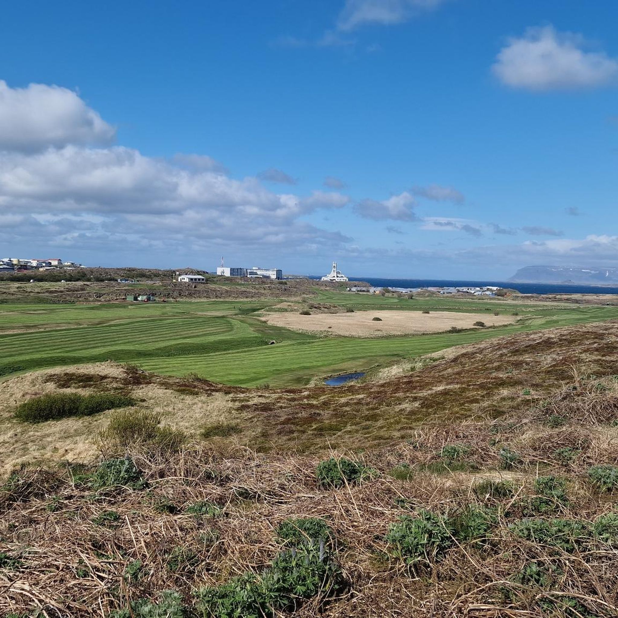
Hiking in Helgafellssveit, a coastal region on the Snæfellsnes Peninsula, offers diverse landscapes for outdoor exploration. The area features rolling hills, distinctive volcanic rock formations, and basaltic mountains. Trails often lead through gorges with rhyolitic tuff and past waterfalls, providing varied terrain. The region's natural features include coastal views and unique geological formations.
Best hiking trails in Helgafellssveit
- The most popular hiking route is Brook – Selvellir Gorge loop from Selvalafoss, a 2.5 miles (4.0 km) trail that takes…
Last updated: June 28, 2026
4.6
(16)
96
hikers
4.01km
01:17
110m
110m
Moderate hike. Great for any fitness level. Mostly accessible paths. Sure-footedness required.
4.3
(11)
90
hikers
Easy hike. Great for any fitness level. Easily-accessible paths. Suitable for all skill levels.

Sign up for free
4.5
(2)
39
hikers
Easy hike. Great for any fitness level. Easily-accessible paths. Suitable for all skill levels.
4.7
(3)
9
hikers
Moderate hike. Good fitness required. Easily-accessible paths. Suitable for all skill levels.
5.0
(3)
26
hikers
Easy hike. Great for any fitness level. Easily-accessible paths. Suitable for all skill levels.
5.0
(1)
6
hikers
13.7km
03:36
110m
110m
Moderate hike. Good fitness required. Easily-accessible paths. Suitable for all skill levels.
Our route recommendations are based on thousands of hikes, rides, and runs completed by other people on komoot.
Start today with a free account
Your next adventure awaits.
Login or Signup
Popular around Helgafellssveit
Other adventures in Helgafellssveit

Tips from the Community

Quaint little lighthouse
0
0

In April, we had to cross the small stream that flows from the waterfall. This was done relatively easily in two steps over existing stones.
0
0

Just before a stream we can follow a gully up to the left. Here we not only follow thick rock formations of rhyolitic tuff, but also the partly intensely orange colored stream bed and some springs lined with deep green moss contribute to the beautiful nature experience.
10
0
Popular viewpoint with picnic benches
9
1

The former island north of Stykkishólmur harbor used to be grazed by sheep. Nowadays you can climb it via a staircase and admire the 360° panorama including the lighthouse. Ideal for evening hours.
4
0

An architecturally beautiful church. Rather plain on the inside. Behind the church you have a great view of the city and the surrounding area.
2
0
Frequently Asked Questions
What kind of landscapes can I expect to see while hiking in Helgafellssveit?
Helgafellssveit offers a diverse range of landscapes, from rolling hills and striking volcanic rock formations to unique gorges with rhyolitic tuff. You'll encounter coastal views, basaltic mountains, and areas adorned with vibrant green moss, providing a visually stunning backdrop for your hikes.
Are there any easy hikes suitable for families in Helgafellssveit?
Yes, Helgafellssveit has several easy trails perfect for families. For instance, the View of Stykkishólmur Harbor – Súgandisey Island loop from Stykkishólmur is an easy 3.3 km path that offers panoramic views from Súgandisey Island. Another easy option is the View of the Lake – View of Snæfellsnes Peninsula loop from Grundarfjörður Airport, which is 5.6 km long.
Where can I find waterfalls along the hiking trails in Helgafellssveit?
You can experience a unique waterfall hike on the Brook – Selvellir Gorge loop from Selvalafoss. This moderate route explores the Selvellir Gorge and passes by Selvallafoss (Sheep's Waterfall), where you can even follow a path behind the cascading water for a memorable view.
What are some notable landmarks or points of interest to explore in Helgafellssveit?
Helgafellssveit is rich in natural and historical landmarks. You can hike up Helgafell (Holy Mountain), an easy 10-minute climb offering panoramic views and a local legend of wishes. Súgandisey Island, accessible via a staircase, provides 360-degree views and a lighthouse. The Selvellir Gorge is also a distinctive natural feature with its orange stream bed and moss-covered springs.
Are there any circular hiking routes in the region?
Yes, many of the trails in Helgafellssveit are designed as loops. For example, the Brook – Selvellir Gorge loop from Selvalafoss and the View of Stykkishólmur Harbor – Súgandisey Island loop from Stykkishólmur are both excellent circular options, allowing you to start and end at the same point.
What is the best time of year to go hiking in Helgafellssveit?
The best time to visit Helgafellssveit for outdoor activities, including hiking, is during the summer months. The weather is generally more stable, and the extended daylight hours provide ample time for exploration.
What do other hikers enjoy most about hiking in Helgafellssveit?
The area is highly rated by the komoot community, with an average score of 4.7 stars from over 30 reviews. Hikers often praise the diverse landscapes, from coastal paths and volcanic formations to unique gorges, and the variety of trails suitable for different ability levels.
What should I wear or bring for hiking in Helgafellssveit?
Given the varied terrain, which can be uneven and wet, it is highly recommended to wear sturdy shoes. Layered clothing is also advisable to adapt to changing weather conditions, especially during the summer months.
Are there any longer, more challenging hikes available in Helgafellssveit?
While many trails are easy to moderate, some offer a longer experience. The Waterfall Crossing – View of the Lake loop from Grundarfjörður Airport is a moderate 13.7 km trail, and the View of the Mountains and Lake – Stream Crossing loop from Grundarfjörður is a moderate 10.3 km route, both offering more extensive exploration.
Can I find any historical sites or cultural attractions near the hiking trails?
Yes, the region has historical significance. At the base of Helgafell, you'll find Helgafellskirkja, a church near the burial site of Guðrún Ósvífursdóttir from the Icelandic Laxdæla Saga. Additionally, the Norwegian House Museum and Stykkishólmskirkja are also nearby attractions worth exploring.
How many hiking trails are available in Helgafellssveit?
There are 7 distinct hiking trails available in Helgafellssveit, offering a range of experiences from easy walks to moderate routes.
Most popular routes in Helgafellssveit
Most popular attractions in Helgafellssveit

Get inspired with the komoot mobile app


Explore more
Browse the best Hikes in other regions.
