The best MTB trails in Pradera
4.7
(66)
134
riders
9
rides
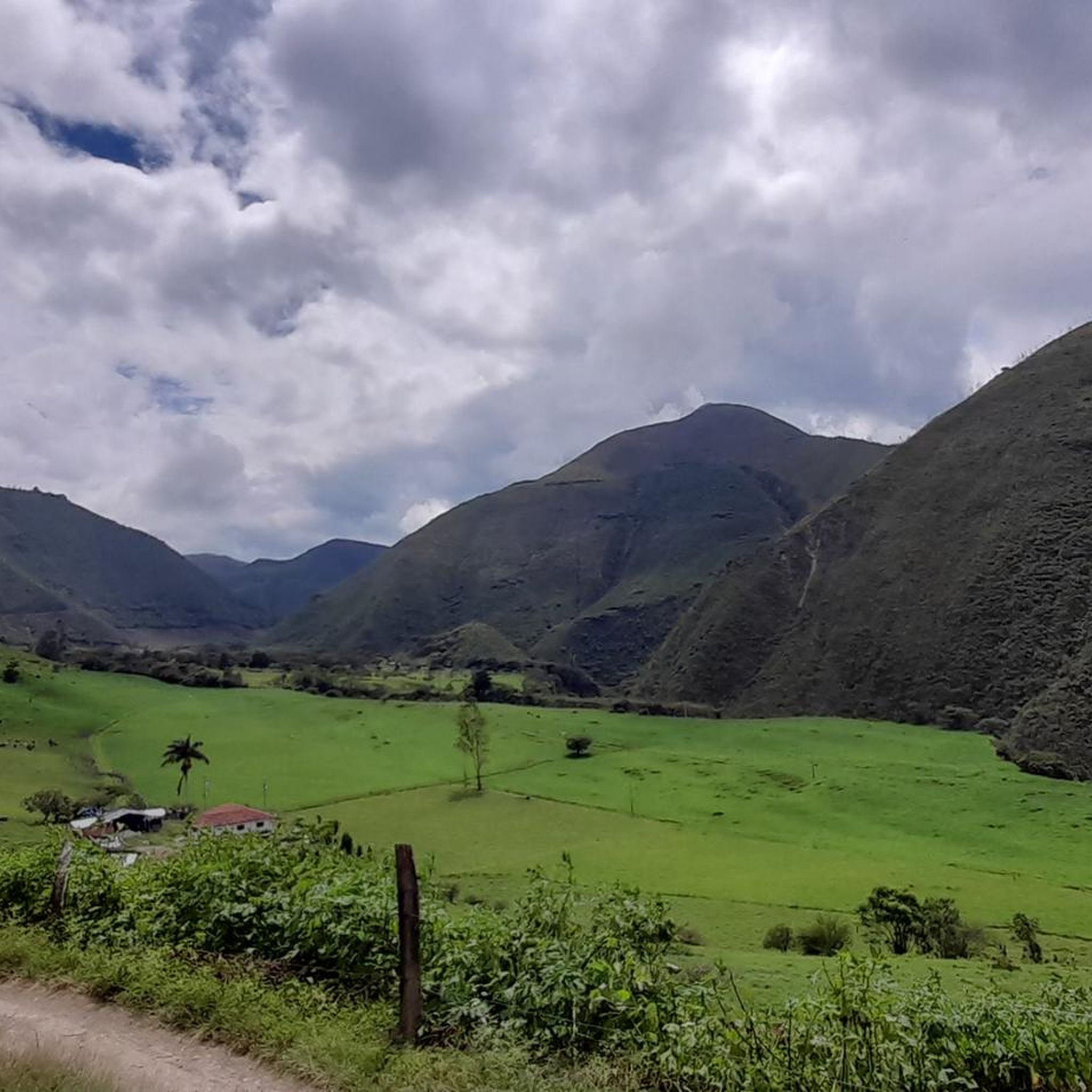
Mountain bike trails in Pradera are set within a landscape of rolling hills and expansive open space, characteristic of the region. The terrain features a mix of paved and unpaved trails, including singletrack and dirt/gravel roads. This environment provides varied riding experiences, from winding paths through lush greenery to routes with technical elements.
Best mountain bike trails in Pradera
- The most popular mountain bike trail is La Buitrera de Palmira – Sanchocho de Gallina Rest Stop loop from Palmira,…
Last updated: June 28, 2026
4.3
(3)
20
riders
37.5km
02:28
390m
390m
Moderate mountain bike ride. Good fitness required. Suitable for all skill levels.
4.7
(6)
19
riders
39.7km
02:40
500m
500m
Moderate mountain bike ride. Good fitness required. Suitable for all skill levels.

Sign up for free
5.0
(1)
15
riders
53.7km
03:08
480m
490m
Moderate mountain bike ride. Good fitness required. Suitable for all skill levels.
5.0
(5)
13
riders
53.6km
03:12
530m
530m
Moderate mountain bike ride. Good fitness required. Suitable for all skill levels.
13
riders
46.8km
02:58
390m
390m
Moderate mountain bike ride. Good fitness required. Suitable for all skill levels.
Get access to more routes and recommendations from other explorers.
Sign up for free
Already have an account?
Our route recommendations are based on thousands of hikes, rides, and runs completed by other people on komoot.
Start today with a free account
Your next adventure awaits.
Login or Signup
Popular around Pradera

Tips from the Community

Santa Elena is a Colombian township belonging to the municipality of El Cerrito, in the department of Valle del Cauca. It is known for its tourism and scenic value, and for the location of heritage properties within this township, such as Hacienda El Paraíso and Hacienda Pie de Chinche. The township of Santa Elena borders the municipality of Ginebra to the north, the township of El Placer to the south, the townships of El Pomo and El Castillo to the east, and the municipal seat of El Cerrito to the west. The territory of Santa Elena is located on the right bank of the Cauca River, flat in its area near the river valley and mountainous in the eastern region. It lies between the Amaime and Zabaletas rivers, has an average altitude of 1,100 meters above sea level, an average temperature of 22°C, and an area of approximately 24 km². Santa Elena is located approximately 37 km from the city of Cali, 13 km from Palmira, 30 km from Buga, 30 km from Guacarí, 15 km from Ginebra, 157 km from Roldanillo, 107 km from La Unión, 126 km from Popayán, 156 km from Pereira, 152 km from Armenia, and 7 km from its municipality of El Cerrito. The municipality of Santa Elena is recognized at the departmental and national levels for being home to the "El Paraíso" hacienda, where Jorge Isaacs wrote his romantic novel "María" and which was also the place where the author himself lived. The "Pie de Chinche" hacienda is famous for being the site of some of the oldest sugar mills for processing and extracting sugarcane honey. The "Tomb of María" is located in the Central Catholic Cemetery, a memorial to the work that made the town famous. There is also the "Choza de Chuchú" house museum, a place that dates back to approximately 1910 thanks to Walter Belalcázar, who managed to recreate representative places of the town in his home, such as the first barbershop, the first store, the bar, and the movie theater, so that each space conveys the essence of the era thanks to its antique artifacts. Electricity is provided through the National Electric Interconnection Service. Regarding public lighting, reports from the community indicate that it is very poor.
0
0
El Castillo is a village in the municipality of El Cerrito, Valle del Cauca, at an altitude of 1,432 meters. El Castillo is located near the town of La Honda, as well as the Casa Museo Hacienda El Paraiso, and is also very close to Santa Elena.
0
0

In the photo you can see the Lunar Pyramid located in Vda Chontaduro, located on the road to La Buitrera and the Nirvana Natural Reserve
0
0
Sector of recreational farms and country restaurants
1
0
town in Palmira, Valle del Cauca and has an elevation of 1054 meters. Aguaclara is located near Chontaduro and La Buitrera.
1
0
It is a Colombian municipality in the department of Valle del Cauca in Colombia; located in the southern region of the department. It is known as La Villa de las Palmas. It is located on the eastern bank of the Cauca River, it is part of the Cali Metropolitan Area and is also the center of large sugar mills, constituting one of the most important commercial, industrial and agricultural centers of Valle del Cauca.4 The city is located 26 km from the urban area of Cali, the capital. Palmira is the headquarters of the International Center for Tropical Agriculture (CIAT), the most important in Colombia and South America, where development research is carried out on agricultural production throughout the country, in the variety of cassava, beans, sugar cane and palm. It is also known as the "Agricultural Capital of Colombia".
1
0
a town in Palmira, Valle del Cauca and has an elevation of 1,029 meters. Amaime is situated nearby to the town of El Placer and LA PAMPA.
0
0

Frequently Asked Questions
What kind of mountain biking terrain can I expect in Pradera?
Mountain bike trails in Pradera feature a diverse landscape of rolling hills and expansive open space. You'll encounter a mix of paved and unpaved trails, including singletrack and dirt/gravel roads. The terrain offers varied riding experiences, from winding paths through lush greenery to routes with technical elements.
What is the typical difficulty level of mountain bike trails in Pradera?
The mountain bike trails in Pradera are generally considered moderate. All 9 available routes are rated as moderate, offering a good challenge for riders with some experience. While none are classified as easy or difficult, some routes do feature technical elements that add to the riding experience.
What are the average distances and durations for mountain bike rides in Pradera?
The mountain bike routes in Pradera typically range from approximately 23 to 33 miles (37 to 54 km) in length. Most rides can be completed within 2.5 to 3.5 hours, depending on your pace and the specific trail. For example, the La Buitrera de Palmira – Sanchocho de Gallina Rest Stop loop from Palmira is about 23.3 miles (37.5 km) and takes around 2 hours 28 minutes.
Are there any circular mountain bike routes in Pradera?
Yes, many of the mountain bike trails in Pradera are designed as loops, offering convenient circular routes. Examples include the La Albania – La Quisquina loop from Palmira and the El Castillo Village – Hacienda El Paraíso loop from Palmira, allowing you to start and finish at the same point.
What do other mountain bikers enjoy most about riding in Pradera?
The mountain bike trails in Pradera are highly rated by the komoot community, with an average score of 4.8 stars from over 60 reviews. Riders often praise the varied terrain, the scenic vistas, and the well-maintained paths that navigate through the region's natural features.
Are there any notable natural features or wildlife to look out for while mountain biking in Pradera?
Pradera is known for its rolling hills and over 600 acres of preserved open space, providing a serene natural retreat. While riding, you might encounter local wildlife such as deer, foxes, and various bird species like hawks. The landscape also features dramatic elevation changes, wetlands, and ponds, particularly in areas resembling the 'Mountain Nine' and 'Lake Nine' descriptions from the broader Pradera region.
What are the elevation gains like on Pradera's mountain bike trails?
The mountain bike trails in Pradera feature moderate elevation gains. For instance, the Hacienda El Paraíso – El Castillo Village loop from Palmira involves an ascent of approximately 533 meters (1,749 feet), while the La Albania – Tienda Nueva loop from Palmira has an elevation gain of around 392 meters (1,286 feet). These varied ascents contribute to the moderate difficulty of the routes.
Is Pradera suitable for mountain bikers looking for longer rides?
Yes, Pradera offers several options for longer mountain bike rides. The El Castillo Village – Hacienda El Paraíso loop from Palmira, for example, is a substantial 33.4 miles (53.7 km) route, often completed in just over 3 hours, providing a good endurance challenge.
What is the best time of year for mountain biking in Pradera?
While specific seasonal details for the routes are not provided, the broader Pradera region in Colorado experiences distinct seasons. Spring and fall generally offer pleasant temperatures for riding, avoiding the heat of summer and potential snow or colder conditions in winter. It's always advisable to check local weather conditions before heading out.
Are there any specific technical features on the mountain bike trails in Pradera?
Yes, some of the mountain bike trails in Pradera incorporate technical elements. While the overall difficulty is moderate, riders may encounter features like jumps, berms, and rock faces, particularly on singletrack sections and dirt/gravel roads, adding to the excitement and challenge of the ride.
How many mountain bike trails are available in Pradera?
There are 9 mountain bike trails available in Pradera, all of which are rated as moderate difficulty. These routes offer a variety of experiences across the region's diverse terrain.
Most popular routes in Pradera

Get inspired with the komoot mobile app


Explore more
Browse the best MTB trails in other regions.
