The best MTB trails in Cerinza
4.6
(60)
205
riders
30
rides
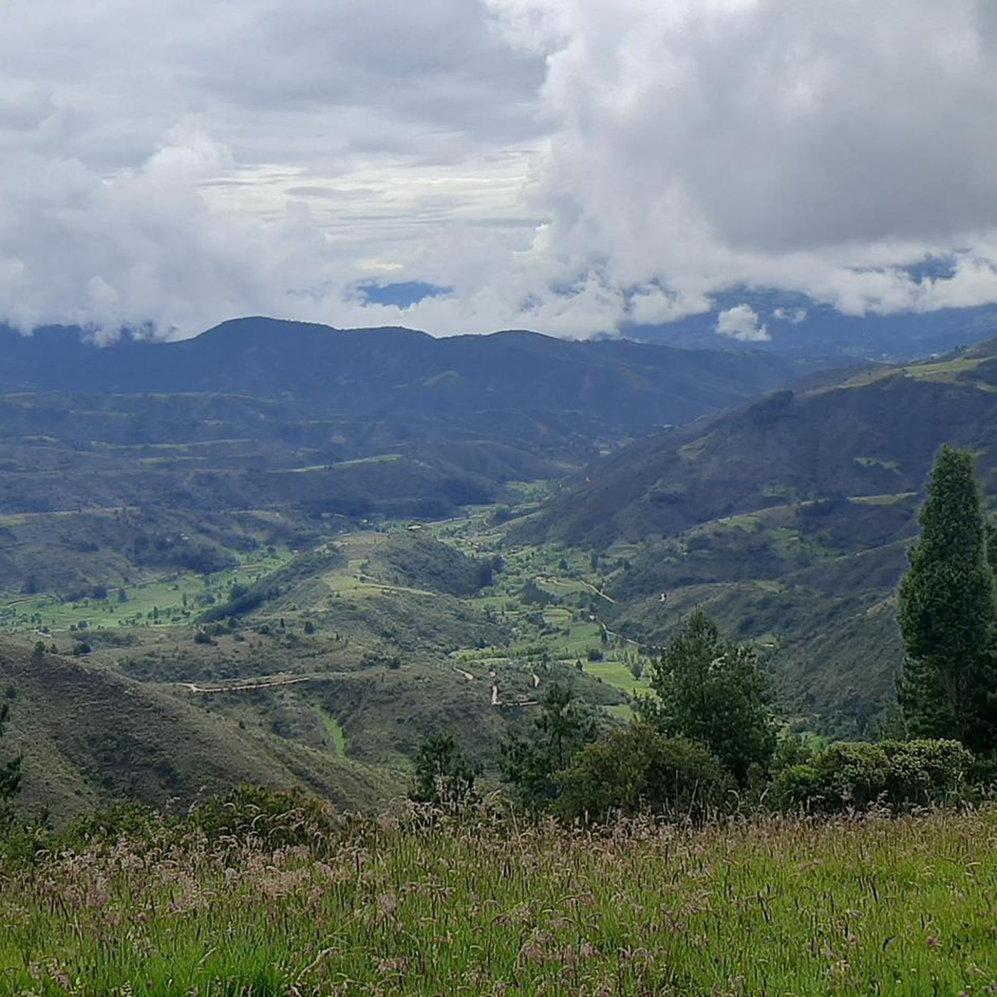
Mountain bike trails in Cerinza are set within the Andean landscapes of Colombia's Boyacá department, offering diverse terrain for cycling. The region is characterized by green hills, elevated viewpoints, and the unique páramo ecosystems, including the Páramo de la Rusia. Cerinza itself is situated at an altitude of 2,750 meters, contributing to varied elevation changes across its routes. This topography provides a range of mountain biking experiences, from moderate climbs to challenging descents.
Best mountain bike trails in Cerinza
- The…
Last updated: July 1, 2026
4.5
(20)
33
riders
26.2km
01:43
390m
390m
Moderate mountain bike ride. Good fitness required. Suitable for all skill levels.
5.0
(12)
22
riders
Easy mountain bike ride. Great for any fitness level. Suitable for all skill levels.

Sign up for free
4.0
(4)
18
riders
Moderate mountain bike ride. Good fitness required. Suitable for all skill levels.
16
riders
63.0km
06:40
2,090m
2,090m
Hard mountain bike ride. Very good fitness required. Suitable for all skill levels.
5.0
(1)
15
riders
80.1km
08:06
2,410m
2,410m
Hard mountain bike ride. Very good fitness required. Suitable for all skill levels.
Get access to more routes and recommendations from other explorers.
Sign up for free
Already have an account?
Our route recommendations are based on thousands of hikes, rides, and runs completed by other people on komoot.
Start today with a free account
Your next adventure awaits.
Login or Signup
Popular around Cerinza
Tips from the Community

I did it by diverting onto an unpaved route from Santa Rosa de Viterbo, a good option if you want to avoid traffic on the main road, however, it is recommended on MTB or Gravel.
0
0
Main square with beautiful architecture
0
0

Thanks to Ramíro from La Cicleria Taller & Café, the brakes are working again.
0
0


Central park with a beautiful cathedral in the center of Bethlehem.
0
0
Summit between the municipalities of Santa Rosa de Viterbo and Belén. Elevation close to 3000 meters above sea level
0
0
Beautiful park in the municipality of Belén.
0
0
Recommended place for breakfast and lunch.
0
0
Frequently Asked Questions
How many mountain bike trails are available in Cerinza?
Cerinza offers a wide selection of mountain bike trails, with over 30 routes available for exploration. These trails cater to various skill levels, from easy to difficult.
What kind of terrain can I expect on mountain bike trails in Cerinza?
Mountain bike trails in Cerinza are characterized by diverse Andean landscapes, including green hills, elevated viewpoints, and unique páramo ecosystems like the Páramo de la Rusia. The region's altitude of 2,750 meters means you'll encounter varied elevation changes, from moderate climbs to challenging descents.
Are there mountain bike trails suitable for beginners in Cerinza?
Yes, Cerinza has trails suitable for beginners. An easy option is the Alto Tobasía, Duitama – La Cicleria Workshop & Café loop from Santa Rosa de Viterbo, which is 14.5 miles (23.4 km) long and features gentle gradients through scenic landscapes.
What are some challenging mountain bike routes for experienced riders in Cerinza?
For experienced riders seeking a challenge, Cerinza offers several difficult routes. The Pine Forest Trail – Complete MTB Descent loop from Belén is a demanding 49.3 miles (79.3 km) trail with significant elevation changes. Another difficult option is the Puerta de Cuche – Alto de Tobasía loop from Santa Rosa de Viterbo, spanning 23.3 miles (37.5 km).
Are there any circular mountain bike routes in Cerinza?
Yes, many mountain bike routes in Cerinza are circular. Popular options include the moderate Alto Tobasía, Duitama – Puerta de Cuche loop from Santa Rosa de Viterbo (16.3 miles / 26.2 km) and the Alto del Portachuelo – Alto Tobasía, Duitama loop from Santa Rosa de Viterbo (24.0 miles / 38.7 km), which offers rolling hills and elevated viewpoints.
What natural features or viewpoints can I see while mountain biking in Cerinza?
Cerinza's trails offer breathtaking Andean landscapes and numerous viewpoints. You can encounter unique páramo ecosystems with 'frailejones' plants. Specific points of interest along routes include Puerta de Cuche, Alto de Tobasía, and Alto del Portachuelo. Many routes also provide sweeping views of Duitama.
What is the best time of year for mountain biking in Cerinza?
Cerinza, located at an altitude of 2,750 meters, generally has a cool climate. While specific seasonal recommendations aren't provided, the Andean region typically offers good conditions outside of heavy rainy seasons. It's advisable to check local weather forecasts before planning your trip.
Are the mountain bike trails in Cerinza suitable for families?
While the region is great for outdoor activities, the guide highlights trails ranging from easy to difficult. For families, consider easier, shorter routes like the Alto Tobasía, Duitama – La Cicleria Workshop & Café loop, which has gentle gradients. Always check the specific trail difficulty and length to ensure it matches your family's experience level.
Can I bring my dog on the mountain bike trails in Cerinza?
The region is known for its natural beauty and outdoor activities. However, specific regulations regarding dogs on mountain bike trails in Cerinza are not detailed. It's always best to check with local authorities or trail information centers for current pet policies before heading out with your dog.
What do other mountain bikers enjoy the most about mountain biking in Cerinza?
The mountain bike trails in Cerinza are highly rated by the komoot community, with an average score of 4.6 stars from over 60 reviews. Riders often praise the stunning Andean landscapes, the diverse terrain, and the variety of routes available for different ability levels.
Are there any specific trailheads or starting points for mountain biking in Cerinza?
Many popular routes, such as the Alto Tobasía, Duitama – Puerta de Cuche loop and the Alto Tobasía, Duitama – La Cicleria Workshop & Café loop, often start from areas around Santa Rosa de Viterbo, which is a common base for exploring the region's trails.
What is the elevation like on Cerinza's mountain bike trails?
Cerinza is situated at an altitude of 2,750 meters, meaning trails feature significant elevation changes. For example, the Alto del Portachuelo – Alto Tobasía, Duitama loop involves over 700 meters of ascent and descent, providing a good workout amidst the rolling hills.
Most popular routes in Cerinza
Most popular attractions in Cerinza

Get inspired with the komoot mobile app


Explore more
Browse the best MTB trails in other regions.
