The best cycling routes in San Vicente
4.7
(52)
836
riders
22
rides
Touring cycling routes in San Vicente are characterized by significant elevation changes, offering challenging climbs and rewarding descents. The region features a landscape of hills and mountainous terrain, with routes often leading through varied natural environments. Cyclists can expect paths that traverse both paved and unpaved surfaces, providing diverse riding experiences.
Best touring cycling routes in San Vicente
- The most popular touring cycling route is Little Free Library – San Antonio de Pereira Park loop from Marinilla, a 40.4 miles (65.0 km) trail that takes 4 hours 25 minutes to complete. This difficult route features challenging climbs and varied landscapes.
- Another top favourite among local touring cyclists is Alto De Matasanos loop from Girardota, a difficult 27.4 miles (44.1 km) path. This route offers significant elevation gain and panoramic views.
- Local touring cyclists also love the View From Here – Breakfast spot loop from Girardota, a 23.2 miles (37.3 km) trail leading through rolling hills and scenic vistas, often completed in about 2 hours 20 minutes.
- Touring cycling in San Vicente is defined by mountainous terrain, challenging ascents, and diverse natural environments. The network offers options for different ability levels, from moderate rides to difficult, long-distance routes.
- The routes in San Vicente are highly rated by the komoot community with an average score of 4.8 stars from over 50 reviews. More than 900 touring cyclists have used komoot to explore San Vicente's varied terrain.
Last updated: June 29, 2026
13
riders
66.1km
04:31
1,030m
1,030m
Hard bike ride. Very good fitness required. Mostly paved surfaces. Suitable for all skill levels.
10
riders
44.2km
03:25
1,100m
1,100m
Hard bike ride. Very good fitness required. Mostly paved surfaces. Suitable for all skill levels.

Sign up for free
5.0
(3)
8
riders
36.7km
02:16
340m
340m
Moderate bike ride. Good fitness required. Mostly paved surfaces. Suitable for all skill levels.
5.0
(7)
11
riders
21.7km
01:24
270m
260m
Moderate bike ride. Good fitness required. Mostly paved surfaces. Suitable for all skill levels.
5.0
(1)
5
riders
45.1km
03:23
990m
990m
Hard bike ride. Very good fitness required. Mostly paved surfaces. Suitable for all skill levels.
Get access to more routes and recommendations from other explorers.
Sign up for free
Already have an account?
Our route recommendations are based on thousands of hikes, rides, and runs completed by other people on komoot.
Start today with a free account
Your next adventure awaits.
Login or Signup
Popular around San Vicente

Tips from the Community

the street that leads from the church in Barbosa Park
0
0

The included picture is a view out back of the store. This spot is perfect for vegetarian and vegan groceries if you are staying in or passing through Santa Elena.
0
0

There is no better happiness 😌 than oneself competing
0
0

beware of cars. there are too many on this route
0
1
Frequently Asked Questions
How many touring cycling routes are available in San Vicente?
San Vicente offers a diverse network of over 20 touring cycling routes. These routes cater to various skill levels, with a significant number featuring challenging climbs and rewarding descents through mountainous terrain.
What is the general difficulty level of touring cycling routes in San Vicente?
The touring cycling routes in San Vicente are predominantly challenging. Out of the available routes, 16 are classified as difficult, 7 as moderate, and 1 as easy. This indicates a region best suited for cyclists looking for significant elevation changes and demanding rides.
Are there any family-friendly touring cycling routes in San Vicente?
While many routes in San Vicente feature significant elevation changes and are rated as difficult, there is at least one easy route available. For families or those seeking a more relaxed experience, it's advisable to check the specific route details for elevation profiles and terrain before heading out. The View From Here – Breakfast spot loop from Girardota is a moderate option with rolling hills that might be suitable for more experienced families.
What kind of terrain can I expect on San Vicente's touring cycling routes?
Cyclists in San Vicente can expect a mix of paved and unpaved surfaces. The region is characterized by hills and mountainous terrain, meaning routes often involve significant elevation changes, challenging ascents, and diverse natural environments.
What do other touring cyclists say about the routes in San Vicente?
The touring cycling routes in San Vicente are highly regarded by the komoot community, holding an impressive average rating of 4.8 stars from over 50 reviews. Cyclists frequently praise the challenging ascents, panoramic views, and the diverse natural environments encountered along the trails.
Are there any notable landmarks or attractions to see along the cycling routes?
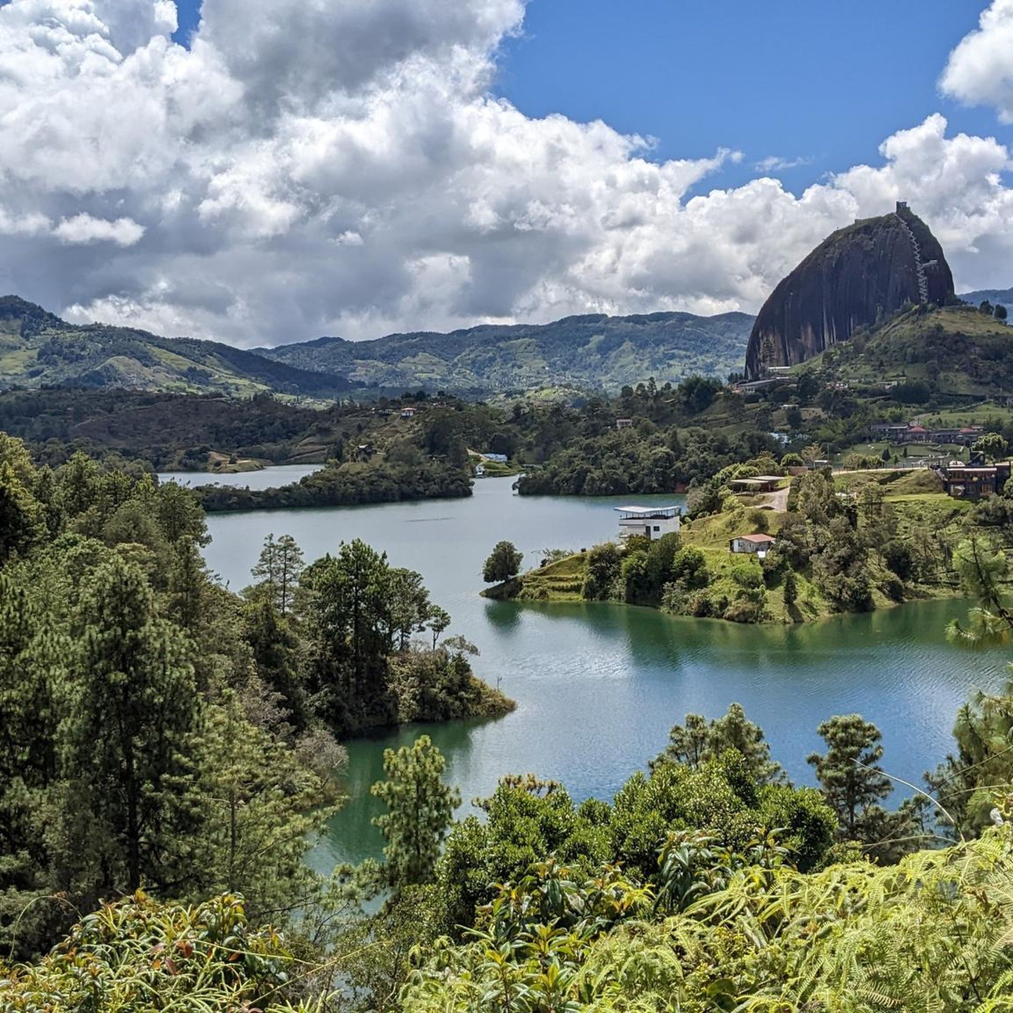
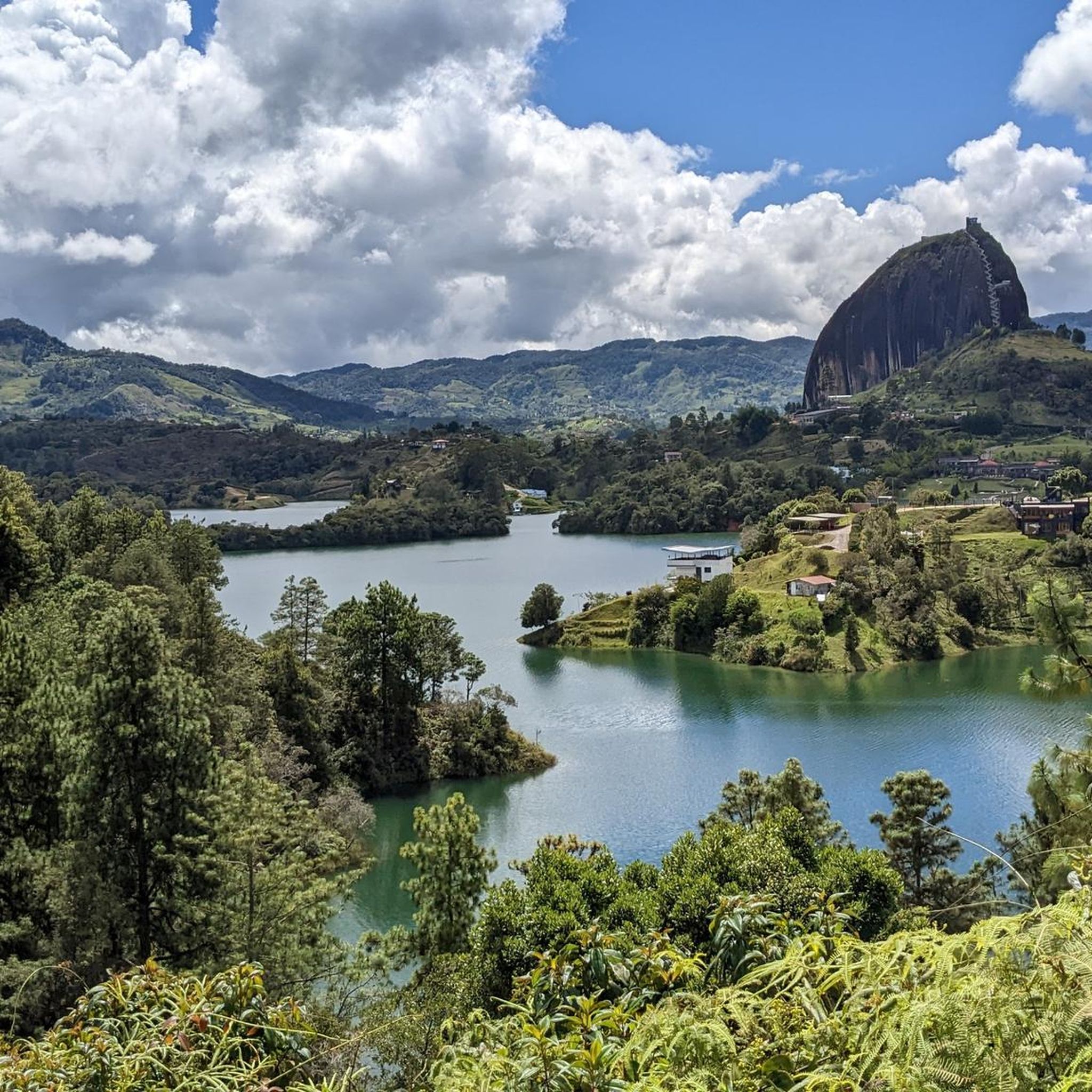
Yes, several routes offer access to significant landmarks and viewpoints. For instance, the El Peñol Rock Ascent – View of the River loop from El Peñol provides stunning views of El Peñol Rock and the Guatapé Reservoir. Other highlights in the broader San Vicente area include The Rock of Guatapé and the Main square of Concepcion.
Can you recommend a challenging route with significant elevation gain?
For a truly challenging experience with substantial elevation gain, consider the Alto De Matasanos loop from Girardota. This difficult 27.4-mile (44.1 km) path features over 1,100 meters of ascent and offers panoramic views, making it a favorite among local touring cyclists.
Are there any circular touring cycling routes in San Vicente?
Yes, many of the popular touring cycling routes in San Vicente are designed as loops, allowing you to start and finish at the same point. Examples include the Little Free Library – San Antonio de Pereira Park loop from Marinilla and the Alto de Matasanos loop from Girardota.
What is a good route for an experienced cyclist looking for a long ride?
Experienced cyclists seeking a longer, demanding ride might enjoy the Little Free Library – San Antonio de Pereira Park loop from Marinilla. This difficult route spans 40.4 miles (65.0 km) and involves over 1,000 meters of climbing, offering varied landscapes over approximately 4 hours and 25 minutes of riding.
Are there any routes that offer a mix of adventure, history, and nature?
While the specific San Vicente in the guide data is in Colombia, the broader concept of San Vicente areas globally often offers such mixes. In the Colombian context, routes often pass through traditional towns and rural landscapes, providing a blend of natural beauty and cultural insights. For example, the areas around El Peñol and Guatapé offer both stunning natural features and historical significance.
What kind of wildlife might I encounter on the trails?
Given the lush, tropical, and mountainous environment characteristic of the region, cyclists might encounter diverse birdlife and other small animals. The varied natural environments along the routes provide habitats for local fauna, though specific sightings will depend on the time of day and season.
Is there a moderate route that still offers scenic views?
Absolutely. The View From Here – Breakfast spot loop from Girardota is a moderate 23.2-mile (37.3 km) trail that leads through rolling hills and offers scenic vistas, making it a great option for those who want beautiful scenery without the most extreme climbs.
Most popular routes in San Vicente
Most popular attractions in San Vicente

Get inspired with the komoot mobile app


Explore more
Browse the best Cycling routes in other regions.
