The best walks and hikes around Burglengenfeld
4.5
(5755)
24,899
hikers
222
hikes
Hiking around Burglengenfeld offers diverse landscapes, situated on the banks of the Naab River and near the Bavarian Jura. The region features rolling hills, dense forests, and impressive rock formations, providing varied terrain for outdoor activities. Extensive woodlands and serene riverside paths characterize the area, with elevations generally under 200 meters, classifying them as hills. This natural setting creates a compelling environment for exploration.
Best hiking trails around Burglengenfeld
- The most popular hiking route is View from Köblitzplatte – Viewpoint…
Last updated: July 5, 2026
4.8
(79)
260
hikers
16.8km
04:33
240m
240m
Moderate hike. Good fitness required. Easily-accessible paths. Suitable for all skill levels.
4.6
(28)
108
hikers
Moderate hike. Good fitness required. Easily-accessible paths. Suitable for all skill levels.

Sign up for free
4.8
(13)
57
hikers
Moderate hike. Good fitness required. Easily-accessible paths. Suitable for all skill levels.
4.9
(27)
74
hikers
Easy hike. Great for any fitness level. Easily-accessible paths. Suitable for all skill levels.
4.8
(4)
34
hikers
8.39km
02:19
150m
150m
Moderate hike. Good fitness required. Easily-accessible paths. Suitable for all skill levels.
Get access to more routes and recommendations from other explorers.
Sign up for free
Already have an account?
Our route recommendations are based on thousands of hikes, rides, and runs completed by other people on komoot.
Start today with a free account
Your next adventure awaits.
Login or Signup

Tips from the Community

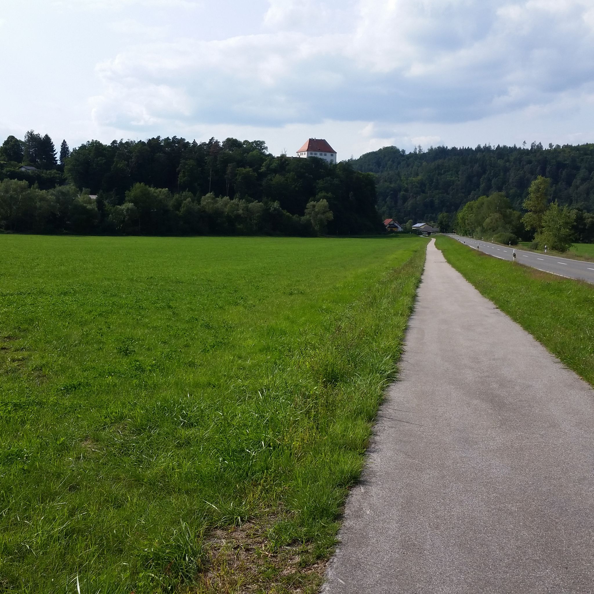
Schloß Münchshofen Schloß Münchshofen had at least one medieval predecessor, of which at least one tower still existed in the 18th century, as a contemporary view shows. The year 1597 is chiseled into a door frame of the west wing. After severe damage during the Thirty Years' War, the complex was extensively redesigned in the second half of the 17th century. Schloß Münchshofen is one of the rare Renaissance-style monuments in the Upper Palatinate. The obelisks and volutes were added later. The complex forms a courtyard closed on three sides towards the Naab. In its floor plan, it is nine bays long. On the rear side, there is a smaller, three-sided arcaded courtyard. The steeply rising Münchshofener Berg here is provided with a two-story retaining wall. In the center of the complex stands the clock tower with the two-flight external staircase. The castle is directly connected to the former castle chapel. A gate passage to the economy yard, remains of the surrounding wall, and a brick barn have been preserved. In 1868, the castle passed to Julie Anna Reichsfreiin von Aretin, who brought it into the family of Reichsgrafen von Armannsperg. In 1910, Freiherr Alexander von Moreau, Royal Bavarian Chamberlain and Government Councilor in Bad Kissingen, acquired it. His son Maximilian Freiherr von Moreau continued the legacy. Today, the castle is privately owned by Antonius Freiherr von Moreau. The castle is privately owned and can only be viewed from the outside. An auction on September 27, 2011, was unsuccessful. Schloß Münchshofen is threatened by decay. Source: Excerpts from www.wikipedia.de
2
0

Saltendorf Pond covers approximately ten hectares and, as the name suggests, is located in Saltendorf, a district of Teublitz. The clubhouse of the Teublitz Fishing Club is also located here. As a former gravel pit lake, it is home to a healthy fish population: eels, pike, carp, perch, zander, tench, and various whitefish await enthusiastic anglers. The Teublitz Fishing Club expertly manages the lake; visitors can purchase 3-day and weekly permits for Saltendorf Pond, as well as other club-owned lakes. While the lake is no longer officially designated for swimming, on warm summer days, expect to see swimmers, stand-up paddleboarders, inflatable mattresses, and other recreational activities. A pleasant lawn with a playground invites visitors to relax, even without fishing. A footpath encircles the lake. Fishing is permitted from 5:00 a.m. to midnight; boats are prohibited.
2
0

The former castle is a late Gothic, three-story, gabled, eaves-facing house with a side-mounted bay window, dating from 1586 (marked). This building was constructed by Hans Melchior Sauerzapf. The two-story wing with a gable roof and profiled stone portal probably dates back to the 17th century. The former castle tavern adjoins the castle. In 1586, a bay-like extension was added to the castle. The castle is now privately owned. Source: https://de.wikipedia.org/wiki/Schloss_Rohrbach_(Kallm%C3%BCnz)
0
0
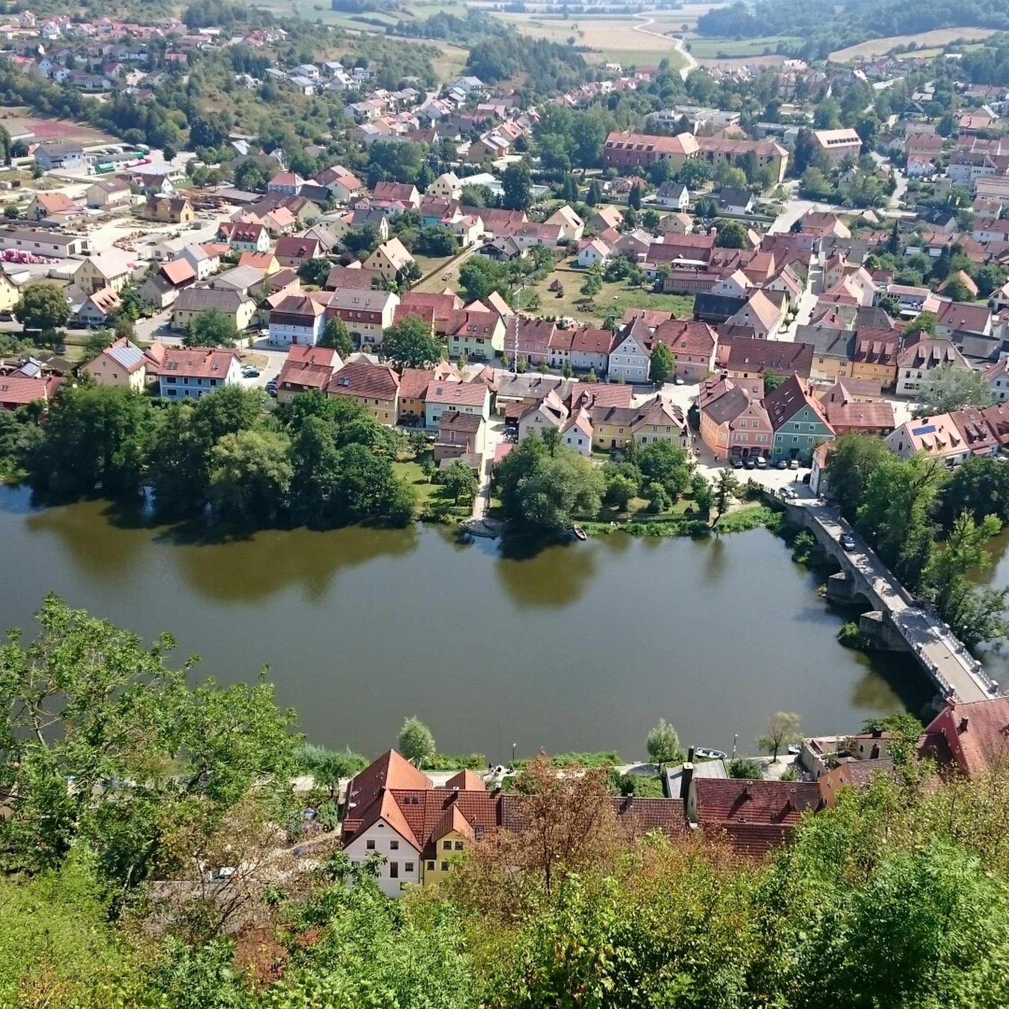
Georgimühle Beer Garden Idyllically situated beer garden directly on the Naab River, with the Kallmünz castle ruins within sight, surrounded by green meadows. In 2021, the beer garden was even named Bavaria's second most popular beer garden. Beer Garden Opening Hours Closed on Mondays Tuesday to Friday from 5 p.m. Saturday from 2 p.m. Sundays and public holidays from 10 a.m. https://www.georgimuehle.de/de/home
1
0

Beautiful hunting lodge directly next to the artificial forest garden
0
0
Very nicely made and nice teeth
0
0
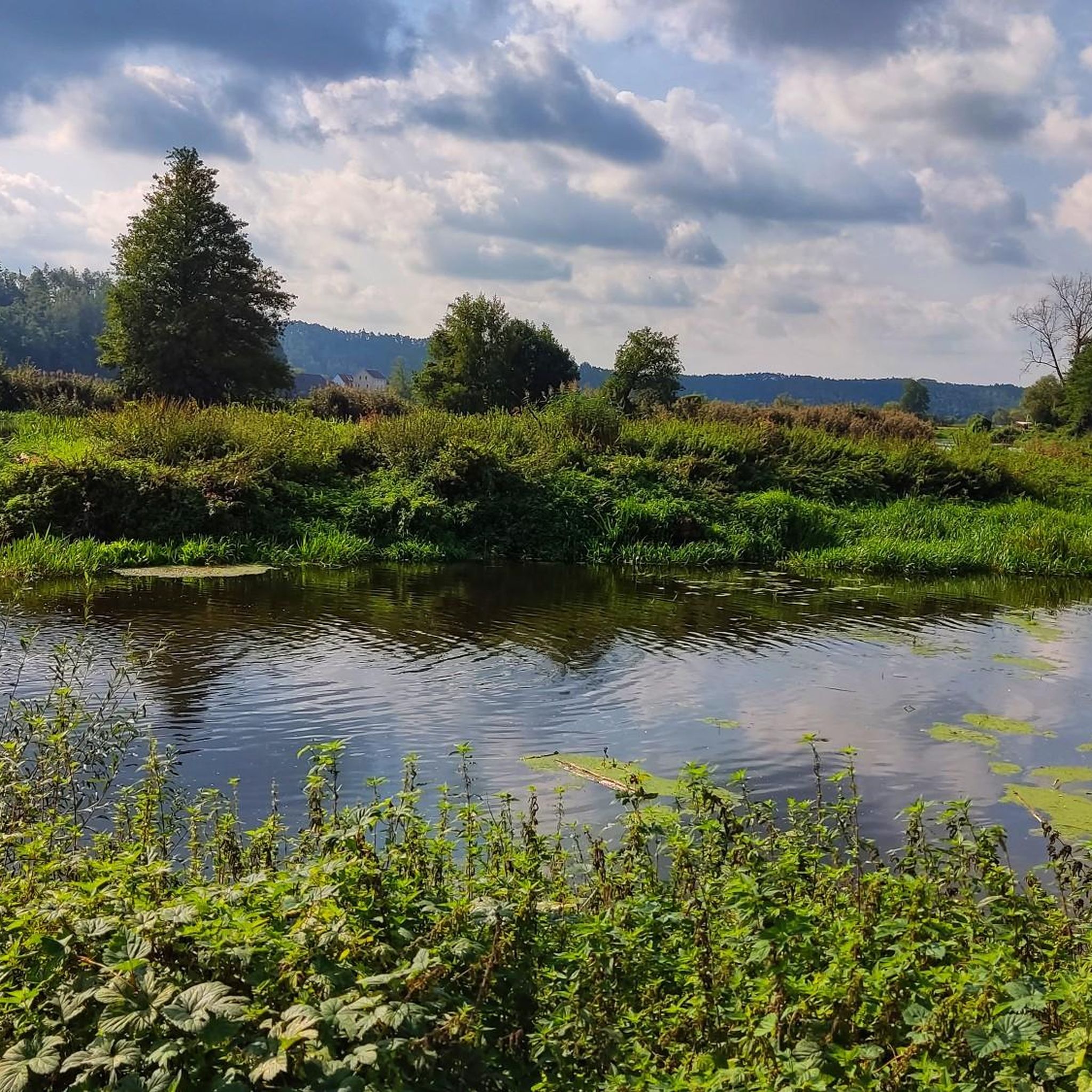
Very nice beer garden with a view of the Naab and good food
0
0
Relatively low mountain with a striking summit cross and very beautiful view
0
0
Frequently Asked Questions
How many hiking trails are available around Burglengenfeld?
There are over 200 hiking routes around Burglengenfeld, catering to various skill levels. This includes more than 120 easy trails, over 80 moderate routes, and a selection of challenging hikes for experienced adventurers.
What kind of landscapes can I expect to see while hiking in Burglengenfeld?
Hiking in Burglengenfeld offers a diverse range of landscapes. You'll find serene riverside paths along the Naab River, rolling hills and impressive rock formations characteristic of the Bavarian Jura, and extensive forested areas like the 'baumreiche Raffa' and powerful beech stands near Schwarzer Berg. The region also features picturesque valleys and occasional ponds.
Are there any family-friendly hiking options in Burglengenfeld?
Yes, Burglengenfeld offers several family-friendly hiking options. The Jägerhäusl Hunting Lodge – Art Forest Garden loop from Waldemar is an easy 3.9 km route, perfect for a shorter outing. Additionally, the Wildpark Höllohe is described as an 'oasis of calm' with paths and animals, making it a great destination for families to explore nature.
Are there any circular hiking routes in the area?
Many of the hiking routes around Burglengenfeld are circular, allowing you to start and end at the same point. Popular circular options include the moderate View from Köblitzplatte – Viewpoint loop from Burglengenfeld, which offers panoramic views, and the Jägerhäusl Hunting Lodge – Cross on the Hutberg near Fischbach loop from Burglengenfeld, which takes you through forested areas.
What are some notable attractions or landmarks to see on a hike?
Beyond the natural beauty, you can encounter several interesting landmarks. The medieval Burg Lengenfeld (Burglengenfeld Castle) offers panoramic views. Along the Wittelsbacher Burgensteig, you can visit the 'Kunstwaldgarten beim Jägerhaus' (an open-air art exhibition) and the artist town of Kallmünz. The region also features various lakes and gorges, such as Saltendorf Pond and the Forellenbachtal.
What do other hikers say about the trails in Burglengenfeld?
The hiking trails in Burglengenfeld are highly regarded by the komoot community, with an average rating of 4.7 stars from over 500 reviews. Hikers often praise the varied terrain, the well-marked paths, and the scenic views, particularly from spots like Köblitzplatte.
Are there any easy hiking trails suitable for beginners?
Yes, Burglengenfeld has a good selection of easy trails. For instance, the Saltendorf Pond – View of California Badeweiher loop from Burglengenfeld is an easy 7.8 km route that takes less than two hours to complete. There are over 120 easy routes in total, offering gentle walks through the region's natural beauty.
Can I find trails that offer views of the Naab River?
Absolutely. Burglengenfeld is situated on the banks of the Naab River, and many trails offer picturesque riverside paths and views of the valley. The Wittelsbacher Burgensteig, for example, provides stunning views of the Naabtal on its return to Burglengenfeld, and the Mühlenweg also features a wild and romantic river landscape.
What is the best time of year to go hiking in Burglengenfeld?
The region experiences warm summers, which are ideal for hiking. However, the diverse landscapes, including dense forests and river valleys, make Burglengenfeld enjoyable throughout spring and autumn as well, offering vibrant foliage or fresh greenery. Winter hiking is also possible, though conditions may vary.
Are there any longer, more challenging hikes available?
For those seeking a challenge, Burglengenfeld offers several longer and more demanding routes. The Jurasteig – Burg Lengenfeld Loop is a challenging day tour of 21.3 km, taking approximately 5.5 hours, traversing the Jura ridge. The Wittelsbacher Burgensteig is another extended option at 24.4 km, offering unique experiences and views.
Are there any trails that pass by lakes or ponds?
Yes, the region includes several lakes and ponds that can be incorporated into your hikes. The Saltendorf Pond – View of California Badeweiher loop from Burglengenfeld is an easy route that passes by Saltendorf Pond. The broader area also features larger bodies of water like Lake Steinberg, which has nearby attractions like the Adventure Sphere and an Observation Tower.
Are there any trails that lead to viewpoints?
Yes, several trails in the area lead to excellent viewpoints. The View from Köblitzplatte – Viewpoint loop from Burglengenfeld is specifically known for its panoramic views from Köblitzplatte. Additionally, the medieval Burg Lengenfeld (Burglengenfeld Castle) offers expansive views of the surrounding landscape.
Most popular routes around Burglengenfeld
Most popular attractions around Burglengenfeld

Get inspired with the komoot mobile app


Explore more
Browse the best Hikes in other regions.
