The best walks and hikes around Milford Haven
4.5
(504)
3,669
hikers
150
hikes
Hiking around Milford Haven is shaped by the Milford Haven Waterway, a large natural harbor and drowned river valley. The landscape provides access to sections of the Pembrokeshire Coast Path, featuring rugged red sandstone cliffs, secluded bays, and tidal inlets. Many routes also pass through areas of ancient woodland that line the watercourses feeding into the main waterway. This region offers a blend of coastal and woodland trails.
Best hiking trails around Milford Haven
- The most popular hiking route is…
Last updated: August 5, 2026
4.0
(6)
17
hikers
13.6km
03:38
160m
160m
Moderate hike. Good fitness required. Easily-accessible paths. Suitable for all skill levels.
4.5
(2)
5
hikers
9.64km
02:34
100m
100m
Moderate hike. Good fitness required. Easily-accessible paths. Suitable for all skill levels.

Sign up for free
5
hikers
3.76km
01:02
50m
50m
Easy hike. Great for any fitness level. Easily-accessible paths. Suitable for all skill levels.
3.0
(1)
10
hikers
10.8km
02:58
170m
170m
Moderate hike. Good fitness required. Easily-accessible paths. Suitable for all skill levels.
4.0
(1)
5
hikers
6.28km
01:46
130m
130m
Easy hike. Great for any fitness level. Easily-accessible paths. Suitable for all skill levels.
Get access to more routes and recommendations from other explorers.
Sign up for free
Already have an account?
Our route recommendations are based on thousands of hikes, rides, and runs completed by other people on komoot.
Start today with a free account
Your next adventure awaits.
Login or Signup



Tips from the Community

Stack Rock Fort is a fort built on a small island in the Milford Haven Waterway. A 3-gun fort was built between 1850 and 1852, and then upgraded from 1859 to 1871 with a new building that completely encased the original gun tower. It is now a Grade II* listed building and a scheduled monument. During WW I the fort was used to monitor and protect the harbor with its big guns. During WW II the old fort was briefly used by the RAF as a military communications relay station. Since 2021 it has been owned by a community interest company.
0
0
Tidal coast path crossing of river, usable 2 1/2 hrs either side of low tide. Photo from July taken about 1 hr before low tide
0
0
This delightful church has a rather unusual tower, which has a tiled roof. St Mary's is a medieval church with a short, 15th Century West tower, set in the 'Doubly Thankful' village of Herbrandston. It was carefully restored in 1904 by C Forde Whitcombe, with a reredos of 1927 in carved unpainted oak by Arts & Crafts architect John Coates Carter. Herbrandston is celebrated as one of the few villages where all service men and women returned safely from both wars, and from all conflicts since. In thanksgiving the stunning deeply carved reredos was given to the church by the people of Herbrandston. The church also contains a 14th century effigy of an unknown knight and two medieval corbel heads, one with a mitre and other with a coronet placed one each side of the nave walls.
0
0

This is a lovely section of trail with great views towards Sandy Haven. This is, despite its proximity to the more industrial parts of the Pembrokeshire Coast.
0
0

This is a much easier way to access the beach than to clamber down the rocks near the car park
0
0

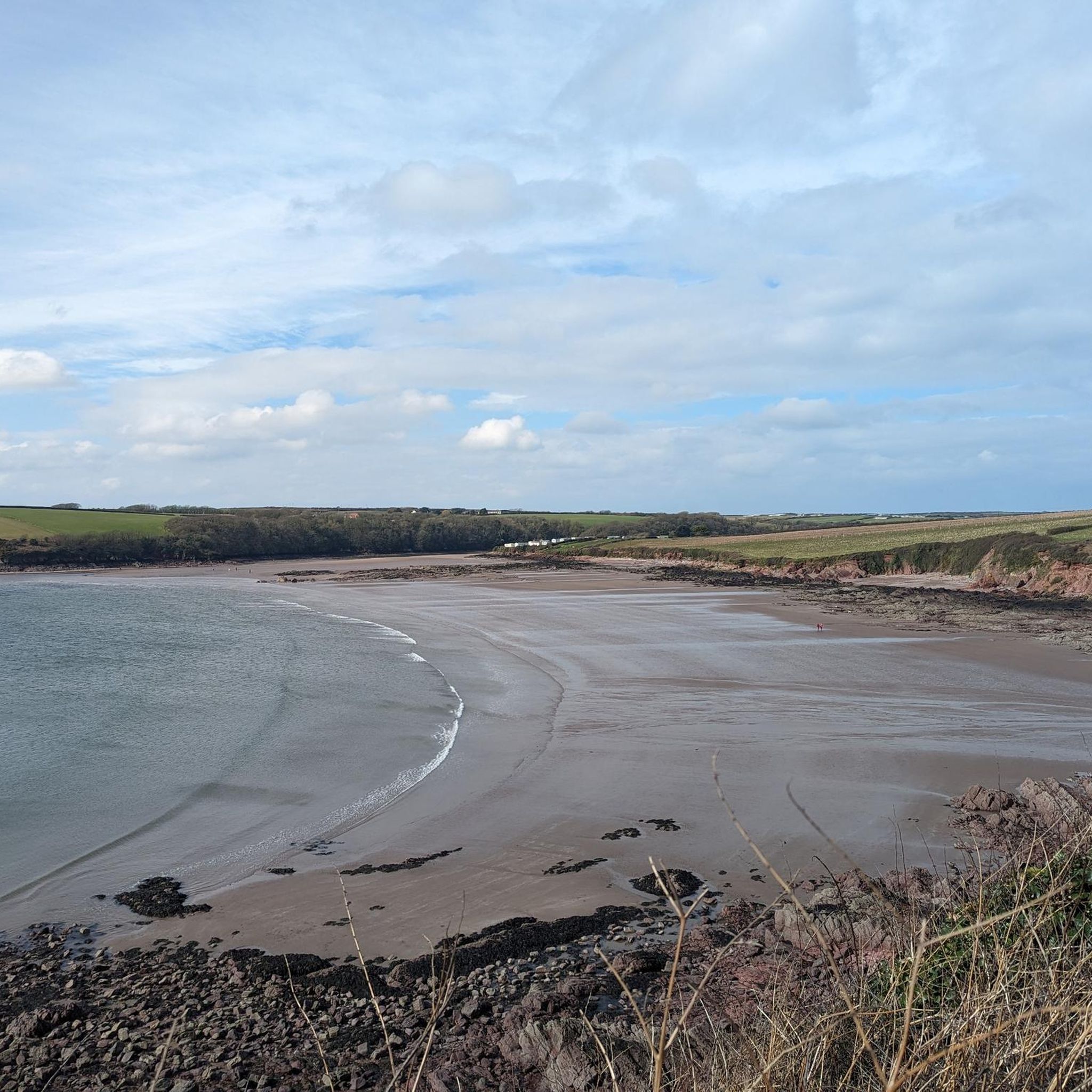
Sandy Haven is a fantastic beach to explore. A huge expanse of around 800m of sand at low tide - yet despite its name is pretty rocky. Loads of rock pools to explore and boulders to climb. Sandy Haven village is along the Sandy Haven Pill, flanked by smoother sand (and mud) and with a boardwalk on which you can cross to the other shore at low tide.
1
0

Especially the names of the ships are great.
0
0
Gelliswick Bay is a sheltered sand and shingle beach close to Milford Haven. The beach is surrounded by cliffs and to the east you can see Fort Hubberston which was built in 1863. If you like watching industry, you can also see across to the jetties that serve some of the worlds largest tankers.
0
0
Frequently Asked Questions
Are the hiking trails around Milford Haven suitable for dogs?
Yes, many trails in the area are great for walking with dogs. The woodland paths, such as those in Goosepill Woods, are local favorites for dog walkers. When on the Pembrokeshire Coast Path, especially near farmland or cliffs, it's recommended to keep your dog on a lead for their safety and to protect wildlife.
What is a good family-friendly walk in the area?
For a shorter, easier walk that's suitable for the whole family, consider the Hubberston Pill loop from Milford Haven. It's a pleasant 2.4-mile (3.9 km) trail that explores local woodland and one of the area's characteristic tidal inlets, taking about an hour to complete.
Are there many circular walks available?
Yes, Milford Haven offers a good selection of circular routes that allow you to start and end in the same place without retracing your steps. A great example is the Gelliswick Bay – St Mary's Church, Herbrandston loop from Herbrandston, which combines coastal views with inland paths.
Can I find woodland walks near Milford Haven?
Absolutely. The landscape is characterized by ancient woodlands lining the tidal creeks, or 'pills'. For a route that specifically explores this scenery, try the Hubberston Pill loop from Steynton. This moderate 5.1-mile (8.2 km) hike takes you through the beautiful woodland surrounding the inlet.
Do I need to worry about tides when hiking?
Yes, paying attention to the tides is crucial for some coastal walks. Certain routes, like the path to Dale, involve tidal crossings such as the one at Sandy Haven Pill. This creek can only be crossed at low tide. Always check a local tide table before you set off to avoid getting cut off or having to take a long detour.
Where can I find a pub or cafe after a hike?
Milford Waterfront is an excellent place to relax after a walk. It's a popular spot with a variety of cafes and restaurants offering views over the marina. It's a perfect place to grab a meal or a drink and is easily accessible from many local trails.
Are there any walks that focus on the town's history?
Yes, for a walk focused on local heritage, you can follow the Milford Haven Heritage Trails. These are a series of three shorter walking routes around the waterfront that explore the themes of the 'Historic Haven', 'Energy Kingdom', and 'Water Ways', detailing the town's rich maritime and industrial past.
What is the hiking like on the Pembrokeshire Coast Path near Milford Haven?
The sections of the Pembrokeshire Coast Path accessible from Milford Haven offer spectacular scenery. The path west towards Dale features grassy clifftops, secluded red sandstone bays, and views of historic forts. The terrain is varied but generally consists of well-trodden paths with some moderate climbs.
Where is a good place for parking to start a walk?
Many walks can be started from Milford Waterfront, which offers parking and is a central hub. For coastal walks heading west, you can often find parking near Gelliswick Bay. It's always a good idea to check for any local parking restrictions, especially during peak season.
What do other hikers enjoy most about the trails around Milford Haven?
The trails are highly regarded by the komoot community. Hikers often praise the unique combination of rugged coastal paths and tranquil woodland trails. The views across the Milford Haven Waterway and the chance to explore the quiet, muddy creeks known as 'pills' are frequently mentioned as highlights.
How many hiking trails are there in the Milford Haven area?
You can find over 150 hiking routes around Milford Haven on komoot. These range from short, easy strolls along the waterfront to more challenging sections of the Pembrokeshire Coast Path, offering plenty of options for all fitness levels.
What kind of scenery can I expect on a coastal walk?
Coastal walks here are defined by the dramatic red sandstone geology, resulting in low cliffs and a series of secluded sandy and shingle bays like Gelliswick Bay and Sandy Haven Beach. You'll also get expansive views across the waterway, one of the world's deepest natural harbors.
Most popular attractions around Milford Haven

Get inspired with the komoot mobile app


Explore more
Browse the best Hikes in other regions.
