The best walks and hikes around Ingol And Tanterton
4.5
(214)
2,948
hikers
228
hikes
Hiking around Ingol And Tanterton offers diverse landscapes, including nature reserves, historic parks, and river paths. The area features a network of green corridors and open spaces, providing varied terrain for outdoor exploration. Trails often follow the River Ribble and connect to larger recreational routes like the Preston Guild Wheel. The region's topography is generally gentle, with minimal elevation changes, making it accessible for various activity levels.
Best hiking trails around Ingol And Tanterton
- The most popular hiking route is Hiking loop from Ashton Community Science College, a 5.0 miles (8.0 km) trail that takes 2 hours 3 minutes to complete. This moderate route explores urban green spaces and local pathways.
- Another top favourite among local hikers is Hiking loop from Our Lady's Catholic High School, an easy 3.4 miles (5.5 km) path. This route offers a pleasant stroll through local residential areas and green spaces.
- Local hikers also love the Preston Docklands loop from St Andrew's Church, a 2.7 miles (4.3 km) trail leading through the historic docklands area, often completed in about 1 hour 7 minutes.
- Hiking around Ingol And Tanterton is defined by nature reserves, Victorian parks, and river paths. The network offers options for different ability levels, from easy strolls to moderate routes.
- The routes in Ingol And Tanterton are highly rated by the komoot community with an average score of 4.4 stars from over 180 reviews. More than 2,800 hikers have used komoot to explore Ingol And Tanterton's varied terrain.
Last updated: June 25, 2026
31
hikers
Easy hike. Great for any fitness level. Easily-accessible paths. Suitable for all skill levels.
4.0
(1)
26
hikers
Easy hike. Great for any fitness level. Easily-accessible paths. Suitable for all skill levels.

Sign up for free
4.3
(4)
167
hikers
Easy hike. Great for any fitness level. Easily-accessible paths. Suitable for all skill levels.
3.5
(2)
8
hikers
Moderate hike. Good fitness required. Easily-accessible paths. Suitable for all skill levels.
14
hikers
Moderate hike. Good fitness required. Easily-accessible paths. Suitable for all skill levels.
Get access to more routes and recommendations from other explorers.
Sign up for free
Already have an account?
Our route recommendations are based on thousands of hikes, rides, and runs completed by other people on komoot.
Start today with a free account
Your next adventure awaits.
Login or Signup
Tips from the Community


Tip5 Alternative Start Points with Parking for the 4 Tours Tour1 The Marina Carpark at Preston Marina The Marina Carpark Position is: 53.761540,-2.738572 Either: Paste the above line into the Google Maps app "Search here" box and then search - click the magnifying glass icon. Or: open your web browser and search for Google Maps 53.761540,-2.738572 Ashton Park Car Parks Link: Ashton Park Highlight https://www.komoot.com/highlight/5137829 Highlight7 on the Tour1 map
0
0
Tip4 Part (a) below explains the use of a split-screen using 2 web browsers. In Part (b), a practical example, you can use either the single web browser or the 2 web browsers method. (a) How To View In Split-Screen on Windows Using Two Web Browsers - example Microsoft Edge and Chrome. This method is similar to and slightly easier than the method in Tip3, part b). Open this highlight in both web browsers on the Windows PC. Their icons will be visible on the Windows taskbar. Then display one browser on the left side of the screen and one on the right. Open this highlight in both web browsers on the Windows PC. Their icons will be visible on the Windows taskbar. Then display one browser on the left side of the screen and one on the right. (b) Practical Use of a Split Screen Use a split screen to practise zooming into and out of a photo in a slide show. Create a split screen on an Android phone. On one half display the instructions in Tip1 on how to Enlarge a Photo in a Slideshow. Use e.g. a Chrome or Firefox browser on the other half to open the slideshow and display photo3 in the Chrome or Firefox browser. Then practise zooming in and out of photo3. Similarly, using a Windows PC and Photo3 practise the Windows PC instructions on how to zoom-in and out.
0
0
Tip3 How To Split-Screen The aim is, for example, to view relevant Tips or Comments alongside a photo or map. Photo4 shows a split-screen (from Tour1) on an Android phone. View photos or the route map on one half and the description on the other half of the screen. Scroll the 2 halves independently to compare a photo with e.g. a description in the Tips or Comments. If using a tablet or mobile, view the description in the website and the photo in the Komoot app - easier to pinch-zoom to see different parts of the photo. Instructions for (a) Android phone (b) Windows PC/Laptop For an iPhone search online for "Harris iPhone split screen" (a) Android Phone Check online for your Android phone. Not all models support split screen. Tap below to start a video - how to use split-screen. On a mobile, view in landscape. https://www.youtube.com/watch?v=zuiKgagO71Y (b) Windows PC/Laptop Easy in Windows 10/11. You can open the same Highlight (or Tour) using 2 web browsers, such as Microsoft Edge and Chrome, one on the left and one on the right of the screen. Or, you can use a single web browser displayed in 2 windows on the left and the right. Use these instructions to practice the technique. The first instructions below use a single web browser, e.g. Microsoft Edge. Using two web browsers is a little easier - see Tip4. 1) On your Windows PC/laptop, maximise the window if not already full-screen. Copy this highlight's Komoot web address. You need to paste it - see below. 2) Opposite-click this browser's tab on the Windows taskbar. That means click the other mouse button. Then click 'Open new window'. When opened, maximise it, paste and open the web address in the new window and scroll to these instructions so that you can continue to follow them. 3) Press and hold the Windows key on the keyboard and press the left arrow key. The active window moves to the left of the split-screen. 4) You should now see the right-hand half of the first window. Click that window to display it 'on top'. These instructions should still be visible in that window. Check that it's full screen. Press and hold the Windows key again and press the right arrow key. 5) The two windows should now display side-by-side. Scroll one window to display the 1st photo and open the slideshow. Scroll the other for the photo descriptions in the Tips. Then display a photo in one half and a corresponding description in the other.
0
0

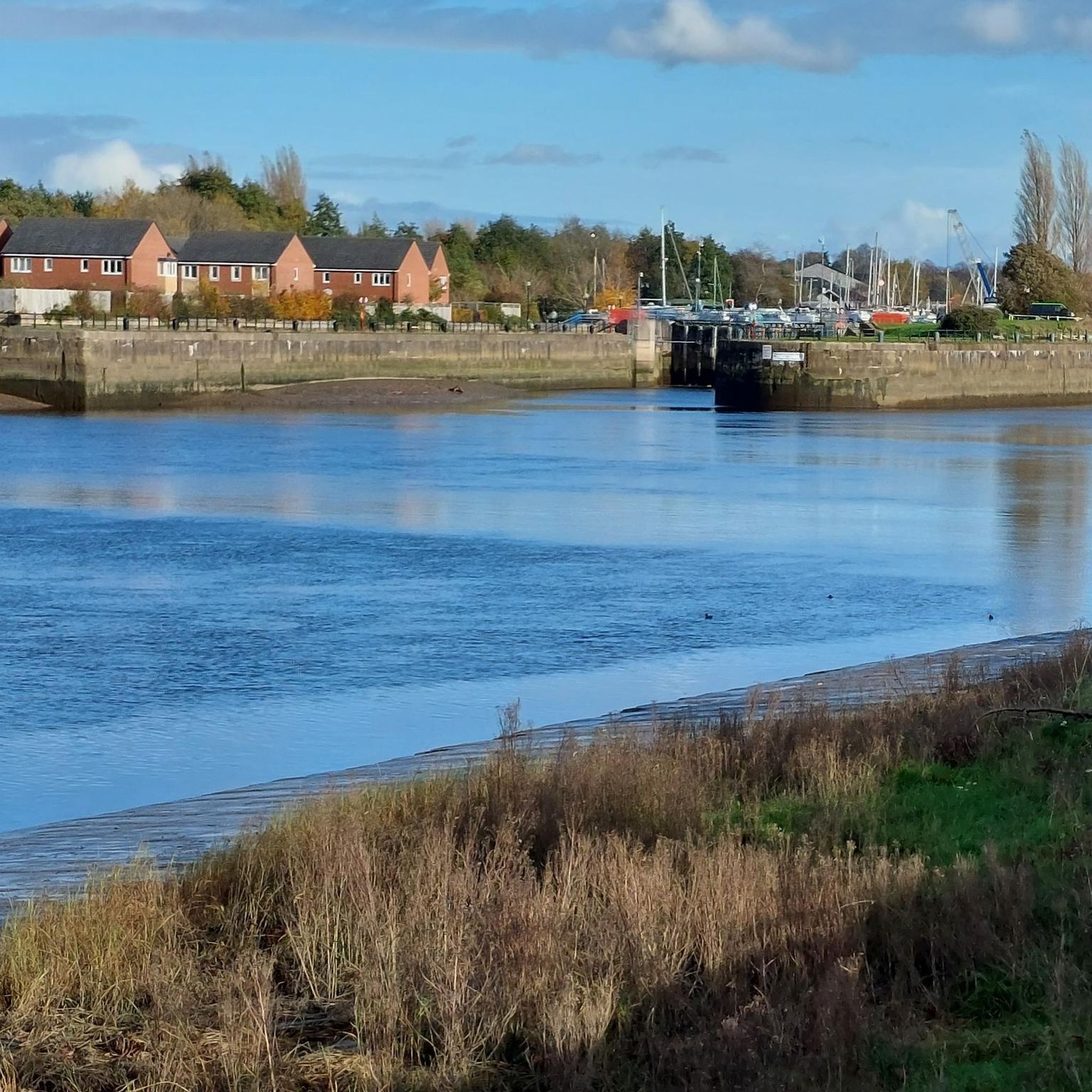
Preston Dock opened in 1892 and, at the time, was the largest single dock in the country. The basin was named after Queen Victoria's first son, Albert Edward the Prince of Wales, due to the Prince laying the dock foundation stone in 1885.
5
0
Tip2 The labelled points, (a), (b), (c) etc on photo3 are used to describe Haslam Park Highlight's segment route through the park, which is followed by Tour1, and optional variations. See the Haslam Park, Preston highlight: www.komoot.com/highlight/3873377 Tour1 starts at point A, the Cottam Lane entrance and carpark - bottom-left of map - photo3. The blue line on photo3 is the route of Tour1 through the park, except for the straight line between points (a) and (e) which doesn't follow a path and is not a cycle route. It simply indicates the direction of travel between (a) and (e). The segment route between those 2 points follows a-b-c-f-d-e, the Tour1 satnav route. You can choose your own route on paths between (a) and (e) - details in the Haslam Park Highlight, although easier to follow the satnav route. Tour1 is called the "Lancaster Canal, Ribble Link, River Ribble, Preston Marina Loop" Link: https://www.komoot.com/tour/610244459 From point (e) on photo3, Tour1 crosses a bridge over Savick Brook, point (h), and enters the Haslam Nature Reserve just before point (i) on the canal. If you park at Bristow Avenue carpark, bottom right on map, then for a tour that starts at Cottam Lane point A you can cycle there via points (b) and (a) so that you can start the navigation at point A. However, that is not necessary for Tour1. You can start at and follow the satnav from Bristow Avenue. The satnav will join the tour at (d) and follow the tour's route d-e-h to the canal at bridge 14, point (i). An alternative Tour1 start, in Ashton Park, follows the eastern edge of Ashton Park north to Cottam Lane. Park at one of Ashton Park's two carparks. Link: https://www.komoot.com/highlight/5137829 From Haslam Park, Tour1 follows the Lancaster Canal to bridge 15 - highlight2 on photo3 - then a part of the Haslam Nature Reserve on dirt tracks, a pleasant section of the Guild Wheel route along the Ribble Link and returns via Preston Marina to your start point.
0
0
Tip2 There are two carparks. The larger carpark, shown on the first photo (a map) labelled P, is just to the left of the Health Centre. The entrance to the park is off Pedders Lane, at the signpost in the 2nd photo labelled Health Centre. The carpark is location 6 on the PDF park map, Ashton Park link 2 above. You can paste the full address (see below) into Google Maps or easier, just the carpark global position. 53.767549,-2.742206 into Google Maps. Using this web browser search: Google Maps 53.767549,-2.742206 Ashton Health Centre, 67-69 Pedders Ln, Ashton-on-Ribble, Preston PR2 1HR The second carpark is at location 13 on the PDF map, near to Ashton House. Entrance off Pedders Lane shown on the 3rd photo, photo3. Grid ref: 53.766330,-2.741237 You may prefer to drive into the park through that Ashton House entrance off Pedders Lane. Google Maps does not show that route. Photo4 shows cars parked near Ashton House.
0
0
Tip1 If you see just Tip1 then click this link: https://www.komoot.com/highlight/5137829 The park is a suitable start-end point for tours, examples: https://www.komoot.com/tour/610244459 https://www.komoot.com/tour/1309854803 There are two carparks in Ashton Park - see Tip2 Ashton Park Links: 1) Website https://www.visitpreston.com/article/3731/Ashton-Park 2) Map https://www.visitpreston.com/media/7409/Ashton-Park-map-PDF/pdf/Ashton-Park-Map.pdf?m=637576465321870000 3) Leaflet https://www.visitpreston.com/media/7410/Ashton-Park-leaflet-PDF/pdf/Ashton-Park-Leaflet.pdf?m=637576465745100000
0
0
Frequently Asked Questions
How many hiking trails are available in Ingol And Tanterton?
There are over 230 hiking routes in Ingol And Tanterton, offering a wide range of options for different preferences and fitness levels. These include easy strolls through green spaces and more moderate paths.
What kind of terrain can I expect on hikes in Ingol And Tanterton?
The hiking trails in Ingol And Tanterton feature diverse landscapes, including nature reserves, historic Victorian parks, and scenic river paths along the River Ribble. You'll find a network of green corridors and open spaces, with generally gentle topography and minimal elevation changes, making it accessible for various activity levels.
Are there easy or family-friendly hiking options in the area?
Yes, Ingol And Tanterton offers many easy and family-friendly routes. Over 120 of the available hikes are rated as easy, perfect for a leisurely stroll with children. These often pass through local green spaces and parks, providing pleasant and accessible outdoor experiences.
What do other hikers enjoy most about hiking in Ingol And Tanterton?
The komoot community highly rates the hiking experience in Ingol And Tanterton, with an average score of 4.4 stars from over 180 reviews. Hikers often praise the area's diverse green spaces, well-maintained paths, and the opportunity to explore both natural reserves and historic parks.
Are there any notable natural attractions or landmarks to see along the hiking trails?
Absolutely. You can explore significant natural attractions like Brockholes Nature Reserve, a haven for wildlife with diverse habitats. The historic Avenham and Miller Parks offer beautifully landscaped gardens and structures like the Miller Park Fountain. You might also encounter the Ribble Link Staircase Locks and the tranquil Haslam Park Nature Reserve.
Can I find circular hiking routes in Ingol And Tanterton?
Yes, many of the routes in Ingol And Tanterton are circular, allowing you to start and end your hike at the same point. An example is the Haslam Park Nature Reserve – Lancaster Canal Towpath loop from University of Lancashire, which offers a scenic round trip.
Are there any dog-friendly trails in Ingol And Tanterton?
Many of the green spaces and public footpaths in Ingol And Tanterton are dog-friendly, making it a great place to hike with your canine companion. Always remember to keep dogs on a lead where required, especially in nature reserves, and clean up after them.
What are some longer hiking options for those seeking a moderate challenge?
For those looking for a moderate challenge, routes like the Hiking loop from Ashton Community Science College, which is about 5 miles (8 km), offer a good workout. Another option is the Lancaster Canal Towpath – Haslam Park Nature Reserve loop from St Michael and All Angels Church, covering over 5.7 miles (9.2 km).
Is there public transport access to the hiking areas in Ingol And Tanterton?
Ingol And Tanterton are well-connected to Preston, which has good public transport links. Local bus services often serve areas close to trailheads and parks, making it possible to access many hiking routes without a car. We recommend checking local bus schedules for specific starting points.
Are there opportunities for wildlife spotting on the trails?
Definitely. Brockholes Nature Reserve is an excellent spot for wildlife enthusiasts, home to diverse birds like wading birds, ospreys, and bitterns, as well as brown hares and roe deer. The various green corridors and nature reserves throughout the area provide habitats for a variety of local flora and fauna.
Can I connect to the Preston Guild Wheel from Ingol And Tanterton?
Yes, Ingol And Tanterton are situated within the vicinity of the Preston Guild Wheel, a 21-mile recreational route. This allows hikers to connect to traffic-free paths that link various green spaces around the city, including Brockholes Nature Reserve, offering extended walking opportunities.
Are there any historical sites or points of interest along the routes?
Beyond the natural beauty, you can discover historical elements. The Victorian-era Avenham and Miller Parks, for instance, feature beautifully preserved gardens and structures. The Ribble Steam Railway is also a nearby point of interest, offering a glimpse into the region's industrial heritage.
Most popular attractions around Ingol And Tanterton

Get inspired with the komoot mobile app


Explore more
Browse the best Hikes in other regions.
