The best walks and hikes around Azerley
4.5
(931)
7,041
hikers
229
hikes
Hikes around Azerley explore the landscape of North Yorkshire, characterized by rolling hills, ancient woodlands, and serene waterways like the River Ure. The region's terrain includes well-defined paths through forests and across open countryside, with routes passing historical sites and reservoirs. The area provides a mix of gentle riverside walks and more extensive circular routes through the Nidderdale Area of Outstanding Natural Beauty.
Best hiking trails around Azerley
- The most popular hiking route is Church of St Andrew and Mowbray Castle loop from Azerley — Nidderdale, a 7.2 mile (11.7 km) trail that takes about 3 hours 5 minutes to complete. This moderate route features historical points of interest including Mowbray Castle.
- Another top favourite among local hiking enthusiasts is River Ure – Hackfall Wood loop from Grewelthorpe, a moderate 8.0 mile (12.8 km) path. The trail follows the River Ure before looping through the historic Hackfall Wood.
- Local hiking enthusiasts also love the Hackfall Forest loop, a 1.9 mile (3.0 km) trail leading through ancient woodland, often completed in about 51 minutes.
- Hiking around Azerley is defined by its ancient woodlands, river valleys, and rolling agricultural hills. The network of paths offers options for different ability levels, from short, easy loops to more moderate circular walks.
- The routes in Azerley are highly rated by the komoot community with an average score of 4.5 stars from over 800 reviews. More than 6,500 hikers have used komoot to explore Azerley's varied terrain.
Last updated: October 4, 2026
4.7
(11)
57
hikers
2.98km
00:51
70m
70m
The Aislabie Walk offers an easy hiking experience through varied scenery, perfect for a quick outing. You will cover 1.9 miles (3.0 km) with a gentle elevation gain of 230 feet (70 metres), taking about 51 minutes to complete. Expect undulating paths winding through woodlands, alongside riverbanks, and across open fields. As you hike, keep an eye out for the serene Hackfall Fountain Pond, a key feature reflecting an 18th-century landscape vision. This route blends natural beauty with historical charm, providing pleasant views of the North Yorkshire countryside.
Before you set out on the Aislabie Walk, be prepared for potentially muddy conditions, especially after rain. It is highly recommended to wear hiking boots or trail shoes with good treads for comfort and safety. The trail includes several stiles you will need to cross. While some wooded sections have narrow paths with steep drops, these are not considered particularly dangerous for hikers. This easy route is accessible for most, making it a good choice for a leisurely walk.
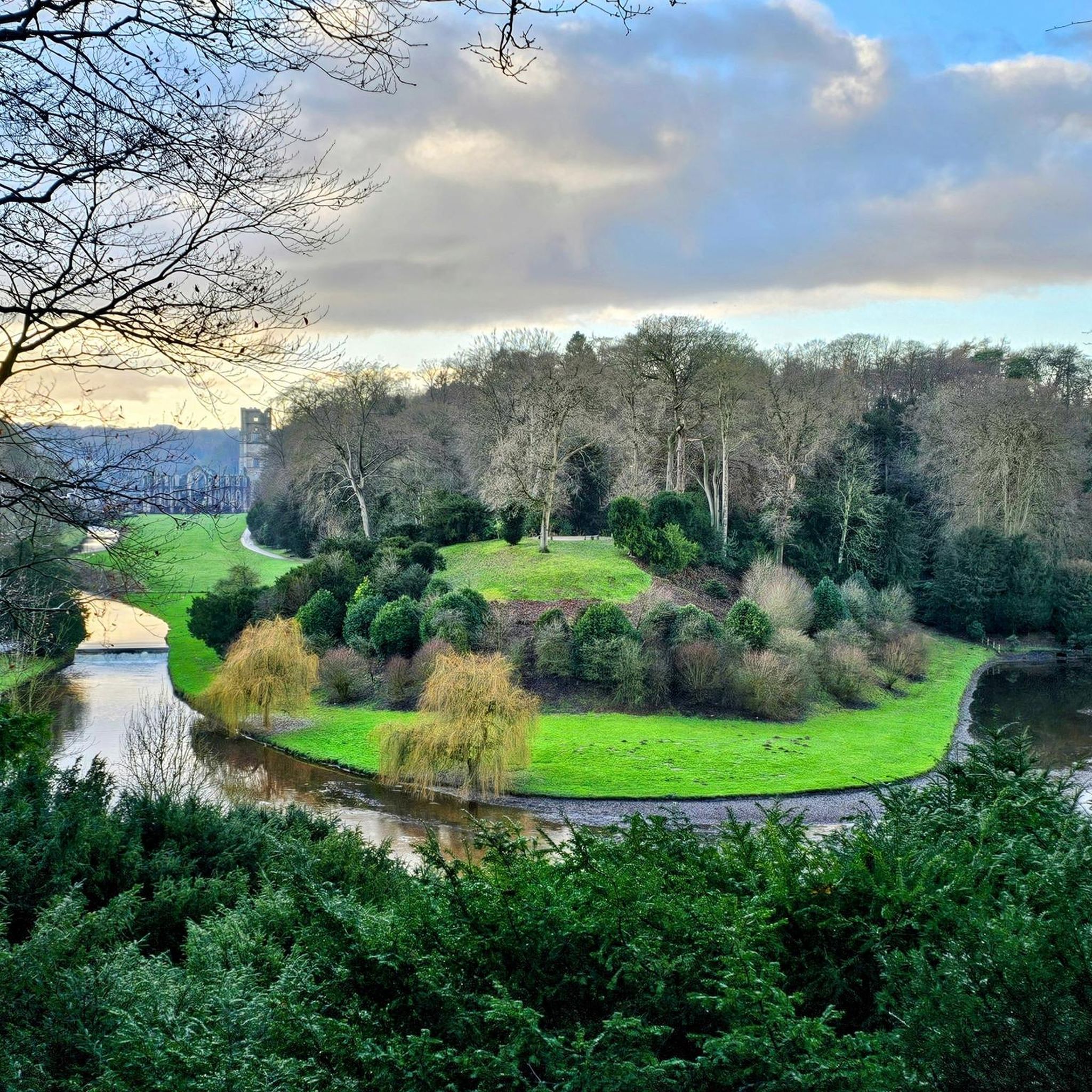
The Aislabie Walk is situated within Hackfall Wood, offering a unique glimpse into a historically significant landscape. You will traverse parts of the Studley Royal Deer Park and explore the valleys of the River Skell and River Laver. The route showcases the 18th-century 'picturesque landscape' vision of William Aislabie, blending natural beauty with rich historical context. It is a notable trail for experiencing the diverse environment of North Yorkshire.
4.2
(6)
20
hikers
11.7km
03:04
110m
110m
Embark on the Church of St Andrew and Mowbray Castle loop from Azerley, a moderate hike through the picturesque Nidderdale AONB. This 7.2-mile (11.7 km) route, with an elevation gain of 346 feet (105 metres), typically takes around 3 hours and 4 minutes to complete. You'll traverse well-defined footpaths and tracks through open fields and ancient woodlands, offering views of rolling hills and serene waterways, including the River Ure. A significant portion of the trail winds through Hackfall Wood, an 18th-century landscape garden where winding paths reveal romantic follies and dramatic viewpoints. Be prepared for some steeper sections and potentially muddy paths, especially within Hackfall Wood, where you'll encounter numerous stiles and steps. The terrain can become rougher in places, featuring craggy woodland flight steps.
For this moderate hike, sturdy hiking boots or trail shoes with good treads are recommended for comfort and stability, particularly given the varied nature of the paths and potential for mud after rain. While much of the route uses well-defined footpaths and bridleways, some sections utilize quiet country roads. Exercise caution on short stretches that use faster roads where there isn't much verge for pedestrians. The numerous stiles and steps, especially within Hackfall Wood, require a good level of fitness.
This loop is notable for its journey through Hackfall Wood, a Grade I listed Historic Garden and Site of Special Scientific Interest (SSSI). Within the wood, you'll discover Mowbray Castle, not a true medieval fortress, but an 18th-century mock ruin or folly designed as an eye-catcher to enhance the picturesque landscape. The wood itself was meticulously landscaped by William Aislabie to create a

5.0
(4)
19
hikers
2.22km
00:38
60m
60m
Explore the easy 1.4-mile (2.2 km) Aislabie Walk through Hackfall Wood, featuring Hackfall Fountain Pond and historic Mowbray Castle.
4.5
(2)
11
hikers
Hard hike. Very good fitness required. Easily-accessible paths. Suitable for all skill levels.
4.4
(13)
81
hikers
12.5km
03:24
170m
180m
Moderate hike. Good fitness required. Easily-accessible paths. Suitable for all skill levels.
Get access to more routes and recommendations from other explorers.
Already have an account?
Our route recommendations are based on thousands of hikes, rides, and runs completed by other people on komoot.
Start today with a free account
Your next adventure awaits.


Tips from the Community

North Gill Beck is a small upland stream forming the northern boundary of Dallowgill. It runs eastwards through enclosed pasture and woodland toward the River Laver. These bridges and and forward are in Pye Carr and Hodgson Wood which are nice and cool on a hot day.
0
0
Lumley Moor was built to release water, not just store it. Victorian waterworks often reduced natural river flow. When towns like Ripon began abstracting water from upland streams, they risked lowering summer flows, affecting mills downstream, killing fish and breaching riparian rights (a big legal issue for Victorians). So water authorities were legally required to put water back into the river to compensate for what they took out. Same as Gouthwaite Reservoir but on a much smaller scale, this is a type of compensation reservoir.
0
0
Very nice place for a pit-stop. The little waterfall created by the drop in the beck bed is unusual, most fords on the Nidderdale moors are flat and featureless crossings.
0
0

Grade II listed bridge that crosses the River Burn
1
0


The River Ure in Yorkshire is about 74 miles (119 km) long from its source to where it joins the River Ouse. It starts near Ure Head on Abbotside Common and joins the Ouse at Cuddy Shaw Reach near Linton-on-Use. Along its meandering journey are numerous well-known beauty spots, including Aysgarth Falls, and it is bordered by plenty of beautiful walking paths, including the Rippon Rowel Walk.
1
1

Masham is a small market town that is built around a large square. It has held a market charter since 1250 and thrived due to the easy access of the flocks of sheep from nearby Fountains and Jervaulx Abbeys. There is still a sheep fair every September where huge numbers of sheep are bought and sold.
0
0
Masham Market Place is one of the largest in England. It has elegant Georgian houses that stand around its periphery and an ancient cross with cobbled area at its centre.
0
0
Frequently Asked Questions
Are there many circular walks starting from Azerley?
Yes, the area around Azerley is well-suited for circular hikes. The network of public footpaths allows for various loops through the rolling hills and agricultural landscapes of North Yorkshire. You can find routes of different lengths and difficulties that begin and end in or near the village.
What are some good family-friendly walks near Azerley?
For an easy and engaging walk with the family, the Hackfall Forest loop is an excellent choice. It's a short, manageable trail of about 3 km through ancient woodland, which is great for keeping younger walkers interested. Another gentle option is the Hackfall Wood Fountain Pond loop, which is even shorter and leads to the scenic Fountain Pond.
Are the hiking trails around Azerley suitable for dogs?
Most trails in the countryside around Azerley are dog-friendly, but it's important to be mindful of the landscape. You'll be walking through farmland with livestock, so keeping your dog on a lead is essential in many areas. The woodlands, such as Hackfall Woods, offer great opportunities for walks, but always check for local signage regarding dogs.
Where can I find a challenging, long-distance hike?
If you're looking for a demanding trek, the Carlesmoor Beck and Lumley Moor Reservoir loop offers a significant challenge. This difficult route covers over 18 km and includes notable elevation gain, taking you through varied terrain including moorland and past reservoirs.
What do other hikers enjoy about the trails in this region?
The trails around Azerley are highly regarded by the komoot community. Hikers often praise the region's serene atmosphere, particularly the walks through ancient woodlands and along the River Ure. The mix of historical sites, like follies in Hackfall Wood, and the natural beauty of the Nidderdale landscape are frequently mentioned as highlights.
Are there any historic walks in the area?
Yes, the region is rich with history. Many routes incorporate historical points of interest. For example, you can find trails that pass by the site of Mowbray Castle and the historic Church of St Andrew. The walks in Hackfall Woods are also famous for their 18th-century follies and water features, blending natural beauty with historical landscaping.
Where can I find good views or scenic spots while hiking?
For impressive scenery, consider a walk that takes you to the Nidd Gorge Viaduct, which offers lovely views over the gorge. The wider Nidderdale National Landscape is a vast area of rolling countryside providing countless opportunities for stunning vistas. Walks around local reservoirs like Leighton Reservoir also provide tranquil and picturesque settings.
What is the terrain like on the walks around Azerley?
The terrain is quite varied. You can expect well-defined paths through woodlands, some of which can be steep and muddy after rain. Other routes cross open fields and rolling hills on grassy tracks and public footpaths. There are also gentle, flat sections along riverbanks, such as by the River Ure.
How many hiking trails are available around Azerley?
There are over 200 hiking routes to explore in the Azerley region. These range from short, easy strolls under an hour to challenging all-day treks, ensuring there's a trail for every fitness level and interest.
Where is the best place to park for walks in Hackfall Woods?
There is a dedicated car park for Hackfall Woods located just outside the village of Grewelthorpe. It's the most convenient starting point for exploring the various trails within the woods. Be aware that it can get busy, especially on weekends.
Are there any pubs on or near the walking routes?
Several villages near the walking trails, such as Grewelthorpe, Kirkby Malzeard, and Masham, have traditional pubs that are popular with walkers. It's a good idea to plan your route to finish in one of these villages if you're hoping for refreshments after your hike.
Most popular attractions around Azerley

Get inspired with the komoot mobile app


Explore more
Browse the best Hikes in other regions.
