The best walks and hikes around East Tanfield
4.5
(632)
5,367
hikers
139
hikes
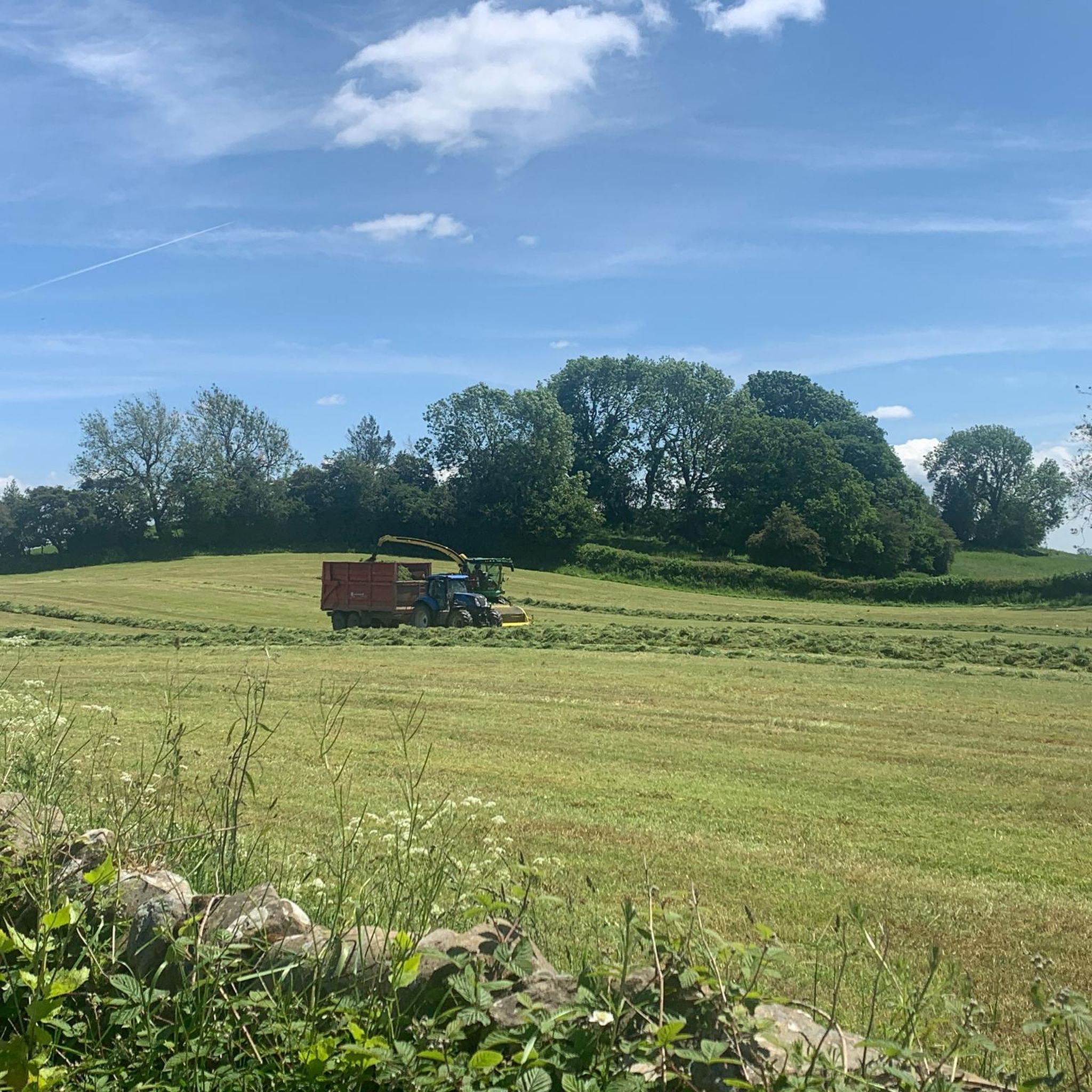
Hikes near East Tanfield explore a landscape of ancient woodlands, riverside paths, and rolling hills. The area is characterized by the meandering River Ure and the designed wilderness of Hackfall Wood, which features follies and waterfalls. Trails often follow public footpaths through a mix of semi-natural forest and open fields.
Best hiking trails around East Tanfield
- The most popular hiking route is the Hackfall Forest loop, a 1.9 mile (3.0 km) trail that takes about 50 minutes to complete. This easy route explores the notable 18th-century designed landscape of Hackfall Wood.
- Another top favourite among local hiking enthusiasts is the River Ure – Hackfall Wood loop from Grewelthorpe, a moderate 8.0 mile (12.8 km) path. The route combines quiet riverside sections along the River Ure with trails through the woods.
- Local hiking enthusiasts also love the Church of St Andrew and Mowbray Castle loop from Azerley — Nidderdale, a 7.2 mile (11.7 km) trail leading through fields and woodland, often completed in about 3 hours.
- Hiking around East Tanfield is defined by ancient woodlands, riverside walks along the River Ure, and paths leading to historic follies. The network of trails provides options for both short, easy walks and longer, more moderate hikes.
- The routes in East Tanfield are highly rated by the komoot community with an average score of 4.4 stars from over 500 reviews. More than 4,900 hikers have used komoot to explore East Tanfield's varied terrain.
Last updated: September 28, 2026
4.7
(11)
57
hikers
2.98km
00:51
70m
70m
Easy hike. Great for any fitness level. Easily-accessible paths. Suitable for all skill levels.
4.2
(6)
20
hikers
11.7km
03:04
110m
110m
Moderate hike. Good fitness required. Easily-accessible paths. Suitable for all skill levels.

5.0
(4)
19
hikers
2.22km
00:38
60m
60m
Easy hike. Great for any fitness level. Easily-accessible paths. Suitable for all skill levels.
4.4
(13)
81
hikers
12.5km
03:24
170m
180m
Moderate hike. Good fitness required. Easily-accessible paths. Suitable for all skill levels.
5.0
(7)
31
hikers
12.7km
03:20
100m
100m
Moderate hike. Good fitness required. Easily-accessible paths. Suitable for all skill levels.
Get access to more routes and recommendations from other explorers.
Already have an account?
Our route recommendations are based on thousands of hikes, rides, and runs completed by other people on komoot.
Start today with a free account
Your next adventure awaits.



Tips from the Community

Good pub grub. It has a nice beer garden at the rear that’s set close to the River Ure
0
0
Grade II listed bridge that crosses the River Burn
1
0

For a serene experience along the Riverside Path, consider visiting during the early morning hours, around 4 am. At this time, the River Thames is often exceptionally calm, reflecting the city lights like a mirror, offering a unique and tranquil perspective of the surroundings. [1] https://wanderlog.com/place/details/1748893/riverside-walk-gardens
0
0


The River Ure flows down Wensleydale past the town of Hawes, past Aysgarth and then the market town of Middleham. The Ure is approximately 119 km (74 miles) long from its source to the point where it changes its name to the River Ouse
0
0
West Tanfield is a village located near the River Ure in North Yorkshire. It is in a picturesque location and is renowned for its historical sites, including the Marmion Tower, a 15th-century gatehouse that belonged to a large manor house. The village has traditional stone houses and well-preserved architectural sites.
0
0
The Bull Inn is a 17th century historic pub on the banks of the River Ure in WestTanfield.
0
0
The church was built in 1841, funded by the family of Colonel Dalton, of Sleningford Park. It is in the Early English style, and was Grade II listed in 1986
0
0
Frequently Asked Questions
Are there any easy, family-friendly walks in the Tanfield area?
Yes, the region offers many options for families. The Hackfall Forest loop is a short walk of under 2 miles through a magical woodland with follies and small waterfalls to discover, making it great for keeping children engaged.
Can I take my dog on the hiking trails?
Many trails in the Tanfield area are suitable for dogs, but they should be kept under control, especially near farmland and wildlife reserves. In Hackfall Wood, dogs are welcome but must be kept on a lead to protect the sensitive habitat and ground-nesting birds.
Where can I find a good circular walk?
Circular routes are very common here. For a longer day out, consider the River Ure – Hackfall Wood loop from Grewelthorpe. This 8-mile trail combines peaceful riverside paths with the scenic woodlands of Hackfall.
What are the parking options for hikes near Tanfield?
Parking availability varies by trail. For walks exploring Hackfall Wood, there is a dedicated car park. For trails in County Durham, such as those around Tanfield Lea Marshes, parking is available at the old East Tanfield Station carpark.
Are there any walks with historical points of interest?
Definitely. The area is rich in history. The Church of St Andrew and Mowbray Castle loop from Azerley — Nidderdale is a great example, taking you past Mowbray Castle, a romantic 18th-century folly. Many walks from West Tanfield also pass the 15th-century Marmion Tower.
Can I find a trail with waterfalls?
Yes, the best place to see waterfalls is within Hackfall Wood. This 18th-century designed landscape was created with cascades and water features. The Hackfall Wood Fountain Pond loop — Nidderdale is a short route specifically designed to take in these beautiful features.
What kind of difficulty should I expect from the hikes?
The trails around Tanfield cater to a range of abilities. You'll find a large number of easy walks, perfect for a gentle stroll, as well as many moderate routes that involve more distance and some gentle climbs. There are very few technically difficult hikes in the immediate area.
Are there any walks along the river?
The River Ure provides a beautiful backdrop for many walks. A significant portion of the Ripon Rowel Trail follows the river near West Tanfield, offering gentle paths through fields and villages. The Hackfall Wood – View of the River Ure Valley loop from Grewelthorpe provides excellent elevated views of the river valley.
How many hiking trails are there around East Tanfield?
There are nearly 150 hiking routes to explore around East Tanfield. The network of trails covers everything from short woodland loops and riverside rambles to more substantial countryside circuits.
What do other hikers think of the trails in this region?
The area is highly regarded by the komoot community, with an average rating of 4.4 stars. Hikers often praise the romantic, wild feeling of Hackfall Wood and the peaceful, scenic paths along the River Ure.
Are there any nature reserves I can visit on a walk?
Yes, the Tanfield Lea Marshes Local Nature Reserve in County Durham offers trails through diverse wetland and woodland habitats. Near West Tanfield, you can also find the Nosterfield Nature Reserve, a popular spot for bird watchers with several well-maintained hides.
Most popular attractions around East Tanfield

Get inspired with the komoot mobile app


Explore more
Browse the best Hikes in other regions.
