The best running trails around Hothersall
4.2
(32)
4,646
runners
338
runs
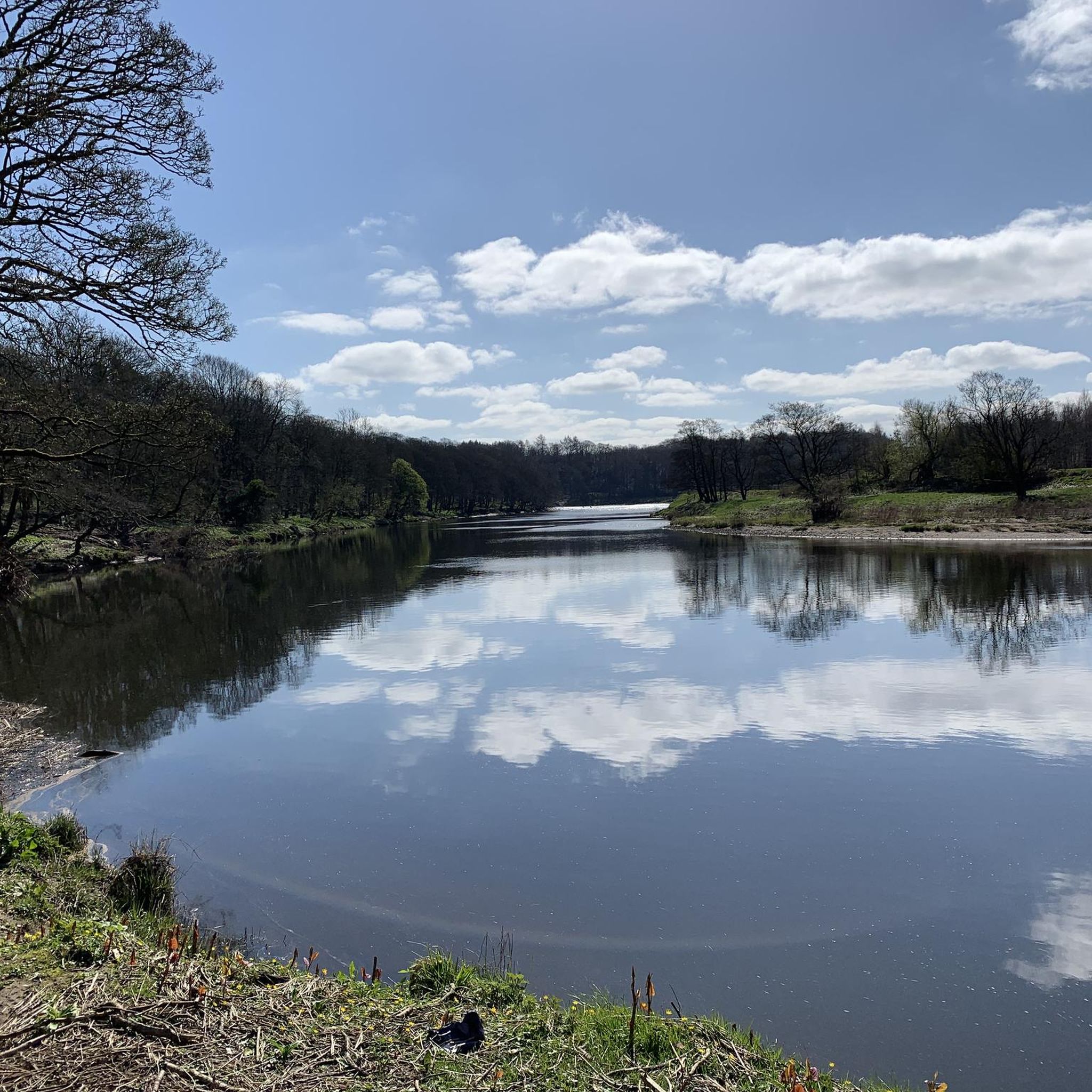
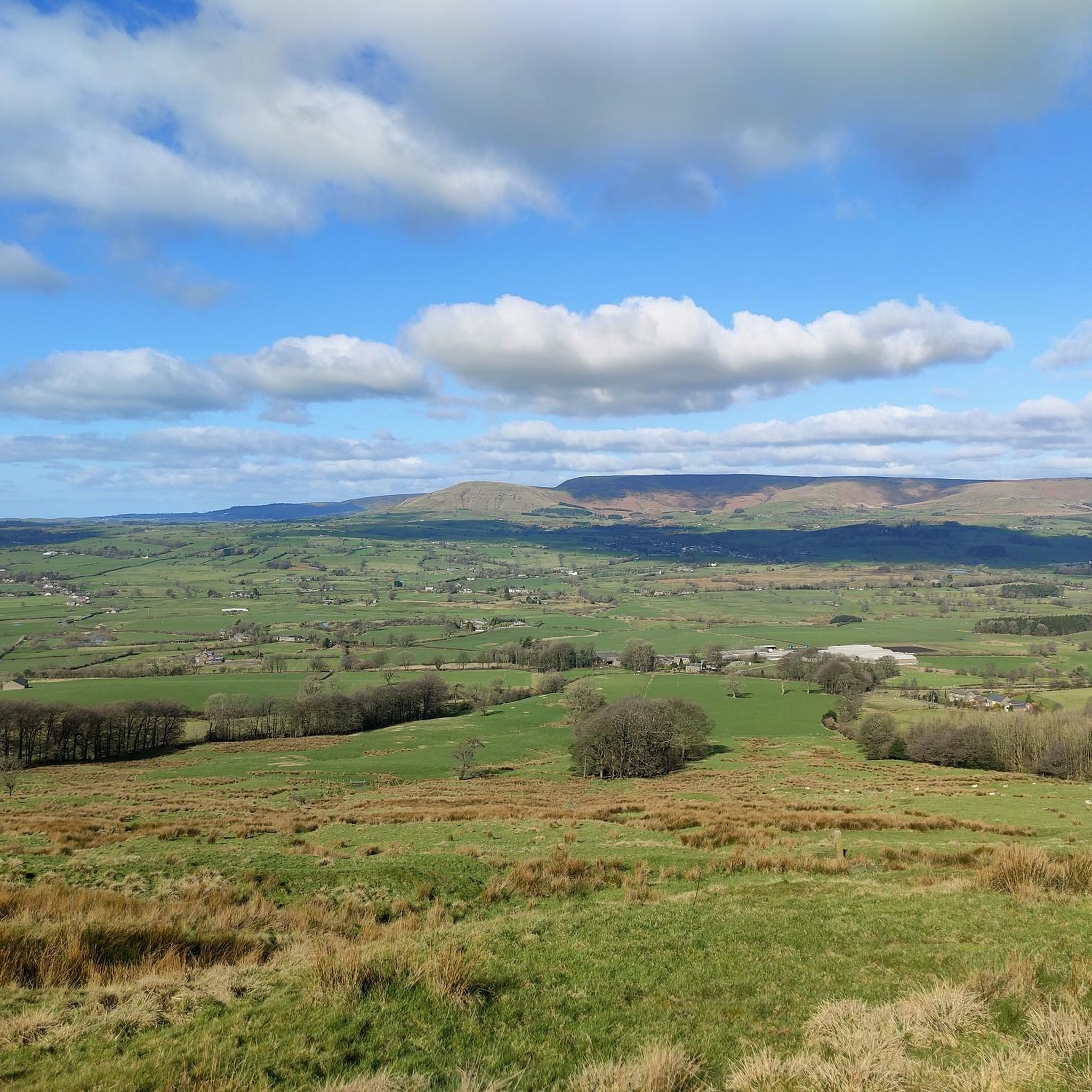
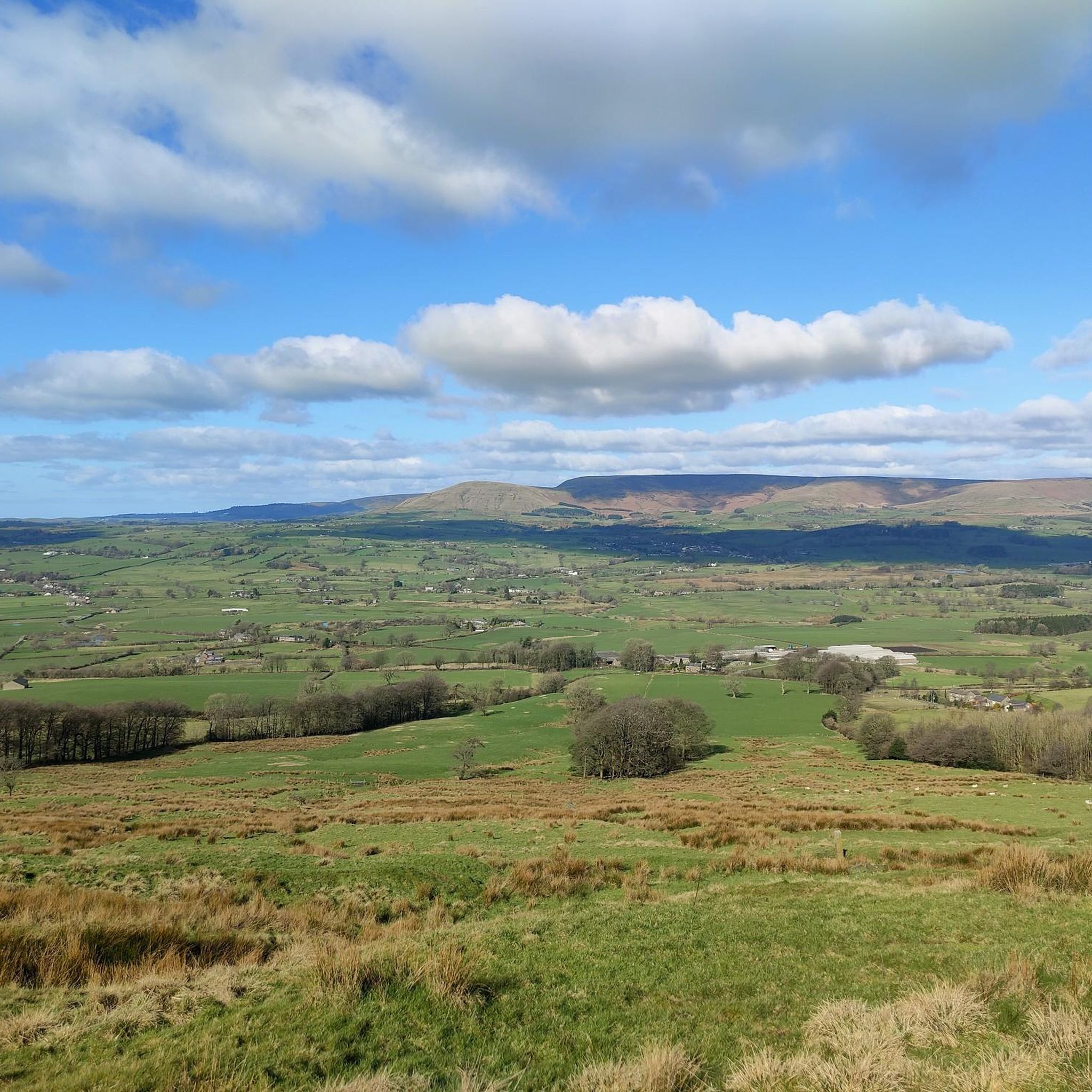
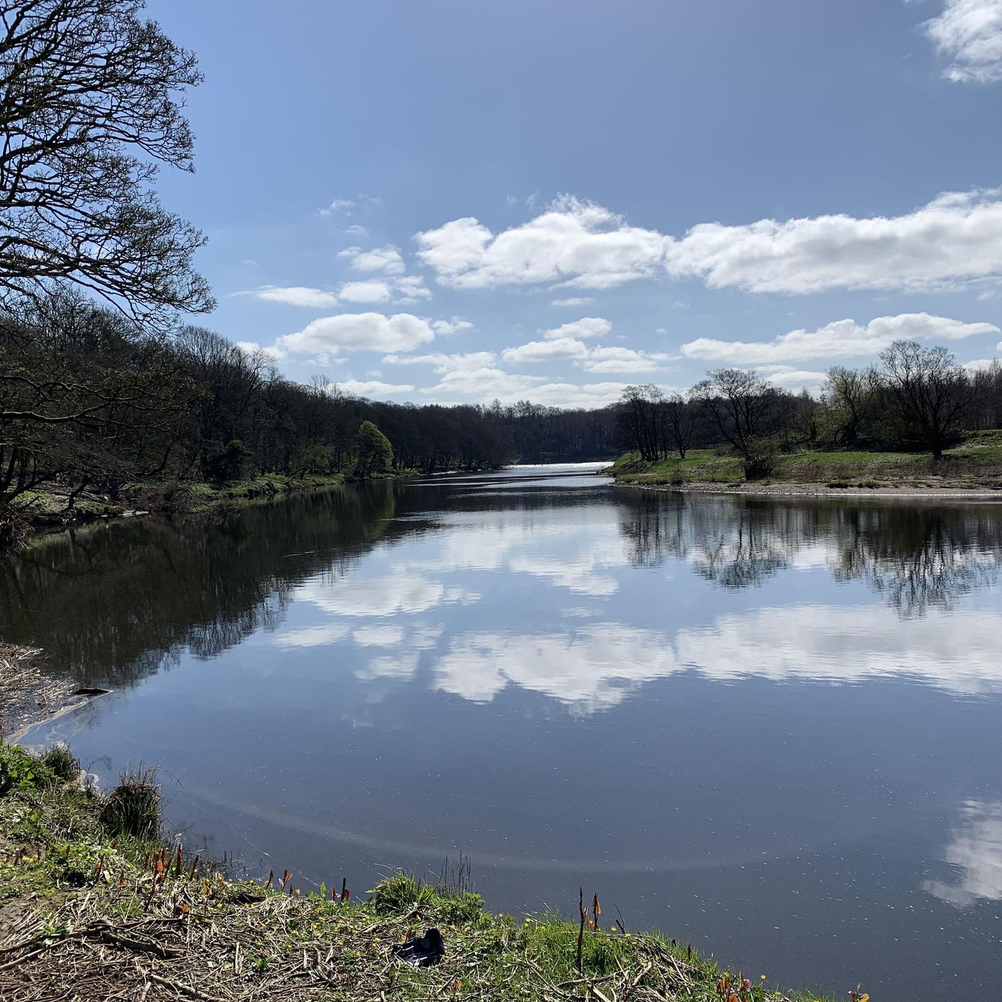
Jogging routes around Hothersall are set within Lancashire's Ribble Valley, offering diverse natural features for outdoor enthusiasts. The area is characterized by the River Ribble, which provides riverside paths, and is surrounded by woodlands and agricultural fields. Elevated sections offer views of the Ribble Valley and distant fells, while bridleways and quiet lanes contribute to a varied running experience.
Best jogging routes around Hothersall
- The most popular jogging route is Derby Arms loop from Longridge, a 4.8 miles (7.7…
Last updated: May 24, 2026
4.0
(1)
9
runners
7.72km
00:50
100m
100m
Moderate run. Good fitness required. Mostly paved surfaces. Suitable for all skill levels.
9
runners
17.9km
01:55
260m
260m
Hard run. Very good fitness required. Mostly paved surfaces. Suitable for all skill levels.

Sign up for free
11
runners
5.08km
00:32
30m
30m
Moderate run. Good fitness required. Mostly paved surfaces. Suitable for all skill levels.
4.0
(1)
7
runners
16.6km
01:44
130m
130m
Hard run. Very good fitness required. Mostly paved surfaces. Suitable for all skill levels.
4.0
(1)
10
runners
8.39km
00:53
60m
60m
Moderate run. Good fitness required. Mostly paved surfaces. Suitable for all skill levels.
Get access to more routes and recommendations from other explorers.
Sign up for free
Already have an account?
Our route recommendations are based on thousands of hikes, rides, and runs completed by other people on komoot.
Start today with a free account
Your next adventure awaits.
Login or Signup
Tips from the Community

Quirky Cafe, well worth a stop for the great food and surroundings.
0
0

A cycle along this smooth, tarmacked road offers stunning panoramic views of the surrounding landscape within the Forest of Bowland National Landscape.
1
0

Amazing place enjoyed the scenery but climbs was a little tough
1
0
The Forest of Bowland National Landscape covers 312 square miles of rural Lancashire and adjacent Yorkshire. From Hurst Green in the south to Wennington in the North, the Forest of Bowland is dotted with charming stone villages, some of which date as far back as pre-historic times. It took me breath away when I saw the views here
3
0

The viewpoint on Jeffrey Hill is at 262m. Great views north onto the Forest of Bowland and west out over Morecombe Bay. If you ride up to the higher point on the road to the southeast you can also see across to Pendle Hill. The road up to this point from the north is hard work but the climb isn't long. Descending from here is great.
1
0

Stop here. Landlady Charlotte (like most Charlottes) is an utterly delightful and generous human. One way or another I intend to return. Oh, and great beer and good too!
0
0

This is a really tough climb from the North. Very steep and long, although you can ry and distract yourself with the amazing view back down into Bowland.
1
0

Fantastic for a mid ride stop.. great coffee, great food.. a must!!!
0
0
Frequently Asked Questions
How many running routes are available around Hothersall?
Hothersall offers a wide variety of running routes, with over 360 trails documented on komoot. These range from easy jogs to more challenging runs, ensuring options for all fitness levels.
What kind of terrain can I expect on running trails in Hothersall?
The running trails in Hothersall feature diverse terrain. You'll find pleasant riverside paths along the River Ribble, tranquil routes through woodlands and agricultural fields, and quiet country lanes. Elevated sections also provide expansive views across the Ribble Valley and distant fells.
Are there running routes that offer scenic views in Hothersall?
Absolutely. Many routes in Hothersall provide stunning vistas. For example, the difficult Ribchester Arms – View from Jeffrey Hill loop from Ribchester offers expansive views across the Ribble Valley. You can also find viewpoints like View of the Forest of Bowland from Jeffrey Hill and Trig point at Longridge Fell summit along various trails.
Are there any historical landmarks or points of interest I can see while jogging?
Yes, Hothersall's routes often pass by points of interest. You might encounter Hothersall Hall, a historic building situated along the River Ribble, adding a cultural element to your run. The area also features natural monuments like the Confluence of the Rivers Calder and Ribble.
Are the running trails in Hothersall suitable for families?
Hothersall offers several routes suitable for families, particularly those that follow the flatter riverside paths or quiet lanes through fields. These easier trails provide a gentle introduction to running in the countryside, allowing families to enjoy the natural environment together.
Are the running routes in Hothersall dog-friendly?
Many of Hothersall's running routes are dog-friendly, especially those on public footpaths, bridleways, and quiet country lanes. However, always keep dogs under control, particularly when passing through agricultural land with livestock, and be mindful of local signage and regulations.
Are there options for shorter or longer runs in Hothersall?
Yes, Hothersall caters to various distances. You can find shorter loops like the Running loop from Longridge, which is 3.4 miles (5.4 km). For longer, more challenging runs, consider routes such as the The Dog Inn – Derby Arms loop from Longridge, spanning over 10 miles (16 km).
What do other runners enjoy most about jogging in Hothersall?
The komoot community highly rates the running experience in Hothersall, with an average score of 4.2 stars from over 30 reviews. Runners frequently praise the diverse scenery, from tranquil woodlands to open fields, and the well-established network of paths that offer varied and enjoyable routes.
Is there parking available near the running routes in Hothersall?
While specific parking facilities vary by starting point, Hothersall and its surrounding villages often have public car parks or on-street parking available. Many routes also utilize quiet country lanes where roadside parking might be an option, but always check local restrictions.
Can I find circular running routes in the Hothersall area?
Yes, Hothersall is well-suited for circular running routes. Many trails are designed as loops, allowing you to start and finish at the same point. For instance, the Derby Arms loop from Longridge is a popular circular option.
What are the typical trail conditions like, especially after rain?
Given Hothersall's rural setting with woodlands and agricultural fields, some trails, particularly those on natural surfaces, can become muddy after heavy rain. Routes along the River Ribble or on paved country lanes tend to remain firmer. It's always advisable to wear appropriate footwear, especially during wetter seasons.
Most popular routes around Hothersall
Most popular attractions around Hothersall

Get inspired with the komoot mobile app


Explore more
Browse the best Running Trails & Routes in other regions.
