Blawith And Subberthwaite
Blawith And Subberthwaite
The best mountain hikes around Blawith And Subberthwaite
5.0
(1)
10
hikers
1
hike
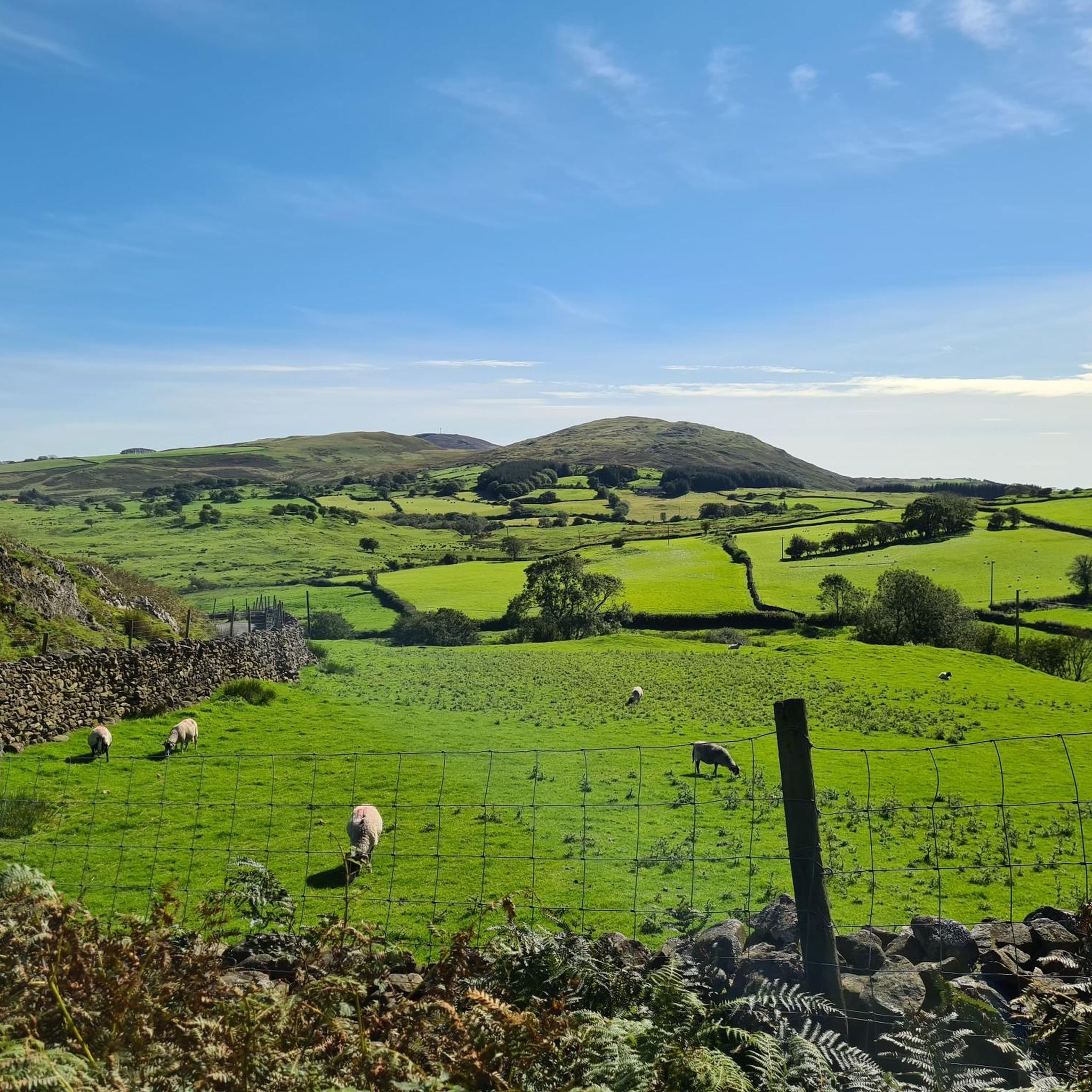
Mountaineering routes around Blawith And Subberthwaite are situated within the Lake District National Park, offering diverse and dramatic landscapes. The region is characterized by prominent fells like the Coniston Fells, rugged crags, expansive fellside, and numerous tarns and woodlands. This area provides access to both challenging ascents and varied terrain for mountaineering.
Best mountaineering routes around Blawith And Subberthwaite
- The most popular mountaineering route is Coniston Waterfall – Old Man of Coniston summit loop from Coniston, a 6.5 miles…
Last updated: July 3, 2026
5.0
(1)
6
hikers
10.5km
04:18
700m
700m
Moderate mountaineering route. Good fitness required. Mostly accessible paths. Sure-footedness required.
2
hikers
11.7km
04:42
890m
890m
Moderate mountaineering route. Good fitness required. Easily-accessible paths. Suitable for all skill levels.

Sign up for free
2
hikers
7.26km
03:10
590m
590m
Moderate mountaineering route. Good fitness required. Mostly accessible paths. Sure-footedness required.
Our route recommendations are based on thousands of hikes, rides, and runs completed by other people on komoot.
Start today with a free account
Your next adventure awaits.
Login or Signup
Popular around Blawith And Subberthwaite

Tips from the Community

To describe this mountain, here is a quote: "Although cruelly scarred and disfigured by the quarries, the Old Man has retained a dignified bearing and still lifts his proud and venerable head to the sky. His tears flow quietly into Low Water and Goats Water, two beautiful mountain tarns, whence they eventually... find their way to Coniston Water, bathing his ancient feet." Alfred Wainwright, "A Pictorial Guide to the Lakeland Fells, Book Four: The Southern Fells"
5
0
A beautiful waterfall, but difficult to view in the summer due to dense vegetation.
7
0

Very much one of the iconic mountains of the Lake District, Wetherlam is a rugged 763-metre (2,502 ft) mountain top, and getting here is pretty hard work from any direction. It has a rocky summit plateau, and the views across towards the Coniston group are super nice. Now for the big decent!
0
0
Coming to Swirl How from Great Carr is an easy affair; getting to it from Wetherlam is a different matter. If you come in from that direction, you are in for a good scramble on the 'Prison Band' section of the approach. To be honest, I would rather come up it than down it, as it looked like a fun scramble. There is a decent cairn on the top of Swirl How, and the views across to Wetherlam are great.
0
0
It is a nice walk to get to Great Carrs from Grey Friar, not too stiff at all, and the views across to Swirl How are great. The top is a bit of a rocky affair, and if you are on the way across to Swirl How it is nearly within throwing distance from here.
0
0

On a clear day, the views are spectacular from up here.
0
0

With a summit height of 2,502 feet (763 m), Wetherlam offers a truly rewarding hiking experience amidst the stunning mountain scenery of the Lake District. From the top, enjoy expansive views of the Coniston Fells, Little Langdale, and the picturesque patchwork of green valleys that give the region its timeless charm. https://www.tellpopeyes.it.com
0
0
This is the route you take to go up Coniston Old Man from Low Water. The path takes you up a series of sharp and steep zigzags, and as you reach the top, you hang a right along the ridge to the trig point and the nearby summit cairn. It is a great route to get to the top with fantastic views.
1
0
Frequently Asked Questions
What kind of mountaineering routes can I expect around Blawith And Subberthwaite?
The region offers a diverse range of mountaineering experiences, from challenging ascents to more moderate rambles. You'll find prominent fells like the Coniston Fells, rugged crags, expansive fellside, and numerous tarns and woodlands. The routes cater to various abilities, with options for both moderate ascents and more demanding mountain days.
Are there any circular mountaineering routes in the area?
Yes, several routes offer circular options. For instance, the Coniston Waterfall – Old Man of Coniston summit loop from Coniston is a popular circular trail featuring well-defined paths and historical quarry remnants. Another option is the Wetherlam loop from Holme Fell, which takes you through rugged crags and expansive fellside.
What are some notable peaks or landmarks to see on a mountaineering trip here?
The area is rich with impressive fells and natural features. You can reach the Old Man of Coniston summit, known for its historical slate quarrying. Other significant peaks include Wetherlam Summit, offering views across the Scafell massif, and Swirl How, which provides excellent vistas and a sense of solitude. Brim Fell summit is also part of the Coniston Fells ridge.
Are there any routes suitable for beginners or those looking for an easier mountaineering experience?
While many routes involve significant elevation, some sections or shorter loops can be more accessible. The region offers a range of difficulties, and while specific 'easy mountaineering' routes are not explicitly highlighted, the overall network includes options for different ability levels. Always check the route details for elevation and distance to match your experience.
What do other mountaineers enjoy most about the routes in Blawith And Subberthwaite?
The area is highly rated by the komoot community, with an average score of 5.0 stars. Reviewers often praise the varied terrain, the dramatic landscapes, and the opportunities to explore prominent fells and historical sites. The well-defined paths on popular routes like the Old Man of Coniston are also frequently appreciated.
Can I find routes that offer long-distance mountaineering challenges?
Yes, you can combine routes or choose longer loops for a more extended mountaineering experience. For example, the Wetherlam – Summit of Swirl How loop from Holme Fell is a moderate 7.2-mile (11.5 km) path that offers significant elevation gain and expansive views, making it suitable for a longer day out.
What is the best time of year for mountaineering in this region?
The Lake District, including Blawith and Subberthwaite, is beautiful year-round. However, for mountaineering, late spring to early autumn (May to October) generally offers the most favorable weather conditions with longer daylight hours and less chance of snow or ice on higher fells. Winter mountaineering is possible but requires appropriate gear and experience due to potentially harsh conditions.
Are there opportunities for scrambling on these routes?
Yes, the region offers opportunities for scrambling. Peaks like Harter Fell (though not directly on the listed routes) are known for short scrambles to their summits. The Coniston Fells, including Swirl How, also feature enjoyable run/scrambles along sections like Swirl Band and Prison Band, adding an element of challenge for experienced mountaineers.
Are there any wild swimming spots near the mountaineering routes?
While specific wild swimming spots directly on the mountaineering routes are not detailed, the region is known for its tarns and lakes. Coniston Water, located about a mile and a half north of Blawith, offers opportunities for water-based activities, and high tarns are often found on the fells, which might be suitable for a refreshing dip on a warm day.
What are the typical durations for mountaineering routes in Blawith And Subberthwaite?
Route durations vary depending on distance, elevation, and your pace. For example, the Coniston Waterfall – Old Man of Coniston summit loop from Coniston typically takes around 4 hours 18 minutes. Shorter loops, like the Wetherlam loop from Holme Fell, can be completed in about 3 hours 7 minutes, while longer routes such as the Wetherlam – Summit of Swirl How loop from Holme Fell might take closer to 4 hours 40 minutes.
Is public transport available to access the mountaineering trails?
The Lake District National Park has public transport options, including buses, that serve various villages and trailheads. While specific public transport links for every trailhead in Blawith and Subberthwaite are not detailed here, it's advisable to check local bus schedules for services to Coniston or other nearby villages, which often serve as starting points for these routes.
Are there any cafes or places to eat near the mountaineering trails?
The villages surrounding the mountaineering areas, such as Coniston, typically offer cafes, pubs, and other eateries where you can refuel before or after your hike. It's a good idea to check opening times, especially outside of peak season.
Most popular routes around Blawith And Subberthwaite
Most popular attractions around Blawith And Subberthwaite

Get inspired with the komoot mobile app


Explore more
Browse the best Mountain Hikes & Routes in other regions.
