The best cycling routes around Gilcrux
4.6
(115)
1,907
riders
157
rides
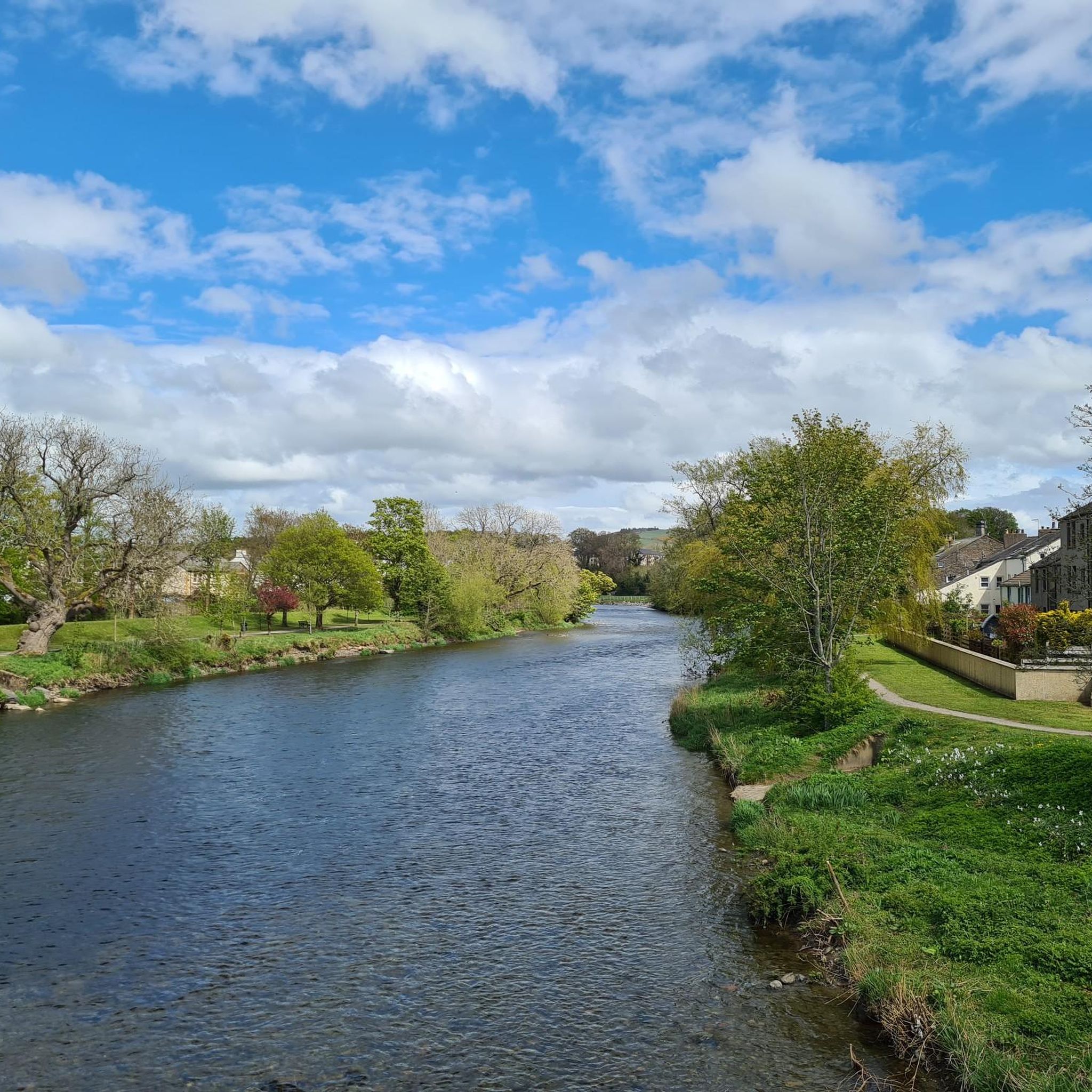
Touring cycling around Gilcrux offers access to diverse landscapes on the fringe of the Lake District National Park. The area features gently undulating countryside extending towards the Solway Coast, providing scenic views and varied terrain. The village itself is situated on the south bank of the River Ellen, surrounded by fertile soil and abundant greenery. Cyclists can explore routes that combine coastal vistas with the peaceful environment of local streams and woodlands.
Best touring cycling routes around Gilcrux
- The most…
Last updated: June 26, 2026
6
riders
35.1km
02:12
270m
270m
Moderate bike ride. Good fitness required. Mostly paved surfaces. Suitable for all skill levels.
6
riders
Moderate bike ride. Good fitness required. Mostly paved surfaces. Suitable for all skill levels.

Sign up for free
3.8
(4)
11
riders
14.5km
00:57
110m
110m
Easy bike ride. Great for any fitness level. Mostly paved surfaces. Suitable for all skill levels.
4
riders
5.42km
00:22
80m
80m
Easy bike ride. Great for any fitness level. Mostly paved surfaces. Suitable for all skill levels.
5.0
(1)
3
riders
31.0km
01:56
250m
250m
Moderate bike ride. Good fitness required. Mostly paved surfaces. Suitable for all skill levels.
Get access to more routes and recommendations from other explorers.
Sign up for free
Already have an account?
Our route recommendations are based on thousands of hikes, rides, and runs completed by other people on komoot.
Start today with a free account
Your next adventure awaits.
Login or Signup

Tips from the Community

Allonby Beach is a vast sand and shingle beach on the Solway Firth, known for its panoramic views, shallow tidal pools, and rich birdlife. Located along the B5300, the beach is a popular stop on the Solway Coast Cycleway. Historically, Allonby was a fishing village with Quaker influences, evident in buildings like the Reading Rooms and North Lodge. Today, the beach is popular with walkers, kitesurfers, and heritage seekers, with views across to southern Scotland and, on a clear day, the Isle of Man. It is part of the Solway Coast Area of Outstanding Natural Beauty and borders the environmentally protected Allonby Bay.
8
0
The Solway Coast Cycleway winds along the Solway Firth coast between Maryport and Carlisle, and is one of the most accessible and visually appealing sections of Hadrian's Cycleway. The route largely follows the B5300 and offers panoramic views across the Irish Sea, with views of southern Scotland and the Isle of Man on a clear day.
7
0
Plus, super friendly people and a warm welcome. Don't miss it.
9
0
Located on Blue Dial Farm, The Moody Cow is a fourth-generation family farm committed to regenerative agriculture and soil health. A 24/7 vending machine allows visitors to purchase fresh, non-homogenized milk—straight from the cow, with the cream still on top. The adjacent Moo Hall, a cozy retreat overlooking grazing cows and the coastal landscape, also offers milkshakes, smoothies, local vegetables, and eggs. Combining agricultural authenticity with hospitality and sustainability, the site is within walking distance of Roman remains and the Solway Coast.
9
0
In 2024, artist Alan Roper created a striking series of murals and artistic panels as part of the redevelopment of Maryport's town center. His work adorns the new signage and lampposts along Senhouse Street and the route from the train station. The designs combine elements from Maryport's history—such as the lighthouse, the Steamship VIC 96, Christ Church, and the Golden Lion Hotel—with a stylized letter "M" subtly incorporated into each image. Roper's style plays with visual layering: shapes within one image reveal other images, bringing Maryport's past to life in a surprising way. His work is intended to celebrate the town's identity and give visitors a glimpse of the hidden heritage behind the high street's facades.
8
0
The Reivers Route is the toughest C2C (Coast to Coast) route. It typically departs from Newcastle and travels east to west against the wind. While it may be the toughest, it's also undoubtedly the most beautiful. You'll pass stunning panoramas along the way.
9
0
Maryport Harbour lies at the mouth of the River Ellen, where it flows into the Irish Sea. Once a bustling center of shipbuilding and coal exports, it boasted busy quays and a vibrant maritime trade. Today, the harbor exudes a tranquil charm, with a modern marina accommodating both sailboats and motorboats. The old warehouses and stone quays are reminders of its industrial past, while the lighthouse and views of the Solway Firth provide a picturesque backdrop. Around the harbor, you'll find charming cafés, seafood restaurants, and walking trails that invite you to explore.
10
0
Hadrian's Cycleway in Ling Beck (Seaton) traffic-free, but many walkers with dogs.
10
0
Frequently Asked Questions
How many touring cycling routes are available around Gilcrux?
There are over 160 touring cycling routes around Gilcrux, offering a wide variety of options for different skill levels. This includes 23 easy routes, 84 moderate routes, and 56 difficult routes, ensuring there's something for every cyclist.
What kind of terrain can I expect on touring cycling routes near Gilcrux?
The terrain around Gilcrux is diverse, ranging from gently undulating countryside to more challenging ascents on the fringe of the Lake District National Park. Many routes offer scenic views towards the Solway Coast, while others delve into the peaceful environment of local streams and woodlands. You'll find a mix of paved roads and quieter country lanes.
Are there any family-friendly cycling routes in Gilcrux?
Yes, Gilcrux offers several family-friendly cycling options. For an easy and shorter ride, consider the Bike loop from Bridekirk, which is just over 5 km and takes about 20 minutes. The area's fertile soil and abundant greenery also provide a pleasant backdrop for leisurely family rides.
Can I find circular touring cycling routes around Gilcrux?
Many of the touring cycling routes around Gilcrux are circular, allowing you to start and end in the same location. For example, the popular View of the Offshore Wind Farm – River Derwent loop from Crosscanonby is a moderate 35.4 km circular route offering diverse scenery.
What are some notable natural features or viewpoints I can see while cycling?
Cycling around Gilcrux offers access to stunning natural features and viewpoints. You can enjoy views of the Solway Coast, glimpses of the offshore wind farm, and the serene River Ellen. For specific viewpoints, consider routes that pass by Binsey Summit or Watch Hill Summit, which offer panoramic vistas of the surrounding landscape.
Are there any historical or cultural sites accessible by bike from Gilcrux?
Yes, the Georgian market town of Cockermouth, about 5 miles south of Gilcrux, is easily accessible by bike and offers cultural enrichment. Routes like Views from Hundith Hill Road – Cockermouth Town Hall loop from Bridekirk will take you through this charming town, home to Wordsworth House and Garden.
What do other touring cyclists say about the routes in Gilcrux?
The touring cycling routes in Gilcrux are highly regarded by the komoot community, with an average rating of 4.7 out of 5 stars from over 100 reviews. Nearly 2,000 touring cyclists have used komoot to explore the varied terrain, often praising the scenic views, the mix of coastal and countryside rides, and the peaceful atmosphere.
Are there any easy coastal touring routes near Gilcrux?
Absolutely. For an easy coastal experience, the View of Solway Coast – Maryport History Sculpture loop from Crosscanonby is an excellent choice. This 14 km route takes about 55 minutes and leads through beautiful coastal landscapes, offering views of the Solway Coast.
What is the best time of year to go touring cycling in Gilcrux?
Gilcrux is particularly pleasant for cycling in spring and summer. The area's fertile soil results in abundant gardens, trees, and rich birdlife, creating a vibrant and verdant backdrop for your rides. The weather is generally milder, making for more comfortable touring conditions.
Are there places to eat or drink along the cycling routes in Gilcrux?
Gilcrux itself is a peaceful village with two real ale pubs and a village shop, providing options for refreshments. While specific cafes or pubs directly on every route may vary, the proximity to towns like Cockermouth and other villages means you'll often find amenities within a reasonable distance for a break during your ride.
Do I need any special permits to cycle on trails near Gilcrux, especially those close to the Lake District National Park?
Generally, you do not need special permits for cycling on public roads and designated cycle paths around Gilcrux or within the Lake District National Park. However, it's always advisable to check local regulations for specific trails or private land if you plan to venture off established routes. Whinlatter Forest, about 10 miles away, offers maintained mountain biking trails and bike hire facilities.
Where can I find parking for touring cycling routes around Gilcrux?
While specific parking areas for each route trailhead are not detailed, Gilcrux and nearby villages often have public parking available. For routes starting from places like Crosscanonby or Bridekirk, you can typically find roadside parking or small village car parks. It's recommended to check local parking options for your chosen starting point before your ride.
Most popular attractions around Gilcrux

Get inspired with the komoot mobile app


Explore more
Browse the best Cycling routes in other regions.
