The best road cycling routes around Dalmellington
5.0
(17)
336
riders
18
rides
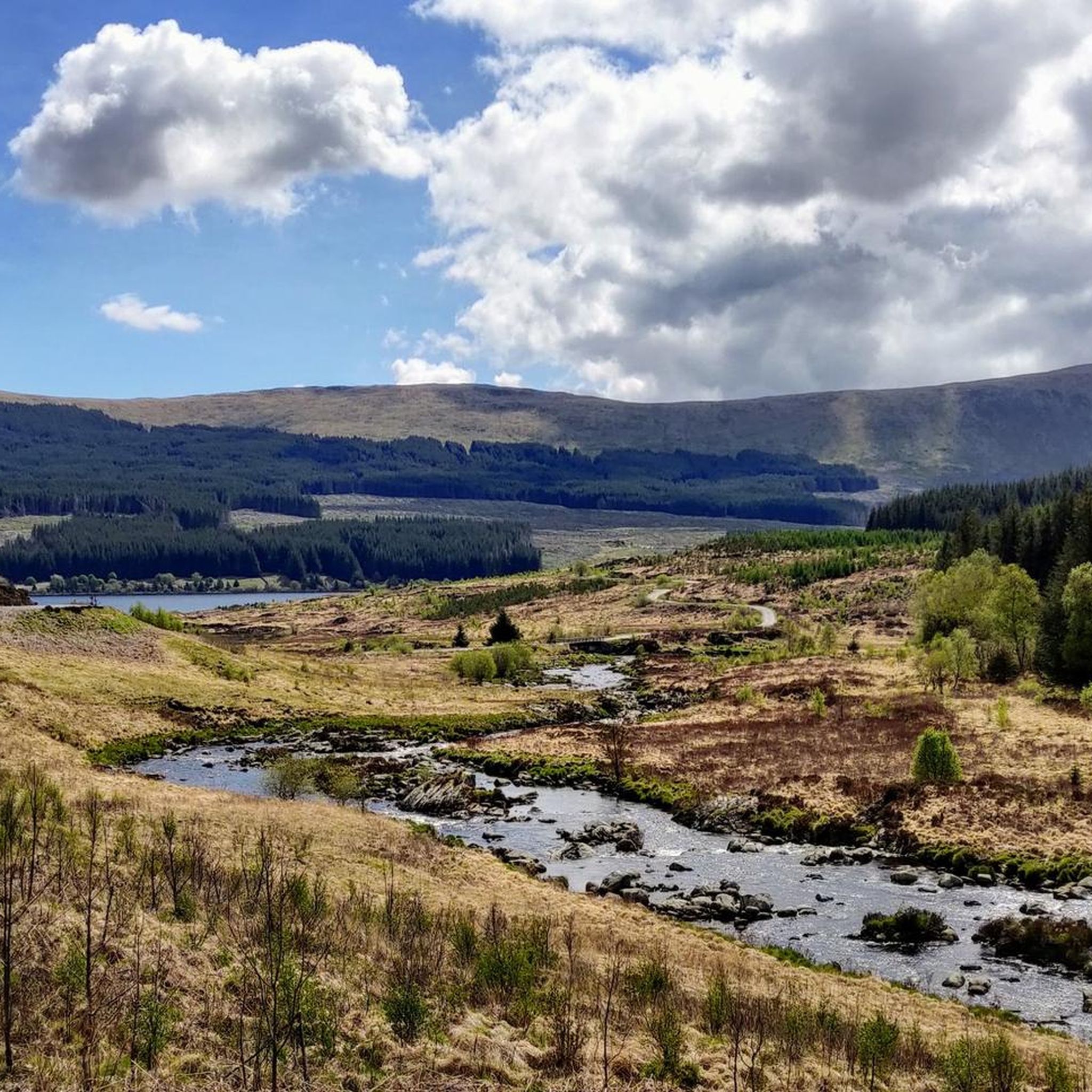
Road cycling routes around Dalmellington are situated at the northern edge of Scotland's Southern Uplands, bordering the Galloway Forest Park. The region features diverse landscapes, including tranquil lochs like Loch Doon, wetlands, and hills. Terrain varies from well-paved roads to some unpaved segments, offering varied cycling conditions.
Best road cycling routes around Dalmellington
- The most popular road cycling route is Straiton 'Strade Bianche' light gravel loop from Dallemington, a 28.4 miles (45.7 km) trail that takes about 4 hours 35 minutes to complete. This moderate route includes some unpaved sections.
- Another top favourite among local road cyclists is Drumlanrig Castle loop from Dalmellington, a difficult 67.6 miles (108.8 km) path. This route features significant elevation gain through the region's varied terrain.
- Local road cyclists also love the Nic O'Balloch Climb – Straiton Village loop from Dalmellington, a 73.6 miles (118.5 km) trail leading through the local hills and valleys, often completed in about 6 hours 2 minutes.
- Road cycling around Dalmellington is defined by its proximity to the Southern Uplands, the expansive Galloway Forest Park, and scenic lochs like Loch Doon. The network offers options for different ability levels, from moderate rides to more demanding routes with substantial elevation gain.
- The routes in Dalmellington are highly rated by the komoot community with an average score of 5.0 stars from more than 10 reviews. More than 300 road cyclists have used komoot to explore Dalmellington's varied terrain.
Last updated: May 17, 2026
14
riders
45.7km
04:35
480m
480m
Moderate road ride. Good fitness required. Some segments of this route may be unpaved and difficult to ride.
7
riders
109km
05:27
1,130m
1,130m
Hard road ride. Very good fitness required. Mostly well-paved surfaces and easy to ride.

Sign up for free
5.0
(1)
103
riders
118km
06:02
1,760m
1,760m
Hard road ride. Very good fitness required. Mostly well-paved surfaces and easy to ride.
46
riders
43.2km
02:11
750m
750m
Moderate road ride. Good fitness required. Mostly well-paved surfaces and easy to ride.
11
riders
123km
05:31
1,260m
1,260m
Hard road ride. Very good fitness required. Mostly well-paved surfaces and easy to ride.
Get access to more routes and recommendations from other explorers.
Sign up for free
Already have an account?
Our route recommendations are based on thousands of hikes, rides, and runs completed by other people on komoot.
Start today with a free account
Your next adventure awaits.
Login or Signup
Other adventures around Dalmellington

Tips from the Community

Very rough road the other side, great climb tho!
0
0
Watch out for the holes in the road and be ready for the wind! Great hill climb!
0
0


Good weather, long ride and I thought initially you had pigtails!
0
0
Very pleasant road, little traffic and rather easy
0
0


Open to public and some nice easy trails to walk in grounds.
0
0
Frequently Asked Questions
How many road cycling routes are available around Dalmellington?
There are over 15 road cycling routes around Dalmellington, offering a variety of experiences for different skill levels. The komoot community has explored more than 300 road cycling tours in the area.
What kind of terrain can I expect on road cycling routes around Dalmellington?
The terrain around Dalmellington is diverse, ranging from tranquil lochs and wetlands to hills and mountains up to 2,600 feet. You'll find a mix of well-paved roads and some unpaved segments, especially on routes like the Straiton 'Strade Bianche' light gravel loop, offering varied and challenging conditions.
Are there road cycling routes suitable for beginners or families in Dalmellington?
Yes, Dalmellington offers routes suitable for various abilities. While some routes feature significant elevation gain, there are easier options available. For example, the Loch Doon Forest Road, though not listed in the guide, is mentioned as an on-road route suitable for all abilities, following the west shore of Loch Doon.
What are some challenging road cycling routes for experienced riders?
Experienced riders looking for a challenge will find several difficult routes. The Drumlanrig Castle loop from Dalmellington is a demanding 67.6-mile ride with significant elevation gain. Another difficult option is the Nic O'Balloch Climb – Straiton Village loop from Dalmellington, covering 73.6 miles through local hills and valleys.
What natural features or landmarks can I see along the road cycling routes?
The routes often pass through or near significant natural features. You can explore the scenic Loch Doon, which features historic castle ruins. The area also borders the vast Galloway Forest Park, the UK's first Dark Sky Park. Notable summits like The Merrick Summit and Cairnsmore of Carsphairn Summit are nearby, offering rewarding views for those who undertake the climbs.
Are there any scenic viewpoints along the road cycling routes?
Many routes offer scenic views, particularly those traversing the hills and lochs. The region's diverse landscapes, including the northern Galloway range and the Carsphairn and Scaur Hills, provide numerous opportunities for panoramic vistas. Keep an eye out for viewpoints like Corserine Summit and Craiglee Summit, which are accessible in the wider area.
What is the best time of year for road cycling in Dalmellington?
The best time for road cycling in Dalmellington generally aligns with milder weather conditions. Spring and summer offer longer daylight hours and more predictable weather, making it ideal for exploring the diverse landscapes. Autumn can also be beautiful with changing foliage, but be prepared for cooler temperatures and potentially wetter conditions.
Are there circular road cycling routes available in Dalmellington?
Yes, many of the road cycling routes around Dalmellington are designed as loops, allowing you to start and finish in the same location. Examples include the Drumlanrig Castle loop and the Nic O'Balloch Climb – Straiton Village loop, providing convenient options for exploring the region.
Where can I find parking for road cycling routes in Dalmellington?
While specific parking locations for each route are not detailed here, Dalmellington serves as a common starting point. As a gateway to Galloway Forest Park and Loch Doon, there are likely public parking areas within the village or at key access points to the park and loch. It's advisable to check local signage upon arrival.
Is public transport available to reach cycling routes in Dalmellington?
Dalmellington is a local hub, and public transport options, such as bus services, connect it to larger towns in Ayrshire. However, direct public transport links to the specific starting points of all cycling routes may be limited. Planning your journey in advance and checking local bus schedules is recommended.
What do other road cyclists enjoy most about road cycling in Dalmellington?
The road cycling routes in Dalmellington are highly rated by the komoot community, with an average score of 5.0 stars from over 10 reviews. Cyclists often praise the diverse terrain, the challenging climbs, and the scenic beauty of the lochs and hills, particularly the proximity to Galloway Forest Park.
Are there places to stop for refreshments or food along the routes?
Dalmellington itself offers amenities like cafes and pubs where you can refuel before or after your ride. For longer routes that venture into more remote areas, it's wise to carry sufficient provisions. Some routes might pass through smaller villages like Straiton, which may also offer refreshment stops.
Most popular routes around Dalmellington
Most popular attractions around Dalmellington

Get inspired with the komoot mobile app


Explore more
Browse the best Road cycling routes in other regions.
