The best walks and hikes in Heiðmörk
4.4
(408)
6,374
hikers
221
hikes
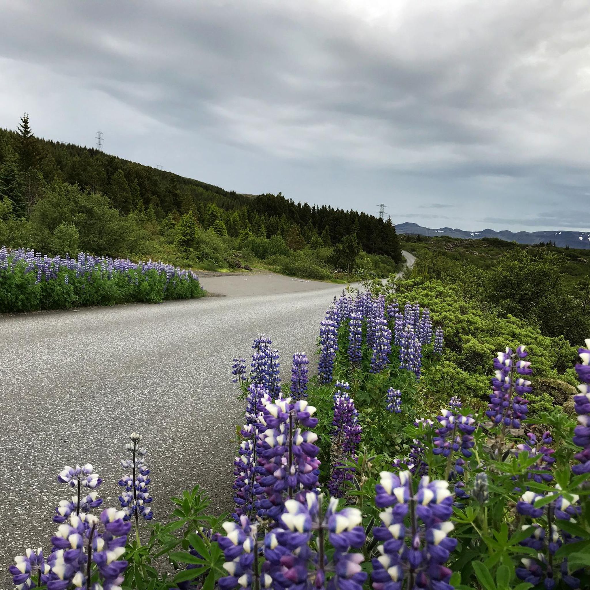
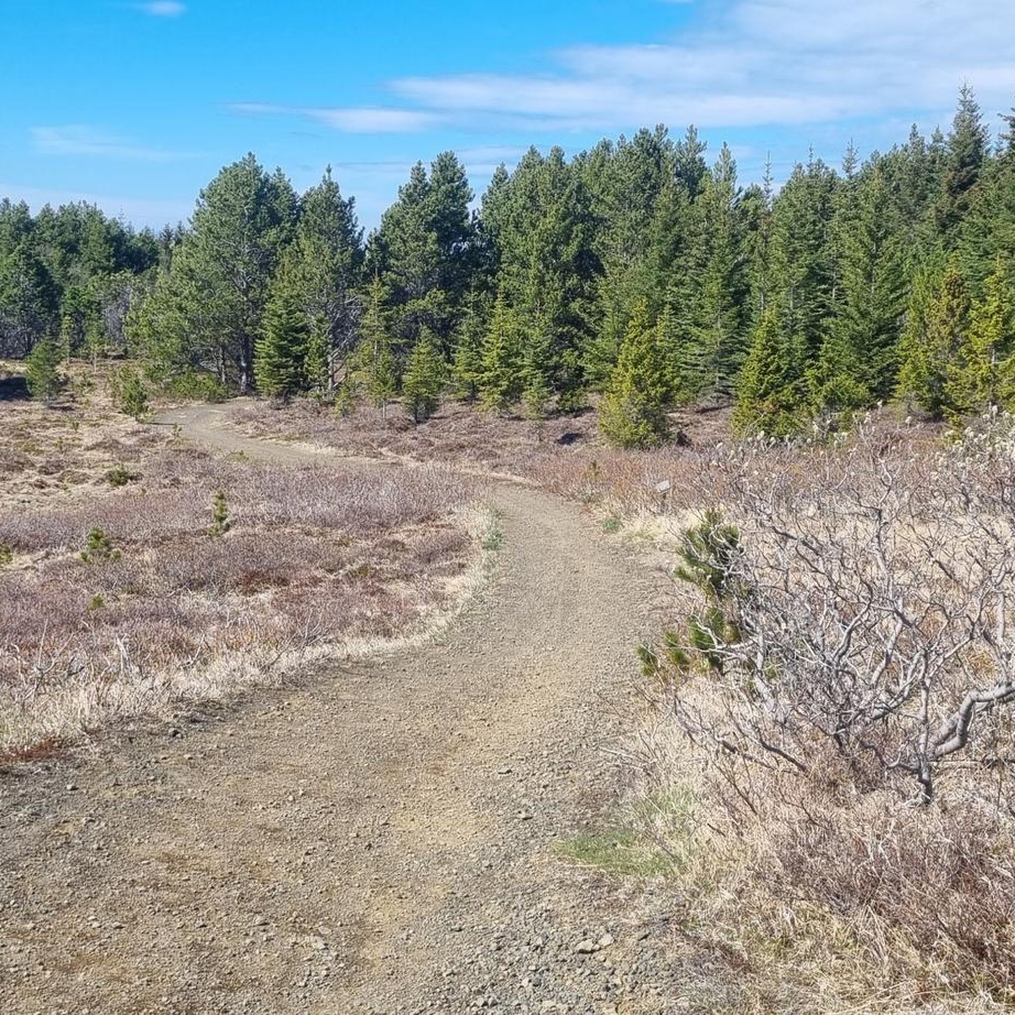
Hiking in Heiðmörk offers diverse natural features, including extensive woodlands, serene lakes, and volcanic formations. This nature reserve, located near Reykjavík, is characterized by its reforested areas with various tree species and lava fields. Hikers can explore a network of trails that wind through these varied landscapes, providing opportunities for observing local flora and fauna.
Best hiking trails in Heiðmörk
- The most popular hiking route is Búrfellsgjá Crater – Búrfellsgjá loop from Búrfell, a 3.6 miles (5.8 km) trail…
Last updated: July 1, 2026
4.5
(10)
210
hikers
5.79km
01:33
70m
70m
Easy hike. Great for any fitness level. Easily-accessible paths. Suitable for all skill levels.
5.0
(2)
101
hikers
7.73km
02:00
50m
50m
Moderate hike. Good fitness required. Easily-accessible paths. Suitable for all skill levels.

Sign up for free
4.5
(2)
73
hikers
4.67km
01:14
50m
50m
Easy hike. Great for any fitness level. Easily-accessible paths. Suitable for all skill levels.
4.5
(2)
44
hikers
3.71km
00:59
40m
40m
Easy hike. Great for any fitness level. Easily-accessible paths. Suitable for all skill levels.
5.0
(3)
19
hikers
7.59km
02:00
60m
60m
Easy hike. Great for any fitness level. Easily-accessible paths. Suitable for all skill levels.
Get access to more routes and recommendations from other explorers.
Sign up for free
Already have an account?
Our route recommendations are based on thousands of hikes, rides, and runs completed by other people on komoot.
Start today with a free account
Your next adventure awaits.
Login or Signup
Tips from the Community

As of August 18, 2025: Iceland experienced its twelfth volcanic eruption in just over four years. On the sparsely populated Reykjanes Peninsula, southwest of Reykjavik, the earth opened up again on Wednesday, July 16. Since Tuesday, August 5, no more lava has been escaping from the eruption fissure located approximately seven kilometers northeast of Grindavik. Volcanologists believe it is highly likely that the eruption has ended for the time being. The temporarily closed campsite in the town of Grindavik is now freely accessible again.
1
0
Really impressive in the old lava fields
1
0

The fissure is surrounded by ancient lava flows that have cooled and solidified, forming a rugged, rocky landscape. Despite the volcanic terrain, the area is home to a surprising amount of vegetation adapted to lava soil, as well as birds and other animals typical of Iceland.
2
0
It is a unique geological feature located near Reykjavik in Iceland. It is a canyon formed by a volcanic fissure in the Hafnarfjörður region on the Reykjanes Peninsula. It is a fascinating place for both its geology and natural beauty. Near Búrfellsgjá is the Búrfell crater, which is an impressive volcanic feature in itself. This crater is almost perfectly shaped and offers a closer look at the volcanic activity that formed the region.
2
0


There are more trails to explore around and you can use this as a starting point. Beautiful.
3
0

Frequently Asked Questions
How many hiking trails are available in Heiðmörk?
Heiðmörk offers a wide network of over 250 hiking routes. These trails cater to various fitness levels, with options ranging from easy strolls to more moderate and even a few challenging paths.
Are there easy hiking trails suitable for beginners or families in Heiðmörk?
Yes, Heiðmörk is very family-friendly, with over 170 easy trails. Routes like the Forest Path – Heiðmörk Nature Reserve loop from Bautasteinar (4.7 km) are perfect for a relaxed walk through the woodlands. The Búrfellsgjá Crater loop from Búrfell (5.8 km) is another excellent easy option that explores interesting volcanic formations.
What kind of natural landscapes can I expect to see while hiking in Heiðmörk?
Heiðmörk is known for its diverse landscapes, including extensive reforested woodlands with pine, birch, and spruce trees, serene lakes like Elliðavatn, and unique volcanic formations such as the Búrfellsgjá Crater. You'll also find rich habitats supporting nearly 200 plant species and over 60 bird species.
Are there any circular hiking routes in Heiðmörk?
Yes, many of the trails in Heiðmörk are circular, allowing you to start and end at the same point. Examples include the Vígsluflöt Memorial loop from Heiðmörk (7.7 km) and the Heiðmörk Nature Reserve – Forest Path loop from Heiðmörk (7.6 km). The 'Water Circle' (Vatnahringurinn) and 'The Sun Circle' are also popular marked circular routes.
What are some notable landmarks or attractions to look out for on the trails?
Hikers can explore the Búrfellsgjá Crater, a significant volcanic fissure. The Vígsluflöt Memorial is another point of interest along some routes. Additionally, the reserve features several peaceful lakes, including Elliðavatn, Myllulækjartjörn, Helluvatn, and Hraunhúsatjörn, which are great for birdwatching and picnics.
Is Heiðmörk accessible by public transport?
Heiðmörk is located just a short drive from Reykjavík, making it easily accessible. While specific public transport routes directly into the reserve might be limited, local bus services can get you close to the main entrances, particularly around Elliðavatn, which serves as a popular starting point for many hikes.
Are there designated parking areas for hikers in Heiðmörk?
Yes, Heiðmörk has several designated parking areas conveniently located near popular trailheads. Elliðavatn is a well-known starting point with parking facilities, and other access points throughout the reserve also offer parking for visitors.
What do other hikers enjoy most about hiking in Heiðmörk?
The komoot community highly rates Heiðmörk, with an average score of 4.5 stars from over 300 reviews. Hikers often praise the quiet woodlands, the variety of well-marked paths, and the peaceful atmosphere that makes it feel like a green lung just outside Reykjavík.
Can I bring my dog on the hiking trails in Heiðmörk?
Heiðmörk is generally dog-friendly, allowing pets on many of its trails. However, it's always recommended to keep dogs on a leash to protect the local wildlife and ensure a pleasant experience for all visitors. Please be mindful of any specific signage regarding pet access in certain areas.
Are there any facilities like picnic areas or restrooms in Heiðmörk?
Yes, Heiðmörk provides amenities for visitors, including designated BBQ and picnic areas equipped with benches, tables, and grills. These spots are ideal for outdoor gatherings and enjoying a meal amidst nature. Restroom facilities are typically available near main entrances and popular gathering points.
What is the best time of year to go hiking in Heiðmörk?
Heiðmörk offers beautiful hiking experiences year-round. Spring and summer bring lush greenery and longer daylight hours, while autumn transforms the woodlands with vibrant yellow, orange, and crimson hues. Even in winter, the snow-covered landscapes can be stunning, though some trails might require appropriate gear.
Are there any longer or more challenging routes for experienced hikers?
While Heiðmörk is known for its accessible trails, there are options for those seeking a longer experience. The 'Heiðmörk via Elliðavatn' loop trail, for example, is approximately 12 km and takes about 3 hours, winding through forests and along lake shores. There are also a few routes rated as 'difficult' for those looking for a greater challenge.
Most popular routes in Heiðmörk

Get inspired with the komoot mobile app


Explore more
Browse the best Hikes in other regions.
