The best walks and hikes in Forêt De La Combe
4.5
(2473)
21,899
hikers
38
hikes
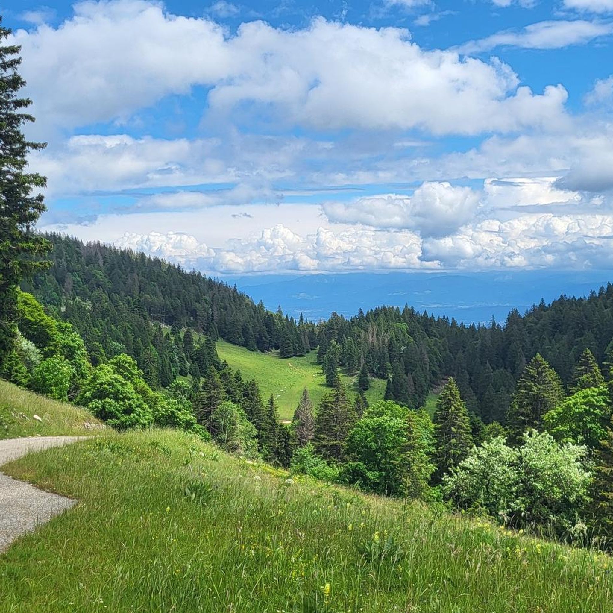
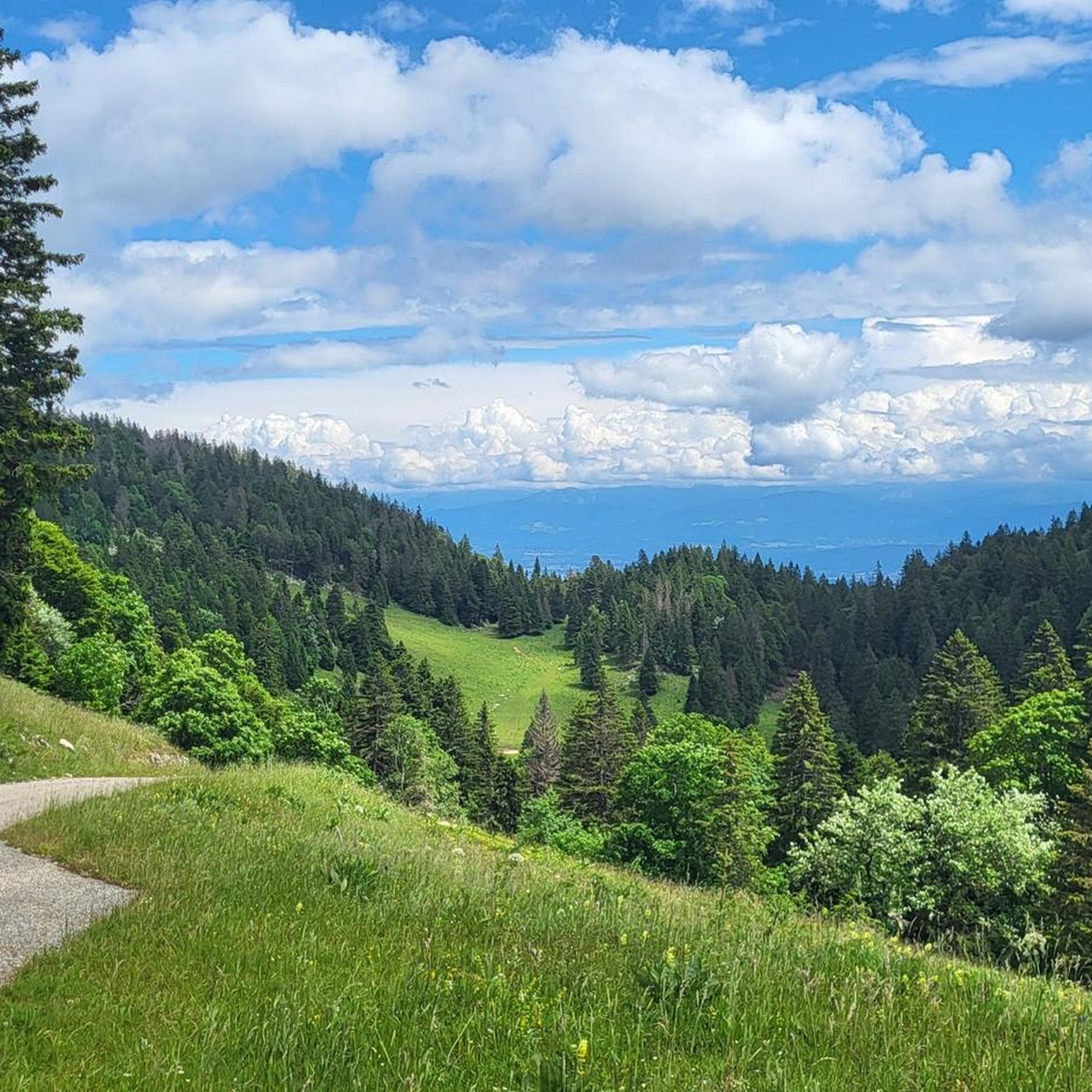
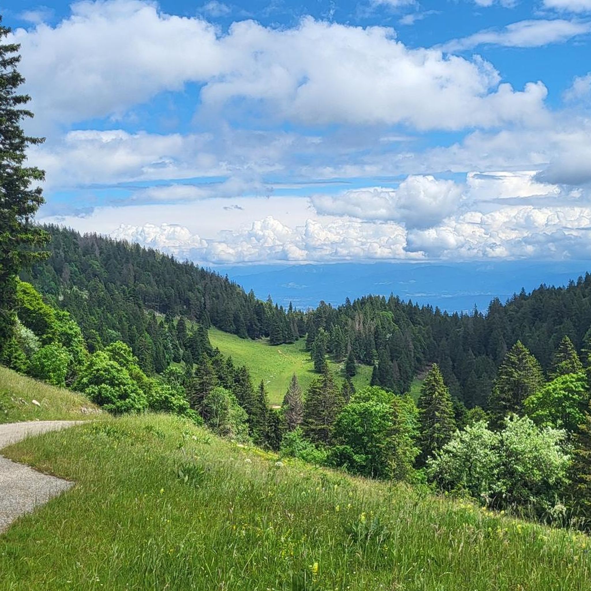
Hiking in Forêt De La Combe offers diverse terrain within the District de Nyon, characterized by extensive forested areas and picturesque alpine pastures. The region features varied elevation changes, providing routes that range from gentle walks to more challenging ascents. Hikers can experience panoramic views of Lake Geneva and prominent features like La Dôle and La Barillette.
Best hiking trails in Forêt De La Combe
- The most popular hiking route is View of Lake Geneva – Fontaine des Platets loop from Arzier, a 7.5 miles (12.1 km) trail that takes 3 hours 38 minutes to complete. This moderate route offers views of Lake Geneva and passes by the Fontaine des Platets.
- Another top favourite among local hikers is View from La Barillette – La Barillette loop from Saint-Cergue, a moderate 5.7 miles (9.2 km) path. This trail provides scenic views from La Barillette, winding through the forested landscape.
- Local hikers also love the Alpine pasture landscape – Old Tree loop from Arzier, a 6.0 miles (9.7 km) trail leading through alpine pasture landscapes, often completed in about 2 hours 47 minutes.
- Hiking in Forêt De La Combe is defined by dense woodlands, open alpine pastures, and viewpoints overlooking Lake Geneva. The network offers options for different ability levels, from easy walks to difficult, longer routes.
- The routes in Forêt De La Combe are highly rated by the komoot community with an average score of 4.4 stars from over 600 reviews. More than 6000 hikers have used komoot to explore Forêt De La Combe's varied terrain.
Last updated: May 20, 2026
4.4
(15)
61
hikers
12.3km
03:40
380m
390m
Moderate hike. Good fitness required. Easily-accessible paths. Suitable for all skill levels.
5.0
(9)
40
hikers
9.65km
02:47
240m
240m
Moderate hike. Good fitness required. Easily-accessible paths. Suitable for all skill levels.

Sign up for free
4.9
(7)
58
hikers
18.8km
06:40
1,060m
1,060m
Hard hike. Very good fitness required. Sure-footedness, sturdy shoes and alpine experience required.
4.8
(5)
46
hikers
14.1km
05:18
950m
950m
Hard hike. Very good fitness required. Easily-accessible paths. Suitable for all skill levels.
4.9
(7)
42
hikers
7.46km
02:04
140m
140m
Moderate hike. Good fitness required. Easily-accessible paths. Suitable for all skill levels.
Get access to more routes and recommendations from other explorers.
Sign up for free
Already have an account?
Our route recommendations are based on thousands of hikes, rides, and runs completed by other people on komoot.
Start today with a free account
Your next adventure awaits.
Login or Signup

Tips from the Community

These forest clearings make up the typical Jura landscape
0
0

Very cool view of the entire length of Lac Leman. With the Alps as a backdrop. Spectacular.
0
0
Amazing views of the Alps - a huge panorama!
0
0

View of Mt. Blanc between the trees
0
0

steep climb, walking shoes recommended: the view is worth the effort
0
0

Greenery, small trail path, wild nature, everything is there to enjoy a breath of fresh air
1
0

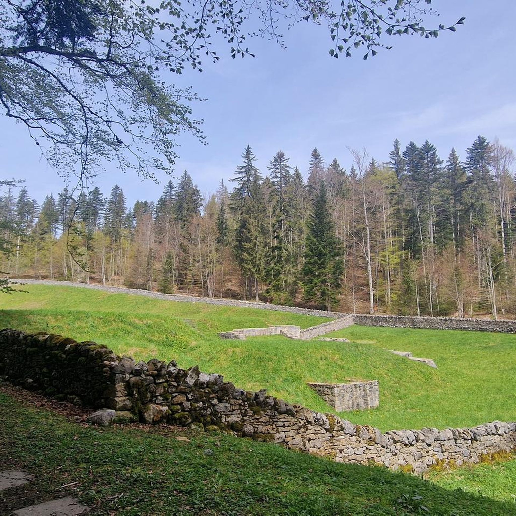
Old fortification, interesting to explore
1
0
Magnificent view of the summit. Early in the morning, the material gondola is in operation
0
0
Frequently Asked Questions
How many hiking trails are available in Forêt De La Combe?
Forêt De La Combe offers a wide selection of hiking routes, with over 35 trails to explore. These range from easy walks to more challenging ascents, catering to various fitness levels.
What types of landscapes can I expect to see while hiking in Forêt De La Combe?
Hikers in Forêt De La Combe will experience diverse landscapes, including extensive forested areas, picturesque alpine pastures, and dramatic karst valley features. The region is known for its rich natural ambiance and varied terrain.
Are there any easy hiking trails suitable for beginners or families?
Yes, Forêt De La Combe has a good selection of easier trails. There are 16 routes categorized as easy, perfect for beginners or families looking for a gentle walk. These paths are generally accessible and offer a pleasant introduction to the area's natural beauty.
What are some notable viewpoints or natural features to look out for?
The region boasts stunning vistas, including magnificent views of Lake Geneva. You can also enjoy sights of prominent features like La Dôle and La Barillette. A specific point of interest often included in hiking loops is the Fontaine des Platets.
Are there any historical sites or landmarks I can visit while hiking?
Yes, you can explore several interesting landmarks. Consider visiting the Ruins of the Notre-Dame d'Oujon Charterhouse, a historical site. Another point of interest is La Baudichonne Pass and Boundary Markers.
What do other hikers enjoy most about the trails in Forêt De La Combe?
The trails in Forêt De La Combe are highly rated by the komoot community, with an average score of 4.4 stars from over 600 reviews. Hikers often praise the diverse terrain, the dense woodlands, open alpine pastures, and the rewarding viewpoints overlooking Lake Geneva.
Are there any challenging hikes for experienced trekkers?
For experienced trekkers, Forêt De La Combe offers challenging routes. There are 2 difficult trails, such as the View of La Dôle Summit – La Dôle Summit loop from Abbaye de Bonmont, which covers over 18 km with significant elevation gain, requiring good fitness and sure-footedness.
Are there any circular hiking routes available?
Yes, many routes in Forêt De La Combe are circular, allowing you to start and end at the same point. Examples include the View from La Barillette – La Barillette loop from Saint-Cergue and the Alpine pasture landscape – Old Tree loop from Arzier.
What is the typical duration for hikes in this region?
Hike durations vary significantly based on the trail's length and difficulty. Shorter, easier walks can be completed in under two hours, while more challenging routes, such as the View of La Dôle Summit – La Dôle Summit loop from Abbaye de Bonmont, can take over five hours.
Is public transport available to access the hiking trails?
While specific public transport details for each trailhead are not provided, the region is located in the District de Nyon, which generally has public transport options. It's advisable to check local transport schedules to plan your access to specific starting points like Arzier or Saint-Cergue.
What is the best time of year to go hiking in Forêt De La Combe?
The diverse landscapes, including alpine pastures and forested areas, suggest that spring through autumn would be ideal for hiking. During these seasons, you can best enjoy the lush greenery and panoramic views. Always check local weather conditions before heading out.
Are there any trails that offer views of La Dôle?
Yes, several trails offer views of La Dôle. A notable difficult route that specifically focuses on this feature is the View of La Dôle Summit – La Dôle Summit loop from Abbaye de Bonmont, which takes you towards the summit.
Most popular routes in Forêt De La Combe
Most popular attractions in Forêt De La Combe

Get inspired with the komoot mobile app


Explore more
Browse the best Hikes in other regions.
