The best cycling routes in Prell Heide
4.5
(3397)
9,806
riders
287
rides
Touring cycling in Prell Heide is characterized by its flat to gently rolling terrain, shaped by glacial origins and featuring extensive forests, heathland, and numerous water bodies. The region includes clear streams and pond landscapes, offering varied scenery for cyclists. Routes often traverse areas with birch, oak, pine, and beech forests, alongside open heathland. This landscape provides a mix of natural environments suitable for touring cyclists seeking diverse paths.
Best touring cycling routes in Prell Heide
- The most popular touring…
Last updated: September 30, 2026
4.6
(12)
38
riders
35.0km
02:04
60m
60m
Moderate bike ride. Good fitness required. Mostly paved surfaces. Suitable for all skill levels.
4.2
(6)
8
riders
17.3km
01:11
40m
40m
Easy bike ride. Great for any fitness level. Mostly paved surfaces. Suitable for all skill levels.

2
riders
24.1km
01:41
40m
40m
Easy bike ride. Great for any fitness level. Mostly paved surfaces. Suitable for all skill levels.
4.0
(2)
3
riders
41.8km
02:37
90m
90m
Hard bike ride. Good fitness required. You may need to push your bike for some segments of this route.
5.0
(1)
2
riders
22.9km
01:31
30m
30m
Easy bike ride. Great for any fitness level. Mostly paved surfaces. Suitable for all skill levels.
Get access to more routes and recommendations from other explorers.
Already have an account?
Our route recommendations are based on thousands of hikes, rides, and runs completed by other people on komoot.
Start today with a free account
Your next adventure awaits.

Tips from the Community

Guesthouse & Café. More info at https://www.faehrhaus-gruna.de/
0
0

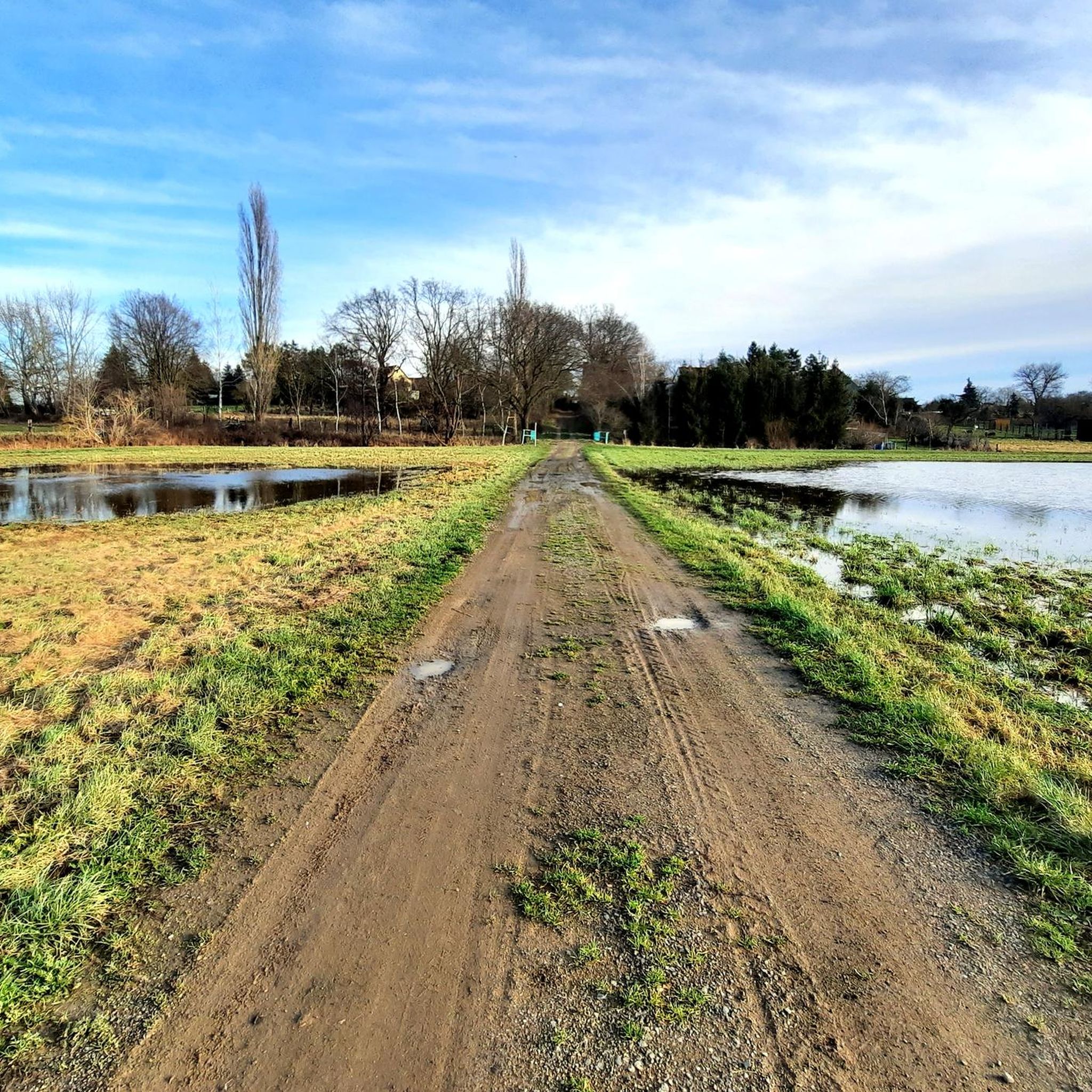
Super beautiful view from the bike path into the Mulde floodplain landscape
1
0
Definitely worth seeing
2
0
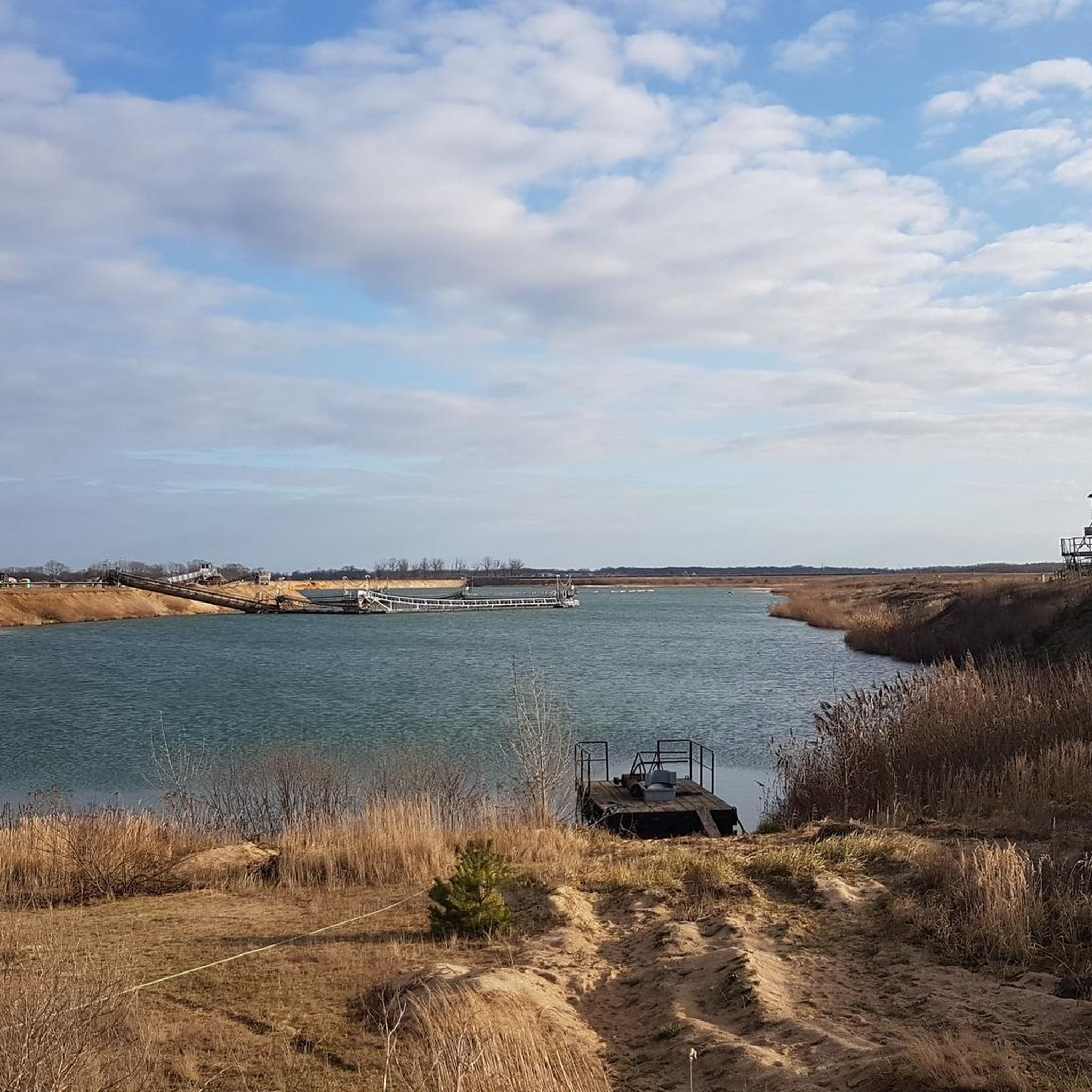
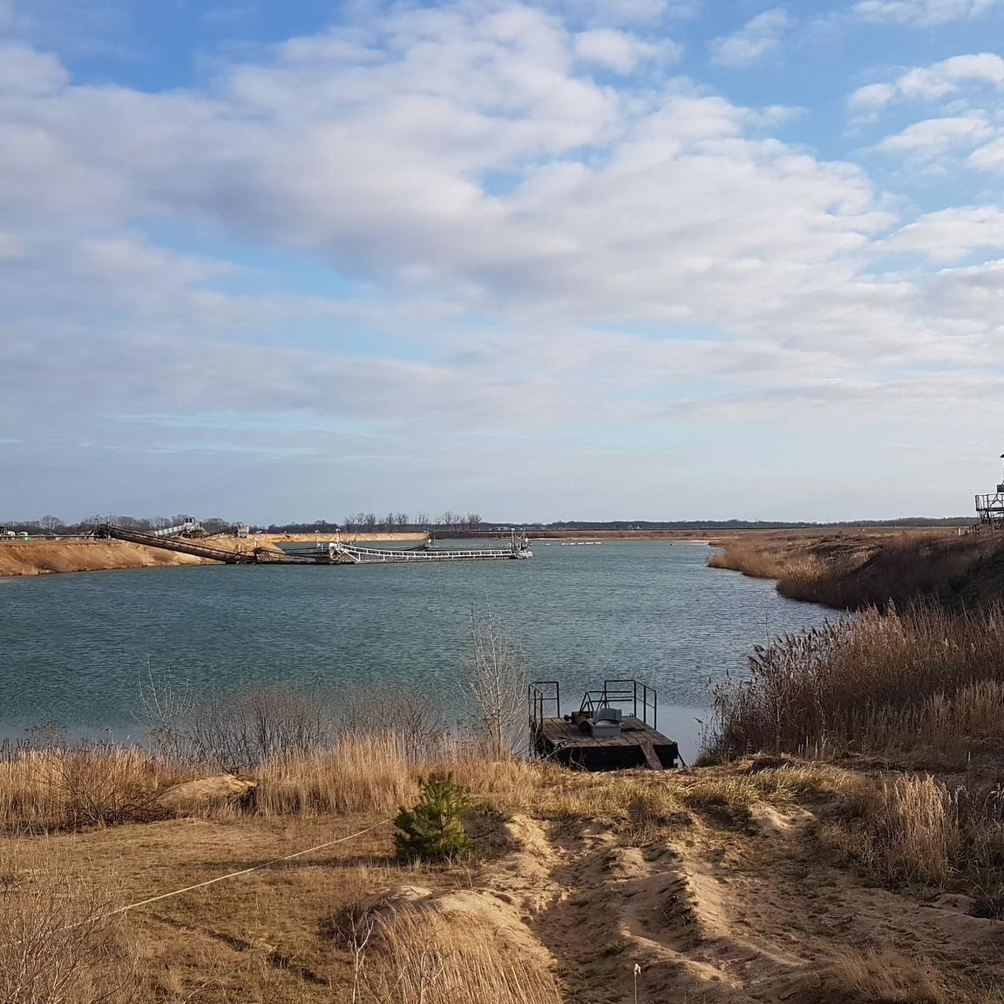
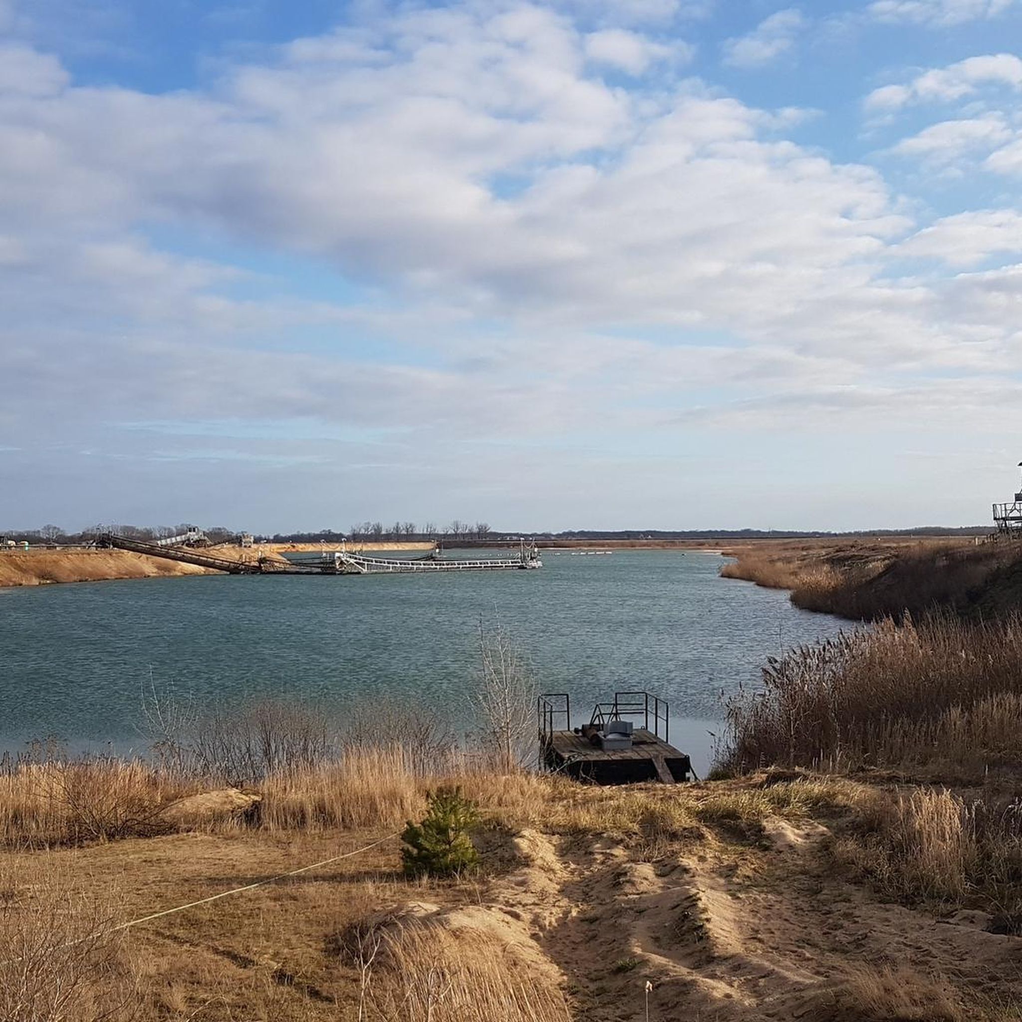
The village of Seelhausen was buried in 1987 during the expansion of the Goitzsche open-cast mine. The Seelhausen Lake was created by flooding the remaining open-cast mine pit. It lies west of Löbnitz, south of Bitterfeld, and north of Delitzsch, in the Central German Lake District. From the end of July 2000, the lake was filled with water from the Mulde River via a pipeline at a rate of 1 m³/s[1] until the pipeline was destroyed by the Elbe River flood in 2002. Since then, the lake has been fed by the Lober-Leine Canal. According to the LMBV (Lausitz and Central German Mining Company), 96% of the planned water level had been reached by March 2004. The flooding work was completed in 2005.[1] A beach area has since been built at the flooding site, and further development of the lake as a recreational area is planned. The larger Goitzsche Lake lies northwest of the Seelhausen Lake. The lake district also includes Lake Paupitzsch, Lake Holzweißig, Lake Ludwig, Lake Neuhaus, and Lake Zöckeritz with Essigloch and Lake Auensee. The total surface area of all lakes in the former Goitzsche open-cast mine is estimated at 24 square kilometers. Lake Seelhausen is a former open-cast mine lake with a water level of 78 meters above sea level. Its storage capacity is 74 million cubic meters, with a surface area of 622 hectares. Source: https://de.wikipedia.org/wiki/Seelhausener_See
2
0
Lake Seelhausen is a former open-cast mining lake of approximately 622 hectares, formed from the former Rösa lignite mine (part of the Goitzsche). It lies mostly in the German state of Saxony and partly in Saxony-Anhalt. Source: https://de.wikipedia.org/wiki/Seelhausener_See
2
0
Beautiful rest area on the lakeside path
4
0
The interior is characterized by the impressive painted coffered ceiling, created between approximately 1688–1691 by Christian Schilling. Of the total 250 panels, 114 images depict biblical stories from the Old (36 images) and New Testament (78 images). A further 36 panels show figures: Jesus Christ, Moses, the Apostles, the Evangelists, the Prophets of Scripture, as well as Martin Luther and Melanchthon. These depictions are complemented by angels with musical instruments and instruments of the Passion on 18 panels. The remaining 82 panels frame this ensemble with floral grisaille paintings. Source: https://de.wikipedia.org/wiki/Dorfkirche_L%C3%B6bnitz
3
0
The church originated at the end of the 17th century (1688–1692) through the conversion of a three-aisled Romanesque pillar basilica from the 13th century, whereby the southern aisle was demolished, the northern aisle was built up to the height of the central nave, and the choir was extended. The tower therefore stands flush with the southern hall wall, whose bricked-up arcades and clerestory windows are still recognizable. The decorative gables of the tower were renewed around 1900. After being closed due to dilapidation, restoration work on the church was carried out in the years 1931–1938, including the renewal of the gable and roof, the replacement of damaged beams, the replacement of windows, the demolition of the sacristy, the conversion of the tower room into a chapel, and restoration work on the painted ceiling. A further restoration was carried out in the years 1971–1972, which included the renovation of the floor, the demolition of the second gallery on the north and south walls, the removal of the pews and their replacement with chairs, the reinstallation of the east windows, which had been bricked up during the Second World War, the renewal of the church tower's spire, and the plastering of the nave. Further restoration work on the furnishings, including the painted ceiling, the pulpit, the epitaphs, and the organ, took place in the years 2008–2016.[1] The church is a plastered brick building with a straight choir end and basket-arch windows. The tower, older in its core, is topped with a cross vault and volute gables. The bricked-up pointed-arch portal in the west was presumably created in the first quarter of the 13th century. Source https://de.wikipedia.org/wiki/Dorfkirche_L%C3%B6bnitz
3
0
Frequently Asked Questions
How many touring cycling routes are available in Prell Heide?
Prell Heide offers a wide selection of touring cycling routes, with over 320 different options to explore. These routes cater to various skill levels, from easy to difficult.
What kind of landscape can I expect while cycling in Prell Heide?
The landscape in Prell Heide is characterized by its flat to gently rolling terrain, shaped by glacial origins. You'll encounter extensive forests, open heathland, and numerous water bodies, including clear streams and picturesque pond landscapes. Routes often traverse areas with birch, oak, pine, and beech forests, alongside open heathland, offering a diverse natural environment.
Are there routes suitable for beginners or less experienced cyclists in Prell Heide?
Yes, Prell Heide has a significant number of routes suitable for beginners. There are over 180 easy touring cycling routes available. An example of an easy route is the Mulde Bridge in Bad Düben – View of Bad Düben loop from Wellaune, which is 10.7 miles (17.3 km) long and features views of Bad Düben and the Mulde Bridge.
What are the typical distances for touring cycling routes in Prell Heide?
The touring cycling routes in Prell Heide vary in length. You can find shorter routes like the Mulde Bridge in Bad Düben – View of Bad Düben loop from Wellaune at 10.7 miles (17.3 km), up to longer options such as the Gruna Ferry House – Gruna Ferry loop from Wellaune, which is 26.2 miles (42.2 km) long.
Are there any circular touring cycling routes in Prell Heide?
Many of the touring cycling routes in Prell Heide are designed as loops, allowing you to start and end at the same point. Examples include the popular Seelhausener Lake – View of Seelhausener Lake loop from Wellaune and the Polder structure Löbnitz – Mulderadweg loop from Wellaune.
What are some interesting places or landmarks to see along the cycling routes?
Along the cycling routes in Prell Heide, you can discover various points of interest. These include natural features like the Phacelia Field, and unique structures such as the Insect Hotel in the Heath Forest. You might also encounter charming rest stops like the Forester’s hut by the heath forest or the Forest Hut Between Badrina and Wellaune.
What is the best time of year to go touring cycling in Prell Heide?
The best time for touring cycling in Prell Heide is generally during the warmer months, especially when the heathlands are in bloom, which typically occurs in late summer (August/September). This period offers particularly scenic views. Spring and early autumn also provide pleasant conditions with milder temperatures and beautiful foliage.
What do other touring cyclists enjoy the most about touring cycling in Prell Heide?
The touring cycling experience in Prell Heide is highly rated by the komoot community, with an average score of 4.5 stars from over 2,800 reviews. Cyclists often praise the region's diverse terrain, which includes extensive forests, open heathland, and clear streams, offering a blend of natural environments. The well-maintained network of paths and varied options for different skill levels are also frequently highlighted.
Are there any amenities like cafes or restaurants along the cycling paths in Prell Heide?
While specific cafes are not listed for every route, the broader region, particularly areas inspired by Naturpark Südheide, is known to have good restaurants and hotels available for refreshments and overnight stays along its cycling networks. It's advisable to check specific route details or local information for amenities directly on your chosen path.
Can I find routes that are suitable for families with children in Prell Heide?
Yes, Prell Heide offers many easy routes that are well-suited for families with children. The flat to gently rolling terrain and well-developed paths make for a pleasant cycling experience for all ages. Routes like the Mulde Bridge in Bad Düben – View of Bad Düben loop from Wellaune are generally considered family-friendly due to their manageable distance and low elevation gain.
Is public transport available to access the cycling trails in Prell Heide?
While specific public transport links directly to every trailhead in Prell Heide are not detailed, regions like Naturpark Südheide often have public transport options connecting to larger towns within or near the park. It's recommended to research local bus or train services to nearby towns like Bad Düben or Wellaune, and then plan your cycling route from there.
Are there options for more challenging touring cycling routes in Prell Heide?
Yes, for those seeking a greater challenge, Prell Heide also offers more difficult touring cycling routes. There are over 40 such routes available. An example of a more demanding route is the Gruna Ferry House – Gruna Ferry loop from Wellaune, which covers 26.2 miles (42.2 km) and features riverine landscapes.
Most popular routes in Prell Heide
Most popular attractions in Prell Heide

Get inspired with the komoot mobile app


Explore more
Browse the best Cycling routes in other regions.
