The best walks and hikes around Kingside Loch
4.5
(4)
30
hikers
11
hikes
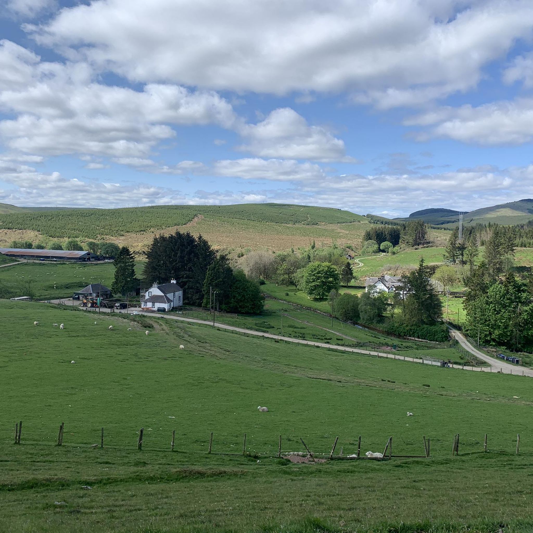
Hiking around Kingside Loch offers routes through a diverse woodland setting within the Scottish Borders. The area features Kingside Loch, a freshwater body designated as a Site of Special Scientific Interest (SSSI) at 348 meters above sea level. Trails traverse Craik Forest, providing views of the loch and surrounding hills, with heather-covered landscapes. Natural water sources like Dirthope Burn and Aithope Burn cross some paths.
Best hiking trails around Kingside Loch
- The most popular hiking route is Wolfcleugh Waterfall and…
Last updated: June 26, 2026
1
hikers
30.3km
08:28
590m
590m
Hard hike. Very good fitness required. Easily-accessible paths. Suitable for all skill levels.
15.4km
04:15
270m
270m
Moderate hike. Good fitness required. Easily-accessible paths. Suitable for all skill levels.

Sign up for free
5.0
(1)
2
hikers
25.6km
07:02
420m
420m
Hike the difficult 15.9-mile Romans and Reivers Route: Girnwood Loch Loop through Craik Forest, featuring loch views and heather.
3.5
(2)
6
hikers
4.53km
01:15
80m
80m
Easy hike. Great for any fitness level. Easily-accessible paths. Suitable for all skill levels.
5.0
(1)
4
hikers
2.82km
00:47
60m
60m
Easy hike. Great for any fitness level. Easily-accessible paths. Suitable for all skill levels.
Get access to more routes and recommendations from other explorers.
Sign up for free
Already have an account?
Our route recommendations are based on thousands of hikes, rides, and runs completed by other people on komoot.
Start today with a free account
Your next adventure awaits.
Login or Signup
Popular around Kingside Loch
Tips from the Community

A bit tricky to find along a tiny forest path but one of the most beautiful waterfalls I have visited
0
0

This is on wide track and not that far from Craik, but it does feel remote here. The grassy descent south halfway gives particularly beautiful views of the hills. If you like solitude, you will love it here. At the northern end of this segment, you will cross Dirthope Burn, and at the southern end Aithope Burn: could use them to replenish your water supplies.
1
0
Girnway is a path in the Craik Forest. On this stretch, you will be able to see the lovely Girnwood Loch (although not directly accessible from the path - the more experienced of you could try wild-walking to it). When you reach Hoscote Burn (the southern end of it), in the summer you should see the area covered in gorgeous purple heather (purple being the colour of the soul!)
1
0
This is on road, starting just east of Outerside (south) and ending at the settlement of Deanburnhaugh, but the road is minor. On this road, between Craik and Roberton, you will be in the constant company of Borthwick Waters, green slopes of the hills here, and you will pass a number of small settlements on the way.
1
0
Crib Law is at 424m. There are great views of the Borders from up here, but you might need to position yourself well as some of the views might be blocked by trees. Nonetheless, it's a great place to be: walk around to find a good place - good views at the end of the track here, too. There is also an information board here with information about the trails and tracks in the forest, which could be useful.
1
0
There are some picnic benches and tables located here on the burn banks; a good place to stop here for your food and drink break. The shade provided by the trees can be welcome on hotter, sunnier days (not sure how many of those you will get in northern Britain!) Not to dampen your spirits, but there is a memorial plaque right next to the picnic area in memory of the crew of Halifax MK II JP190, who crashed here during the war in 1944.
2
0
A long, remote and lonely walk in the Craik Forest. A wide logging track under your feet (can be muddy after lots of rain - this is Scotland!), but otherwise comfortable. A huge amount of forest and a number of well-wooded hills that you will be passing. The border between Roxburghshire and Selkirkshire runs very much near this segment.
1
0
There is a mound on the hill here (Craik Cross Hill at 449 m), which is believed to have been a Roman signal station, which was excavated in 1946. An information board is provided here, telling you a bit more about the site.
1
0
Frequently Asked Questions
What types of hiking trails can I find around Kingside Loch?
Kingside Loch offers a diverse range of hiking trails, from easy strolls to challenging expeditions. You'll find routes traversing attractive woodland settings, with views of the loch and heather-covered hills. The area features wide tracks and a sense of remoteness, with natural water sources like Dirthope Burn and Aithope Burn crossing some paths.
Are there any easy hiking routes suitable for beginners or families?
Yes, Kingside Loch has several easy routes. For a shorter, accessible walk, consider the Wolfcleugh Waterfall loop from Craik, which is 4.47 km long and takes about 1 hour 15 minutes. Another easy option is the Hiking loop from Craik, a 2.8 km trail that can be completed in under an hour.
What are some of the longer or more challenging hikes in the area?
For experienced hikers, the Wolfcleugh Waterfall and Gair loop from Craik — Roxburghshire is a difficult 30.3 km route, typically taking over 8 hours. Another challenging option is the Romans and Reivers Route: Girnwood Loch Loop, a 25.6 km trail through Craik Forest with loch views and heather, usually completed in about 7 hours.
Are there any circular walks around Kingside Loch?
Many of the trails around Kingside Loch are designed as loops, offering circular walking experiences. Examples include the Crib Law loop from Craik — Roxburghshire, a moderate 15.4 km path, and the shorter Wolfcleugh Waterfall loop from Craik.
What natural features or landmarks can I expect to see on the trails?
Kingside Loch itself is a freshwater body designated as a Site of Special Scientific Interest (SSSI), known for its diverse wetland habitat. Trails often feature picturesque loch views, heather-covered landscapes, and the tranquil Craik Forest. You might also encounter natural water sources like Dirthope Burn and Aithope Burn, and some routes pass by the impressive Wolfcleugh Waterfall or offer glimpses of Girnwood Loch.
What is the terrain like for hiking around Kingside Loch?
The terrain around Kingside Loch is varied, featuring wide tracks through woodland, grassy descents with hill views, and heather-covered areas. While many paths are easily accessible, some longer routes require sure-footedness and sturdy shoes due to their length and elevation changes.
Is Kingside Loch a good place for wildlife spotting?
Yes, Kingside Loch's designation as a Site of Special Scientific Interest (SSSI) highlights its rich biodiversity. The wetland ecosystem supports a variety of flora and fauna, making it a haven for wildlife enthusiasts. You can expect opportunities for spotting various bird species and other local wildlife.
What do other hikers say about the trails around Kingside Loch?
The routes in Kingside Loch are highly rated by the komoot community, with an average score of 4.5 stars from 4 reviews. Hikers often praise the attractive woodland setting, the peaceful and secluded environment, and the beautiful views of the loch and surrounding hills.
How many hiking trails are available in the Kingside Loch area?
There are 11 hiking trails recorded around Kingside Loch on komoot. These include 3 easy, 3 moderate, and 5 difficult routes, catering to a wide range of fitness levels and preferences.
Are there any specific routes that feature waterfalls?
Yes, the Wolfcleugh Waterfall loop from Craik is an easy 4.47 km hike specifically designed to take you to Wolfcleugh Waterfall. For a more challenging option that also includes the waterfall, consider the difficult Wolfcleugh Waterfall and Gair loop from Craik — Roxburghshire.
What is the best time of year to hike around Kingside Loch?
While specific seasonal advice isn't detailed, the diverse landscapes, including woodland and heather, suggest that Kingside Loch offers appealing hiking conditions across multiple seasons. Spring and summer would showcase the vibrant flora and fauna, while autumn would bring beautiful colors to the forest. The sense of remoteness and wide tracks make it suitable for year-round exploration, though weather conditions should always be checked.
Most popular routes around Kingside Loch

Get inspired with the komoot mobile app


Explore more
Browse the best Hikes in other regions.
