The best cycling routes around Općina Donji Lapac
4.2
(71)
435
riders
12
rides
Touring cycling routes around Općina Donji Lapac traverse a landscape defined by river valleys, notably the Una River, and its associated waterfalls. The region features a mix of open areas and sections bordering national parkland, offering varied scenery. Elevations range from gentle river-level paths to more challenging climbs, with some routes reaching over 1000 meters in ascent. The terrain primarily consists of paved and unpaved roads suitable for touring bicycles.
Best touring cycling routes around Općina Donji Lapac
- The most popular touring cycling route is Martin Brod Waterfalls – Unac River loop from Martin Brod, a 14.9 miles (24.0 km) trail that takes 1 hour 29 minutes to complete. This moderate route explores the Unac River valley and passes by the Martin Brod Waterfalls.
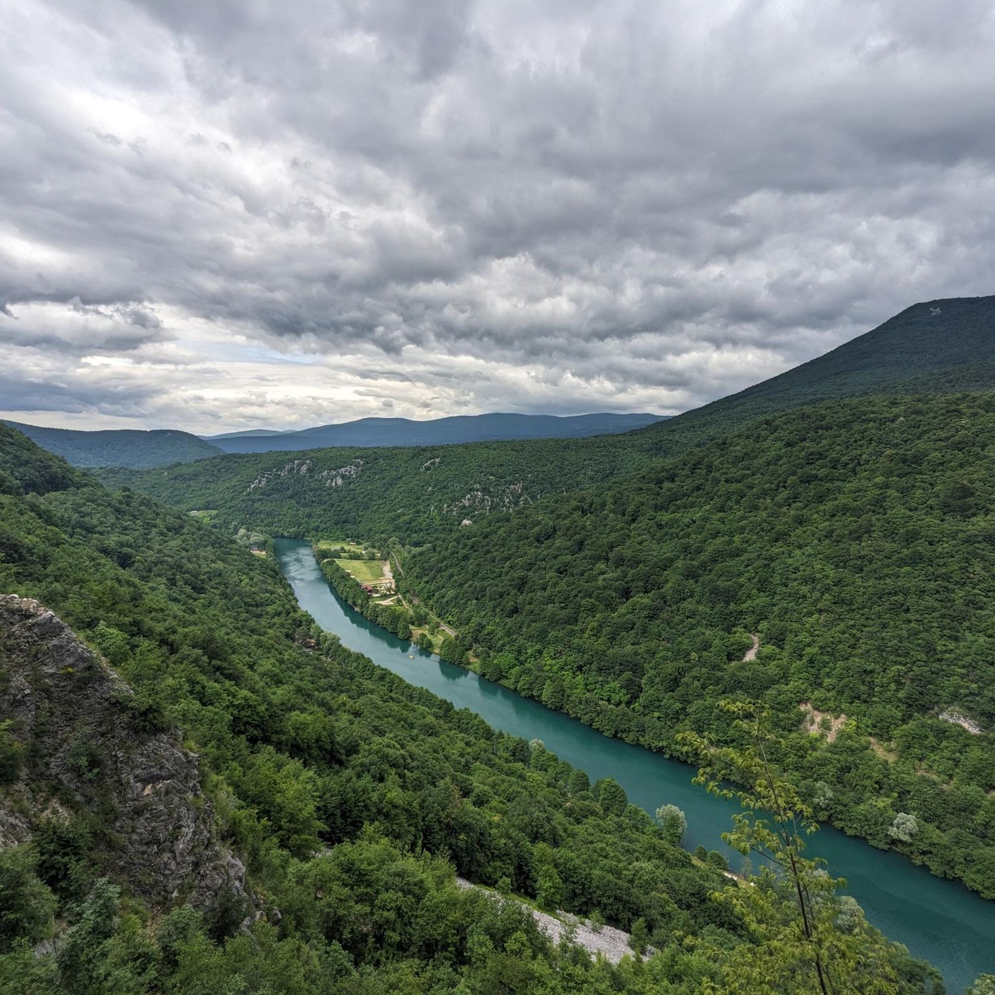
- Another top favourite among local touring cyclists is Martin Brod Waterfalls – Unac River loop from Kulen Vakuf, an easy 14.4 miles (23.2 km) path. This route offers views of the Una River and its waterfalls, starting from Kulen Vakuf.
- Local touring cyclists also love the Štrbački Buk Waterfalls – Road along the Una River loop from Nacionalni park Una, a 15.8 miles (25.5 km) trail leading through the Una National Park, often completed in about 1 hour 31 minutes.
- Touring cycling around Općina Donji Lapac is defined by river valleys, waterfalls, and national park landscapes. The network offers options for various ability levels, from easy bike trails to more advanced cycling routes.
- The routes in Općina Donji Lapac are highly rated by the komoot community with an average score of 4.0 stars from over 40 reviews. More than 300 touring cyclists have used komoot to explore Općina Donji Lapac's varied terrain.
Last updated: October 4, 2026
4.4
(19)
103
riders
23.9km
01:25
140m
150m
Easy bike ride. Great for any fitness level. Mostly paved surfaces. Suitable for all skill levels.
4.3
(20)
109
riders
Easy bike ride. Great for any fitness level. Mostly paved surfaces. Suitable for all skill levels.

4.9
(9)
61
riders
Moderate bike ride. Good fitness required. Mostly paved surfaces. Suitable for all skill levels.
5.0
(3)
36
riders
82.0km
05:19
1,080m
1,080m
Hard bike ride. Very good fitness required. Mostly paved surfaces. Suitable for all skill levels.
4.4
(5)
44
riders
Moderate bike ride. Good fitness required. Mostly paved surfaces. Suitable for all skill levels.
4.4
(5)
34
riders
54.3km
03:11
340m
340m
Moderate bike ride. Good fitness required. Mostly paved surfaces. Suitable for all skill levels.
5.0
(7)
17
riders
22.2km
01:20
100m
100m
Easy bike ride. Great for any fitness level. Mostly paved surfaces. Suitable for all skill levels.
4.5
(2)
20
riders
76.3km
05:39
1,160m
1,160m
Hard bike ride. Very good fitness required. Mostly paved surfaces. Suitable for all skill levels.
5
riders
7.65km
00:45
190m
190m
Moderate bike ride. Good fitness required. Mostly paved surfaces. Suitable for all skill levels.
1.0
(1)
5
riders
46.6km
03:02
580m
580m
Hard bike ride. Very good fitness required. Mostly paved surfaces. Suitable for all skill levels.
Get access to more routes and recommendations from other explorers.
Already have an account?
Our route recommendations are based on thousands of hikes, rides, and runs completed by other people on komoot.
Start today with a free account
Your next adventure awaits.
Tips from the Community

At this location in Martin Brod, as seen in most photos, is the so-called 'Small Waterfall'. It is located on one of the tributaries of the Una River, on the left side of the river course flowing between various village houses and catering establishments. The Unac is a tributary of the Una and flows into the Una about a kilometer downstream.
2
0
U strasnom zagrljaju dvije rijeke, na ušću Unca u Unu, ljubomorno čuva svoje čari neponovljiva i vjekovima nedirnuta prirodna ljepota, naseibuna Martin Brod. U ovom mjestu se nalazi najveći kompleks slapova u Nacionalnom parku “Una”, a nekad je ovdje postojao veliki broj mlinova i bučnica. Naselje je poniklo iz srednjovjekovnog grada koji je podignut krajem XIV ili početkom XV vijeka na ušću Unca u Unu, a postoje mišljenja historičara da ovaj stari grad datira iz XIII vijeka. Po zapisima iz 1396. godine ovaj grad se nazivao Konuba. U izvorima se prvi put spominje 1431. godine kada ga je ugarski kralj Sigismund založio Nikoli Frankopanu. U današnjem Martin Brodu nalazi se pravoslavni manastir Rmnaj koji predstavlja važno duhovno sjedište sjeverne Tromeđe (trograničja Bosne, Like i Dalmacije). Narodna tradicija pripisuje njegovo podizanje Katarini Branković – kćeri srpskog despota Đurđa Brankovića i bizantijske princeze Jerine Kantakuzin a supruzi grofa Urliha II Celjskog. U starijim dokumentima manastir Rmanj se naziva Hrmanj, Ajerman, Chermlja, Szermil, Hermanya, Herman a ime je dobio po Katarininom sinu Hermanu III koji je zbog bolesti mlad umro, te je njemu u spomen Katarina podigla manastir. U narodu se vremenom od imena Herman pretvori u naziv Rmanj i taj naziv je ostao do dana današnjeg. Izvor: https://npuna.com/martin-brod/
4
1
Unac is a river in the western part of Bosnia and Herzegovina, a right tributary of the Una River.
4
1
On a stone plaque is also inscribed (in English) a quote attributed to Mother Teresa: “We cannot all do great things, but we can do small things with great love.”
4
0
Kulen Vakuf je u osmanskim dokumentima iz 18. veka zvan Džisr-i-kebir, što znači “Veliki most.” Naselje je tako nazvano zbog velikog mosta i važnog prelaza preko Une.
4
1
Vakuf means a religious or charitable foundation/property in the Islamic world; in place names, it often means that the area was linked to such a foundation. And Kulen Vakuf refers to a vakuf that was connected to the Kulenović family or Mahmut-paša Kulenović.
4
1
Džisr-i Kebir is not a Bosnian word, but an Ottoman-Turkish name with Arabic roots. -Džisr / jisr: Arabic for “bridge”. -kebir / kabir: Arabic/Ottoman for “great” or “magnificent”. So Džisr-i-Kebir literally means, as Anton also mentions, “the great bridge”.
4
1
Udruženje za afirmaciju pozitivnih vrijednosti ‘Braċa i sestre po vjeri’ je u julu 2023 realizovalo uređenje izvora pitke vode zvanog ‘Zmiċak Rifeta Zibinog’ pokraj regionalnog puta na ulazu u Kulen Vakuf iz pravca Martin Broda. Na kamenoj ploči su ispisane riječi zahvalnosti svima koji su pomogli realizaciju tog projekta (više od stotinu imena donatora pojedinaca i organizacija iz Kulen Vakufa i Bihaċa), a posebno porodici Nihada Begoviċa na ustupljenoj zemlji.
4
0
Frequently Asked Questions
How many touring cycling routes are available in Općina Donji Lapac?
There are over 15 touring cycling routes around Općina Donji Lapac, offering a variety of distances and difficulty levels to explore the region's river valleys and national park landscapes.
Are there easy touring cycling routes suitable for beginners or families?
Yes, Općina Donji Lapac offers several easy touring cycling routes. A great option for beginners or families is the Martin Brod Waterfalls – Unac River loop from Kulen Vakuf, which is 14.4 miles (23.2 km) long and provides beautiful views of the Una River and its waterfalls.
What are some challenging touring cycling routes for experienced cyclists?
For experienced cyclists seeking a challenge, routes like the Church of Saint Anthony, Bihać – Kulen Vakuf loop from Bihać offer significant elevation gains, reaching over 1000 meters of ascent over 81.7 km. Another demanding option is the Una National Park – Štrbački Buk Waterfalls loop from Bihać, covering 76.6 km with substantial climbs.
What natural attractions can I see along the touring cycling routes?
The touring cycling routes in Općina Donji Lapac are rich with natural beauty. You can encounter stunning waterfalls like Štrbački Buk Waterfall and explore the diverse landscapes of Una National Park. Many routes follow the Una River, offering picturesque views of its cascades and the surrounding nature.
Are most touring cycling routes in Općina Donji Lapac circular?
Many of the touring cycling routes in Općina Donji Lapac are designed as loops, allowing you to start and end at the same point. Examples include the popular Martin Brod Waterfalls – Unac River loop from Martin Brod and the Štrbački Buk Waterfalls – Road along the Una River loop from Nacionalni park Una.
What is the best season for touring cycling in Općina Donji Lapac?
The best season for touring cycling in Općina Donji Lapac is typically from late spring to early autumn (May to October). During these months, the weather is generally pleasant, and the river valleys and national park areas are at their most vibrant. Always check local weather forecasts before heading out.
Are there opportunities for wildlife spotting on touring cycling routes?
Given that many routes traverse or border the Una National Park, there are indeed opportunities for wildlife spotting. The diverse ecosystems along the Una River and within the park are home to various bird species and other animals, especially during quieter times of the day.
What do other touring cyclists enjoy the most about touring cycling in Općina Donji Lapac?
The area is highly rated by the komoot community, with an average score of 4.0 stars from over 40 reviews. Reviewers often praise the stunning river scenery, the impressive waterfalls, and the peaceful atmosphere of cycling through the Una National Park.
Are there any less-known touring cycling routes worth exploring?
While routes around the major waterfalls are popular, you might find a quieter experience on routes like the Štrbački Buk Waterfalls – Martin Brod Waterfalls loop from Donji Štrbci. This route offers a comprehensive tour of the region's highlights while potentially encountering fewer crowds than routes starting directly from the main park entrances.
Can I find scenic viewpoints along the touring cycling routes?
Absolutely. The region's topography, with its river valleys and elevated sections, naturally provides numerous scenic viewpoints. Keep an eye out for spots offering panoramic views of the Una River, its waterfalls, and the surrounding forested landscapes, such as those near Ozeblin Peak or along the Una National Park sections.
Are touring cycling routes in Općina Donji Lapac dog-friendly?
While many outdoor areas in Croatia are generally dog-friendly, specific rules may apply within the Una National Park. It's advisable to keep dogs on a leash, especially in protected areas, and to ensure they are well-behaved around wildlife and other visitors. Always check the latest regulations for the national park before bringing your dog.
Are there touring cycling routes that pass by historical or cultural landmarks?
Yes, some routes offer glimpses of the region's history. For instance, the Fethija Mosque – Church of Saint Anthony, Bihać loop from Bihać connects significant religious sites. You might also encounter remnants like the Small Castle Ruins (Kleine Burg) within Una National Park, adding a historical dimension to your ride.
Most popular attractions around Općina Donji Lapac

Get inspired with the komoot mobile app


Explore more
Browse the best Cycling routes in other regions.
