The best running trails around Carvalhais
28
runners
5
runs
Jogging around Carvalhais offers access to diverse landscapes, including dense forested areas and rugged mountain slopes. The region is situated near the Serra da Estrela Natural Park, providing an extensive network of running trails with varied terrain. Features like the Baldio de Carvalhais on the southern slopes of Serra da Arada present challenging gradients and granite outcrops. The presence of the Vouga River also contributes to scenic running opportunities.
Best jogging routes around Carvalhais
- The most popular jogging route is…
Last updated: June 28, 2026
9
runners
8.75km
00:55
60m
60m
Moderate run. Good fitness required. Mostly paved surfaces. Suitable for all skill levels.
9
runners
11.6km
01:45
630m
630m
Hard run. Very good fitness required. Mostly paved surfaces. Suitable for all skill levels.

Sign up for free
3
runners
15.1km
01:37
220m
220m
Hard run. Very good fitness required. Mostly paved surfaces. Suitable for all skill levels.
5
runners
11.5km
01:24
450m
450m
Hard run. Very good fitness required. Mostly paved surfaces. Suitable for all skill levels.
2
runners
9.30km
01:00
130m
130m
Moderate run. Good fitness required. Mostly paved surfaces. Suitable for all skill levels.
Our route recommendations are based on thousands of hikes, rides, and runs completed by other people on komoot.
Start today with a free account
Your next adventure awaits.
Login or Signup
Popular around Carvalhais
Tips from the Community

Mirandela, known as the "Princess of the Tua," is a charming town located on the banks of the Tua River in the Trás-os-Montes region. It stands out for its historical charm, beautifully maintained riverside gardens, and an authentic atmosphere that blends heritage, nature, and genuine flavors. The town offers a well-balanced experience: it's not overcrowded, yet it has enough attractions for a half-day to two-day getaway.
2
0


There are well-marked running routes, such as the Trilho do Tua, which is part of a network of trails used by the local group "Mirandela a Correr." This group organizes activities and training sessions in the area, which can be a great opportunity if you're interested in running in a group.
6
0
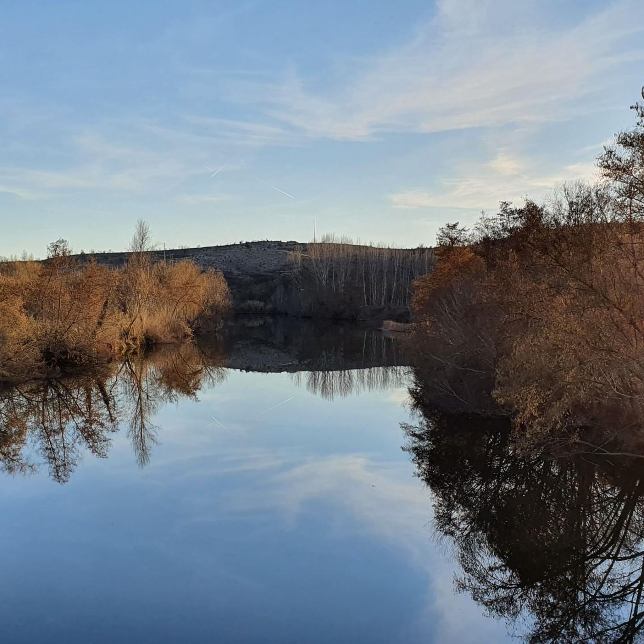
The Tua River avenue is part of the Tua Valley Regional Natural Park, a protected area that encompasses several municipalities, including Mirandela. It's a picturesque setting, with riparian vegetation, river views, and quiet areas ideal for jogging or strolling.
6
0

Views of the waters of the Tua River as it passes through the town of Mirandela. Also beautiful views of the city.
1
1
Frequently Asked Questions
What kind of terrain can I expect on running routes around Carvalhais?
The Carvalhais region offers a diverse range of terrains for runners. You can expect dense forested areas, particularly within the Carvalhais and Soutos Forest Area, characterized by deciduous hardwoods. The Baldio de Carvalhais, on the southern slopes of Serra da Arada, features rugged, rocky terrain with granite outcrops and varied gradients, including hills up to 830 meters. Additionally, routes often follow water lines and river valleys, such as those near the Vouga River, providing a mix of shaded paths and open landscapes.
Are there challenging running trails in Carvalhais?
Yes, Carvalhais is an excellent destination for runners seeking a challenge. The region's proximity to the Serra da Estrela Natural Park and the Baldio de Carvalhais means many routes feature significant elevation gains and rugged terrain. For example, the Buraco da Pala loop from Passos is a difficult 7.2-mile (11.6 km) path with substantial elevation changes, demanding good fitness and sure-footedness.
Are there running routes suitable for beginners or those looking for a moderate run?
While the region offers many challenging options, there are also moderate running routes available. For instance, the Running loop from Mirandela is a moderate 5.4-mile (8.8 km) trail that takes about 55 minutes to complete, offering pleasant views without extreme elevation. Another moderate option is the Alameda do Rio Tua, Mirandela – Mirandela loop from Mirandela, which covers 9.3 km.
What natural features or viewpoints can I enjoy while running in Carvalhais?
Runners in Carvalhais can experience a wealth of natural beauty. The region is rich in high floristic diversity, with ancient forests of chestnut, black oak, wild cherry, and holly. You'll encounter granite outcrops and perennial water lines, especially in the Baldio de Carvalhais. The presence of the Vouga River also adds scenic riverside landscapes to many routes. While not directly on the listed routes, the nearby Passadiços do Paiva Trailhead offers breathtaking views along the Paiva River, suggesting similar scenic opportunities in the broader area.
Are there circular running routes available in Carvalhais?
Yes, many of the running paths around Carvalhais are designed as loops, allowing you to start and finish in the same location. Examples include the Running loop from Mirandela, the Buraco da Pala loop from Passos, and the Alameda do Rio Tua, Mirandela loop from Cedães, all of which are circular trails.
Is Carvalhais a good place for trail running?
Absolutely. Carvalhais, with its proximity to the Serra da Estrela Natural Park and its own diverse landscapes, is ideal for trail running. The region offers an extensive network of trails through dense forests, rugged mountain slopes, and river valleys. The varied gradients and natural surfaces provide an authentic trail running experience, appealing to those who enjoy off-road adventures.
What is the best time of year to go running in Carvalhais?
The best time to go running in Carvalhais largely depends on your preference for weather and trail conditions. Spring and autumn generally offer milder temperatures, making them ideal for longer runs. In summer, the dense forested areas can provide welcome shade, but it's advisable to run early in the morning or late afternoon to avoid the midday heat. Winters can be cooler, especially at higher elevations, but still offer beautiful, crisp running conditions.
Are the running routes in Carvalhais suitable for families?
While some routes in Carvalhais feature challenging terrain and significant elevation, there are also more moderate options that could be suitable for active families. It's recommended to check the difficulty grade and distance of specific routes. For example, the Running loop from Mirandela is a moderate trail that might be more appropriate for families looking for a less strenuous outing.
Can I bring my dog on the running trails in Carvalhais?
Generally, many natural trails in Portugal, especially within natural parks and forested areas like those around Carvalhais, are dog-friendly, provided dogs are kept under control, preferably on a leash, and owners clean up after them. However, it's always best to check specific regulations for the Serra da Estrela Natural Park or any local protected areas you plan to visit, as rules can vary.
Is parking available near the running routes in Carvalhais?
While specific parking areas for each route are not detailed, Carvalhais is a locale with various access points to its natural areas. For routes starting from towns like Mirandela or Passos, you can typically find public parking within the town centers or at designated trailheads. It's advisable to check local maps or route descriptions for the most convenient parking spots before your run.
How many running routes are featured in the Carvalhais guide?
This guide features 5 highly-rated running routes around Carvalhais, offering a variety of experiences from moderate loops to more difficult trails with significant elevation changes. These routes showcase the best of the region's diverse landscapes.
What is the longest running route in this guide?
The longest running route featured in this guide is the Alameda do Rio Tua, Mirandela loop from Cedães, which spans 9.3 miles (15.0 km). This trail takes you through scenic riverine landscapes and is typically completed in about 1 hour and 37 minutes.
Most popular routes around Carvalhais

Get inspired with the komoot mobile app


Explore more
Browse the best Running Trails & Routes in other regions.
